The geologic landscape of Northern New England is complex and diverse. It has been shaped by millions of years of tectonic activity and geological processes.
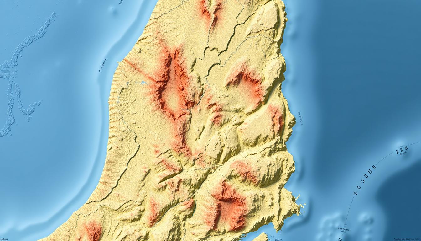
A generalized geologic map gives a detailed overview of this area. It shows the different types of rocks and where they are found.
The map’s data comes from trusted sources like the Florence Bascom Geoscience Center. They have done a lot of research on the lithogeochemical classification of Vermont’s bedrock and other areas.
This information is key to understanding Northern New England’s geological history and its structural features.
The Geological Landscape of Northern New England
Northern New England’s unique geology comes from its complex tectonic history and glacial periods. This area, including Maine, New Hampshire, and Vermont, has diverse geological features. These have been shaped over millions of years.
Defining Northern New England’s Geographic Boundaries
Northern New England is bordered by the Canadian Maritimes to the north and the Atlantic Ocean to the east. Its western edge is roughly where Vermont and New Hampshire meet. This region has varied landscapes, from Maine’s rugged coast to New Hampshire and Vermont’s mountains.
Overview of Major Geological Provinces
The USGS names several major geological provinces in New England, like the White Mountains and the Green Mountains. The White Mountains in New Hampshire are famous for their granite peaks and rich geological history. The Green Mountains in Vermont are known for their mix of metamorphic and sedimentary rocks.
The geological landscape of Northern New England is shaped by tectonic activity, glaciation, and other processes. This complex history has made the region a treasure trove for geological study.
New England Geology: A Comprehensive Overview
New England’s landscape is a mix of different rocks and tectonic events. This mix comes from its special place in North America’s geological story.
Distinctive Geological Characteristics
New England’s geology shows a variety of rock types. These include igneous, metamorphic, and sedimentary rocks. The area has been changed by many tectonic events, like the making of mountains and their erosion.
The geologic history of New England is marked by big tectonic activities. These include the Taconic and Acadian orogenies. They were key in shaping the region’s landscape.
Significance in North American Geological Context
New England’s geology is important not just locally but also for North America. The region’s rocks give us clues about the continent’s tectonic past.
Relationship to Canadian Shield
New England’s geology is tied to the Canadian Shield. This is one of the oldest and most stable parts of North America. The shield’s impact on New England’s geology is clear in their shared tectonic history and rock formations.
The tectonic activity in New England is influenced by its closeness to the Canadian Shield. This has created a unique geological landscape. It shows the complex effects of tectonic forces over millions of years.
The Geological Timeline of Northern New England
The geological history of Northern New England spans over a billion years. It starts from the ancient Precambrian era to today. This long timeline is filled with key events that have molded the area’s varied landscape.
Precambrian Foundations
The Precambrian era set the stage for Northern New England’s geology. Ancient rocks formed during this time. These rocks, mainly gneisses and schists, are at the heart of the region.
Paleozoic Developments
The Paleozoic era brought big changes to Northern New England. Mountains formed, and new rock types appeared. Granite and metamorphic rocks became common, defining the area’s geology.
- The Taconic Orogeny formed the Taconic Mountains.
- The Acadian Orogeny created the Appalachian Mountains.
- The Alleghenian Orogeny further molded the landscape.
Mesozoic to Present Changes
From the Mesozoic era to now, Northern New England has seen more changes. Erosion and deposition have played a big role. Glacial activity has also left a mark on its geology.
- Glacial erosion carved out valleys and lakes.
- Glacial till and sediments were deposited.
- Post-glacial rebound continues to shape the landscape.
In conclusion, Northern New England’s geological timeline is rich and complex. It has shaped the region into what it is today. Understanding this history helps us appreciate the area’s diverse geological features.
Tectonic Activity in New England: Mountain Building Events
New England’s landscape has been molded by tectonic events, including major mountain building orogenies. These significant tectonic activities have shaped the region’s complex geological history.
The Taconic Orogeny (450-440 Million Years Ago)
The Taconic Orogeny was a major mountain building event in the Late Ordovician period. It formed the Taconic Mountains, running from New York to Vermont and Massachusetts. This event was caused by the collision between the North American plate and the Taconic arc.
The Acadian Orogeny (375-325 Million Years Ago)
The Acadian Orogeny happened during the Devonian period. It was caused by the collision between the North American and Avalonia plates. This event formed the Acadian Mountains and greatly impacted New England’s geology.
The Alleghenian Orogeny (300-250 Million Years Ago)
The Alleghenian Orogeny occurred in the Late Paleozoic era. It was the result of the collision between the North American and Gondwana plates. Though more pronounced in the Appalachian region, it also affected New England’s geology.
These tectonic activities have shaped New England’s geological landscape. They created diverse rock formations and landforms.
| Orogeny | Time Period (Million Years Ago) | Geological Impact |
|---|---|---|
| Taconic Orogeny | 450-440 | Formation of the Taconic Mountains |
| Acadian Orogeny | 375-325 | Formation of the Acadian Mountains |
| Alleghenian Orogeny | 300-250 | Influence on the Appalachian region and New England geology |
The data from the Florence Bascom Geoscience Center offers valuable insights. It highlights New England’s complex geological history.
Rock Formations in New England: Types and Distribution
New England’s geology is rich with different rock types. These include igneous, metamorphic, and sedimentary rocks. They show the area’s long history of tectonic shifts, weathering, and erosion.
Igneous Rock Formations
Igneous rocks are a big part of New England’s landscape. They form when magma or lava cools and solidifies. Granite, a common igneous rock, is found all over the region.
Granite Geology in New England
Granite is a key feature in New England. You can see it in the White Mountains of New Hampshire. Granite is strong and beautiful, making it great for building and decoration.
Metamorphic Rock Distributions
Metamorphic rocks are also important in New England. They form when rocks change under heat and pressure. The Green Mountains in Vermont have lots of metamorphic rocks, like marble and schist.
Sedimentary Rocks in New England
Sedimentary rocks are found in New England too. They’re made from compressed sediments. These rocks can have fossils and tell us about the area’s past. Maine and other places have lots of sedimentary rocks.
In summary, New England’s varied rock formations show its complex geological history. Knowing about these formations helps us appreciate the area’s beauty and manage its resources well.
The White Mountains: New Hampshire’s Geological Marvel
New Hampshire’s White Mountains give us a peek into how Northern New England was formed. This mountain range is a key part of the region’s look. It shows the effects of millions of years of tectonic activity and other geological processes.
Formation and Composition
The White Mountains came together through tectonic and volcanic actions. They are made mostly of igneous and metamorphic rocks. These rocks tell us a lot about the area’s history. They’ve been changed in different ways, leading to many types of rocks.
The White Mountain Batholith
The White Mountain Batholith is a big deal in the White Mountains. It’s a large piece of granite and other rocks that formed in the Jurassic period. This batholith is a big part of the range’s geology. It has helped shape the White Mountains’ landscape.
Mount Washington and Presidential Range
Mount Washington, the highest peak in the Northeast, is a key part of the White Mountains. The Presidential Range, which includes Mount Washington, is known for its tough terrain and varied geological features. The range’s look comes from tectonic activity, glaciation, and weathering.
| Geological Feature | Description | Significance |
|---|---|---|
| White Mountain Batholith | Large igneous intrusion formed during the Jurassic period | Key component of the White Mountains’ geology |
| Mount Washington | Highest peak in the Northeast | Prominent feature of the White Mountains and Presidential Range |
| Presidential Range | Rugged terrain with diverse geological features | Unique and complex geological landscape shaped by tectonic activity, glaciation, and weathering |
The Green Mountains: Vermont’s Geological Backbone
The Green Mountains in Vermont are more than just a pretty view. They are a geological wonder with a history that stretches back millions of years. This mountain range shows the power of geological processes that have shaped the area.
Structural Formation and Metamorphic History
The Green Mountains were formed by tectonic forces and metamorphic changes. They are made mostly of metamorphic rocks that changed under high pressure and temperature. The Florence Bascom Geoscience Center says the mountains were shaped by several orogenic events, like the Taconic and Acadian orogenies.
These events caused the rocks to deform and change, creating the mountains’ complex structure. The metamorphic history of the Green Mountains shows how sedimentary and igneous rocks turned into metamorphic rocks like schist and gneiss.
Rock Types and Mineral Composition
The Green Mountains have a variety of rocks, including metamorphic, igneous, and sedimentary rocks. The metamorphic rocks, like schist and gneiss, are common and contain minerals like quartz, feldspar, and mica. The range also has igneous rocks, like granite, from ancient magmatic activity.
Notable Geological Sites and Features
The Green Mountains have many geological wonders. One key feature is Mount Mansfield, with its unique geology. The range also has U-shaped valleys and glacial lakes from the last ice age.
Geologists find the Green Mountains very interesting. They offer insights into the region’s geological past. The range’s varied rocks and complex structures make it a great subject for research.
Maine’s Diverse Geological Features
Maine’s landscape is stunning, from Acadia National Park’s granite coast to Mount Katahdin’s grandeur. Its geology has been molded by millions of years of tectonic forces, weathering, and erosion. This has created a rugged yet beautiful terrain.
Acadia National Park’s Granite Coastline
Acadia National Park is famous for its granite coastline, shaped by the Atlantic Ocean’s constant waves. The park’s geology features granite and metamorphic rocks, making its coastline dramatic. Visitors can explore the rugged shore, hike mountains, and see the unique geological wonders of Acadia.
The Maine Coast’s Rocky Shorelines
The Maine coast, beyond Acadia, boasts rocky shorelines with scenic coves and inlets. Its geology is mainly metamorphic and igneous rocks, shaped by weathering and erosion. This creates a stunning coastline perfect for hiking, kayaking, and more.
Interior Mountain Ranges and Basins
Maine’s interior features mountain ranges and basins, including Mount Katahdin. Located in Baxter State Park, Mount Katahdin offers breathtaking views and challenging hikes.
Mount Katahdin and Baxter State Park
Mount Katahdin is a key geological feature in Maine, known for its rugged terrain and varied rock formations. It’s part of Baxter State Park, aimed at preserving the area’s natural beauty. Visitors can hike to the summit, explore mountains and forests, and see the unique geological wonders of this place.
Glacial Impact on Northern New England’s Landscape
Glaciers have shaped Northern New England’s diverse landscape. The movement and melting of ice sheets left unique landforms. These features tell the story of the region’s past.
The Laurentide Ice Sheet’s Influence
The Laurentide Ice Sheet covered much of North America during the last ice age. It was over a mile thick in some areas. This ice sheet reshaped the region’s topography through pressure and erosion.
Glacial Landforms and Features
The ice sheet’s retreat revealed various glacial landforms. These include:
- Eskers: Long, sinuous ridges formed by meltwater flowing through tunnels in the ice.
- Moraines: Ridges of debris deposited at the ice margin.
- Drumlins: Elongated, teardrop-shaped hills formed by the erosive action of the ice.
Eskers, Moraines, and Drumlins
These features are visually striking and offer insights into the region’s history. Eskers and moraines show where meltwater and ice margins were. They are key to understanding the area’s past.
Post-Glacial Rebound and Modern Landscapes
After the ice sheets melted, the region experienced post-glacial rebound. The Earth’s crust rose as the ice’s weight was removed. This process, along with ongoing geological changes, continues to shape Northern New England’s landscape today.
Regional Geology of New England: State-by-State Analysis
New England, made up of Maine, New Hampshire, and Vermont, has a varied landscape. Each state shows different geological features. These are key to understanding the region’s complex history.
Maine’s Geological Provinces
Maine has several unique geological areas. The Avalon terrane, with its volcanic and sedimentary rocks, is found along the coast. Inland, the Central Maine Basin is rich in sand, gravel, and clay. This shows its past as a major sedimentary basin.
New Hampshire’s Bedrock Geology
New Hampshire’s bedrock is mainly the White Mountain Batholith. This large igneous intrusion happened during the Mesozoic Era. The state’s terrain also features metamorphic rocks in the west and north. These have been shaped by tectonic activity.
Vermont’s Geological Structures
Vermont’s geology includes thrust faults and folds, seen in the Green Mountains. The state’s bedrock is mostly metamorphic rocks like schist and gneiss. These have been deformed and changed during orogenic events.
| State | Major Geological Features | Predominant Rock Types |
|---|---|---|
| Maine | Avalon terrane, Central Maine Basin | Volcanic, sedimentary, metamorphic |
| New Hampshire | White Mountain Batholith | Igneous, metamorphic |
| Vermont | Green Mountains, thrust faults | Metamorphic (schist, gneiss) |
New England’s geology is a mix of different features and rock types. This diversity comes from its varied tectonic history. Knowing this helps us appreciate the natural beauty and resources of Maine, New Hampshire, and Vermont.
Mineral Resources and Economic Geology of Northern New England
Mineral resources are key to Northern New England’s economy. This area is rich in geological history. It has many minerals, from gemstones to industrial ones.
Historical Mining Activities
Mining in Northern New England started early, in the colonial days. Mines here have given up copper, lead, zinc, and silver. Old mines used traditional methods to extract these valuable minerals.
Current Mineral Production
Today, Northern New England is a big mineral producer. The USGS says it’s a major source of industrial minerals like granite and sand. These are vital for building and fixing roads and buildings. The area is also famous for its gemstones, like tourmaline and garnet.
Gemstone Deposits and Localities
Northern New England is famous for its gemstones. These are found in many places across the region. The area’s complex geology makes it perfect for gemstone deposits.
Tourmaline, Beryl, and Garnet Occurrences
Tourmaline, beryl, and garnet are big finds in Northern New England. They can be found in pegmatites and metamorphic rocks. Maine and New Hampshire are known for these gemstones.
| Gemstone | Location | Geological Setting |
|---|---|---|
| Tourmaline | Maine, New Hampshire | Pegmatites |
| Beryl | Maine, Vermont | Pegmatites, Metamorphic rocks |
| Garnet | New Hampshire, Vermont | Metamorphic rocks |
Hydrological Features and Their Geological Context
Understanding the geological context is key to grasping Northern New England’s hydrological features. The area’s varied landscape, with its rivers, lakes, and groundwater, stems from its rich geological past.
Major River Systems and Their Formation
The region’s major rivers, like the Connecticut and Androscoggin, formed over millions of years. Tectonic shifts, glaciation, and erosion shaped them. These rivers are essential for the landscape and local life.
Lakes and Their Geological Origins
Lakes in Northern New England, like Lake Winnipesaukee and Lake Champlain, owe their existence to glaciers. Glaciers carved out these depressions, which then filled with meltwater.
Groundwater Resources and Aquifers
Groundwater is vital in Northern New England. Aquifers, layers of rock that hold water, are mainly replenished by rain. Knowing about these aquifers helps manage water resources wisely.
| Hydrological Feature | Geological Context | Significance |
|---|---|---|
| Major River Systems | Formed through tectonic activity, glaciation, and erosion | Shape the landscape, support ecosystems |
| Lakes | Originated from glacial activity | Provide water resources, support biodiversity |
| Groundwater Resources | Stored in aquifers recharged by precipitation | Critical for drinking water, agriculture, and industry |
Geological Hazards in Northern New England
Geological hazards are a big worry in Northern New England. They affect the environment and human places. The area’s complex geology makes it prone to many natural hazards.
Seismic Activity and Earthquake Probability
Northern New England sees seismic activity, but it’s not a high-risk area for earthquakes. The USGS gives info on earthquake risks in the area. They say earthquakes in New England are rare but can be big when they happen.
Landslides and Mass Wasting Events
The rugged terrain in Northern New England makes it prone to landslides and mass wasting. These happen a lot during heavy rain or when humans change the landscape. They can damage buildings and harm local ecosystems.
Flooding and Erosion Concerns
Flooding and erosion are also big hazards in the area. Heavy rain, storm surges, and snowmelt can cause flooding. Erosion gets worse with deforestation and construction. Knowing about these hazards helps us prepare and lessen their effects.
By getting ready for these geological hazards, Northern New England can become more resilient. This helps reduce risks from earthquakes, landslides, and floods.
How Geology Shaped Human Settlement in Northern New England
The geology of Northern New England has greatly influenced where people settled. The area’s varied landscapes have shaped how and where communities developed over time.
Influence on Indigenous Peoples’ Territories
Native American tribes settled in areas rich with resources. Rivers, coastlines, and fertile valleys were key for their survival. They provided food, transportation, and materials for homes.
The USGS says the geology helped decide where these resources were found. This, in turn, shaped the territories and ways of life of indigenous peoples. Places with good soil and water were more populated.
Impact on Colonial Settlement Patterns
European colonizers also found the landscape important. They settled near harbors and rivers for trade and access to the sea. Fertile valleys and plains were great for farming, helping colonies grow.
The geology brought both benefits and challenges. Maine and New Hampshire’s rugged terrain made some areas hard to reach and farm. But, the rich mineral deposits in these states later supported mining.
Geological Resources and Industrial Development
Northern New England’s geology has driven its industrial growth. The area is rich in granite, marble, and other stones for building and monuments. Copper and zinc mining in Maine and Vermont also boosted the economy.
| State | Major Geological Resources | Industrial Use |
|---|---|---|
| Maine | Granite, Copper, Zinc | Construction, Mining |
| New Hampshire | Granite, Quartz | Construction, Electronics |
| Vermont | Marble, Granite | Construction, Sculpture |
The region’s geology has been key in shaping settlements and economic growth. It has influenced both the initial settlements and later industrial development.
Conclusion: The Dynamic Geological Legacy of Northern New England
Northern New England’s landscape shows the area’s complex and interesting past. Its varied geological features were formed over millions of years. This includes tectonic activity, glaciation, and erosion.
The White Mountains and the Green Mountains are key parts of this landscape. They were shaped by different geological processes. This has given New England a rich geological heritage.
New England’s geology has greatly influenced its ecosystems and human settlements. It has also provided important mineral resources. Understanding this geological legacy helps us appreciate the region’s beauty and manage its resources.
As we learn more about Northern New England’s geology, we value the processes that have shaped our environment. This knowledge is essential for preserving the region’s natural wonders.