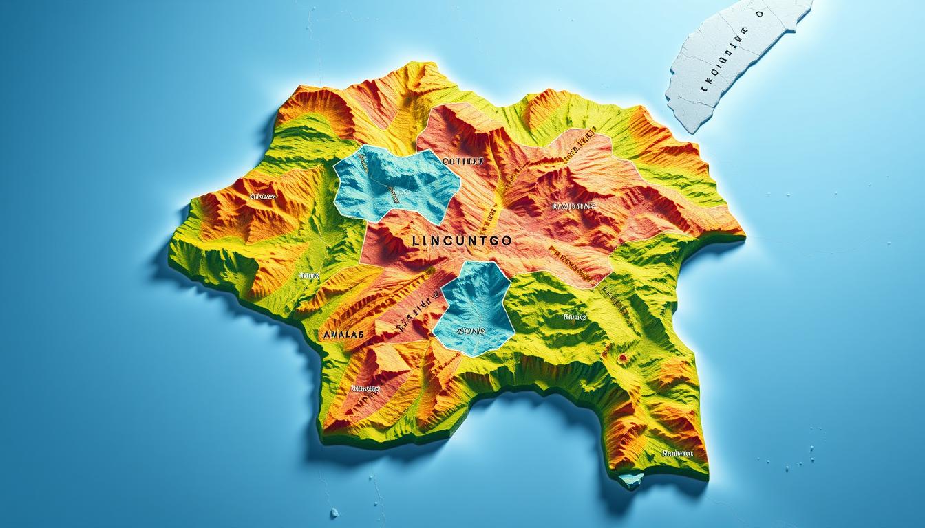
The Democratic Republic of Congo is a vast and diverse country in Central Africa. It has vast rainforests, rivers, and mountains. The country is divided into 11 provinces, each with its own unique features.
A detailed Congo Map shows these geographical features. It includes major cities, rivers, and mountains. Knowing the Democratic Republic Congo map helps us understand the country’s geography and its provinces.
The Democratic Republic of Congo: A Geographical Overview
The DRC is the second-largest country in Africa, covering over 2.3 million square kilometers. It is in central Africa, sharing borders with Angola, Zambia, Tanzania, and Uganda. Its location makes it key in regional and global affairs.
Location and Size in African Context
The DRC’s vast territory shows Africa’s diverse landscapes. Its size and location affect its climate, economy, and culture.
Topographical Diversity
The country has mountains, valleys, and plateaus. The Mitumba Mountains and Ruwenzori Range stand out, with the latter having Africa’s highest peaks. The Congo Basin, a huge tropical rainforest, is a key feature of the DRC’s geography.
Climate Zones and Ecological Regions
The DRC’s climate changes from tropical in the north to temperate in the south. There are big differences in temperature and rain across regions. The country’s ecological areas, from rainforests to savannas, support a wide variety of life. They are also important for the world’s ecological balance.
Historical Development of the Congo Map
The Congo Map’s story is one of colonialism, indigenous cultures, and new tech. The mapping of the Democratic Republic of Congo has seen many changes over time.
Pre-Colonial Indigenous Territories
Before colonial times, the area now known as the Democratic Republic of Congo was home to many indigenous groups. Each group had its own lands and boundaries. These early territories were key in the early mapping of the region.
Belgian Colonial Cartography
The late 19th century saw the arrival of Belgian colonizers. They brought a new era in mapping the Congo. Belgian cartographers made detailed maps to help manage and use the colony’s resources.
Post-Independence Mapping Changes
After gaining independence in 1960, the Congo’s maps changed a lot. The country’s borders were redrawn, and new areas were created. These changes showed the political shifts in the region.
Understanding the Modern Congo Map: Provincial Structure
To grasp the Congo’s provincial setup, we must look at the 2006 Constitution. It brought big changes to the country’s way of organizing itself.
The 2006 Constitution and Provincial Reorganization
The 2006 Constitution of the Democratic Republic of Congo made big changes. It split the original 11 provinces into 26. This move aimed to spread power and make governance better.
This change was meant to help local areas grow and be governed well. But, it’s faced issues like money problems and getting things done.
Administrative Hierarchy and Governance
The Congo’s system of government is complex. It has provinces, territories, and local areas. Good management at these levels is key for the country’s growth.
| Administrative Level | Description |
|---|---|
| Provinces | Major administrative divisions, currently 26 in number. |
| Territories | Subdivisions within provinces, responsible for local administration. |
| Local Entities | The most local level of governance, including cities and rural areas. |
Kinshasa Province: The Capital Region
Kinshasa Province is the lively heart of the Democratic Republic of Congo. It’s the biggest city and the economic center. Kinshasa is key to the country’s growth.
Urban Geography and Strategic Location
Kinshasa sits on the south bank of the Congo River. It’s a major trade and commerce hub. The city’s unique geography has made it a big urban center with over 12 million people.
The city’s layout shows both modern and traditional buildings. This mix shows the city’s rich culture.
The city’s spot on the Congo River makes it easy to move goods. This has helped Kinshasa become a big economic force.
Economic and Political Significance
Kinshasa is not just an economic center but also the political heart of the Democratic Republic of Congo. It’s home to many government offices, international groups, and embassies. This shows its big role in national and global affairs.
The city’s economy is strong, thanks to manufacturing, trade, and services. Its dynamic economy has drawn a lot of investment. This has made Kinshasa a major player in the country’s progress.
Kongo Central Province
Kongo Central Province is a key area in the Democratic Republic of Congo. It has a mix of history and modern economic growth. Its spot on the Atlantic Ocean makes it a major trade hub.
Atlantic Access and Coastal Features
The province’s coast on the Atlantic Ocean offers direct access to international trade routes. This boosts its economic role. The ports and harbors help move goods in and out, making the area economically strong.
The coast is also vital for trade and has diverse ecosystems. These support a wide range of marine life. This biodiversity is key for the local environment and economy, helping fisheries and related industries.
Historical Importance and Modern Development
Kongo Central Province has a deep history. It was important before and during colonial times. The area has many historical sites and cultural landmarks showing its rich past.
Today, the province is growing, with new infrastructure and economic projects. This mix of history and modern growth makes Kongo Central a unique and important part of the Democratic Republic of Congo.
Équateur Province
Équateur Province is in the heart of the Democratic Republic of Congo. It’s full of biodiversity and natural resources. The area has vast equatorial forests and complex river systems, making it key to the Congo Map.
Equatorial Forest Ecosystems
Équateur Province has some of the world’s most untouched equatorial forests. These forests are not just rich in life but also vital for our planet’s health. They house many plants and animals, including endangered ones. It’s very important to protect these ecosystems for our planet’s well-being.
- Rich in biodiversity
- Crucial for global ecological balance
- Home to endangered species
Major Rivers and Transportation Networks
The province is crossed by big rivers, like the Congo River. This river network helps move goods and people, linking Équateur Province to other parts of the Democratic Republic of Congo and more. The rivers also support fishing and other jobs, which is good for the local economy.
Équateur Province is very important on the Democratic Republic Congo map. Its unique ecosystems and waterways are both ecologically and economically vital.
Nord-Kivu Province
Nord-Kivu Province is key to the Democratic Republic of Congo’s stability and growth. It has a mix of landscapes and ecosystems. The province is known for its volcanic areas and Lake Kivu.
Volcanic Landscapes and Lake Kivu
The volcanic landscapes in Nord-Kivu add to its ecological richness. Lake Kivu, a Great African Lake, is also important. It provides fresh water and supports fishing, helping local communities.
Border Dynamics and Regional Challenges
The province borders Rwanda, bringing both chances and hurdles. The border’s stability affects trade and security. Managing these issues is vital for peace and economic ties.
Nord-Kivu faces security and development hurdles. To tackle these, a detailed plan is needed. This plan must consider the province’s geography and politics.
Sud-Kivu Province
The Sud-Kivu Province is key to the Democratic Republic of Congo’s economy. It has diverse landscapes, including volcanoes and Lake Kivu’s shores.
Great Lakes Geography
Sud-Kivu Province is in the Great Lakes region of Africa. It’s known for its big geographical features. The province borders Lake Kivu to the east, a major African Great Lake.
Lake Kivu is a vital freshwater source. It supports fishing and tourism, boosting the economy.
The area’s geography includes volcanic landscapes. The Virunga Mountains, part of the Albertine Rift, are famous for their biodiversity and beauty.
Natural Resources and Economic Activities
Sud-Kivu is rich in minerals like tin, tungsten, and gold. Mining here is big, helping the local and national economy. But mining also causes environmental problems like deforestation and pollution.
Agriculture is also important in Sud-Kivu. The fertile soil and good climate are perfect for crops like coffee, maize, and cassava. Farming not only feeds locals but also brings in money from crop sales.
| Natural Resource | Economic Activity | Environmental Impact |
|---|---|---|
| Tin, Tungsten, Gold | Mining | Deforestation, Pollution |
| Fertile Soils | Agriculture | Soil Degradation |
| Lake Kivu | Fishing, Tourism | Overfishing, Pollution |
Maniema Province
The Democratic Republic of Congo’s Maniema Province is a key area. It’s known for its complex geography and mining riches. Located in the heart of the DRC, Maniema Province is vital for the country’s economy and geography.
Central Location and Isolation Challenges
Maniema Province is in the middle of the DRC. This central spot is both strategic and challenging due to its isolation. The area’s dense forests and rough terrain make travel and communication hard.
This isolation impacts the lives of locals and slows down economic growth. It also makes it hard to get essential services. Improving the infrastructure is key to solving these problems.
Mining Potencial and Infrastructure
Despite the hurdles, Maniema Province has a lot of mining promise. It’s full of minerals, drawing in investors.
But, mining growth depends on better infrastructure. This includes roads, transport systems, and energy.
| Mineral Resource | Potential Impact | Current Status |
|---|---|---|
| Gold | High economic revenue | Under exploration |
| Diamonds | Significant export opportunity | Active mining |
| Copper | Industrial growth | Planned mining operations |
Developing Maniema Province’s mining could boost the economy. It could also raise the standard of living for its people.
Kasaï-Oriental Province
Kasaï-Oriental Province is known for its rich natural resources, including diamonds. The mining here plays a big role in the local and national economy.
The province has some of the biggest diamond deposits in the Democratic Republic of Congo. This makes it a key area for mining. The mining industry in Kasaï-Oriental uses both traditional and modern mining methods.
Diamond-Rich Territories
The diamond-rich areas in Kasaï-Oriental Province are mainly around Tshangalele Lake. These places are famous for their alluvial diamond deposits. People often use traditional methods to mine these diamonds.
| Region | Diamond Deposit Type | Mining Method |
|---|---|---|
| Tshangalele Lake | Alluvial | Artisanal |
| Surrounding Areas | Alluvial | Industrial |
Cultural Landscape and Ethnic Diversity
Kasaï-Oriental Province is not just about its natural wealth. It’s also known for its rich culture and diverse ethnic groups. Each group has its own traditions and cultural practices.
The province’s cultural diversity is seen in its many languages, traditional music, and art. This diversity enriches the province’s cultural heritage. It makes Kasaï-Oriental a place of cultural exchange and understanding.
Kasaï-Occidental Province
Kasaï-Occidental Province is key to the Congo’s geography and economy. It has vast agricultural zones and big cities. The fertile soil makes it perfect for farming.
Agricultural Zones and Rural Development
The agricultural sector is vital in Kasaï-Occidental Province. It covers large areas for crops like maize, cassava, and peanuts. “Agriculture is the mainstay of our economy,” say local experts.
Rural development programs help farmers. They provide modern tools, irrigation, and training. These efforts boost crop yields and food security, helping the province’s economy grow.
Urban Centers and Population Distribution
Kananga is a major city in Kasaï-Occidental Province. It’s a center for business and government. The city has markets, transport, and public services.
Most people live in rural areas, working in farming. Cities like Kananga draw people looking for jobs. This creates a diverse population.
Katanga Province
Katanga Province is a key area on the Congo Map. It’s famous for its huge copper deposits. This place has been vital to the Democratic Republic of Congo’s mining for years.
Copper Belt and Mining Infrastructure
The copper belt in Katanga Province is a major highlight in Africa. It has a lot of mining infrastructure. The Katanga Copperbelt is known for its rich minerals. Big mining companies work here, helping the local and national economy a lot.
Environmental Impacts of Resource Extraction
But, mining in Katanga Province has caused big environmental problems. Copper and other mineral extraction has led to pollution and habitat destruction. There are efforts to fix these issues, like cleaning up polluted areas and making mining better.
Finding a balance between economic growth and protecting the environment is hard for Katanga Province. As mining changes, it’s important to use sustainable methods. This will help reduce harm to the environment.
Major Geographical Features on the Congo Map
The Democratic Republic of Congo is known for its diverse geography. This diversity is key to its rich biodiversity and natural resources. The landscape shapes the climate, economy, and where people live.
The Congo River System
The Congo River System is a major feature. It’s a vast network of rivers and tributaries. They provide fresh water and support many aquatic species.
The Congo River is the second-largest river by discharge volume. It’s also a key transportation route.
Great Lakes Region
The Great Lakes region is vital in the Congo. It includes lakes like Lake Tanganyika and Lake Kivu. These lakes are beautiful and important for the ecosystem and economy.
They support fishing and are a source of fresh water.
Mountain Ranges and Highlands
The Congo has mountain ranges and highlands. The Mitumba and Virunga Mountains are examples. These areas have volcanic landscapes and diverse wildlife.
They are rich in natural resources like minerals and fertile soils. This makes them important for local economies and conservation.
| Geographical Feature | Description | Significance |
|---|---|---|
| Congo River System | Vast network of rivers and tributaries | Critical for transportation and aquatic life |
| Great Lakes Region | Includes Lake Tanganyika and Lake Kivu | Important for fishing and regional ecosystem |
| Mountain Ranges and Highlands | Mitumba and Virunga Mountains | Rich in minerals and biodiversity |
The Congo Rainforest: Second Largest in the World
The Congo Rainforest is the second-largest in the world. It covers many provinces in the Democratic Republic of Congo, as shown on the Congo Map. It’s key to the country’s nature and economy.
Distribution and Biodiversity
The Congo Rainforest is famous for its rich biodiversity. It has many species found only there. The rainforest’s varied ecosystems support a wide range of plants and animals.
“The Congo Rainforest is a treasure trove of biodiversity, hosting a vast array of plant and animal species.” Experts say saving this biodiversity is vital for the planet’s health.
Conservation Efforts and Deforestation Challenges
The Congo Rainforest is under threat from deforestation and habitat loss. Many efforts are being made to protect it. These include setting up protected areas and using sustainable forest management.
A well-known conservationist once said,
“Protecting the Congo Rainforest is not just about saving trees; it’s about preserving a way of life for countless communities and maintaining the health of our planet.”
The Democratic Republic Congo map shows the big areas being conserved. It shows the country’s dedication to saving its natural treasures.
Interactive Congo Maps: Digital Resources for Navigation and Research
Interactive maps are key for exploring the Democratic Republic of Congo’s complex geography. They offer a detailed and easy way to see the region’s varied landscapes and features.
Satellite Imagery and Remote Sensing Applications
Satellite imagery and remote sensing have greatly improved our view of the Congo. They give us high-resolution images and data on environmental changes and natural resources. These tools help researchers and explorers track deforestation, water resources, and climate change impacts.
Open-Source Mapping Projects and Educational Tools
Open-source mapping and educational tools let more people dive into Congo’s geography. Sites like OpenStreetMap let users help make and edit maps, making them more accurate. Educational tools, like interactive atlases, help students and researchers learn more about the region’s complex geography.
Conclusion: The Evolving Nature of the Congo Map
The Congo Map shows the changes in the Democratic Republic of Congo’s geography over time. The country’s economy, culture, and politics are always changing. So, its map changes too.
The Democratic Republic Congo map has seen big changes. These include new provinces and infrastructure. Knowing these changes helps us understand Congo’s geography better.
The Congo map is very important for researchers, policymakers, and explorers. It gives us insights into the country’s ecosystems, natural resources, and culture. As Congo grows, its map will keep being a key resource.
Looking at the Congo Map helps us understand the country’s complex geography and challenges. As the map evolves, it will keep being essential for studying and exploring the Democratic Republic of Congo.