The Maltese archipelago is located just south of Sicily and north of Africa. It’s a key spot in the Mediterranean.
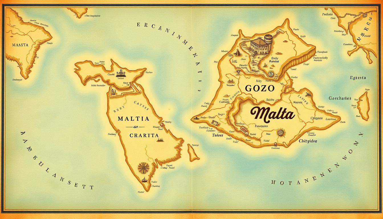
This group includes three main islands: Malta, Gozo, and Comino. There are also two uninhabited islets, Comminotto and Filfla.
The islands’ strategic spot has made them historically and culturally important. Knowing the geography of the Maltese islands helps us understand their role in the Mediterranean.
The islands’ unique features and location make them interesting to explore.
The Maltese Archipelago: An Overview
The Maltese archipelago includes Malta, Gozo, and Comino. It’s a mix of history, culture, and natural beauty. These islands in the Mediterranean are known for their strategic location and rich heritage.
Geographic Location in the Mediterranean
The Maltese islands are in the central Mediterranean. They are between Europe and Africa. Their limestone composition shapes their landscape and buildings.
The Three Main Islands: Malta, Gozo, and Comino
Malta is the biggest island, 27 kilometers long and 14.5 kilometers wide. It’s where most people live, work, and enjoy culture. Gozo is peaceful, with lots of green land and farms. Comino is tiny but famous for its pristine beaches and clear waters.
| Island | Size (km²) | Notable Features |
|---|---|---|
| Malta | 246 | Valletta, Grand Harbor, rich history |
| Gozo | 67 | Agricultural land, Citadel, scenic landscapes |
| Comino | 3.5 | Blue Lagoon, beaches, crystal-clear waters |
Knowing the geography of these islands helps us understand the detailed Malta map. The topographic map of Malta shows the unique features of each island, like heights and coastlines.
Historical Significance of Malta’s Strategic Position
Malta’s history is tied to its strategic spot between Europe and Africa. This location has made it valuable to many empires and cultures over time.
Malta’s Role in Mediterranean History
Malta sits close to Europe and Africa, making it key for trade and cultural exchange. It has been ruled by the Romans, Arabs, Knights of St. John, and the British. Each left their mark on Malta’s culture and buildings.
“Malta’s strategic position has made it a focal point for the great powers of the Mediterranean.”
How Geography Shaped Malta’s Development
Malta’s geography has greatly shaped its growth. Its natural harbors and strategic location made it perfect for naval powers. Here are some key events in Malta’s history influenced by its geography:
| Period | Ruling Power | Significance |
|---|---|---|
| Roman Era | Romans | Established Malta as a commercial hub |
| Knights of St. John | Knights Hospitaller | Fortified the island, creating Valletta |
| British Era | British Empire | Utilized Malta as a naval base |
Malta’s geography has not only shaped its military and economic growth. It has also influenced its cultural identity.
Comprehensive Malta Map Guide for Travelers
The Maltese archipelago, made up of Malta, Gozo, and Comino, offers a unique travel experience. It starts with understanding its maps. Travelers need to get to know local terms, learn to read Maltese maps, and think about seasonal changes that affect navigation.
Understanding Maltese Geographic Terms
Maltese geography uses unique terms that might be new to visitors. Knowing these terms is key for navigating well. For example, “Il-Girgenti” is a place known for its history. “Ta’ Cenc” is a spot on Gozo. Learning these terms helps visitors understand local maps and signs better.
- Localities: Areas with names tied to history or culture.
- Districts: Administrative areas that organize the islands.
- Topographic features: Natural spots like bays and hills that are important for getting around.
Reading Maltese Maps: Tips for First-Time Visitors
Reading Maltese maps can be tough for newcomers because of language and geography. But, with some tips, it gets easier. Using an interactive Malta map on a phone or tablet is very helpful. It often has translations and updates in real-time.
- Find key spots like major roads, historical sites, and public transport.
- Know the map’s scale to figure out distances.
- Get used to local symbols and legends on Maltese maps.
Seasonal Considerations for Map Navigation
Malta’s weather changes a lot with the seasons, affecting how you move around. In tourist season, maps show popular places. Off-season, some paths are less busy. A tourist map of Malta that shows these changes helps plan trips better.
By knowing Maltese terms, reading local maps, and thinking about the seasons, travelers can explore Malta and Gozo confidently. Whether using an interactive map or a traditional one, being ready is essential for a great trip.
Detailed Malta Map: Exploring the Main Island
Malta’s main island is a mix of history, culture, and geography. It’s split into regions and districts, each with its own charm and sights.
Regions and Districts of Malta
Malta is divided into the Northern, Central, and Southern Regions. These regions have districts like Valletta, Sliema, and St. Julian’s. These places are lively and full of history.
- Northern Region: Known for its picturesque villages and beaches.
- Central Region: Encompasses the capital city Valletta and surrounding areas.
- Southern Region: Characterized by its rugged landscapes and historical sites.
Valletta and the Grand Harbor Area
Valletta, Malta’s capital, is a key spot on any map. The Grand Harbor area is filled with landmarks like the Grand Master’s Palace and St. John’s Co-Cathedral. Its history and location make it a top place to visit.
Major Cities and Towns: Sliema, St. Julian’s, and Mdina
Sliema is great for shopping and eating, while St. Julian’s is known for its nightlife. Mdina is a historic city with ancient walls and narrow streets.
- Sliema: A shopper’s paradise with a scenic waterfront.
- St. Julian’s: The entertainment capital of Malta, known for its vibrant nightlife.
- Mdina: A historic fortified city with a rich history and stunning architecture.
These cities and towns are key on a detailed Malta map. They show the island’s varied offerings.
Gozo on the Map: Malta’s Sister Island
Gozo is the second-largest island in the Maltese archipelago. It has a unique charm that makes it different from Malta. The island is famous for its green countryside, hidden beaches, and rich history. It’s a great place for those who want a calm vacation.
Geographical Features of Gozo
Gozo’s landscape is full of rolling hills, green valleys, and a rocky coastline. It’s called the “Island of the Three Hills” because of its shape. Its beauty is enhanced by ancient temples and historical sites, attracting history and nature enthusiasts.
Victoria (Rabat) and the Citadel
Victoria is Gozo’s capital, famous for its Citadel. This medieval fortress is filled with landmarks like the Cathedral of the Assumption and the Old Prison. Walking through its narrow streets, you can see the island’s cultural heritage up close.
Coastal Highlights: Dwejra, Ramla Bay, and Xlendi
Gozo’s coast has beautiful bays and beaches, each with its own charm. Ramla Bay is known for its white sand and blue waters. Dwejra, where the Azure Window once stood, is breathtaking. Xlendi Bay is perfect for swimming and snorkeling, away from the crowds.
| Location | Main Attraction | Activities |
|---|---|---|
| Victoria (Rabat) | The Citadel | Historical exploration, shopping |
| Ramla Bay | Golden sandy beach | Swimming, sunbathing |
| Dwejra | Natural beauty, former Azure Window site | Scenic viewing, photography |
| Xlendi | Secluded bay | Swimming, snorkeling, diving |
Comino and Smaller Islands on the Malta Map
Malta and Gozo are not the only islands in the Maltese archipelago. There are smaller islands too, each with its own special charm. Comino is one of these, known for its beautiful landscapes and clear waters.
Exploring Comino and the Blue Lagoon
Comino is a small island between Malta and Gozo. It’s famous for the Blue Lagoon, a bay with turquoise waters. It’s perfect for a day trip, with great spots for snorkeling and diving.
To find your way around Comino, you’ll need a Comino map. It shows you all the important places and sights.
Uninhabited Islets of the Maltese Archipelago
The Maltese archipelago also has uninhabited islets like Comminotto and Filfla. These islands are known for their natural beauty and wildlife. For a better look at these islets, a satellite map of Malta is very helpful. It shows their geography in detail.
| Island | Main Attractions |
|---|---|
| Comino | Blue Lagoon, snorkeling, diving |
| Comminotto | Natural beauty, wildlife |
| Filfla | Wildlife, scenic views |
Topographic Map of Malta: Understanding the Terrain
A topographic map of Malta shows the island’s varied landscape. It includes its highest points and coastal formations. This detailed map is key to understanding Malta’s geographical features.
Malta’s Unique Landscape Features
Malta’s terrain is marked by low hills and terraced fields. These features show the island’s long history of farming. The highest spot, Dingli Cliffs, is 253 meters above sea level, with stunning views of the Mediterranean.
The landscape is also filled with cliffs, caves, and bays. This makes Malta’s geology truly unique.
Elevation Patterns and Coastal Formations
Malta’s elevation patterns are mostly gentle slopes and low-lying areas. Some areas have more noticeable relief. The coastlines are characterized by cliffs and rocky shores.
But, there are also sandy bays and pebbled beaches. Knowing these features helps us appreciate Malta’s natural beauty and its rich history.
Historical Maps of Malta Through the Ages
Historical maps of Malta show the island’s changing role in the Mediterranean. These maps highlight Malta’s geography and its strategic and cultural importance over time.
Ancient and Medieval Cartography of Malta
The earliest maps of Malta go back to ancient times. Cartographers like the Greeks and Romans mapped Malta’s strategic location. In the medieval period, maps got more detailed, showing Malta’s rise in maritime trade and its part in Christian-Islamic conflicts.
| Period | Notable Cartographers | Map Characteristics |
|---|---|---|
| Ancient | Greek and Roman cartographers | Basic geographical features, trade routes |
| Medieval | Portolan chart makers | Detailed coastlines, navigation aids |
Knights of Malta and Colonial Era Maps
The Knights of St. John arrived in the 16th century, changing Malta’s map history. They made detailed maps to strengthen the island’s defenses. Later, European powers, like Britain, made maps showing Malta’s role as a naval base.
These maps are a key part of Malta’s history. They offer valuable insights for historians and researchers today.
Interactive Malta Map Resources for Modern Travelers
Travelers to Malta and Gozo today have many interactive map resources at their disposal. These digital tools change how we explore the islands. They make travel more personal and efficient.
Digital Mapping Tools and Websites
Many websites offer detailed maps of Malta and Gozo. They include points of interest, road networks, and topography. Google Maps is a top choice, with accurate and current info. Other sites focus on history, topography, and tourist spots, meeting different traveler needs.
Mobile Apps for Navigating the Maltese Islands
Mobile apps are key for travelers. Apps like Maltagozo and Malta Map provide offline maps and GPS. They also offer real-time traffic updates, useful for exploring without internet.
GPS and Offline Map Options
For those who like traditional navigation or need maps offline, GPS devices and offline maps are great. Many GPS devices have Malta and Gozo maps. Some apps let you download maps for offline use, helping you navigate without internet.
Political Map of Malta: Administrative Divisions
Knowing Malta’s political map helps us understand how it’s run. The map shows the country’s administrative areas. These areas are key for local services, voting, and statistics.
Local Councils and Governance Structure
Malta has 68 local councils. They handle local services and infrastructure. These councils have some freedom to manage their areas.
For more details, check out the districts of Malta and their councils.
Understanding Malta’s Electoral Districts
Malta has 13 electoral districts for voting. Each district picks representatives for the House of Representatives. Knowing these districts helps us understand voting and representation.
Road Map of Malta: Navigating the Island
Visitors can easily explore Malta’s historic sites and scenic landscapes with a well-structured road system. The island’s road network connects major towns, historical sites, and scenic areas. This makes travel across Malta efficient.
Major Highways and Road Systems
Malta’s highways and road systems are well-developed for easy travel. The main roads are in good condition, with clear signs to key destinations. Main highways connect major towns like Valletta, Sliema, and St. Julian’s, making it easy to get around by car or scooter.
The road network covers both urban and rural areas. This ensures visitors can reach even the most remote parts of the island.
Public Transportation Routes and Bus Maps
Public transportation in Malta is convenient and affordable. The Malta Public Transport system has an extensive network of buses. Routes include major tourist destinations, making it easy to travel between towns and attractions.
Bus maps are available at major bus stations and online. Travelers can purchase ticket cards for a set period. This offers flexibility and convenience.
Ferry Connections Between Islands
Ferry connections link Malta to its sister islands, Gozo and Comino. Regular ferry services operate between the islands. The ferry route between Malta and Gozo is very popular, with frequent departures throughout the day.
Ferry timetables are available online and at the ferry terminals. This makes planning your inter-island travel easy. Visitors can enjoy scenic views of the Mediterranean while traveling between the islands.
Tourist Map of Malta: Essential Attractions
Malta is a gem in the Mediterranean, filled with history, beaches, and nightlife. Its history and beauty make it a top spot for travelers worldwide.
UNESCO World Heritage Sites
Malta boasts several UNESCO World Heritage Sites. These include the Megalithic Temples and the City of Valletta. They are both historic and draw tourists from everywhere.
- The Megalithic Temples, from 3600-2500 BC, are among the oldest structures.
- The City of Valletta shows Malta’s past with its Baroque buildings.
Beaches and Natural Attractions
Malta’s beaches, like Golden Bay and Ramla Bay, are stunning. The islands also have unique spots like the Blue Hole and Dwejra on Gozo.
Entertainment Districts and Nightlife Areas
Malta’s nightlife shines in Paceville and St. Julian’s. These spots have bars, clubs, and restaurants for all tastes.
Paceville and St. Julian’s Entertainment Map
Paceville is Malta’s nightlife hub, with bars and clubs open late. St. Julian’s offers a more refined scene with upscale dining and bars.
- Paceville’s nightlife is lively and varied.
- St. Julian’s is known for its sophisticated dining and entertainment.
Specialized Maps for Malta Activities
Malta offers a wide range of activities, from diving to hiking. Each experience is better with the help of detailed maps. These maps guide you through the best spots, making your adventures unforgettable.
Diving and Underwater Site Maps
Malta is a diving paradise with many sites to explore. These maps show you the best places to dive, including wrecks and reefs. They also tell you about the depths and special features of each site.
Some top dive spots include:
- The Comino Caves
- The Malta shipwreck
- The Blue Hole
These maps are vital for both new and seasoned divers. They ensure a safe and fun dive.
Hiking Trail Maps in Malta and Gozo
Hiking in Malta offers stunning views of the Mediterranean. The maps provide details on the trails, their difficulty, and interesting spots. You can explore:
- The Dingli Cliffs trail
- The Ta’ Cenc trail in Gozo
- The Ggantija Temples trail
These maps help hikers plan their trips. They make sure you don’t miss the beauty of the islands.
Culinary and Wine Route Maps
Malta’s food and wine are also worth exploring. The maps show the best places to eat and drink. You can discover:
- The Valletta food tour
- The Gozo wine route
- The Marsaxlokk market tour
These maps improve your food and wine journey. They offer tips and insights into Malta’s culinary world.
Conclusion: Navigating Malta and Gozo with Confidence
Travelers can now explore Malta and Gozo with ease. This is thanks to the maps and resources in this article. They provide a solid foundation for navigating the islands’ attractions and experiences.
Visitors can choose from detailed topographic maps to interactive digital tools. Understanding geographic terms and reading Maltese maps helps. Knowing the seasonal considerations also makes navigating the islands easier.
With the right information, navigating Malta and Gozo becomes seamless. Whether exploring Valletta’s historic streets or visiting the Blue Lagoon on Comino. Or hiking through Gozo’s scenic landscapes, travelers can enjoy a fulfilling experience.