The Horn of Africa is a peninsula in East Africa. It includes countries like Djibouti, Eritrea, Ethiopia, and Somalia. This area is famous for its varied landscapes, deep history, and complex cultures.
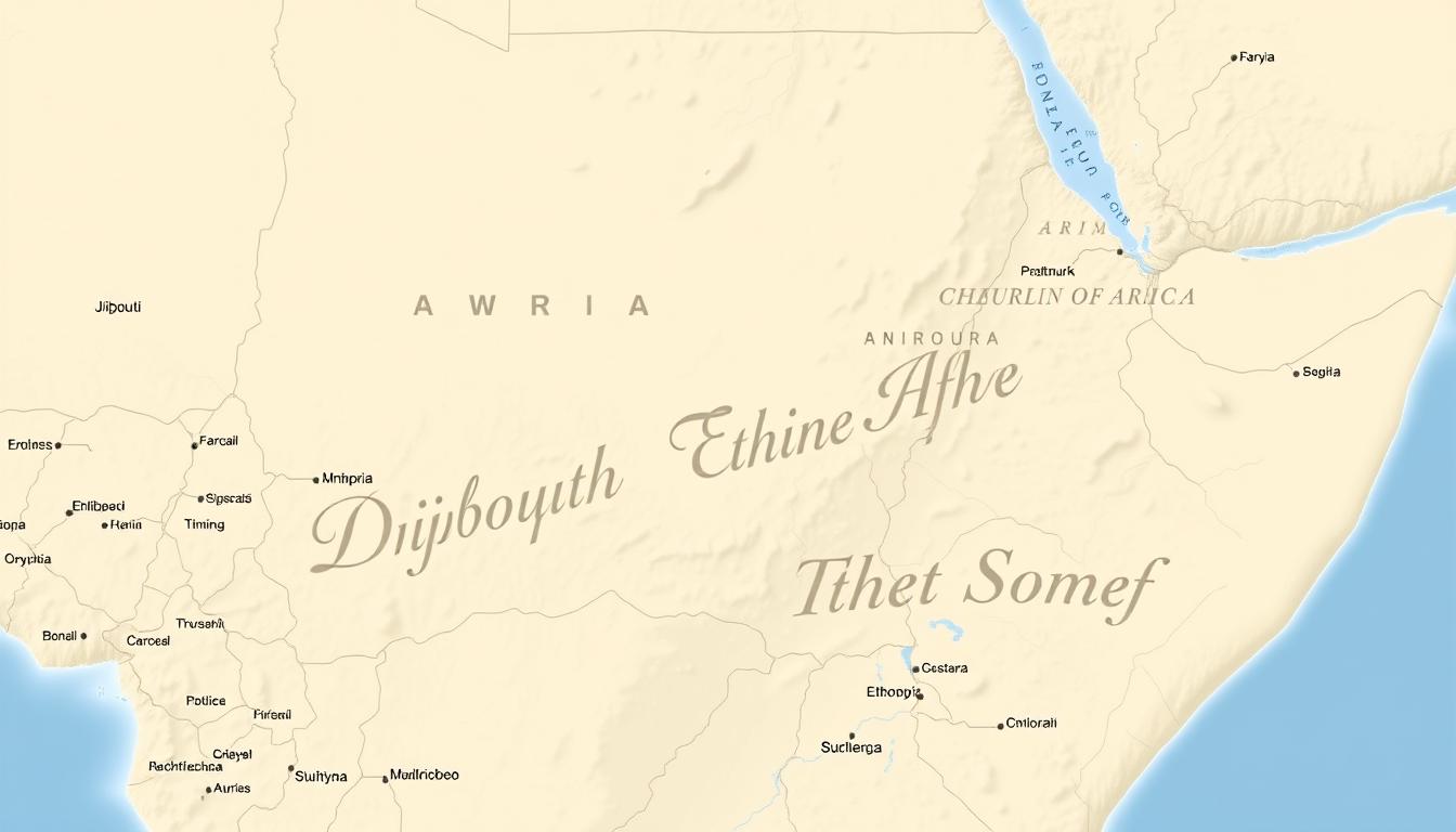
Knowing the geography of this region is key to understanding its past, culture, and economy. The map of the Horn of Africa shows the countries, their borders, and important landmarks.
Geographical Definition of the Horn of Africa
The Horn of Africa is a place of great diversity. It is surrounded by the Red Sea, the Gulf of Aden, and the Indian Ocean. This unique setting has greatly influenced its climate, economy, and culture.
Physical Boundaries and Extent
The Horn of Africa has clear physical limits. It is bordered by the Red Sea to the north, the Gulf of Aden to the east, and the Indian Ocean to the southeast. Countries like Djibouti, Ethiopia, and Somalia make up this diverse area.
| Country | Boundary | Significant Feature |
|---|---|---|
| Djibouti | Gulf of Aden | Strategic Port |
| Ethiopia | Landlocked | Highlands and Mountains |
| Somalia | Indian Ocean | Coastal Plains |
Distinctive Topographical Features
The Horn of Africa boasts unique landscapes. It has highlands, mountains, and coastal plains. The Ethiopian Highlands stand out, with their rugged terrain and high altitudes.
Mountain Ranges and Highlands
The Ethiopian Mountains are a key feature. They reach high altitudes, influencing the climate and ecosystem.
Coastal Plains and Lowlands
The coastal areas are different, with plains and lowlands. The Danakil Desert, with its harsh climate, is a prime example of the region’s varied landscapes.
The Horn of Africa’s diversity is what makes it unique. Knowing its geography helps us understand its complexities.
Historical Evolution of the Horn of Africa
The Horn of Africa has a long history, with many kingdoms rising and falling. Today, it includes Ethiopia, Eritrea, Somalia, and Djibouti. It has been a key place for trade, cultural exchange, and power.
Ancient Kingdoms and Trade Networks
The Horn of Africa was once home to powerful kingdoms like Aksum. It thrived from the 1st to the 8th century AD. Aksum was famous for its obelisks, stelae, and wide trade networks.
Trade was vital for these kingdoms. The area’s location helped trade goods like gold, ivory, and spices.
| Kingdom | Period | Notable Features |
|---|---|---|
| Aksum | 1st – 8th century AD | Obelisks, extensive trade networks |
| Adal Sultanate | 13th – 16th century AD | Islamic influence, conflict with Ethiopian kingdoms |
European Colonial Influence and Partitioning
In the late 19th and early 20th centuries, European powers like Italy, Britain, and France colonized the Horn of Africa. This changed the region’s politics by dividing it into territories.
The colonial era’s impact is seen today. It shaped borders and politics, affecting stability and international relations.
Post-Independence Border Formations
After gaining independence, the Horn of Africa faced challenges with its borders. These borders, set by colonial powers, didn’t always match ethnic or linguistic groups. This led to tensions and conflicts.
Creating today’s borders was complex. It was influenced by history, ethnic groups, and power dynamics. Knowing about these border formations helps understand the region’s current challenges.
Ethiopia: The Highland Nation
Ethiopia is known for its rugged highlands and rich culture. It’s a key nation in the Horn of Africa. Its diverse geography and long history make it interesting.
Geographical Features and International Borders
Ethiopia’s highlands are a big part of its geography. They shape the country’s climate and ecosystem. It borders several countries, including Eritrea, Djibouti, Somalia, Kenya, South Sudan, and Sudan.
Major Cities and Administrative Regions
Addis Ababa is Ethiopia’s capital and main hub. Dire Dawa and Mekelle are also important cities. The country is split into regions, each with its own culture and geography.
| Region | Capital | Population |
|---|---|---|
| Tigray | Mekelle | 4.9 million |
| Amhara | Bahir Dar | 20 million |
| Oromia | Adama | 30 million |
Cultural and Historical Landmarks
Ethiopia is famous for its culture and history. It has ancient sites and modern cities that show its rich past and present.
Ancient Historical Sites
The rock-hewn churches of Lalibela are a UNESCO World Heritage Site. They were carved in the 12th century. These churches show Ethiopia’s deep religious roots.
Modern Urban Centers
Addis Ababa is a lively city that mixes old and new. It has museums, cultural centers, and historical sites. The National Museum of Ethiopia is home to “Lucy,” a famous fossil.
Ethiopia’s landmarks, old and new, make it special in the Horn of Africa. It’s a place of interest because of its heritage and modern life.
Somalia: The Eastern Peninsula
Somalia has a long coastline along the Gulf of Aden and the Indian Ocean. It plays a big role in regional maritime activities. The country is in the Horn of Africa, known for its long coastline and varied landscapes.
Coastline and Maritime Boundaries
Somalia’s coastline is over 3,000 kilometers long, one of Africa’s longest. Its maritime boundaries are key for international trade. Ports like Mogadishu and Berbera help move goods in and out.
The coastline also offers rich fishing grounds. This boosts the country’s economy and ensures food for its people.
Internal Regions and Territorial Divisions
Somalia is split into several regions, each unique. The country’s clan system shapes its territorial divisions and how it’s governed. These regions have different levels of freedom and cultural and economic ways.
Autonomous Regions: Somaliland and Puntland
Somaliland and Puntland are two areas in Somalia with their own rules. Somaliland declared it was independent in 1991. Puntland stays part of Somalia but has its own rule.
Governance Structures
Somaliland has a stable government with a president and a two-chamber legislature. Puntland also has its own government, part of Somalia. Both work to build strong governments despite hurdles.
Border Disputes
Both Somaliland and Puntland face border issues, with Somalia and each other. These disputes are about resources, territory, and past problems. Solving these is key to peace in the region.
In summary, Somalia’s geography and politics are complex. This affects its growth and development. Knowing about its regions and governments is vital for tackling challenges and seizing opportunities in the Horn of Africa.
Eritrea: The Red Sea State
Eritrea is a key player in the Horn of Africa. It’s located in the northeastern part of the region. It borders Ethiopia and Sudan and has a coastline along the Red Sea.
Geographical Position and Natural Features
Eritrea has diverse landscapes. It ranges from highlands to low-lying coastal areas. The terrain includes mountains, valleys, and deserts.
Key geographical features include:
- The Dahlak Archipelago, a group of islands off the coast of Eritrea.
- The Semien Mountains, a rugged and mountainous region.
- The Danakil Depression, one of the lowest and hottest places on Earth.
Border Relations with Ethiopia and Sudan
Eritrea’s border relations with its neighbors are complex. The border with Ethiopia has been a major point of tension. There have been historical conflicts over territorial claims.
| Country | Border Length (km) | Key Issues |
|---|---|---|
| Ethiopia | 912 | Territorial disputes, historical conflicts |
| Sudan | 605 | Border demarcation, local conflicts |
Strategic Coastal Importance
Eritrea’s coastline along the Red Sea is very important. The port city of Massawa is a key commercial center. Maritime trade is vital to its economy.
The Red Sea is a major shipping lane. It connects Europe and Asia through the Suez Canal. Eritrea’s ports are critical for trade in the region and beyond.
Djibouti: The Strategic Gateway
Djibouti is key in global maritime trade and security. It’s near the Bab-el-Mandeb Strait.
Djibouti is in East Africa, small but very important. It’s near the Bab-el-Mandeb Strait. This makes it a big trade gateway.
Location and Territorial Dimensions
Djibouti is small, about 23,200 square kilometers. But, its location and natural features make it big in global affairs.
The country has different landscapes. There are volcanic plateaus, mountains, and coastal plains. This makes Djibouti’s environment and weather unique.
International Military Bases and Presence
Djibouti has bases from the US, France, and others. These bases show Djibouti’s role in security.
The US has Camp Lemonnier, a key base for fighting terrorism. France also has a base, showing Djibouti’s ties with France.
| Country | Military Base | Purpose |
|---|---|---|
| United States | Camp Lemonnier | Counter-terrorism operations |
| France | French Military Base | Regional security and defense |
Port Facilities and Maritime Significance
Djibouti’s ports are vital for trade. The Port of Djibouti is very busy, handling lots of cargo.
The port’s location near the Bab-el-Mandeb Strait is key. It connects Europe, Asia, and Africa. The Doraleh Container Terminal, run by DP World, boosts Djibouti’s maritime power.
A maritime expert says, “Djibouti’s ports are key to its economy. They help trade and boost the nation’s GDP.”
“The strategic location of Djibouti and its port facilities make it an attractive hub for international trade and investment.”
The Horn of Africa’s Strategic Waterways
The Horn of Africa is key to global trade, security, and economy. Its unique geography gives it access to the Red Sea, the Gulf of Aden, and the Indian Ocean. This makes it very important.
These waterways are very important. They help move goods like oil and gas, affecting global energy markets. They also face security concerns because of their strategic value.
Red Sea Corridor
The Red Sea Corridor is a major trade route. It connects Europe and Asia, handling a lot of shipping. It’s also linked to the Suez Canal, a key trade shortcut.
Gulf of Aden and Maritime Security
The Gulf of Aden is a busy shipping area. But, it’s also a problem spot for piracy. To solve this, countries work together to keep the waters safe.
Indian Ocean Access and Trade Routes
The Indian Ocean connects the Horn of Africa to the world. Its ports, like Djibouti, are key for trade. They help landlocked countries reach the global market. The ocean is also important for the environment and weather.
In summary, the Horn of Africa’s waterways are vital for its economy and security. Knowing their importance helps us understand the region better.
Climate and Ecological Diversity
The Horn of Africa has many climates and ecosystems. It ranges from highlands to deserts and coasts. This variety comes from its complex geography, affecting local climates and ecosystems.
Highland Climate Systems and Rainfall Patterns
Highlands in Ethiopia and Eritrea have a temperate climate. They get a lot of rain during some seasons. This rain is key for farming, helping millions of people.
Rainfall varies across the region. Some areas get heavy monsoon rains, while others stay dry.
Key characteristics of highland climate systems include:
- Cool temperatures compared to lowland areas
- High levels of rainfall, mainly during monsoon seasons
- Diverse ecosystems, like forests and grasslands
Coastal and Desert Ecosystems
The coastal areas of Somalia and Djibouti have a hot, arid climate. They get little rain. Deserts in Somalia and Ethiopia have extreme temperatures and low humidity. These places have unique plants and animals.
Environmental Challenges and Conservation Efforts
The Horn of Africa faces big environmental challenges. Desertification and water scarcity are major issues. Climate change and human actions make these problems worse.
Desertification
Desertification harms land and reduces its productivity. To fight it, there are reforestation and sustainable land use efforts.
Water Resource Management
Managing water well is key to solving water scarcity. This means using efficient irrigation and teaching communities to save water.
The region’s diverse ecosystems are precious. But, they need careful management to tackle environmental challenges. Conservation is vital to protect the Horn of Africa’s natural resources and ecosystems.
Population Distribution Across the Horn of Africa
The Horn of Africa is known for its diverse ethnic and linguistic groups. Countries like Ethiopia, Somalia, Eritrea, and Djibouti have a complex population. This diversity comes from history, culture, and geography.
Major Ethnic Groups and Language Families
Many ethnic groups live in the Horn of Africa, each with their own language and culture. In Ethiopia, the Oromo and Amhara are the main groups. Somalia is mostly Somali.
The languages spoken here include Afro-Asiatic and Nilo-Saharan. This shows the area’s rich language diversity.
| Country | Major Ethnic Groups | Primary Language Families |
|---|---|---|
| Ethiopia | Oromo, Amhara | Afro-Asiatic |
| Somalia | Somali | Afro-Asiatic |
| Eritrea | Tigrinya, Tigre | Afro-Asiatic |
| Djibouti | Somali, Afar | Afro-Asiatic |
Religious Composition and Cultural Zones
The Horn of Africa is home to many Muslims and Christians. Ethiopia and Eritrea have strong Christian traditions. Somalia and Djibouti are mostly Muslim.
This mix of religions adds to the region’s rich culture.
Migration Patterns and Refugee Movements
Migration and refugee movements are big in the Horn of Africa. They are often due to conflict, economic issues, and environmental problems. Many from Somalia and South Sudan have moved to places like Ethiopia.
Current Political Landscape
The Horn of Africa has a mix of governance systems. This shows the region’s diverse political dynamics.
Governance Systems and Political Structures
The Horn of Africa has different governance systems. Ethiopia has a federal parliamentary system. On the other hand, Eritrea is ruled by a single-party regime. Djibouti has a presidential system. These systems affect political stability and development in the region.
Ongoing Conflicts and Peace Processes
There are ongoing conflicts in the Horn of Africa, like in Somalia and parts of Ethiopia. Peace efforts are underway, involving regional and international actors. For example, the African Union Mission in Somalia (AMISOM) has helped stabilize Somalia.
International Relations Between Horn Nations
International relations in the Horn of Africa are complex. Regional organizations like the Intergovernmental Authority on Development (IGAD) play a key role. Relations between countries like Ethiopia and Eritrea have changed, with periods of conflict and recent peace agreements. External partners also add to the complexity of these relations.
| Country | Governance System | Notable Conflicts |
|---|---|---|
| Ethiopia | Federal Parliamentary | Tigray Conflict |
| Eritrea | Single-Party Regime | Border disputes with Ethiopia |
| Djibouti | Presidential System | Border disputes with Eritrea |
Economic Resources and Development Corridors
The Horn of Africa’s economy is strong thanks to its natural resources and location. It has fertile lands, minerals, and better roads. These help the economy grow.
Agricultural Zones and Food Production
The Horn of Africa has big areas for farming. Countries like Ethiopia and Somalia grow crops like maize and coffee. Farming helps the economy and keeps people fed.
The Food and Agriculture Organization (FAO) says the area could be a big farming center. But, it faces challenges like drought and land loss.
Mineral Resources and Extraction Industries
The Horn of Africa has gold, oil, and gas. Eritrea and Ethiopia mine these resources. Mining brings in money and jobs.
For example, Ethiopia’s gold mining has grown a lot. It helps the country earn more money from exports.
Transportation Networks and Economic Corridors
Good roads and railways are key for the Horn of Africa’s growth. They help trade and business.
Road and Rail Systems
The area has invested in its roads and railways. The Addis Ababa-Djibouti railway has made trade easier and cheaper.
Port Connectivity
Ports like Djibouti and Berbera are important for trade. They connect the Horn of Africa to the world. Better ports mean more trade.
| Country | Major Ports | Key Commodities |
|---|---|---|
| Djibouti | Djibouti Port | Oil, containers, livestock |
| Somalia | Berbera Port | Livestock, bananas, frankincense |
| Eritrea | Assab Port | Oil, salt, minerals |
“The development of transportation infrastructure is critical for the Horn of Africa’s growth. Better roads and railways will boost trade and unity.”
The Horn of Africa’s resources and roads are key for its success. By using its farms, mines, and transport, it can grow and connect with the world.
Interpreting the Horn of Africa Map
Understanding the Horn of Africa map means looking at its features, disputed areas, and past boundary changes. The area’s varied landscapes and climates are shown on the map.
Key Cartographic Features and Symbols
The map of the Horn of Africa uses symbols and features to show different places and political areas. Topographical features like mountains and deserts help us understand the climate and where people can live. For example, the Ethiopian Highlands affect the local environment and farming.
Cartographic symbols mark borders, cities, and important sites. Knowing these symbols helps us understand the map better. It gives us insights into the region’s geography and politics.
Understanding Contested Borders and Territories
Border disputes are a big part of the Horn of Africa map. Ethiopia and Eritrea have long-standing border issues. These disputes often involve deeper issues like identity, resources, and power.
“The border disputes in the Horn of Africa are not just about territorial control but also about the complex interplay of historical grievances, ethnic identities, and economic interests.”
It’s important to understand these disputed areas. They help us see the region’s dynamics and the challenges people face.
Historical Changes in Regional Boundaries
The Horn of Africa’s borders have changed a lot over time. These changes were influenced by colonialism, post-colonial adjustments, and local conflicts. The old colonial lines often don’t match the local ethnic or geographical realities.
These historical changes have shaped the Horn of Africa’s politics and society today. Looking at these changes helps us understand the region’s complex history and ongoing issues.
Conclusion
The Horn of Africa is a complex and dynamic region. It has diverse geography, rich history, and complex cultural dynamics. Understanding these aspects is key to grasping its current challenges and opportunities.
The region has a lot of economic promise. This comes from its agricultural zones, mineral resources, and transportation networks. Yet, it also faces big challenges like ongoing conflicts, environmental degradation, and development constraints.
To tackle these challenges, we need a deep understanding of the Horn of Africa’s geography. We must also commit to sustainable development and peacebuilding. As a critical part of East Africa, the Horn plays a vital role in regional and global affairs.
By looking into the region’s complexities and opportunities, we can see why promoting stability and prosperity is so important. This strategic region is key to the future.