Albania is found in southeastern Europe. It is surrounded by several countries. These include Montenegro to the northwest, Kosovo to the northeast, North Macedonia to the east, and Greece to the south.
Knowing the geography of Albanian Regions is key to understanding the country’s role in the area. The Albania Map is a vital tool. It helps us explore its features and the countries around it.
This article will explore why the map is important. It will help us understand Albania’s location and its neighboring countries.
Geographical Overview of Albania
Albania’s landscape is varied, with mountains, rivers, and a coastline along the Adriatic Sea. This mix makes the country’s natural beauty and ecosystems unique.
Location and Size of Albania
Albania lies in Southeastern Europe, in the Balkan Peninsula. It spans about 11,100 square miles (28,748 square kilometers). It’s roughly 210 miles (340 km) long and 95 miles (150 km) wide.
This geographical positioning places Albania as a key player in the region. It shares borders with Montenegro to the northwest, Kosovo to the northeast, North Macedonia to the east, and Greece to the south.
Key Geographical Features
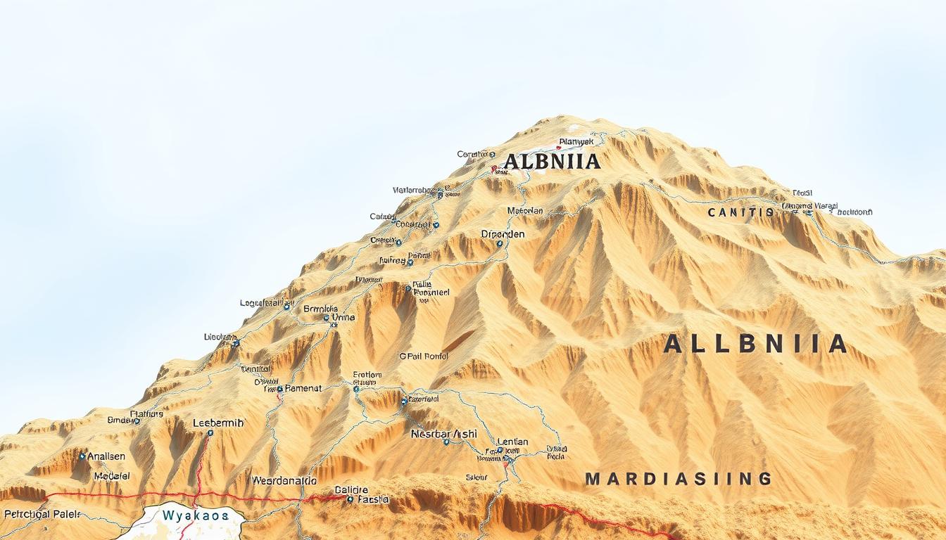
The terrain of Albania is marked by mountains, forests, and rivers. The Albanian Alps in the north and the Accursed Mountains, part of the Dinaric Alps, dominate the landscape. shows the varied landscape. It includes major rivers like the Drin and Vjosë, and lakes like Lake Ohrid and Lake Prespa.
These features add to Albania’s natural beauty and are vital for its ecosystem and economy.
Geographers say Albania’s varied terrain supports a wide range of biodiversity. This is clear in the country’s diverse flora and fauna. They thrive in the mountains, forests, and water bodies.
Historical Context of Albania’s Borders
The history of Albania’s borders is filled with change and adaptation. Albania sits at the heart of the Balkan Peninsula. This location has made it a meeting place for many cultures and empires.
Evolution of Albanian Boundaries
Over the years, Albania’s borders have changed a lot. It was once part of the Illyrian kingdom and later under Roman rule. The Ottoman Empire also had a big influence. The Interactive Albania Map shows how the country’s size has changed.
In the 20th century, Albania became independent and its borders were set. But, its borders have kept changing due to regional politics and conflicts. Knowing how Albania’s borders have changed helps us understand its current situation.
Impact of Historical Events on Current Borders
Many historical events have shaped Albania’s borders. Its time under Ottoman rule and fight for independence are key. The Satellite Map of Albania helps us see how these events have shaped its geography.
The world wars and the Cold War also affected Albania’s borders. The country’s alliances and involvement in conflicts have left marks on its territory.
Today, Albania’s borders are recognized worldwide. The country is active in both regional and global affairs. Its border history helps us understand its current role in the Balkans.
The Complete Albania Map Guide
Understanding Albania’s geography starts with its maps. A Printable Albania Map is great for travelers and those who love geography. It shows the country’s varied landscapes in detail.
Reading and Understanding Albanian Maps
To use an Albania map well, you need to know the symbols, legends, and scales. Maps show real distances and features. For example, the Albania Map points out mountains, rivers, and coastlines.
Maps use colors and symbols to show different areas. Knowing these helps you navigate Albania’s geography. It’s useful for planning trips or studying the area.
Major Geographical Coordinates
Albania’s location and climate are key to understanding it. It’s between latitudes 39° and 43° North, and longitudes 19° and 21° East. This puts Albania in southeastern Europe, in the Balkan Peninsula.
Knowing these coordinates helps find important places like Tirana. It also shows how the country’s geography affects its weather.
Learning about the Albania Map and its coordinates deepens your understanding. It shows Albania’s diverse landscapes and its role in Europe.
Administrative Divisions of Albania
Knowing Albania’s administrative divisions is key to understanding its politics and geography. The country is split into several layers, starting with counties, then municipalities, and local units.
Albania’s setup helps with governance and organizing regions. The 12 counties (qarks) are the first level, playing a big role in governance.
12 Counties (Qarks) of Albania
The 12 counties are Albania’s main divisions, each a big unit in geography and politics. Here are the counties:
- Berat
- Dibër
- Durrës
- Elbasan
- Fier
- Gjirokastër
- Korçë
- Kukës
- Lezhë
- Shkodër
- Tiranë
- Vlorë
These counties are shown on the Political Map of Albania, which details their boundaries.
| County | Capital | Area (km²) |
|---|---|---|
| Berat | Berat | 1,798 |
| Dibër | Peshkopi | 1,088 |
| Durrës | Durrës | 766 |
61 Municipalities (Bashkia) Structure
Albania has 61 municipalities, the second level, handling local governance. They cover the 12 counties, ensuring each area has a governance system.
A report says, “Municipalities handle public services, manage infrastructure, and set local policies.” This shows how vital municipalities are in Albania’s setup.
“The decentralization process has empowered municipalities to take on more responsibilities, improving local governance and community involvement.”
map shows where these municipalities are in Albania, giving a clear view of its divisions.
In summary, Albania’s divisions are key to its governance and identity. Knowing about the 12 counties and 61 municipalities helps understand its political landscape.
Topography and Physical Features of Albania
Albania’s terrain is a mix of mountains, rivers, and coastlines. Its topography is complex, featuring various geographical elements. This makes Albania a unique spot in the Balkans.
Albanian Alps and Mountain Ranges
The Albanian Alps, also known as the Accursed Mountains, are in northern Albania. They are part of the Dinaric Alps and offer stunning views and tough trails. Mount Jezerca, at 2,694 meters, is the highest peak.
The mountains are not just beautiful. They also shape the climate and ecosystems of Albania.
Key Features of the Albanian Alps:
- Diverse flora and fauna
- Rugged terrain ideal for hiking and trekking
- Scenic valleys and glacial lakes
Rivers and Lakes of Albania
Albania has many rivers and lakes, adding to its biodiversity. The Drin River is long, flowing through mountains to the Adriatic Sea. Lakes Ohrid and Prespa are famous for their clear waters and history.
| River/Lake | Location | Significance |
|---|---|---|
| Drin River | Northern Albania | Longest river, supports hydroelectric power |
| Lake Ohrid | Eastern Albania | UNESCO World Heritage Site, biodiversity hotspot |
| Lake Prespa | Southeastern Albania | Transboundary lake, ecological importance |
Coastal Areas and the Adriatic Sea
Albania’s Adriatic Sea coastline is famous for its beaches and waters. These areas attract tourists and are key to the economy. The ports along the coast help trade with Mediterranean countries.
Albania’s varied landscape, from mountains to coast, showcases its rich geography. Maps help us understand this complex landscape and its natural wonders.
Montenegro: Albania’s Northern Neighbor
The border between Albania and Montenegro is a fascinating region. It offers insights into the complex history and geography of the Balkans. This area is not just a boundary between two countries; it’s a zone of cultural exchange, historical significance, and natural beauty.
Border Regions and Crossing Points
The border between Albania and Montenegro stretches for about 172 kilometers. This region is characterized by its mountainous terrain, making some areas quite remote. Key crossing points include the Bozaj/Kotromanići and Han i Hotit border crossings, which are important for both local communities and international travel.
Using an Interactive Albania Map, one can easily identify these border regions and plan their route. The map highlights not just the crossing points but also the scenic routes that connect the two countries. This makes it easier to explore the region deeply.
Shared Geographical Features
Albania and Montenegro share several significant geographical features. Most notable are the Accursed Mountains (also known as the Albanian Alps) and the Lake Skadar. The Accursed Mountains offer breathtaking landscapes and are a popular destination for hikers and adventurers. Lake Skadar, the largest lake in the Balkan Peninsula, is a vital habitat for diverse wildlife and a significant cultural landmark.
These shared features not only underscore the natural beauty of the region. They also highlight the importance of cooperation between Albania and Montenegro in preserving these resources. An Albania Map can provide detailed insights into these geographical features. This helps travelers and researchers alike.
Kosovo: The Northeastern Border
Kosovo is to the northeast of Albania, more than just a neighbor. It’s a region tied to Albania through history and culture. The bond between Albania and Kosovo is complex, with shared borders and a rich heritage spanning centuries.
Border Regions and Crossing Points
The border between Albania and Kosovo is about 112 kilometers long. There are several crossing points for goods and people. Key spots include:
- Morinë
- Vërmicë
- Qafë Morinë
These areas are vital for trade and family ties, showing the border regions are closely connected.
Historical and Cultural Connections
The historical and cultural ties between Albania and Kosovo are deep. Both share a common Albanian heritage. Important historical figures and events have touched both regions alike. The cultural bond is clear in the similar traditions, folklore, and language of Albania and Kosovo.
Some key aspects of their shared heritage include:
- Common historical figures who have played a significant role in the history of both regions.
- Shared cultural practices and traditions that transcend the border.
- Linguistic similarities, with Albanian being the predominant language in both regions.
This deep connection highlights the significance of the Albania-Kosovo relationship. Their border is not just a political line but a bridge between closely related peoples.
North Macedonia: The Eastern Neighbor
Albania’s eastern border is next to North Macedonia. This country is important for the region’s geography and economy. They share natural resources.
Border Regions and Crossing Points
The border between Albania and North Macedonia is about 151 kilometers long. There are many places where people and goods can cross. The main crossing is near Qafë Thanë town.
A Topographic Map of Albania shows the border’s terrain and height changes. This is key to understanding the area’s geography.
Lake Ohrid and Shared Natural Resources
Lake Ohrid, a UNESCO World Heritage Site, is a big shared resource. It’s famous for its clear waters and diverse life. Both countries gain from its beauty, drawing tourists and boosting local businesses.
A Printable Albania Map is great for those visiting Lake Ohrid and the border. It makes it easy to see the area’s geography. It helps plan trips and itineraries.
Greece: Albania’s Southern Border
Albania and Greece share a border that marks a cultural exchange zone. This area is known for its historical sites and natural beauty. It also shows the interaction between the two countries.
Border Regions and Crossing Points
The border between Albania and Greece is about 282 kilometers long. The Kakavia border crossing is a key spot for trade and travel. An Interactive Albania Map helps explore these areas and plan visits.
- Kakavia border crossing: A major point for trade and travel.
- Mertzani border crossing: Another significant crossing point.
- Various minor crossings for local traffic.
Shared Cultural Heritage and Disputed Areas
The region shared by Albania and Greece is rich in cultural heritage. It has historical sites and traditions that go back before modern states. Yet, there are disputes, like the rights of the Greek minority in Albania and historical narratives. The Albania Map helps show these areas and the cultural and historical ties.
“The cultural heritage of the region is a complex tapestry woven from the threads of various civilizations, including ancient Greeks, Romans, and Ottomans.”
Interactive maps help understand these complex issues. They provide a visual look at the geography and culture.
Major Cities and Landmarks on the Albania Map
The Albania map shows many major cities and landmarks. These places are full of history and natural beauty. They help us understand Albania’s culture and its role in the Balkans.
Tirana: The Capital City
Tirana, Albania’s capital, is a lively city. It mixes modern and old buildings. The Skanderbeg Square is at the heart, with government buildings and museums around it.
The city’s architecture tells its story. You can see mosques from the Ottoman era and buildings influenced by Italy. The National Historical Museum offers a deep dive into Albania’s history, from ancient times to its fight for freedom.
Other Significant Urban Centers
Albania has more than just Tirana. Shkodër in the north is famous for its castle and culture. Vlorë, a coastal city, boasts stunning beaches and the National Independence Museum.
Berat and Gjirokastër are historic towns. They are known for their Ottoman architecture and are UNESCO World Heritage Sites.
UNESCO World Heritage Sites
Albania boasts several UNESCO World Heritage Sites. The Butrint archaeological site is a key ancient ruin. It shows Greek, Roman, and Venetian influences.
The historic centers of Berat and Gjirokastër are also UNESCO sites. They are known for their architecture and history. These sites are cultural treasures and draw tourists, boosting the local economy.
Types of Albania Maps for Different Purposes
Albania offers many maps for travelers and researchers. These maps help understand the country’s geography and culture. They are key for exploring Albania’s varied landscapes, from mountains to the Adriatic coast.
Political Map of Albania
A Political Map of Albania shows the country’s divisions. It includes 12 counties and 61 municipalities. This map is great for learning about Albania’s political areas and major cities.
Topographic Map of Albania
The Topographic Map of Albania displays the country’s physical features. It shows mountains, rivers, and valleys. It’s perfect for hikers, researchers, and anyone curious about Albania’s geography.
Interactive and Satellite Maps of Albania
Interactive Maps of Albania let you explore the country in a fun way. You can zoom in and out and find more info on places. Satellite Maps of Albania give a real view of the terrain. They’re great for learning and planning trips.
Printable Albania Maps for Travelers
Printable Albania Maps are great for travelers. They provide a solid guide during your trip. These maps are handy when you’re in areas with no internet.
In summary, Albania has many maps for different needs. Whether you’re traveling, researching, or just interested in geography, there’s a map for you.
Practical Guide to Using Albania Maps
Exploring Albania’s geography is easier with the right map skills. The country’s varied landscapes, from the Albanian Alps to the Adriatic Sea coast, need a good map to fully enjoy and navigate.
Navigating Albanian Roads and Highways
Albania’s roads connect major cities and towns. The A1 highway links Tirana to Kosovo. Other key roads go to Montenegro, North Macedonia, and Greece. An Interactive Albania Map helps plan your trip and know the road conditions.
The SH1 highway is key for coastal travel. It links many coastal towns and cities. Knowing the road network is essential for travelers, helping them move between areas.
Understanding Map Symbols and Legends
Map symbols and legends are key to reading Albania maps. Symbols show different features like roads, rivers, and historical sites. For example, a red line is a main highway, and a blue line is a river.
| Symbol | Meaning |
|---|---|
| Red Line | Main Highway |
| Blue Line | River |
| Star | Capital City |
Mobile Apps and Digital Resources
In today’s world, mobile apps and online tools are great for exploring Albania. Apps like Google Maps and Maps.me offer detailed maps and traffic updates. A Satellite Map of Albania also shows the country’s geography and infrastructure.
Using these digital tools makes traveling in Albania better. They provide current info and help you find your way around more easily.
Conclusion: Understanding Albania’s Place in the Balkan Peninsula
Albania is a key country in the Balkan Peninsula, known for its rich history and culture. The Albania Map shows the country’s location and its ties to neighbors like Montenegro, Kosovo, North Macedonia, and Greece.
The country’s geography is varied, with mountains, rivers, and coastlines along the Adriatic Sea. Knowing its geography helps us understand its culture and history.
The Albania Map also highlights the country’s administrative setup. It has 12 counties and 61 municipalities. This info is key for traveling and seeing places like Tirana and UNESCO sites.
In summary, the Albania Map is essential for grasping the country’s role in the Balkan Peninsula. By studying the map and exploring Albania’s regions, we can appreciate its complex history, culture, and natural beauty.