The West Nordic region is home to Greenland, Iceland, and the Faroe Islands. It’s a place of stunning beauty and rich culture. These territories are found in the North Atlantic.
These Scandinavian countries are special because of where they are. Iceland is famous for its hot springs and the Northern Lights. It’s a top spot for tourists.
Greenland, Iceland, and the Faroe Islands are different but together they make the Nordic region special. Each place adds its own flavor to the area.
The West Nordic Region: An Overview
The West Nordic Region is in the North Atlantic. It has a unique Nordic culture and stunning landscapes. This area, with Greenland, Iceland, and the Faroe Islands, mixes tough nature with deep culture.
Geographic Location and Maritime Boundaries
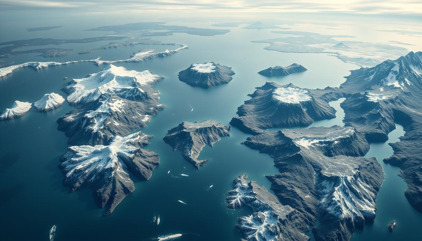
The West Nordic Region is in the North Atlantic. It touches the Arctic and Nordic Seas. Greenland, the biggest island, is to the east of Canada’s Arctic Archipelago. Iceland is near the Arctic Circle. The Faroe Islands are between Iceland and Norway.
The seas around these countries shape their climate, economy, and culture. This is because of their maritime boundaries.
| Country | Maritime Boundary | Significant Features |
|---|---|---|
| Greenland | Arctic and North Atlantic Oceans | Ice sheets, fjords |
| Iceland | North Atlantic Ocean | Volcanic landscapes, geothermal activity |
| Faroe Islands | North Atlantic Ocean | Rocky coastlines, bird sanctuaries |
Historical and Cultural Connections
The West Nordic countries have a shared Nordic culture. This culture comes from Norse history and the Viking Age. They speak Old Norse, a language from Scandinavia, which shows their cultural bond.
“The cultural heritage of the West Nordic Region is a testament to the resilience and adaptability of its people, shaped by their harsh yet beautiful environment.”
Their culture is also shaped by being isolated and meeting other cultures. This includes the Inuit in Greenland and the Danish in the Faroe Islands. Today, they celebrate their diversity through festivals and traditions. This strengthens their unique identity in Northern Europe.
Understanding the Nordic Countries
To understand the Nordic Countries, we need to look at their definition, history, and how they work together. These countries are known for their high quality of life and strong social systems. Each country has its own history and culture.
Definition and Composition of Nordic Nations
The term “Nordic Countries” includes Denmark, Finland, Iceland, Norway, and Sweden. It also includes places like Greenland, the Faroe Islands, and Åland. These countries share a Nordic heritage and cultural ties, even though they are different in politics and history.
The Nordic Council, started in 1952, helps these countries work together. It focuses on culture, the environment, and security. This council helps build a sense of community and shared values among its members.
West Nordic Council and Regional Cooperation
The West Nordic Council works on cooperation between Iceland, Greenland, and the Faroe Islands. It deals with issues like maritime resources and cultural exchange. This helps improve regional collaboration and understanding.
Cooperation in the Nordic Countries is based on shared values like democracy, equality, and caring for the environment. These efforts strengthen regional bonds. They also help the world by promoting peace, stability, and growth.
Cartography of the West Nordic Region
The West Nordic Region’s maps have changed a lot over time. This is thanks to new tech and a better understanding of its geography.
Historical Mapping Challenges
Mapping the West Nordic Region was hard in the past. The climate was tough, distances were long, and the land was rough. Cartographers had to face many obstacles, like getting to some places was hard and measuring things accurately was a big task.
The region’s special features, like Greenland’s ice and Iceland’s volcanoes, made things even harder.
Key historical challenges included:
- Limited geographical data
- Harsh weather conditions
- Difficulty in accessing remote areas
Modern Mapping Technologies and Resources
New tech has changed mapping in the West Nordic Region. Satellite images, remote sensing, and digital maps have made maps more accurate and detailed.
Satellite Imagery and Remote Sensing
Satellite images have let cartographers map the region very precisely. Remote sensing helps gather data on the land. For example, it’s key for tracking Greenland’s ice sheet changes, which show how climate is shifting.
Digital mapping tools have made sharing and updating maps easier. These tools let people see detailed maps of the area. They include info on the land, buildings, and nature. Norway and Sweden have also seen big improvements in digital mapping, helping with regional work and growth.
These tech advancements have not just made mapping better. They also help with things like watching the environment, planning cities, and helping tourists.
Greenland: The World’s Largest Island
Greenland, known as Kalaallit Nunaat in Inuit, is a land of great diversity and cultural importance. It’s the world’s largest island, mixing harsh Arctic conditions with a rich cultural heritage.
Geographic Features and Climate Zones
Greenland’s landscape is vast, with ice sheets, fjords, and rugged coastlines. The ice sheet, covering 80% of the island, is up to 3 kilometers thick in some spots. It’s key to the global climate.
The climate changes a lot across the island. From polar in the north to subarctic in the south, it supports different ecosystems. These range from ice caps to tundra.
| Region | Climate Type | Ecosystem |
|---|---|---|
| North | Polar | Ice Caps |
| South | Subarctic | Tundra |
| East/West Coasts | Maritime | Fjords, Coastal Ecosystems |
Political Status and Home Rule Government
Greenland is an autonomous territory in the Kingdom of Denmark. It has a home rule government that started in 1979. This gives Greenland a lot of control over its own affairs.
The Greenlandic government handles many areas, like education and healthcare. But Denmark looks after defense and foreign affairs.
“The home rule arrangement has allowed Greenland to manage its internal affairs while maintaining a close relationship with Denmark,” said a Greenlandic government official.
Indigenous Inuit Culture and Communities
The Inuit culture is a big part of Greenland’s identity. Most people are Inuit, and their traditions and language are closely tied to the Arctic environment.
Despite challenges from climate change and modernization, Inuit communities in Greenland are trying to keep their culture alive. They’re adapting to the changing world while holding onto their heritage.
Mapping Greenland’s Unique Landscape
Greenland’s landscape is filled with a massive ice sheet, rugged coastlines, and unique natural features. It’s a key area for study in Northern Europe. As part of the Nordic Countries, Greenland’s geography is both fascinating and important for global environmental studies.
The Ice Sheet and Its Global Significance
The Greenland ice sheet is the second-largest ice body in the world, covering about 80% of the island. It plays a big role in regulating global sea levels and climate patterns. Research on the ice sheet is vital for understanding climate change impacts.
Coastal Settlements and Urban Centers
Despite the harsh climate, Greenland has several coastal settlements and urban centers. The capital, Nuuk, is home to a significant portion of the population. These settlements are key for the country’s economy and cultural heritage.
Natural Landmarks and Protected Areas
Greenland is home to many natural landmarks and protected areas. These show its diverse and unique ecosystems.
Northeast Greenland National Park
The Northeast Greenland National Park is one of the largest national parks in the world. It covers about 972,000 square kilometers. It’s a haven for Arctic wildlife and a key site for scientific research.
Ilulissat Icefjord UNESCO Site
The Ilulissat Icefjord is a UNESCO World Heritage Site. It’s known for its breathtaking icefjord landscape and high rate of ice calving. It shows the dynamic and changing nature of Greenland’s ice sheet.
These protected areas preserve Greenland’s natural beauty. They also help with global environmental conservation efforts. The preservation of such areas is essential for maintaining biodiversity and supporting climate change research.
Iceland: Land of Fire and Ice
Iceland is known for its stunning landscapes. It’s a place where fire and ice meet in a beautiful dance. This makes Iceland a great subject for study and exploration.
Volcanic Systems and Geothermal Activity
Iceland has some of the world’s most important volcanic systems. It sits on the Mid-Atlantic Ridge, where two tectonic plates meet. This area is very active with volcanoes.
About 130 volcanoes have been found in Iceland, with 30 of them active. The geothermal activity is also impressive, with many hot springs and geysers. The famous Geysir geyser shows the power of geothermal energy in Iceland.
Glaciers, Rivers, and Waterfalls
Iceland’s glaciers cover about 11% of its land. They play a big role in shaping the landscape. Vatnajökull, Europe’s largest glacier, is a key feature.
The country’s rivers and waterfalls are also amazing. Þjórsá is one of Iceland’s longest rivers. Waterfalls like Gullfoss and Skógafoss are not just beautiful but also important in Icelandic culture.
Political Structure and Independence History
Iceland has a parliamentary system. The Althing is one of the oldest parliaments, dating back to 930 AD. Iceland became independent from Denmark in 1944, a big step in its history.
The fight for independence was about self-governance and keeping its culture alive. Today, Iceland is its own country, but it also works with other countries and groups.
Navigating Iceland’s Diverse Regions
Iceland’s landscapes vary greatly, from cities to vast wilderness. Knowing these regions is key for travelers and researchers. It helps them understand the country’s geography.
The Capital Region: Reykjavík and Surroundings
The capital region, around Reykjavík, is the heart of Iceland. It’s where most people live and where culture and economy thrive. Here, you can see modern and traditional Nordic life up close. The city is full of museums, galleries, and historical sites to explore.
The Ring Road and Major Geographic Divisions
The Ring Road is key for getting around Iceland. It links major towns and sights. You’ll see black sand beaches, glaciers, and volcanic areas along the way.
The country is divided into coastal areas, highlands, and valleys. Each has its own beauty and things to see.
Highland Interior and Accessibility
The highland interior is vast and rough. It’s harder to get to than the coast. You’ll find mountains, glaciers, and volcanic deserts here.
Getting to the highlands is mostly through F-Roads. These mountain paths need careful planning and the right vehicle.
F-Roads and Mountain Tracks
F-Roads are for four-wheel drive vehicles only. They’re closed in winter because of bad weather. These roads let adventurers reach remote areas.
Seasonal Access Considerations
Some areas, like the highlands, are only open in summer. Winter brings snow and ice, making travel tough. Always check the weather before you go.
The Faroe Islands: Archipelago in the North Atlantic
The Faroe Islands are a mix of natural wonders and cultural traditions. They are 18 major islands in the North Atlantic Ocean. This archipelago is part of the Danish Realm but self-governing.
The islands have rugged landscapes, steep cliffs, and green valleys. Their unique look comes from volcanic origins and sea erosion.
Island Geography and Formation
The Faroe Islands are between Iceland and Norway in the North Atlantic. Their terrain is mostly volcanic rocks, with basalt being common. Over millions of years, geology and erosion have shaped their landscape.
Self-Governance within the Danish Realm
The Faroe Islands have a lot of freedom within the Danish Realm. They have their own government for most local issues. Denmark takes care of defense and foreign policy. This setup lets the Faroese keep their culture while enjoying Danish support.
Distinct Faroese Culture and Language
The Faroese culture is unique, shaped by the islands’ history and geography. Their language is close to Icelandic and Old Norse but special to the islands. The culture is full of folklore, music, and dance, focusing on community and the sea.
| Aspect | Description |
|---|---|
| Geography | Rugged landscapes, steep cliffs, volcanic origin |
| Governance | Self-governing within the Danish Realm |
| Culture | Distinct Faroese language, rich folklore, traditional music |
Mapping the Faroe Islands
Mapping the Faroe Islands is a complex task. It requires understanding their geography and the solutions to connect 18 major islands.
The 18 Major Islands and Their Features
The Faroe Islands have 18 major islands, each unique. Streymoy and Eysturoy are home to the most people, with Tórshavn being the capital. The islands are known for their rugged terrain, steep cliffs, and deep fjords.
Transportation Networks: Tunnels, Bridges, and Ferries
The transportation network in the Faroe Islands shows engineering at its best. The islands are connected by tunnels, bridges, and ferries.
Subsea Tunnels and Engineering Feats
The Eysturoyartunnilin subsea tunnel has changed travel between islands. It has made journeys faster. These tunnels show the region’s dedication to better connectivity.
Maritime Connections Between Islands
Ferries also link the islands, where roads or tunnels don’t. The ferry network makes sure all islands are reachable. This helps the Faroe Islands stay connected and integrated within the Nordic Countries.
Climate and Environmental Challenges in the West Nordic Region
The West Nordic Region, including Greenland, Iceland, and the Faroe Islands, faces big environmental challenges. These challenges come from its unique geography and global climate change.
Climate Change Impacts and Vulnerabilities
The West Nordic countries are seeing fast climate changes. Rising temperatures are melting Greenland’s ice sheets, raising global sea levels. Iceland’s glaciers are shrinking, affecting its water and ecosystems. The Faroe Islands’ rugged landscapes and marine life are threatened by ocean temperature and acid changes.
Climate change vulnerabilities affect more than just the environment. Traditional ways of life in Greenland and the Faroe Islands are changing. For example, hunting and fishing, key for local communities, are impacted by sea ice changes.
Conservation Efforts and Sustainability Initiatives
The West Nordic countries are fighting back with conservation and sustainability efforts. Sustainability is a major focus, with aims to cut carbon emissions and boost renewable energy. Iceland leads in geothermal energy, while Greenland looks to diversify its economy.
The region is also working together on environmental issues. The West Nordic Council helps with climate change efforts. Conservation initiatives protect natural habitats and biodiversity. They also aim to keep the unique Nordic culture tied to nature.
Economic Geography and Resources
The West Nordic Region includes Greenland, Iceland, and the Faroe Islands. It has a unique economy because of its harsh sea and rich natural resources. Fishing is a key industry here.
Fishing Industries and Marine Resources
Fishing is vital to the West Nordic economy. Greenland, Iceland, and the Faroe Islands are famous for their fishing. They catch a lot of cod, haddock, and mackerel.
Marine resources are managed well to keep fish stocks healthy. Iceland uses a quota system to stop overfishing.
| Country | Main Fishing Products | Contribution to GDP |
|---|---|---|
| Greenland | Cold-water prawns, halibut | Approx. 90% |
| Iceland | Cod, haddock, mackerel | Around 8% |
| Faroe Islands | Mackerel, herring, cod | About 90% |
Tourism Development and Infrastructure
Tourism is growing in the West Nordic Region. The area’s landscapes and natural wonders attract visitors. Iceland’s geothermal areas and Greenland’s icebergs are big attractions.
Building tourism infrastructure is key. This includes hotels, tours, and transport. There’s also a push for sustainable tourism to protect the environment.
Emerging Industries and Future Prospects
The West Nordic Region is looking into new areas like renewable energy and tech. Iceland’s geothermal power is a good example of sustainable energy.
The region’s unique challenges are driving innovation. New industries and technologies are being developed to meet these challenges.
Historical Geography: Viking Settlements to Modern Nations
The West Nordic region, including Greenland, Iceland, and the Faroe Islands, has a rich history. It’s filled with stories of Norse exploration and settlement. This area’s past is a mix of adventure, colonization, and the fight for freedom.
Norse Exploration and Settlement Patterns
In the late 8th century, the Norse started exploring the West Nordic region. Viking settlers set up colonies in Iceland and other islands. They brought their culture, language, and traditions, which shaped today’s nations.
The places they chose to settle were influenced by geography, climate, and resources. This helped form the identity of the modern nations.
Colonial History and Independence Movements
The West Nordic Countries have a complex colonial history. Iceland and the Faroe Islands were part of Denmark, while Greenland was a Danish colony. The path to freedom was long and hard, with Iceland gaining independence in 1944.
The Faroe Islands and Greenland have also sought more control. Greenland has had home rule for 40 years, starting in 1979.
The effects of colonialism are seen today, with debates on identity, culture, and politics. Knowing this history helps us understand the West Nordic region’s complexities.
Cultural Landscapes and Traditions
The West Nordic Region has a unique culture shaped by its harsh Arctic environment. It includes Greenland, Iceland, and the Faroe Islands. These places have a rich heritage seen in their buildings, customs, and food.
Architectural Heritage and Settlement Patterns
The buildings in the West Nordic Region are designed for the local climate and materials. In Greenland, old homes were made from animal hides and snow. Now, there are colorful houses from wood and other materials.
Iceland’s turf houses date back to the Viking era. The Faroe Islands have a mix of traditional Faroese and Danish styles.
The area’s geography and climate shape where people live. Coastal areas are busier because of fishing and easy access.
Traditional Customs and Seasonal Celebrations
The West Nordic Region celebrates many traditions and festivals. Iceland’s Þorrablót festival honors its heritage with food, music, and dance. Greenland’s National Day on June 21st features Inuit games and cultural shows.
The Faroe Islands celebrate Ólavsøka with rowing and folk dancing. This festival honors Saint Olaf.
Culinary Traditions and Local Specialties
The region’s food is influenced by seafood and preservation needs. Iceland is known for fermented shark and lamb. Greenland enjoys whale and fish, while the Faroe Islands have dried and salted fish.
Comparing these countries’ foods shows a shared heritage with unique flavors.
| Country | Traditional Dish | Main Ingredient |
|---|---|---|
| Iceland | Fermented Shark | Greenland Shark |
| Greenland | Suaasat | Seal or Muskox Meat |
| Faroe Islands | Ræst Fish | Fermented Fish |
Conclusion: The Significance of the West Nordic Countries
The West Nordic Countries, including Greenland, Iceland, and the Faroe Islands, are special in the Nordic region and Northern Europe. They have their own culture, history, and environment. This makes them key parts of the Nordic world.
These countries are connected by their shared past, traditions, and location. Being part of the Nordic Countries, they add to the region’s variety. They also help shape its identity in Northern Europe.
Learning about the West Nordic region shows us the complexity of the Nordic world. It shows why regional cooperation and preserving unique cultures and environments are important.