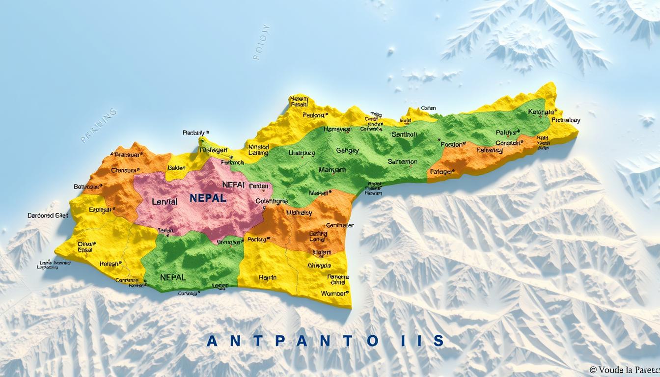
The Nepal map shows a wide range of landscapes. It highlights the country’s seven provinces and many administrative areas.
Understanding Nepal’s administrative divisions is key. It helps us grasp its geography and politics.
A detailed Nepal Map reveals the provinces and divisions. It gives us a closer look at the country’s complex geography.
This introduction prepares us for a deeper dive into Nepal’s geography. It shows why this knowledge is important.
Geographical Overview of Nepal
Nepal is in the heart of the Himalayas. It has mountains and lush plains in the Terai region. An interactive Nepal Map shows its varied landscapes and climate zones.
Location and Borders of Nepal
Nepal is between India and China (Tibet Autonomous Region). Its location is important for its politics. The country’s borders have many geographical features.
Topographical Features and Terrain
Nepal’s terrain changes a lot, from low plains to high mountains. A topographic Nepal Map shows its mountains, hills, and plains. It’s divided into three main areas: the Himalayas, Mid-Hills, and Terai.
Major Climate Zones
Nepal’s climate changes with altitude, creating different zones. These zones are linked to its topography.
Himalayan Region
The Himalayas, home to Mount Everest, have a cold climate. The high and rugged terrain makes it hard for people and farming.
Mid-Hills Region
The Mid-Hills have a temperate climate. It’s warmer in summer and cooler in winter. This area is better for people and farming than the Himalayas.
Terai Region
The Terai is Nepal’s lowland with a subtropical climate. It has hot summers and mild winters. It’s very fertile, known as Nepal’s “breadbasket” for farming.
In summary, Nepal’s geography is diverse, from the Himalayas to the Terai plains. Knowing this diversity helps us understand Nepal’s ecology, culture, and economy.
Historical Evolution of Nepal’s Administrative Boundaries
Nepal’s administrative divisions have changed a lot over time. These changes were influenced by politics, society, and geography.
Pre-2015 Administrative Structure
Before 2015, Nepal had 14 zones and 75 districts. These were grouped into 5 regions for development. This system was set up in 1972. But, it was seen as too centralized and didn’t solve regional issues well.
Constitutional Changes and Federalism
In 2015, Nepal became a federal republic. It was divided into seven provinces. This change aimed to give more power to regions and fix old inequalities.
Transition to Seven Provinces
Changing to seven provinces was a big task. It involved new boundaries and governance at the provincial level. The provinces were made by combining districts, making sure they fit geographically and work well.
Naming Controversies
One big challenge was naming the provinces. They were first called by numbers, but people wanted names that showed local culture. This led to disagreements on what to name them.
Boundary Disputes
Boundary issues also caused problems. Some districts were in dispute between provinces. This made it hard to set final boundaries. It showed the need for clear rules and ways to solve disputes.
Nepal’s new administrative setup is a big step towards better governance. It aims to include more people and give power to local areas. While there are hurdles, this change could help Nepal grow and improve local rule.
Comprehensive Nepal Map: Types and Resources
Nepal’s diverse mapping resources help us understand the country better. These include digital and interactive maps. They meet various needs, from administrative and political insights to geographical and tourist information.
Political and Administrative Maps
Political and administrative maps of Nepal show the country’s seven provinces and their divisions. These maps are key to understanding Nepal’s federal structure and governance. They highlight major cities, district boundaries, and provincial capitals, making them essential for administrative work.
Topographic and Relief Maps
Topographic maps of Nepal show the country’s varied terrain, including the Himalayas, valleys, and plains. These maps are vital for trekking, hiking, and other outdoor activities. They provide detailed elevation, relief, and landform information.
“Topographic maps are not just tools for navigation; they are gateways to understanding the complex geography of Nepal.” –
Tourist and Travel Maps
Tourist maps of Nepal focus on major attractions and travel routes. They highlight cultural sites, national parks, and trekking routes. These maps are key for planning trips.
- Major tourist destinations
- Cultural and historical sites
- National parks and wildlife reserves
- Trekking and hiking routes
Digital and Interactive Maps
Digital and interactive maps of Nepal offer a modern way to explore the country. These maps are available online and can be accessed on various platforms and devices. They provide real-time information, making them useful for navigation, research, and education.
| Map Type | Features | Use Cases |
|---|---|---|
| Political and Administrative | Provincial boundaries, district divisions, major cities | Administrative purposes, governance |
| Topographic and Relief | Elevation, landforms, terrain | Trekking, hiking, adventure activities |
| Tourist and Travel | Tourist destinations, cultural sites, travel routes | Trip planning, travel guides |
| Digital and Interactive | Real-time information, dynamic data | Navigation, research, education |
Looking for a printable Nepal Map or an online Nepal Map? There are many resources available. These maps cater to different needs, ensuring you have the information you need, whether you’re a traveler, researcher, or policymaker.
Province1: The Eastern Himalayan Gateway
Province1 is a special place in Nepal. It’s known as the Eastern Himalayan Gateway. This area has diverse geography and a rich cultural heritage. It’s a mix of Himalayan landscapes and fertile plains.
Geographical Boundaries and Features
Province1 is in the eastern part of Nepal. It borders Tibet to the north and Bihar, India, to the south. The terrain changes from the high Himalayas in the north to the fertile Terai plains in the south.
The province has many important geographical features. These include the Kanchenjunga mountain range and the Koshi River basin. These features add to the region’s beauty and help keep the ecosystem balanced.
Major Cities Including Biratnagar and Dhankuta
Biratnagar is the industrial heart of Province1. It’s a major city known for its economic activities. Dhankuta is another key city, acting as an administrative and educational center. These cities are important for the region’s growth and culture.
Other cities like Bhojpur and Dharan also play a big role. They add to the province’s cultural diversity and economic growth.
Key Districts and Administrative Units
Province1 is divided into several districts. These include Jhapa, Morang, and Sunsari. Each district has municipalities and rural municipalities, making up the administrative structure.
| District | Headquarters | Area (sq km) |
|---|---|---|
| Jhapa | Bhadrapur | 1,606 |
| Morang | Biratnagar | 1,855 |
| Sunsari | Inaruwa | 1,257 |
Economic Resources and Cultural Heritage
Province1 is rich in natural resources. It has fertile land, forests, and water. The region is also known for its cultural heritage, with many festivals and traditional practices.
“The cultural diversity of Province1 is reflected in its various ethnic groups and their traditional practices, making it a vibrant and culturally rich region.”
If you want to learn more about Province1, a free Nepal Map download is a great resource. It offers insights into the region’s geography and cultural landmarks.
Madhesh Province: The Southern Plains
The southern plains of Nepal are home to Madhesh Province. This region is a mix of cultural heritage and economic vitality. It is one of Nepal’s seven provinces, known for its fertile Terai region and significant agricultural production.
Geographical Extent and Terrain
Madhesh Province is in the southern part of Nepal, bordering India to the south. It covers a big part of the Terai region. This area is flat and fertile, making it a key agricultural hub for Nepal.
Major Urban Centers Including Janakpur
Janakpur is a major city in Madhesh Province, known for its history and culture. It’s a big pilgrimage site for Hindus, linked to the epic Ramayana. Other important cities like Birgunj, Kalaiya, and Rajbiraj also play big roles in the province’s economy and culture.
Administrative Divisions and Governance
Madhesh Province has eight districts: Sarlahi, Rautahat, Bara, Parsa, Dhanusha, Mahottari, Siraha, and Saptari. Janakpur is the provincial capital, acting as the administrative and political center. The province follows a federal model, with a provincial assembly and a council of ministers.
Cultural Significance and Economic Activities
Madhesh Province is culturally diverse, with many ethnic groups and languages. It’s known for its lively cultural festivals, traditional crafts, and historical sites. The province mainly focuses on agriculture, growing crops like rice, wheat, and sugarcane. It also has opportunities for industrial growth, in food processing and textiles.
| District | Headquarters | Major Crops |
|---|---|---|
| Sarlahi | Malangwa | Rice, Wheat |
| Rautahat | Gaur | Sugarcane, Rice |
| Bara | Kalaiya | Wheat, Maize |
Bagmati Province: Home to the Capital
Bagmati Province is where Nepal’s capital city is located. It has diverse landscapes and a rich cultural heritage. The province is known for its vibrant cities and ancient monuments.
Geographical Scope and Landscape
The landscape of Bagmati Province varies greatly. It goes from the high Himalayan ranges to the flatlands of the Terai region. This variety supports a wide range of ecosystems and biodiversity.
Kathmandu Valley and Surrounding Areas
The Kathmandu Valley is a UNESCO World Heritage Site and the heart of Bagmati Province. It’s surrounded by areas like the Pashupatinath Temple and Nagarkot. Nagarkot is famous for its stunning sunrise views over the Himalayas.
District Organization and Urban Centers
Bagmati Province is split into several districts, each with its own center. The urban centers, mainly in the Kathmandu Valley, are key for commerce, education, and governance. Cities like Kathmandu, Bhaktapur, and Lalitpur are culturally significant and drive the province’s economy.
Historical Monuments and UNESCO Sites
The province is famous for its historical monuments and UNESCO-recognized sites. The Kathmandu Durbar Square, Patan Durbar Square, and Bhaktapur Durbar Square showcase the region’s rich history and architectural heritage.
Kathmandu Durbar Square
Kathmandu Durbar Square is a historic royal palace complex. It has seen many important events in Nepalese history. It symbolizes the country’s cultural and political legacy.
Patan and Bhaktapur
Patan and Bhaktapur are key cultural centers in the Kathmandu Valley. They are known for their traditional craftsmanship and historic temples. These contribute to Nepal’s rich cultural heritage.
Gandaki Province: Land of Lakes and Mountains
Gandaki Province is in the heart of the Himalayas. It’s full of natural beauty. The area has everything from tall mountains to calm lakes and green valleys.
Geographical Boundaries and Natural Features
Gandaki Province is surrounded by important places. It borders the Tibetan Autonomous Region of China to the north and India to the south. The Annapurna range, with its high peaks, dominates the terrain.
Pokhara and Other Major Cities
Pokhara is the main city in Gandaki Province. It’s famous for its beautiful lakeside and as a starting point for the Annapurna Circuit. Other key cities are Baglung, Besisahar, and Waling. Each city gives a glimpse into the region’s culture and economy.
Administrative Structure and Districts
Gandaki Province has 11 districts, each with its own center. Pokhara is the provincial capital. This setup helps with local governance and development.
| District | Administrative Center |
|---|---|
| Baglung | Baglung |
| Gorkha | Gorkha |
| Kaski | Pokhara |
| Lamjung | Besisahar |
| Manang | Chame |
Tourism Destinations and Trekking Routes
Gandaki Province is perfect for trekkers and adventure lovers. The Annapurna Circuit and Phewa Lake are top spots.
Annapurna Circuit
The Annapurna Circuit is famous worldwide. It offers stunning Himalayan views, traditional villages, and a variety of wildlife and plants.
“The Annapurna Circuit is a trekker’s dream, with its diverse landscapes and rich cultural heritage.” –
Phewa Lake
Phewa Lake, near Pokhara, is great for water sports or just relaxing. It’s a peaceful place in nature.
In conclusion, Gandaki Province is a mix of natural wonders, culture, and adventure. It’s a key part of Nepal’s tourism and geography.
Lumbini Province: Birthplace of Buddha
Lumbini Province is in western Nepal. It’s full of Buddhist history and culture. The province is also known for its varied landscapes and rich traditions.
Geographical Extent and Characteristics
The province is in the western Terai region of Nepal. It has both fertile plains and hilly areas. It shares borders with India’s Uttar Pradesh, Gandaki Province, and Karnali Province.
Major Cities and Urban Centers
Important cities like Butwal and Siddharthanagar are in the province. These cities are key for the region’s growth. They offer many services for locals and visitors.
Administrative Organization
Lumbini Province has several districts. Each has its own headquarters. The capital, Deukhuri, is being improved for better governance.
Religious and Historical Significance
Lumbini Province is where Lord Buddha was born. It’s filled with Buddhist sites, drawing visitors from everywhere.
Lumbini Sacred Garden
The Lumbini Sacred Garden is a major pilgrimage site. It’s where Siddhartha Gautama was born. The garden is peaceful, surrounded by monasteries from different Buddhist groups.
Archaeological Sites
Lumbini has many archaeological sites. They show the area’s history and culture. You can find ancient monasteries, stupas, and other Buddhist artifacts.
An interactive Nepal Map helps understand Lumbini Province better. It lets users see the area’s geography and importance. It’s great for finding key places and seeing how they relate to each other.
Karnali Province: The Remote Highlands
The remote highlands of Karnali Province show Nepal’s untouched beauty and tough terrains. It’s in the northwest and is a big part of Nepal’s federal setup. It’s known for its rough landscapes and isolated communities.
Geographical Isolation and Terrain
Karnali Province is far away and has tough terrains, making it hard to get to. It has some of Nepal’s toughest landscapes, like high mountains and deep valleys. The topographic Nepal Map shows how complex its terrain is, with many different geographical features.
Major Settlements and Administrative Centers
Despite the tough terrain, Karnali Province has important settlements and administrative centers. Birendranagar is the provincial capital, acting as the main administrative hub. Other key towns like Surkhet and Jumla are important for the province’s economy and governance.
District Structure and Governance
Karnali Province is split into ten districts, each with its own management. The districts are run by both local and provincial governments. This ensures that both levels work together to tackle the region’s challenges. Good governance is key for the province’s growth.
Development Challenges and Natural Resources
The province has many development challenges, like limited infrastructure and harsh weather. But, it’s also rich in natural resources, like water, forests, and minerals. Using these resources wisely is important for the province’s growth and the well-being of its people.
In conclusion, Karnali Province is a unique part of Nepal, with its landscapes and challenges. Understanding its terrain through a topographic Nepal Map is vital for planning and development.
Sudurpashchim Province: The Far Western Region
The far western region of Nepal, known as Sudurpashchim Province, is a mix of natural beauty and cultural diversity. It’s a key part of Nepal’s political map. It adds to the country’s rich geography and culture.
Geographical Boundaries and Features
Sudurpashchim Province has a varied geography. It goes from the Himalayan mountains in the north to the Terai plains in the south. It borders India to the west and south, and other Nepalese provinces to the east and north.
This location is key for trade and cultural exchange between countries.
Major Cities and Administrative Hubs
The province has big cities like Godawari and Dhangadhi. These cities are important for administration. Dhangadhi is a major urban center with many organizations.
These cities are vital for the province’s economy and governance.
District Organization
Sudurpashchim Province is split into nine districts. Each district has its own government structure. This ensures good governance and public services.
The district setup is key for local development projects.
Cultural Diversity and Economic Activities
The province is home to many ethnic groups. This diversity is seen in local festivals, traditions, and languages. The economy is based on agriculture, tourism, and trade.
The Terai plains are great for farming. The Himalayas offer chances for tourism.
In conclusion, Sudurpashchim Province is essential for Nepal. Its diverse geography, rich culture, and economic activities are vital for the country’s growth.
Nepal’s Three-Tier Administrative Structure
Nepal has a three-tier system for governance. This helps in effective management across the country. It makes public services more accessible to everyone.
Federal Government Organization
The federal government is at the top. It handles national decisions and policies. It looks after defense, foreign affairs, and national infrastructure.
The government is led by a prime minister. It has various ministries and departments.
Provincial Government Structure
The second tier is the provincial level. Nepal has seven provinces, each with its own government. They focus on education, health, and local infrastructure.
These governments work with the federal government. They help implement national policies at the provincial level.
Local Government Units
The local government is the third tier. It includes rural municipalities, municipalities, and metropolitan cities. These units are key for basic services to citizens.
Rural Municipalities (Gaunpalika)
Rural municipalities group villages together. They handle services like water supply, sanitation, and road maintenance.
Municipalities (Nagarpalika)
Municipalities are urban areas with a big population. They offer services like waste management, public health, and urban planning.
Metropolitan and Sub-Metropolitan Cities
Metropolitan and sub-metropolitan cities are bigger urban areas. They have more autonomy. They handle services like public transportation and advanced healthcare.
“The three-tier system has improved governance in Nepal,” said a government official. It decentralizes power and makes services more accessible.
This structure has been praised for improving public service delivery. It promotes local governance. As Nepal grows, this framework will be key to its development.
Natural Features on the Nepal Map
Nepal’s map shows off the country’s stunning natural beauty. It features majestic mountains, rivers, and protected areas. The diverse geography attracts tourists and researchers.
Major Mountain Ranges and Peaks
Nepal boasts some of the world’s most impressive mountains, like the Himalayas. These towering peaks draw trekkers and climbers.
Mount Everest and the Himalayan Range
The Himalayan range is a key feature on Nepal’s map. Mount Everest, the world’s highest peak, is here. The Himalayas offer stunning views and challenging climbs across several districts.
Annapurna and Dhaulagiri Massifs
Nepal also has the Annapurna and Dhaulagiri ranges. These areas are known for their beauty and are favorites among trekkers and adventurers.
River Systems and Watersheds
Nepal’s rivers, like the Koshi and Gandaki, are vital. They shape the landscape and support local ecosystems.
National Parks and Protected Areas
Nepal protects its biodiversity with national parks and protected areas. Chitwan National Park and Sagarmatha National Park are home to diverse flora and fauna. They are key for conservation and eco-tourism.
Nepal’s natural wonders make it a global biodiversity hotspot and a top nature tourism spot. An online Nepal Map or a free Nepal Map download can help plan visits to these amazing places.
Practical Guide to Using Nepal Maps
Whether you’re a traveler, researcher, or geography enthusiast, knowing how to use Nepal maps is key.
Online Resources and Official Map Repositories
Nepal has many online resources for maps. The official government sites have detailed maps. Tourism sites show maps of attractions and trekking paths.
- Government Websites: The Survey Department of Nepal has topographic and administrative maps.
- Tourism Websites: Nepal Tourism Board maps focus on tourist spots and trekking.
Mobile Applications for Navigation
Many mobile apps help navigate Nepal’s varied landscapes. Some top picks are:
- Google Maps: It has detailed maps and live traffic updates.
- Nepal Map: A special app with full coverage of Nepal’s geography.
GIS Data Sources for Researchers
For researchers, GIS data is a treasure. You can find it in:
- OpenStreetMap: A project where anyone can edit maps.
- NASA’s GIS Data: Provides satellite data and topographic info.
Printable Maps for Travelers
Travelers find printable maps handy. You can get them from:
- Tourist Information Centers: They often give out free maps.
- Travel Agencies: Many offer custom maps for trips and treks.
Using these resources, you can easily explore Nepal. Whether trekking in the Himalayas or visiting cultural sites.
Conclusion
Knowing about Nepal’s geography and its parts is key for many reasons. This includes traveling, studying, and managing the country. The Nepal Map shows the country’s seven provinces, its borders, and its natural beauty.
In this article, we looked at Nepal’s geography from old times to today. We talked about the different maps like political, topographic, and tourist maps.
The Nepal Map helps people understand Nepal’s varied landscapes, culture, and economy. It’s useful for travelers, researchers, or anyone curious about Nepal. The map is a must-have for learning more.
If you want to learn more, there are many online resources and official map sites. These places offer the latest and most accurate info on Nepal’s geography and its parts.