The border between Pakistan and India is complex and very important. It starts at the Line of Control in the north. This line separates the Indian state of Jammu & Kashmir from Pakistani-administered Kashmir.
It ends at Sir Creek in the south. Sir Creek is a tidal estuary in the Rann of Kutch. It lies between the Indian state of Gujarat and the Pakistani province of Sindh.
The Indo-Pak Border Dispute began with India’s partition in 1947. This led to the creation of two separate countries. The division of the region into different territories has caused ongoing tensions.
Especially, the Kashmir Conflict is a big issue. Knowing the boundaries and their history is key to understanding this long-standing dispute.
Historical Formation of South Asian Boundaries
The partition of British India in 1947 was a key moment in South Asian history. It led to the birth of two new nations: India and Pakistan. This event was not just a simple handover but a complex process that changed the map of the region.
It resulted in one of the largest migrations in history. It also brought about significant changes in the region’s politics and economy.
The Partition of 1947 and Its Aftermath
The partition was a result of the British government’s decision to give India its freedom. The British Empire was weakening after World War II. At the same time, Indians were demanding their right to rule themselves.
The aftermath was marked by violence, displacement, and a complex boundary. This boundary has been a source of conflict for years.
“The partition of India is a seminal event in the history of the subcontinent, with far-reaching consequences for the region’s politics, society, and economy,” as noted by historians. The division led to the creation of India and Pakistan, setting the stage for decades of tension over territorial disputes.
Sir Cyril Radcliffe’s Boundary Commission
Sir Cyril Radcliffe was given the task of drawing the boundary between India and Pakistan. This led to the creation of the Radcliffe Line. The line divided Punjab and Bengal based on religion, separating Muslim-majority areas from Hindu-majority areas.
The haste and complexity of the task led to many disputes over the boundary. These disputes continue to affect the region.
The Radcliffe Line became a critical factor in the conflicts between India and Pakistan. It played a big role in the disputes over Kashmir. The boundary commission’s work, done under immense pressure, laid the groundwork for the territorial disputes that persist in South Asia.
Understanding Pakistan India Boundaries Today
The border between Pakistan and India is more than just a line on a map. It’s complex, with different parts each with its own issues.
The boundaries between Pakistan and India are divided into three main types. These are the International Border (IB), the Line of Control (LoC), and the Working Boundary. Each plays a key role in the relationship between the two countries.
Types of Boundaries: IB, LoC, and Working Boundary
The International Border (IB) is the official line between Pakistan and India. It goes through many landscapes. The Line of Control (LoC) divides Kashmir between India and Pakistan, and is heavily guarded. The Working Boundary is the edge between India’s Jammu and Kashmir and Pakistan’s Punjab.
- The International Border is seen as more formal.
- The Line of Control is sensitive because of the Kashmir issue.
- The Working Boundary has its own security and local population concerns.
Total Length and Key Geographic Features
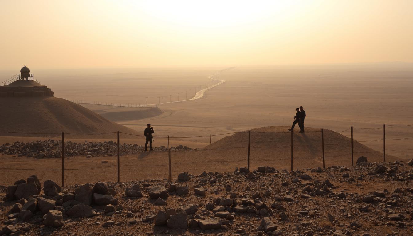
The Pakistan-India border is about 2,900 kilometers long. It goes through many landscapes, from dry areas to snowy mountains.
Between 1988 and 1993, India built fences and lights on 461 km of the Punjab border. By 1999, the Rajasthan-Pakistan border was also secured. These actions show the efforts to protect the border.
The International Border (IB) Between Pakistan and India
Understanding the International Border between Pakistan and India is key to knowing their relationship. This border is a dividing line between the two nations. It’s a critical part of their bilateral relations.
Official Demarcation and Recognition
The International Border is officially recognized by both Pakistan and India. It was demarcated based on the Radcliffe Line during the Partition of India in 1947. This clear border reduces the chance of territorial disputes.
The official recognition helps with diplomatic relations and trade. Yet, tensions remain, mainly in culturally or historically important areas.
Major Crossing Points and Border Infrastructure
There are several major crossing points along the International Border. These points help with trade and people-to-people contact. The Wagah-Attari border is famous for its daily flag-lowering ceremony.
| Crossing Point | Location | Significance |
|---|---|---|
| Wagah-Attari | Punjab | Wagah Border Ceremony, significant cultural event |
| Hussainiwala-Gandhi Singh Wala | Punjab | Major trade route |
The border has fencing, floodlights, and surveillance for security. Despite these, the border is sensitive. Both countries have a strong military presence here.
In conclusion, the International Border between Pakistan and India is complex and sensitive. It’s officially recognized but tensions and disputes persist. Understanding this border is vital for grasping Indo-Pak relations.
The Line of Control (LoC) in Kashmir
The LoC was set up after the 1972 Simla Agreement. It is a real border between Indian-administered Jammu and Kashmir and Pakistani-administered Azad Kashmir.
Origin and Historical Evolution
The Line of Control was created after the 1972 Simla Agreement. This agreement came after the Indo-Pakistani War of 1971. It aimed to set a ceasefire line, now known as the LoC.
Over time, the LoC has seen many fights and exchanges of fire. It’s a key part of the Kashmir conflict.
Current Status and Military Presence
Today, the LoC is very militarized. India and Pakistan have a big military presence there. There are often reports of ceasefire violations.
The LoC is about 740 kilometers long. It goes through mountains and forests, making it hard to secure.
Both sides have built a lot of infrastructure. This includes fencing, bunkers, and surveillance systems. They use these to watch and control the border.
| Characteristics | Details |
|---|---|
| Length | Approximately 740 kilometers |
| Terrain | Diverse, including mountains and forests |
| Military Presence | Highly militarized with significant infrastructure |
Ceasefire Agreements and Violations
Despite ceasefire agreements, there are often violations along the LoC. The biggest agreement was in 2003. But, there have been many incidents of firing and shelling.
These violations cause casualties on both sides. They add to the tension between India and Pakistan.
There are ongoing efforts to keep peace along the LoC. Diplomatic and military talks happen regularly. But, the situation is always volatile, and the LoC remains a key part of the Kashmir conflict.
The Working Boundary in Punjab
The Working Boundary separates the Indian-administered Jammu and Kashmir from Pakistan’s Punjab province. It is a key part of the complex India-Pakistan border dispute.
Definition and Geographical Location
The Working Boundary is the border between Pakistan’s Punjab and India’s Jammu and Kashmir. It runs through the Punjab plains. Even though it’s not officially an international border, it’s treated as one for administrative reasons.
Strategic Importance and Security Challenges
The Working Boundary is very important because of its location in the Punjab plains. It’s a key area for both India and Pakistan. The boundary’s disputed nature makes security a big challenge, with both sides having a strong military presence.
Tensions here can rise fast, affecting the whole region’s stability.
| Characteristics | Description |
|---|---|
| Geographical Location | Punjab Plains |
| Strategic Importance | Critical for both India and Pakistan due to fertile land and economic significance |
| Security Challenges | Heightened military presence and possible escalation |
Kashmir: The Core Territorial Dispute
Kashmir is a key area of conflict between India and Pakistan. It’s rich in history and culture. The long-standing dispute has big implications for both countries.
Historical Claims by Pakistan and India
The Kashmir issue started when British India was divided in 1947. India and Pakistan both wanted to control Jammu and Kashmir. Pakistan says it’s right because most people there are Muslim. India claims the Maharaja, who was Hindu, chose to join India.
Current Division and Administrative Control
Now, Kashmir is split between India and Pakistan. India controls Jammu and Kashmir. Pakistan has Azad Kashmir and Gilgit-Baltistan. This setup makes managing the area very complex.
UN Resolutions and International Perspectives
The United Nations has tried to help solve the Kashmir problem. They’ve suggested a vote to decide Kashmir’s future. But, India and Pakistan can’t agree. The world wants peace and talks between the two.
The Kashmir issue is a big deal in India-Pakistan relations. The world is watching. Finding a solution will take a lot of effort and both sides needing to make concessions.
Sir Creek Maritime Boundary Dispute
The Sir Creek dispute has been a big issue between India and Pakistan for years. Sir Creek is a tidal estuary in the Rann of Kutch. It’s on the border between Gujarat, India, and Sindh, Pakistan.
Geographic Location and Economic Importance
Sir Creek’s location is key for setting maritime boundaries. It’s rich in natural resources and could define the sea borders between India and Pakistan. The creek’s changing tides make setting boundaries hard. It’s thought to have lots of oil and gas, making it very valuable.
- The creek is important for fishing for both countries.
- It’s a key area for setting sea boundaries, including the continental shelf and exclusive economic zones.
Competing Claims and Negotiation Attempts
India and Pakistan both claim Sir Creek, because the boundary is unclear. They disagree on how to draw the sea boundary. Many talks have happened, but no deal has been reached.
- India and Pakistan have tried many times to solve the problem.
- The talks have focused on the technical details of setting the boundary, like using the thalweg principle.
Fixing the Sir Creek maritime boundary is key to better relations between India and Pakistan. It could also unlock the area’s economic value. More talks and a shared goal are needed for a good outcome.
Pakistan’s Boundaries with Afghanistan and Iran
Understanding Pakistan’s borders with Afghanistan and Iran is complex. It involves history, politics, and society. These borders are key to Pakistan’s foreign policy and its place in the region.
The Durand Line: History and Controversies
The Durand Line, created in 1893, marks the border between Pakistan and Afghanistan. Sir Mortimer Durand drew it to separate British India from Afghanistan. But, it has long been a point of contention, mainly between Pakistan and Afghanistan.
Afghanistan has always questioned the Durand Line’s legitimacy. This is because it was imposed without the consent of local people. It divides tribal areas, leading to disputes over who controls the land.
The Durand Line’s significance goes beyond just a border. It affects regional security, trade, and the lives of people living there. Talks to solve these issues have been ongoing, but finding a solution is hard.
Pakistan-Iran Border: Cooperation and Challenges
The Pakistan-Iran border is less disputed than the Durand Line but faces its own hurdles. The area sees both cooperation and tension. Issues include security, trade, and smuggling.
Cooperation between the two countriesaims to improve security and trade. But, problems like militant groups and border fencing remain.
Despite these issues, both countries aim to better their relations. They work to solve border disputes through diplomacy. The border is also vital for regional energy projects and trade, making good relations essential.
India’s Boundaries with China, Nepal, and Bangladesh
India’s borders with China, Nepal, and Bangladesh are key to its foreign policy. They shape the country’s relations with its neighbors. These lines are more than just borders; they affect politics, economy, and society.
The McMahon Line and Aksai Chin Disputes
The McMahon Line, set in 1914, is the unofficial border between India and China. China disputes it. The Line separates India’s Arunachal Pradesh from China’s Tibet. The Aksai Chin area is also a point of contention, with China controlling it but India claiming it.
This has led to standoffs, including the 1962 Sino-Indian War. The ongoing tensions along this border highlight the complexities of India-China relations.
India-Nepal Border Issues
The India-Nepal border is generally peaceful but faces challenges. The Kalapani region is a major dispute, with both sides claiming it. Diplomatic efforts aim to solve these issues, showing the importance of good relations.
India-Bangladesh Enclaves and Recent Resolutions
The India-Bangladesh border has been complex, with many enclaves. The Land Boundary Agreement of 2015 was a big step, solving the enclave problem. This agreement improved relations and the lives of enclave residents by reducing confusion and conflict.
| Border | Length (km) | Key Issues |
|---|---|---|
| India-China | 3,488 | Disputes over McMahon Line, Aksai Chin |
| India-Nepal | 1,751 | Boundary delineation, Kalapani region |
| India-Bangladesh | 4,096 | Historical enclave issues, border fencing |
Cartographic Representation of Disputed Boundaries
Cartography is key in how Pakistan and India show their disputed borders. Maps greatly shape public views and global understanding of these disputes.
Official Map Policies of Pakistan and India
Pakistan and India each have their own map rules. Pakistan’s maps include all of Kashmir, while India’s maps show Kashmir as part of India. These rules show each country’s view on the disputed lands.
| Country | Map Policy on Kashmir | Boundary Representation |
|---|---|---|
| Pakistan | Includes entire Kashmir region | Disputed boundary with India |
| India | Kashmir shown as part of India | Claims sovereignty over entire Kashmir |
International Mapping Standards and Controversies
International rules for maps often face challenges with disputed areas. The United Nations has guidelines for such territories. Yet, countries may disagree on what’s fair.
Maps of disputed areas are more than technical issues. They are deeply political. Cartographers and leaders must find ways to make maps clear and not divisive.
Border Security Infrastructure and Technology
The India-Pakistan border uses advanced tech and infrastructure. Both sides have worked hard to boost their security.
Fencing, Floodlights, and Physical Barriers
India has built fences and installed floodlights on its border with Pakistan. This setup aims to stop illegal entry and smuggling. It’s most common in areas where people often try to cross over.
Surveillance Systems and Smart Border Initiatives
Surveillance tech, like CCTV cameras and motion detectors, is now common. It lets officials watch the border live. This helps them catch and handle security issues quickly.
Military Deployments and Border Forces
India and Pakistan have a lot of troops on their shared border. The Border Security Force (BSF) in India and the Pakistan Rangers in Pakistan keep watch. They deal with any security problems that arise.
The mix of fences, tech, and troops shows how complex border security is. As tensions rise, the use of tech and infrastructure will likely grow.
Cultural and Human Dimensions of Boundaries
The border between Pakistan and India is more than just a line on a map. It’s a complex mix of culture and people. The lives of those near the border are deeply affected by this boundary.
The Wagah-Attari Border Ceremony
The Wagah-Attari border ceremony shows both the rivalry and unity between India and Pakistan. It happens every evening, with flag-lowering ceremonies watched by huge crowds. This event is a mix of military show and cultural display, drawing tourists and locals.
Divided Families and Cross-Border Communities
Many families were split during India’s partition in 1947, creating Pakistan. These families have relatives on both sides, making their lives complex. Despite the border, they keep their cultural traditions alive through stories, festivals, and visits.
This separation has also shown the strength of these families. Their stories of struggle and resilience highlight the human side of the border.
Visa Regimes and People-to-People Contact
Getting a visa to cross the Pakistan-India border is hard. But, there are efforts to bring people together. These include cultural exchanges, family reunions, and trade deals. These steps aim to build friendship and understanding, even with tough politics.
Making visa rules easier and boosting cross-border talks could help ease tensions. It could also lead to more peace.
The cultural and human sides of the Pakistan-India border show its complexity. Understanding these aspects is key to peace and cooperation between the two nations.
Economic Impact of Border Disputes
The border disputes between Pakistan and India have big economic effects. They impact trade and sharing of resources. These tensions hurt not just the two countries but the whole region too.
Trade Restrictions and Possible Benefits
Trade between Pakistan and India is limited due to border disputes. Tariffs and barriers have cut down their trade. For example, Pakistan gave India Most Favored Nation (MFN) status in 1996, but talks have stalled.
Improving trade could bring big economic gains. It could increase trade volumes and foster cooperation.
| Year | Trade Volume (USD Billion) | Growth Rate (%) |
|---|---|---|
| 2015 | 2.6 | -5% |
| 2016 | 2.3 | -11.5% |
| 2017 | 2.1 | -8.7% |
Cross-Border Resources and Water Sharing
The Indus River is vital for both Pakistan and India. The Indus Waters Treaty (IWT) of 1960 manages this shared resource. But, disputes over its meaning have caused problems.
“The Indus Waters Treaty has been a beacon of hope for water sharing between India and Pakistan, but its success depends on both countries’ commitment to its provisions.”
Managing shared resources like the Indus River is key for both countries’ economies. Working together can bring benefits like better farming and more hydroelectric power.
Conclusion: Future Prospects for Border Resolution
The India-Pakistan border dispute is a long-standing issue. It started with the partition of 1947. This event created the boundaries between the two nations.
To solve this, we need a detailed plan. It must tackle the historical, political, and social sides of the conflict. The Kashmir Conflict is a big part of this.
Improving India-Pakistan Relations is key for peace in the area. Diplomacy and talks between the two can ease tensions. This creates a space for solving the border issue.
The solution must include building trust and engaging people. It’s about working together and finding a peaceful way out. This way, both sides can find a solution they can live with.
In the end, solving the border dispute depends on both countries’ commitment. They must aim for peace and stability in the region.