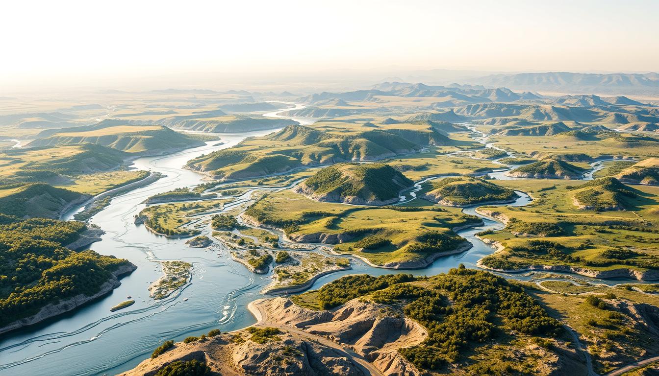
The ancient civilizations along the Nile, Jordan, Tigris, and Euphrates rivers were very important. A detailed River Systems Map shows how these navigable waterways are connected. This map gives us a clear view of the river network information.
Knowing the geography and history of these rivers is key. It helps us see how they shaped human history. The maps of these rivers take us back in time. They show how ancient people used these rivers for food, trade, and culture.
The Significance of Middle Eastern River Systems
The Middle Eastern river systems are very important. They have helped ancient and influential civilizations thrive. Rivers like the Nile, Jordan, Tigris, and Euphrates have been key for human growth and development.
Historical Importance of Rivers in Civilization Development
The major rivers worldwide, mainly in the Middle East, have been vital. The Nile River helped Ancient Egypt grow by providing fertile land and water. The Tigris and Euphrates rivers were essential for Mesopotamian civilizations, known as the cradle of civilization.
- Supported early agriculture and settlements
- Enabled trade and cultural exchange
- Provided water resources for drinking and irrigation
Modern Relevance in Geopolitics and Resource Management
Today, these rivers are key in hydrographic features and watershed mapping. They shape geopolitics and resource management. Managing these rivers is vital for regional peace, as they are a source of fresh water in a dry area.
Effective watershed mapping and management are key for growth and avoiding conflicts.
- Regional cooperation is necessary for water resource management
- Dam construction and water diversion projects impact regional geopolitics
- Climate change affects river flow and volume, necessitating adaptive management strategies
Understanding River Systems Map Technology
Technology has changed how we map river systems a lot. Before, mapping rivers was hard work that needed lots of effort. Now, thanks to new tech, we can show river systems more accurately and in detail.
Evolution of Cartographic Techniques
Cartography, or the art of making maps, has a long history. River mapping was key in this. Early cartographers used basic tools, leading to mistakes. But, as time went on, they got better, using things like aerial photos. This made topographical river maps much more accurate.
Modern Technologies in Hydrographic Mapping
New tech like sonar and bathymetric surveys has changed hydrographic mapping. These tools help measure river depths and map underwater areas. Also, river basin visualization has gotten better, helping us understand and manage rivers better.
Satellite Imagery and Remote Sensing Applications
Satellites have also changed river mapping. They take clear pictures of rivers, river flow data, and the land around them. This info is great for tracking river changes, managing water, and spotting flood risks.
These technologies have made river maps more accurate and opened up new ways to study and manage rivers. As tech keeps improving, we’ll see even more detailed and dynamic river system maps.
The Nile River System
The Nile River System is the longest river in the world. It is vital for the ecosystem and economy of the regions it touches. Stretching over 6,600 kilometers, it supports a complex network of aquatic ecosystems. These ecosystems are essential for biodiversity and the livelihoods of millions.
Geographical Overview and Key Tributaries
The Nile has several key tributaries. The White Nile and the Blue Nile are the most important. The White Nile comes from Lake Victoria and keeps the river flowing. The Blue Nile, from Ethiopia’s Lake Tana, adds a lot of water during the rainy season.
The White and Blue Nile Convergence
The White and Blue Nile meet near Khartoum, Sudan. This is a critical point for the river’s flow and character. It’s not just a geographical spot but also a vital ecological zone for wildlife and agriculture.
Delta Formation and Mediterranean Connection
The Nile Delta is where the river meets the Mediterranean Sea. It’s one of the most fertile areas in the world. The delta was formed by the river’s sediment over millennia, making it perfect for farming.
Ecological Zones Along the Nile
The Nile River System has many ecological zones. From the tropical wetlands of the Sudd in South Sudan to the arid Nubian Desert. Each zone has unique biodiversity and is key to the river’s health.
- The Sudd wetlands provide habitat for numerous aquatic species.
- The Nile’s floodplains support intensive agriculture.
- The river’s banks are home to a variety of flora and fauna.
Historical Significance of the Nile
The Nile River’s role in history is immense. It helped form one of the world’s oldest civilizations. As a major river, it has shaped human history.
Ancient Egyptian Civilization and the Nile
The Nile’s flooding brought silt that made land good for farming. This helped Ancient Egyptian civilization grow. The river’s navigable waterways also helped in trade and cultural exchange, boosting prosperity.
Colonial Era Exploration and Mapping
In the colonial era, the Nile drew European explorers and cartographers. Mapping the river highlighted its importance. It helped in using its resources.
| Era | Significance of the Nile |
|---|---|
| Ancient | Agriculture, Trade, and Cultural Development |
| Colonial | Exploration, Mapping, and Resource Exploitation |
| Modern | Hydroelectric Power, Irrigation Projects |
Modern Development Projects and Their Impact
Recently, the Nile has seen many development projects. Dams and irrigation systems have been built. These projects have affected the environment and local people, showing the need for sustainable use.
The Nile remains key to the regional ecosystem and economy. It shows its lasting importance as a major river.
The Jordan River System
The Jordan River is very important historically and ecologically. It’s a complex network that includes the river and its watershed mapping and hydrographic features.
Geographical Features and Watershed
The Jordan River starts in the Anti-Lebanon Mountains. It flows south through the Sea of Galilee to the Dead Sea. Its watershed has many ecosystems, from freshwater lakes to salty wetlands.
The river’s landscape changes a lot because of its drop in elevation.
The Dead Sea Basin and Tributaries
The Dead Sea Basin is key to the Jordan River System. It’s where the river ends. The Yarmouk and Zarqa rivers are major tributaries.
The basin’s unique geology and chemistry support special plants and animals. These are adapted to its salty conditions.
Ecological Challenges in the Jordan Valley
The Jordan River System has many ecological challenges. Water diversion, pollution, and climate change are big problems. These have reduced the river’s flow and harmed biodiversity.
It’s important to work on restoring and conserving the Jordan River System. This is key to keeping its ecological balance.
Cultural and Religious Significance of the Jordan
The Jordan River has a deep history, making it a key part of many cultures and religions. It touches many areas of society and faith.
Biblical References and Religious Importance
The Jordan River is a big part of the Bible, standing for spiritual renewal and cleansing. Baptismal rituals here are very important, showing its deep religious value. Its role in stories and traditions shows its lasting spiritual importance.
Aquatic ecosystems mapping around the Jordan River shows the balance between nature and human life. This highlights the river’s key role in the environment.
Modern Cultural Identity and the Jordan
Today, the Jordan River keeps shaping cultural identity. It stands as a symbol of heritage and history. Communities along its banks keep traditional ways alive, while river basin visualization tools help manage its resources.
The Jordan’s cultural importance is seen in its part in local stories and folklore. It shows how the river affects local identities.
The Tigris River System
The Tigris River is a key waterway in the Middle East. It has supported many civilizations over time. Its basin is home to diverse ecosystems and is vital for agriculture, industry, and cities.
Source to Mouth: Mapping the Tigris
The Tigris starts in the Taurus Mountains of southeastern Turkey. It travels over 1,750 kilometers southeast through Iraq. There, it meets several major rivers before joining the Euphrates to form the Shatt al-Arab. This waterway then flows into the Persian Gulf. Knowing the Tigris’s path is key to managing its resources well.
Major Tributaries and Watershed Areas
The Tigris gets water from many rivers, like the Diyala and Zab. These rivers are important for its flow. The Tigris’s watershed covers parts of Turkey, Iraq, and Syria. Managing these areas well is important for the river’s health and the ecosystems around it.
- The Diyala River is a big tributary that meets the Tigris near Baghdad.
- The Zab rivers, Great and Little, help the Tigris flow and support farming.
Seasonal Variations and Flow Patterns
The Tigris’s flow changes a lot with the seasons. This is mainly because of rain and snowmelt in its upper areas. Having good data on the river’s flow is key to managing these changes. It helps keep the river open for travel and supports local needs. Knowing these patterns is vital for managing water resources.
Historical Mesopotamia and the Tigris
Mesopotamia, known as the cradle of civilization, owes much to the Tigris River. The Tigris and the Euphrates created a fertile plain. This plain supported the growth of ancient civilizations.
Ancient Civilizations Along the Tigris
The Tigris River was home to the Sumerians, Akkadians, and Assyrians. These civilizations thrived because of the river’s water. It helped with agriculture and trade.
- The Sumerians developed sophisticated irrigation systems.
- The Akkadians expanded trade networks along the Tigris.
- The Assyrians built powerful cities near the river.
Historical Changes in River Course
The Tigris River has changed its course over time. These changes have affected the landscape and human settlements.
Key factors influencing the river’s course include:
- Siltation and sedimentation.
- Human activities such as dam construction.
- Natural geological processes.
Archaeological Discoveries and River Mapping
Archaeological discoveries along the Tigris have given us insights into Mesopotamia’s history. Mapping the river and its settlements has helped researchers understand early civilizations.
Notable discoveries include the ancient city of Nineveh and the royal tombs at Ur.
The Euphrates River System
The Euphrates River stretches over 2,800 kilometers. It’s a key part of the region’s hydrographic features, supporting many aquatic ecosystems. It flows through Turkey, Syria, and Iraq, playing a big role in the area’s water cycle.
Geographical Extent and Major Features
The Euphrates starts in Turkey’s Armenian Highlands. It’s made by the Kara and Murat rivers. Then, it goes southeast through Syria and Iraq.
There, it meets the Tigris River to form the Shatt al-Arab. This waterway flows into the Persian Gulf. The river’s basin is about 440,000 square kilometers. It supports agriculture, cities, and wildlife.
| Country | Length of Euphrates (km) | Major Features |
|---|---|---|
| Turkey | 455 | Keban Dam, Karakaya Dam |
| Syria | 610 | Tabqa Dam, Lake Assad |
| Iraq | 1,213 | Hindiya Barrage, various irrigation canals |
Tributaries and Flow Patterns
The Euphrates has big tributaries like the Balikh and Khabur rivers in Syria. Its flow changes with the seasons. In spring, snowmelt in the Armenian Highlands makes the river swell.
Ecological Significance of Euphrates Wetlands
The wetlands by the Euphrates are vital for life. They’re home to many plants and animals. These areas help with fishing, farming, and herding.
They also support local communities. Saving these wetlands is key for the environment and for people’s well-being.
The Fertile Crescent: Euphrates in History
The Euphrates River has been vital for the Fertile Crescent, supporting civilizations for thousands of years. Its waters helped grow cities, agriculture, and cultures. This made it key to the region’s history.
Cradle of Civilization Perspective
The Fertile Crescent, with the Euphrates River valley, is seen as the cradle of civilization. The river’s flooding brought nutrient-rich silt, making the land good for farming. This helped early cities grow and led to the start of writing, governance, and specialized jobs.
Historical Settlements and River Utilization
Many settlements thrived along the Euphrates River. It provided water for irrigation, drinking, and travel, helping trade and cultural sharing. Cities like Mari and Babylon were major powers, relying on the Euphrates for their success.
Cultural Exchange Along River Routes
The Euphrates was a key path for cultural exchange between civilizations. It connected different areas, moving goods, ideas, and people. This exchange enriched the Fertile Crescent’s culture, with the Euphrates playing a big role in art, literature, and religion.
The Euphrates’ role in the Fertile Crescent shows how vital river network information and watershed mapping are. They help us understand history and culture. By looking at the Euphrates, we see how geography, culture, and history are connected.
Comprehensive River Systems Map Analysis
A detailed look at the River Systems Map shows how the four major rivers in the Middle East are connected. This study is key to grasping their geographical, ecological, and cultural importance.
Interconnections Between the Four River Systems
The Nile, Jordan, Tigris, and Euphrates rivers are unique yet linked. They all support agriculture, cities, and wildlife in their areas.
Shared Characteristics:
- Ecological significance
- Historical importance
- Cultural relevance
Comparative Analysis of River Characteristics
Comparing the rivers shows their varied features and roles. The table below highlights some key differences:
| River | Length (km) | Average Discharge (m³/s) | Major Features |
|---|---|---|---|
| Nile | 6,853 | 2,800 | White and Blue Nile convergence, Nile Delta |
| Jordan | 252 | 30 | Dead Sea Basin, Jordan Valley |
| Tigris | 1,850 | 1,014 | Mesopotamian Plain, confluence with Euphrates |
| Euphrates | 2,800 | 830 | Anatolian Highlands, Mesopotamian Marshes |
Watershed Boundaries and Overlaps
The watersheds of these rivers sometimes overlap, forming complex systems. Knowing these overlaps is vital for managing water and avoiding water rights disputes.
The River Systems Map shows these boundaries and overlaps. It’s a useful tool for those making policies and conducting research.
Modern Challenges Facing These River Systems
The Middle East’s rivers, like the Nile, Jordan, Tigris, and Euphrates, face big challenges today. These issues affect their health and the people who rely on them. Problems come from the environment, infrastructure, and politics.
Climate Change Impacts on Flow and Volume
Climate change is changing how these rivers work. Warmer temperatures and different rain patterns are altering their flow and size. For example, the Nile’s flow is now less predictable, making it hard for farmers and water managers.
Dam Construction and Water Management Issues
Dams are important for power and storing water, but they bring big problems. The Grand Ethiopian Renaissance Dam on the Nile is causing worries about water flow. Finding good ways to manage water is key to solving these problems.
Political Tensions Over Water Rights
There’s growing conflict over who gets to use the water from rivers like the Tigris and Euphrates. Turkey, Syria, and Iraq disagree on how to share the water. The Jordan River is also a source of tension between Israel, Palestine, and Jordan. Diplomacy and cooperation are needed to fix these issues.
The table below shows the main challenges facing these river systems:
| River System | Climate Change Impact | Dam Construction Issues | Political Tensions |
|---|---|---|---|
| Nile | Unpredictable flow | Grand Ethiopian Renaissance Dam | Egypt, Sudan, Ethiopia tensions |
| Jordan | Reduced water levels | Water diversion projects | Israel, Palestine, Jordan disputes |
| Tigris and Euphrates | Changing precipitation patterns | Southeast Anatolia Project (GAP) | Turkey, Syria, Iraq water rights issues |
Conservation Efforts and Sustainable Management
Efforts to save the Nile, Jordan, Tigris, and Euphrates rivers are getting better. They use international teamwork and new technology. This mix is key to solving the big problems these rivers face.
International Cooperation Initiatives
Global partnerships are vital for saving these rivers. The Nile Basin Initiative and the Middle East Desalination Research Center show we’re working together. They help countries share knowledge, tech, and resources.
Technological Solutions for River Preservation
New tech like satellite images and GIS mapping is changing how we watch over rivers. Tools like aquatic ecosystems mapping and watershed mapping help us see changes and how people affect rivers.
Community-Based Conservation Programs
Local people are leading the way in saving rivers. Programs that get communities involved are working well. They teach people to care for rivers and build a sense of community.
| Conservation Initiative | Description | Impact |
|---|---|---|
| Nile Basin Initiative | Collaborative water management among Nile Basin countries | Improved water security and socio-economic development |
| Middle East Desalination Research Center | Research and development of desalination technologies | Enhanced water availability and reduced environmental impact |
| Community-Based River Management | Local community engagement in river conservation | Increased community involvement and sustainable river management |
In conclusion, saving the Middle East’s major rivers needs a big team effort. With teamwork, new tech, and community help, we can manage these rivers well for the future.
Accessing and Using River Systems Map Resources
Using river systems maps well means knowing the tech and the area. These maps are more than pictures; they offer deep insights into rivers’ health and impact on people.
Digital Resources and GIS Applications
Digital tools, like Geographic Information Systems (GIS), change how we use river maps. GIS mixes different data, like land and water, to make detailed maps.
GIS helps a lot in river mapping:
- It makes river paths more accurate
- It lets us combine data for a full view
- It tracks changes in rivers over time
Educational and Research Applications
River maps are key in school and research. They help teach about rivers and the environment. Scientists use them to study rivers, plan for conservation, and predict climate change effects.
“River maps in school improve students’ grasp of water science.”
Open-Source Mapping Tools for River Analysis
Open-source tools make mapping rivers easier and cheaper. Sites like OpenStreetMap and QGIS let people make and edit maps without spending a lot. These tools help people work together and come up with new ideas for river studies.
Some top open-source tools are:
- QGIS for detailed spatial analysis
- OpenStreetMap for team mapping projects
- GRASS GIS for all-around geospatial data work
Future Projections for These River Systems
Climate change, population growth, and new technologies will change these major rivers worldwide. It’s important to understand these changes for better water management and sustainability.
Climate Models and Flow Predictions
Climate models show big changes in river flows. The Nile River might see a 25% drop in flow by 2050. This is due to changes in rain and more evaporation.
The Tigris and Euphrates rivers could also see less water. This is because of melting snow and different rain patterns.
Projected Changes in River Flow
| River | Projected Change in Flow | Primary Cause |
|---|---|---|
| Nile | -25% | Changes in precipitation and evaporation |
| Tigris | -15% | Melting snowpack and altered rainfall |
| Euphrates | -20% | Changes in precipitation and dam construction |
| Jordan | -10% | Reduced rainfall and increased evaporation |
Demographic Pressures and Water Demand
More people living near these rivers means more water is needed. This will put a strain on the water supply. We need better ways to manage water.
Technological Innovations in River Management
New technologies like remote sensing and GIS will help manage these rivers. They will improve how we monitor and predict water resources. This will lead to better water management.
Conclusion: The Enduring Importance of Middle Eastern River Systems
The River Systems Map of the Nile, Jordan, Tigris, and Euphrates shows how rivers have shaped the Middle East. These rivers have been key to civilizations, helping with farming, trade, and cities.
It’s important to understand how these rivers connect. This helps us tackle issues like climate change, dams, and water rights disputes. We need global teamwork, new tech, and local efforts to manage these rivers well.
Looking at these rivers’ past and present shows their lasting value. The River Systems Map is a key resource for experts, leaders, and everyone. It helps us see how rivers support the area’s nature and economy.
Looking ahead, the Middle Eastern River Systems will keep influencing the region. We must keep working on protecting and managing these rivers. This is key for their future and ours.