The continent is blessed with an abundance of both natural and human resources, making it a significant player in the global economy.
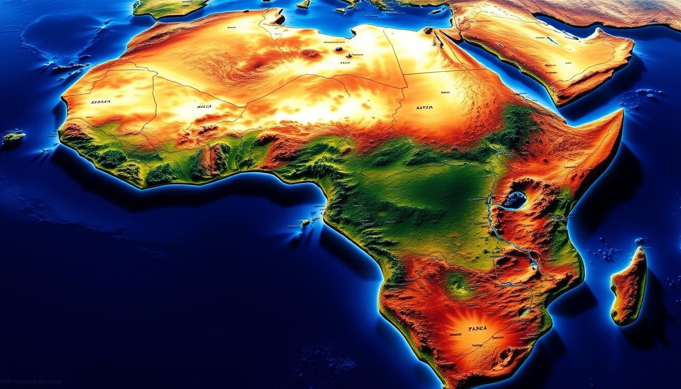
Understanding the geography of this vast continent is key to grasping its overall importance. A detailed guide to the African continent map offers valuable insights into its diverse regions and rich cultural heritage.
By exploring the Africa Countries Map, one can gain a deeper understanding of the continent’s layout and the relationships between its various nations.
The Geographic Overview of Africa
Africa is the second-largest continent and has a wide range of geographical features. It’s important to know its position, size, and major features to understand its complexity.
Africa’s Position in the World
Africa sits at the center of the globe, crossing the equator and several climate zones. Its central location has made it key in world affairs for centuries. It is surrounded by the Mediterranean Sea to the north, the Red Sea to the northeast, the Indian Ocean to the southeast, and the Atlantic Ocean to the west.
Size and Scale of the African Continent
The African continent is about 30.3 million square kilometers, making up 20% of the Earth’s land. It has diverse ecosystems like deserts, savannas, and rainforests. With 55 recognized countries, each has its own geography and climate.
Major Geographic Features
Africa has key features like the Sahara Desert, the Nile River, and the Ethiopian Highlands. The Sahara, the largest hot desert, covers much of North Africa. The Nile, one of the longest rivers, flows through 11 countries, supporting millions.
The Ethiopian Highlands are known for their rugged terrain and biodiversity. Knowing these features helps us understand Africa’s diversity and complexity. The African continent map and geographic map of African nations are vital for exploring and understanding its varied landscapes and countries.
Understanding Africa Countries Map: A Complete Guide
Maps of Africa are key to understanding its geography and politics. They show the continent’s history, culture, and natural features. Each map type offers unique insights into Africa.
Political Maps vs. Geographic Maps of Africa
Africa is mapped in two main ways: political and geographic. Political maps show countries, borders, and capitals. They help us see the political layout. Geographic maps, on the other hand, highlight mountains, rivers, and more. They give us a close look at Africa’s natural beauty.
| Map Type | Features Highlighted | Usefulness |
|---|---|---|
| Political Map | Country borders, capitals | Understanding political divisions |
| Geographic Map | Mountains, rivers, deserts | Appreciating natural features |
How to Read and Interpret African Maps
Understanding maps of Africa involves knowing map legends, scales, and symbols. The legend tells us what the symbols mean. The scale shows how far apart things are. Knowing these helps us get the most from the map.
An interactive map of Africa can show us a lot. It can display data on people, climate, and economy. This makes it great for students and researchers.
Historical Evolution of African Maps
Mapping Africa has been around as long as the continent. Early maps were made by explorers and cartographers. Over time, these maps have grown more detailed, showing Africa’s changes.
The creation of clickable maps of Africa countries has made information easier to access. Now, we can explore specific areas in depth.
In summary, knowing about Africa’s maps is essential. They help us understand its geography, politics, and culture. By using different maps and learning to read them, we can dive deeper into Africa’s complexities.
The Five Regions of Africa
Africa is split into five main regions. Each has its own special features and countries. This helps us see the continent’s wide range of geography, culture, and economy.
North Africa
North Africa has countries like Egypt, Libya, and Tunisia. It’s known for its Mediterranean coast and the vast Sahara Desert.
East Africa
East Africa includes places like Ethiopia, Kenya, and Tanzania. It’s famous for its highlands and the Serengeti.
West Africa
West Africa has countries such as Nigeria, Ghana, and Côte d’Ivoire. It’s known for its rich cultures and valuable resources.
Central Africa
Central Africa is home to countries like the Democratic Republic of Congo and Cameroon. It’s covered in dense rainforests and has big rivers.
Southern Africa
Southern Africa includes South Africa, Namibia, and Botswana. It’s famous for its wildlife and beautiful landscapes.
To get a clear view of these regions and their countries, look at a detailed map of African countries. These maps show the continent’s layout and help spot countries in each area.
| Region | Countries | Notable Features |
|---|---|---|
| North Africa | Egypt, Libya, Tunisia | Mediterranean coastline, Sahara Desert |
| East Africa | Ethiopia, Kenya, Tanzania | Ethiopian Highlands, Serengeti |
| West Africa | Nigeria, Ghana, Côte d’Ivoire | Diverse cultures, economic resources |
| Central Africa | DRC, Cameroon | Dense rainforests, river systems |
| Southern Africa | South Africa, Namibia, Botswana | Diverse wildlife, natural landscapes |
A map showing countries in Africa is key for seeing the continent’s regions. It helps us understand what makes each area special.
North African Countries and Their Characteristics
North Africa is a region with a rich history. It has many countries, each with its own unique traits. The area’s varied landscapes, from the Mediterranean to the Sahara, influence its cultures, economies, and politics.
Egypt, Libya, and Tunisia
Egypt is famous for its pyramids and the Nile River. It’s a key cultural and economic center in North Africa. Libya’s vast deserts support an economy mainly based on oil and gas. Tunisia’s economy is diverse, with activities like agriculture, manufacturing, and tourism.
The political map of Africa shows Egypt’s strategic role, controlling the Suez Canal. Libya and Tunisia’s locations along the Mediterranean are also critical for trade and politics.
Algeria and Morocco
Algeria is the largest country in North Africa by land. Its economy relies heavily on oil and gas exports. Morocco’s economy is more varied, with activities like agriculture, mining, and tourism. Both countries have unique cultures, blending Arab, Berber, and Mediterranean influences.
Western Sahara and Sudan
Western Sahara’s political status is complex, with its future uncertain. Sudan faces various political and economic hurdles. The Africa Countries Map helps understand their geographical and political positions in North Africa.
| Country | Capital | Main Economic Activity |
|---|---|---|
| Egypt | Cairo | Tourism, Suez Canal |
| Libya | Tripoli | Oil and Gas |
| Tunisia | Tunis | Agriculture, Manufacturing |
Knowing about North African countries is key to understanding the region’s importance. The political map of Africa and the Africa Countries Map are vital for grasping this diverse area’s complexities.
East African Nations on the Map
The map of East Africa shows a mix of countries, each unique in its own way. This area is rich in cultures, landscapes, and wildlife. It’s a place of great interest and study.
Ethiopia, Kenya, and Tanzania
Ethiopia, Kenya, and Tanzania stand out in East Africa. Ethiopia is known for its ancient history and culture. Places like Lalibela’s rock-hewn churches are famous.
Kenya is known for its safaris and national parks. The Maasai Mara is key for wildlife. Tanzania has the Serengeti and Mount Kilimanjaro, drawing tourists worldwide.
Uganda, Rwanda, and Burundi
Uganda, Rwanda, and Burundi are also important. Uganda is home to diverse wildlife, including mountain gorillas. Rwanda is known for its conservation and tourism, like gorilla tracking.
Burundi may not get as many visitors but has a rich culture and beautiful landscapes.
Somalia, Djibouti, and Eritrea
Somalia, Djibouti, and Eritrea are on the Horn of Africa. Somalia has a long Indian Ocean coastline, good for trade and tourism. Djibouti is near the Bab-el-Mandeb strait, key for shipping. Eritrea has a rich history, with Asmara being a UNESCO World Heritage Site.
East Africa’s diversity is not just in geography but also culture. Over 200 languages are spoken here. The geographic map of African nations helps us understand the region. An interactive map of Africa offers real-time data and insights.
West African Countries and Their Borders
West Africa is home to countries like Nigeria, Ghana, and Côte d’Ivoire. It’s a place where old traditions meet new ways of life. This area is important for its history, culture, and economic growth.
Nigeria, Ghana, and Côte d’Ivoire
Nigeria is Africa’s most populous country and a big economic center. Ghana is known for its stable government and gold. Côte d’Ivoire is a key player in the region’s economy because of its farming.
The borders of these countries show a mix of old colonial lines and natural features. For example, Nigeria borders Niger to the north and Cameroon to the east. Ghana is surrounded by Côte d’Ivoire to the west and Togo to the east.
| Country | Capital | Population (millions) |
|---|---|---|
| Nigeria | Abuja | 202 |
| Ghana | Accra | 31 |
| Côte d’Ivoire | Yamoussoukro | 26 |
Senegal, Gambia, and Guinea
Senegal is famous for its culture and music. Gambia is the smallest country in mainland Africa, surrounded by Senegal. Guinea is rich in minerals and has a varied landscape.
Their borders show their colonial history and affect their economy and culture. For example, Senegal and Gambia share a special bond because of their shared past and geography.
Mali, Niger, and Burkina Faso
Mali, Niger, and Burkina Faso are landlocked countries in West Africa. Their economies rely on farming and mining. Mali is known for Timbuktu, Niger for uranium, and Burkina Faso for its mining and culture.
Their borders are shaped by the Sahara Desert to the north. This affects their climate and economy. A detailed map of African countries would show the vast deserts and the Sahel region.
Knowing about West Africa’s geography and borders helps us understand its culture and economy. A clickable map of Africa countries offers deeper insights into the region’s complexity and connections.
Central African Nations: Location and Features
The heart of Africa is home to many nations, each unique. Central Africa, full of diversity, includes countries like the Democratic Republic of Congo. It’s the second-largest country in Africa by land area.
Central Africa is rich in natural resources. It has vast mineral deposits and extensive forests. The Congo Basin, the second-largest tropical rainforest, is a key part of the global ecosystem.
Democratic Republic of Congo and Congo
The Democratic Republic of Congo (DRC) and the Republic of Congo share the Congo River basin. The DRC has vast mineral resources like cobalt, copper, and diamonds. It’s a big player in the global mining industry. The Republic of Congo focuses on oil and timber.
Cameroon, Central African Republic, and Chad
Cameroon is known as “Africa in miniature” because of its diverse geography. The Central African Republic (CAR) has savannas and rainforests. Chad has deserts in the north and savannas in the south. These countries are rich in natural resources like oil, timber, and minerals.
Gabon and Equatorial Guinea
Gabon is famous for its dense rainforests and oil reserves. It has a small population but is rich in timber and minerals. Equatorial Guinea has grown economically thanks to its oil. Both countries aim to diversify their economies.
A map showing countries in Africa helps us understand each country’s geography. Central Africa’s diverse geography and natural resources are key to studying the African continent map.
Southern African Countries on the Continental Map
From the deserts of Namibia to the vibrant cities of South Africa, Southern Africa is a region of remarkable diversity.
The region includes several countries, each with its own unique features. A printable map of Africa with countries can show the layout and boundaries of these nations.
South Africa, Namibia, and Botswana
South Africa has diverse landscapes, from mountains to coastlines. Namibia is known for its vast deserts, including the Namib Desert. Botswana is famous for its wildlife and the Okavango Delta.
These countries have different economies. South Africa is a major economic hub. Namibia relies on mining. Botswana’s economy is driven by tourism and diamond mining.
Zimbabwe, Zambia, and Malawi
Zimbabwe, Zambia, and Malawi are another cluster of countries in Southern Africa. Zimbabwe is known for its historical sites like Victoria Falls. Zambia is famous for its natural beauty and wildlife. Malawi is known for its lakes and mountains.
Their economies vary. Zambia has a significant mining sector. Malawi relies on agriculture. Zimbabwe is diversifying its economy.
Mozambique, Angola, and Madagascar
Mozambique, Angola, and Madagascar are key countries in the region. Mozambique has a long coastline along the Indian Ocean. Angola is rich in oil and minerals. Madagascar is known for its unique biodiversity.
These countries have diverse economic activities. Mozambique is developing its natural gas resources. Angola relies on oil. Madagascar focuses on agriculture and tourism.
| Country | Capital | Main Economic Activity |
|---|---|---|
| South Africa | Pretoria | Mining, Manufacturing |
| Namibia | Windhoek | Mining |
| Botswana | Gaborone | Tourism, Diamond Mining |
A detailed map of African countries is essential for understanding Southern Africa. It shows the diversity and complexity of the region.
Interactive and Digital Maps of Africa
Digital technology has changed how we explore Africa with interactive maps. Now, we can see detailed and moving maps of the continent.
Online Interactive Maps and Resources
Online maps give us lots of info on Africa’s countries and culture. Sites like Google Maps and GIS systems let us zoom in and explore. We can also find more data layers.
Some great online resources include:
- Google Maps: Offers detailed satellite imagery and street maps.
- GIS platforms: Provide detailed geographical data and analysis tools.
- Africa-specific mapping projects: Focus on the continent’s unique geographical and cultural features.
Mobile Apps for Exploring African Geography
Mobile apps make it easy to explore Africa’s geography anywhere. Apps like Maps.me and GeoGebra have offline maps and tools for learning.
| App Name | Features |
|---|---|
| Maps.me | Offline maps, GPS navigation, points of interest |
| GeoGebra | Interactive geometry, algebra, and geography tools |
Educational Tools Featuring Clickable Maps of Africa Countries
Educational tools with clickable maps are great for teaching geography. They let students interact with maps and learn about countries. It makes learning fun and engaging.
Examples include:
- Interactive whiteboards with geographical content.
- Educational software that includes clickable maps and geographical quizzes.
- Online platforms that offer interactive geography lessons.
These digital tools help teachers make learning more fun. They help students understand Africa’s diverse geography better.
Printable and Educational Maps of African Countries
Printable maps of African countries are great for both teachers and students. They help improve geography knowledge and support learning activities.
High-Quality Printable Maps for Various Uses
High-quality printable maps of Africa with countries are key for many uses. They are perfect for education, travel planning, and research. These maps come in different sizes and types, meeting many needs.
- Educational places use them to teach about geography and culture.
- Travelers and explorers use them to plan their trips.
- Researchers use them to study Africa’s geography, climate, and natural resources.
Detailed Maps of African Countries for Education
Detailed maps of African countries are very useful in schools. They help students learn about the continent’s complex geography. This includes country borders, major cities, and natural features.
These maps are used in many educational activities, such as:
- Teaching geography and cultural studies.
- Improving knowledge of African countries’ politics and economy.
- Supporting research on African studies.
Where to Find Reliable Map Resources
Finding good sources for detailed maps of African countries is important. Many online platforms and resources offer accurate and up-to-date maps, including:
- National Geographic’s online map collection.
- Government websites of African countries.
- Websites focused on geography and African studies.
Major Geographical Features Across African Countries
Africa is home to a wide range of geographical features. These include vast deserts, towering mountains, and extensive rivers. Each feature adds to the continent’s beauty and diversity.
Deserts: Sahara, Kalahari, and Namib
The Sahara Desert is the world’s largest hot desert, covering much of North Africa. It spans across several countries, including Algeria, Chad, Egypt, Libya, Mali, Mauritania, Morocco, Niger, and Tunisia. The Kalahari Desert in southern Africa covers parts of Botswana, Namibia, and South Africa. The Namib Desert along Namibia’s coast is known for its unique foggy climate.
Mountain Ranges: Atlas, Ethiopian Highlands, and Drakensberg
Africa has several significant mountain ranges. The Atlas Mountains stretch across Morocco, Algeria, and Tunisia. They form a dramatic backdrop to the northwestern part of the continent. The Ethiopian Highlands are often called the “Roof of Africa,” with peaks over 4,500 meters. The Drakensberg range in South Africa is known for its stunning scenery and rich cultural heritage.
Major Rivers and Lakes: Nile, Congo, Niger, Victoria, and Tanganyika
Africa’s major rivers and lakes are vital to its ecosystem and human settlement. The Nile, the world’s longest river, flows through 11 countries, including Egypt, Sudan, and Ethiopia. The Congo River is a major waterway in central Africa. The Niger River supports agriculture and industry in West Africa. Lake Victoria, the source of the Nile, is the largest lake in Africa. Lake Tanganyika is the second-deepest lake in the world.
| Feature | Location | Significance |
|---|---|---|
| Sahara Desert | North Africa | Largest hot desert in the world |
| Nile River | 11 countries, including Egypt and Sudan | Longest river in the world, supports agriculture and drinking water |
| Ethiopian Highlands | Ethiopia | Known as the “Roof of Africa,” rich biodiversity |
| Lake Victoria | Tanzania, Uganda, Kenya | Largest lake in Africa, source of the Nile River |
For a more detailed exploration of Africa’s geographical features, visiting a satellite image of Africa can provide valuable insights into the continent’s diverse landscapes.
Cultural and Economic Diversity Across the African Map
Africa is known for its rich cultural and economic diversity. It has many languages, ethnic groups, and resources. This makes the continent complex and interesting to study.
Language and Ethnic Distribution
The African continent boasts over 2,000 languages and more than 3,000 ethnic groups. These languages and ethnicities spread out differently across regions. For example, the diversity map of Africa shows the varied linguistic and ethnic scenes. In West Africa, Nigeria alone has hundreds of ethnic groups. In East Africa, Swahili is widely spoken across several countries.
Religious Patterns Across the Continent
Religion greatly influences African cultures. The continent is mainly split between Christianity, Islam, and traditional African religions. North Africa is mostly Muslim, while Sub-Saharan Africa has a mix of Christians, Muslims, and traditional religion followers. This diversity affects cultural practices, social norms, and economic activities.
Economic Resources and Development Zones
Africa is rich in natural resources like oil, gold, diamonds, and minerals. The resources are spread out, with some areas like Nigeria and Angola being oil-rich. Others, like the Democratic Republic of Congo, are known for cobalt. Economic zones often form around these resources, shaping trade and growth.
The detailed map of African countries shows the complex cultural and economic diversity. It’s important to understand this diversity to appreciate Africa’s complexities. It helps in developing strategies that meet the continent’s varied needs.
Conclusion: Appreciating Africa’s Diverse Landscape and Nations
Africa’s diversity is a key part of its identity. It shows in its varied landscapes, cultures, and nations. The African continent map displays a wide range of geographical features, from the Sahara Desert to the Cape of Good Hope. It also highlights the complexity of its political boundaries.
In this article, we’ve looked at Africa’s different regions. These include North, East, West, Central, and Southern Africa. Each region has its own unique characteristics and features. Understanding the African continent map and its countries is key to appreciating the continent’s rich cultural heritage and economic diversity.
By studying Africa’s geographical features, cultural patterns, and economic resources, we gain a deeper understanding. This understanding reveals the complexities and opportunities in this vast and varied continent. As we continue to explore and learn about Africa, it’s clear that its diverse landscape and nations offer a wealth of experiences waiting to be discovered.