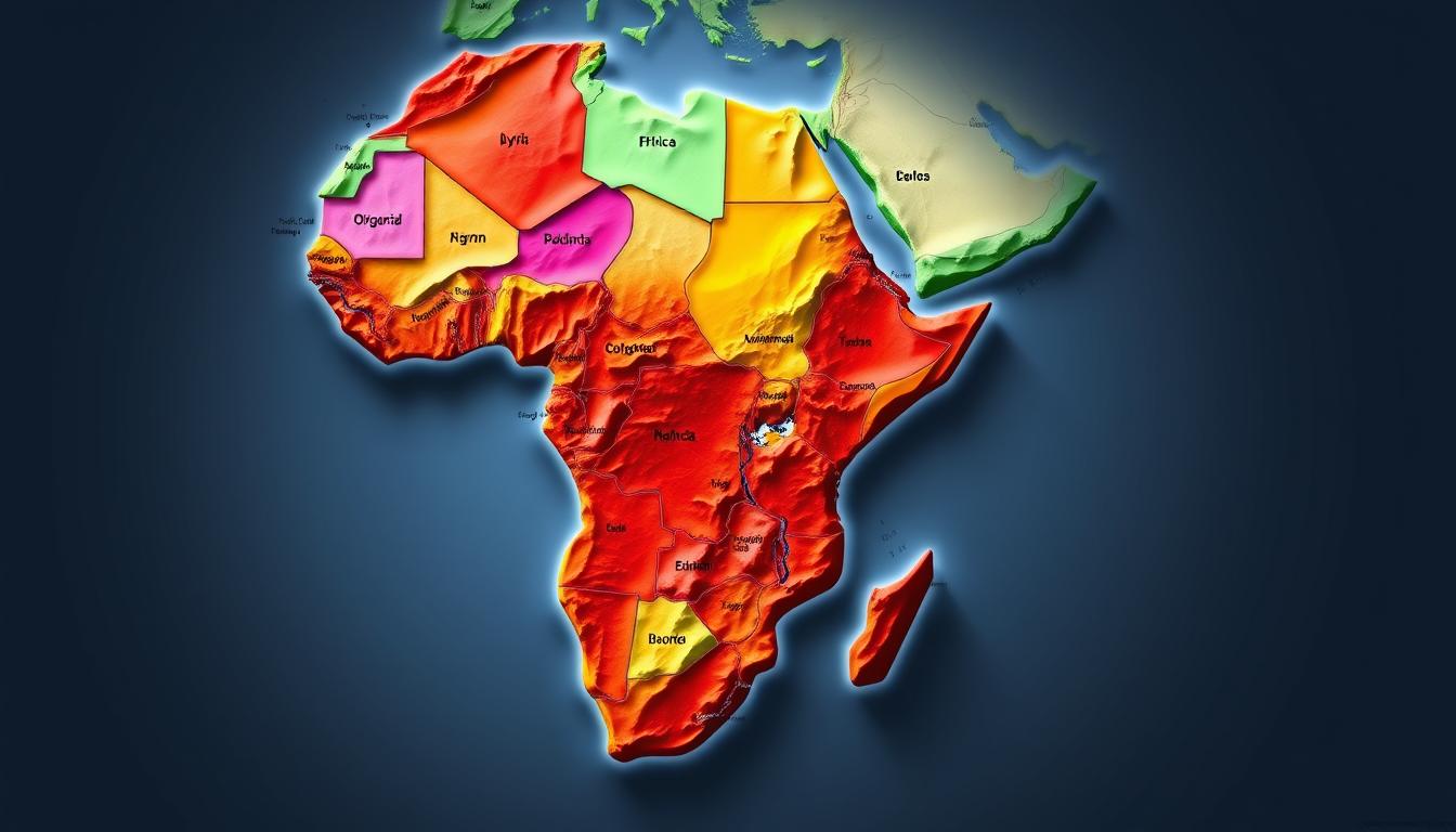
The continent’s diverse geography and rich cultural heritage are reflected in its African countries map. It shows a complex tapestry of nations.
From deserts to savannas, the Africa Map visually represents the continent’s varied ecosystems and geographical features.
Knowing the layout of these countries is key. It helps us understand the continent’s overall significance and the unique traits of each nation.
The Diverse Continent of Africa
Africa is a land of contrasts, with vast deserts, towering mountains, and expansive savannas. Its geographical diversity is not just about varied landscapes. It’s also about its significant position on the globe.
Geographical Significance and Position
Africa is the second-largest continent, covering about 30 million square kilometers. It’s surrounded by the Mediterranean Sea to the north, the Red Sea to the northeast, the Indian Ocean to the southeast, and the Atlantic Ocean to the west. This location has made Africa a key spot for trade and cultural exchange for centuries.
The physical map of Africa shows the continent’s diverse features. It includes vast deserts like the Sahara, mountain ranges like the Atlas and Drakensberg, and extensive river systems like the Nile and Congo.
Africa’s Unique Physical Features
Africa’s physical features are both varied and impressive. The continent boasts some of the world’s most notable geographical features. For example, the Nile River, the longest river, runs through several countries, supporting agriculture and human settlement. The Sahara Desert, the largest hot desert, covers a big part of North Africa.
- The Atlas Mountains in the north separate the Mediterranean coastal regions from the Sahara Desert.
- The Ethiopian Highlands are often referred to as the “Roof of Africa.”
- The Serengeti and Maasai Mara are renowned for their annual wildlife migrations.
Understanding the Africa Map
To navigate the Africa map, you need to know about cartography and its parts. It’s important to understand the map’s components to read and interpret it well.
How to Read an Africa Map
Reading an Africa map means knowing about country borders, capitals, and big cities. A printable Africa map is great for learning. It helps you see the continent’s geography clearly.
Scale and Projections
The map’s scale is key because it shows how detailed it is. Different projections can change how countries look. It’s important to pick a projection that shows Africa’s geography right.
Map Legends and Symbols
Map legends and symbols give extra info about Africa’s geography. They show things like mountains, rivers, and forests. Knowing these helps you understand Africa’s varied landscapes better.
Historical Development of African Borders
Africa’s borders have a rich and varied history. The current shape of the continent is shaped by past events. These events have molded its countries and borders over time.
Pre-Colonial African Territories
Africa was full of different territories before European colonizers arrived. These ranged from small chiefdoms to large empires. The boundaries of these territories changed often due to conquests, alliances, and trade.
An outline map of Africa can show these historical territories. It helps us understand their importance.
The Scramble for Africa and Colonial Boundaries
The Scramble for Africa in the late 19th century was a key moment. European powers divided Africa at the Berlin Conference, ignoring ethnic and linguistic divisions. This led to artificial borders that many countries have kept today.
An African countries map from this time shows the big changes that happened.
Post-Independence Border Formations
When African countries got their freedom in the mid-20th century, they kept most of the old borders. This was partly because of the Organization of African Unity’s (OAU) policy of respecting old boundaries. This policy was meant to avoid conflict.
But, it has caused ongoing problems. These include border disputes, territorial claims, and the challenge of integrating diverse ethnic groups into one country.
Types of Africa Maps
Maps of Africa come in many forms, like political, physical, thematic, and historical/cultural. Each type meets different needs, from learning to geographical studies.
Political Maps of Africa
A political map of Africa shows the continent’s countries, capitals, and big cities. It helps us understand the political landscape, with borders and cities marked. This map is key for studying Africa’s political and administrative areas.
Physical and Topographical Maps
The physical map of Africa displays natural features like mountains, rivers, deserts, and lakes. It shows Africa’s varied landscapes and is vital for geography studies. Topographical maps add details on terrain elevation and relief.
Thematic Maps
Thematic maps focus on specific topics, like climate, population, or resources. They give insights into Africa’s climate, people, and economy. These maps are great for researchers, policymakers, and teachers.
Historical and Cultural Maps
Historical and cultural maps of Africa highlight its rich heritage. They show old trade paths, ancient cultures, and cultural areas. A blank Africa map is useful for teaching geography and history.
In summary, Africa maps have many uses, from politics and geography to education and culture. Each map type offers unique views into Africa’s complexity.
North African Countries
North Africa is a place of great diversity. Each country has its own history and culture. The area stretches from the Mediterranean Sea to the Sahara Desert.
Egypt: Land of the Pharaohs
Egypt is famous for its ancient past. The Pyramids of Giza are among the Seven Wonders of the Ancient World. The Nile River has been vital to Egypt for thousands of years.
Libya and Its Coastal Regions
Libya has a long coastline along the Mediterranean Sea. Most of its land is desert, with the Sahara covering a lot of it.
Tunisia: Mediterranean Gateway
Tunisia is a small country with a big history. It was once a major center of the Carthaginian civilization. Its location on the Mediterranean makes it key for trade.
Algeria: Saharan Giant
Algeria is the biggest country in North Africa. It has a lot of Sahara Desert. Its geography varies from coastal plains to mountains.
Morocco and Western Sahara
Morocco is known for its rich culture and varied landscapes. It has the Atlas Mountains and coastal areas along the Atlantic. The issue of Western Sahara adds to the region’s complexity.
These North African countries are key to understanding the Africa Map and the African countries map. Each country brings its own culture, history, and geography to the continent.
West African Nations
The West African region is full of diverse nations. It shows a mix of old traditions and new ways of life. This mix is seen in its geography, culture, and history.
Nigeria: Africa’s Most Populous Country
Nigeria is the most populous country in Africa. It has a large and varied population. Its cities, like Lagos, are centers of business.
Ghana and Its Historical Significance
Ghana is known for being the first country in sub-Saharan Africa to gain freedom. It keeps its cultural heritage alive in places like the Cape Coast Castle.
Senegal and The Gambia
Senegal and The Gambia are next to each other and have their own cultures. Senegal is famous for its lively music. The Gambia is known for its stunning nature and animals.
Côte d’Ivoire and Neighboring States
Côte d’Ivoire, or the Ivory Coast, is a big player in the economy. Its capital, Abidjan, is a key financial center. Nearby countries like Mali and Burkina Faso share cultural and historical bonds.
Other West African Countries
Guinea, Sierra Leone, and Liberia are also important in West Africa. Each has its own story, culture, and challenges. For example, Guinea is rich in minerals. Sierra Leone has worked hard to heal from past wars.
Looking at an African countries map or a printable Africa map helps understand where these countries are. It shows their locations and how they relate to each other.
Central African Region
The Central African region is full of history and varied landscapes. It includes several countries, each with its own culture and geography.
Democratic Republic of Congo: Heart of Africa
The Democratic Republic of Congo is the largest country in the Central African region. It’s famous for its huge rainforests and mineral wealth. It’s called the “Heart of Africa” because of its central spot on the continent.
Cameroon: Africa in Miniature
Cameroon has a wide range of geography, from coastlines to mountains and savannas. It’s called “Africa in Miniature” because of its many ecosystems and cultures.
Central African Republic and Chad
The Central African Republic and Chad are landlocked countries. They have different landscapes, like savannas and mountains. Despite challenges, they are rich in natural resources.
Congo-Brazzaville and Gabon
Congo-Brazzaville and Gabon are neighbors with lots of rainforest. They are known for their biodiversity and play a big role in conservation.
Equatorial Guinea
Equatorial Guinea has diverse geography, including coastlines and islands. It’s rich in oil and plays a big role in the region’s economy.
The Central African region is complex and diverse. Each country brings its own culture, geography, and economy. To understand this region, we need to look at each country’s role in Africa, as shown on the outline map of Africa.
- The region has vast natural resources, like minerals and timber.
- Cultural diversity is a key feature, with many ethnic groups and languages.
- Economic growth varies, with some countries growing fast.
Looking at the Africa Map helps us understand the region’s geography and country boundaries.
East African Countries
East Africa is a mix of cultures and landscapes. It has several countries that are important in geography, history, and economy. The region is known for its diverse features, from mountains to deserts, and its rich culture.
Kenya and Its Great Rift Valley
Kenya is a key country in East Africa. It’s famous for the Great Rift Valley, a natural wonder. This valley is also important for farming and tourism.
Kenya has different landscapes, like savannas and mountains. These support a wide range of wildlife. This makes Kenya a top spot for safari tours.
Tanzania and Zanzibar
Tanzania is another important country in the region. It’s known for its vast wilderness and iconic mountains like Mount Kilimanjaro. Zanzibar, off Tanzania’s coast, is famous for its beautiful beaches and history as a trading hub.
Ethiopia: Ancient African Kingdom
Ethiopia is one of the oldest countries in the world. It has a rich history and culture. Places like Lalibela, a UNESCO World Heritage Site, show its ancient heritage.
Ethiopia’s landscapes vary from highlands to deserts. These support different cultures and farming practices.
Uganda and Rwanda
Uganda and Rwanda are known for their mountainous landscapes and diverse wildlife. Uganda is where the Nile River starts. Rwanda is called the “land of a thousand hills.”
Both countries have made big strides in protecting wildlife. They focus on saving mountain gorillas.
Somalia, Djibouti, and Eritrea
Somalia, Djibouti, and Eritrea are in the Horn of Africa. They are known for their strategic coastal locations. These countries have diverse landscapes, from deserts to coasts, and complex histories and cultures.
| Country | Capital | Notable Feature |
|---|---|---|
| Kenya | Nairobi | Great Rift Valley |
| Tanzania | Dodoma | Mount Kilimanjaro |
| Ethiopia | Addis Ababa | Lalibela |
Southern African Nations
The Southern African region is full of diverse countries. Each has its own culture, geography, and economy. This variety is shown on the political map of Africa, highlighting each country’s unique territory and borders.
South Africa: Rainbow Nation
South Africa is known as the Rainbow Nation for its mix of cultures. It has modern cities and vast wilderness areas. These features boost its economy and tourism.
Namibia and Its Desert Landscapes
Namibia is famous for its stunning desert landscapes, like the Namib Desert. It’s one of the driest places on Earth. Its unique geography draws tourists and supports a strong economy.
Botswana and Zimbabwe
Botswana and Zimbabwe are key countries in the region. Botswana is known for its untouched wilderness and diverse wildlife. Zimbabwe is famous for its historical sites, including Victoria Falls.
Zambia and Malawi
Zambia and Malawi are known for their natural beauty and cultural heritage. Zambia is home to Victoria Falls (shared with Zimbabwe). Malawi is famous for its scenic Lake Malawi.
Mozambique, Eswatini, and Lesotho
Mozambique has a long coastline along the Indian Ocean. Eswatini (formerly Swaziland) and Lesotho are landlocked kingdoms. They have unique cultural traditions and histories.
| Country | Capital | Notable Feature |
|---|---|---|
| South Africa | Pretoria (administrative) | Table Mountain |
| Namibia | Windhoek | Namib Desert |
| Botswana | Gaborone | Okavango Delta |
The countries of Southern Africa share a common history, culture, and geography. This is shown on the Africa Map. The region is growing economically, with tourism and natural resources playing big roles.
Island Nations on the Africa Map
Africa’s island nations are a treasure trove of diversity. They sit off the vast African coast, showing the continent’s varied geography and cultures. These islands are not just beautiful but also carry unique stories and histories.
Madagascar: The Great Red Island
Madagascar is Africa’s largest island, famous for its wildlife and ecosystems. Its plants and animals have developed on their own for millions of years. This makes Madagascar a key spot for biodiversity. The island’s culture is a mix of African, Asian, and European influences, making it special.
Seychelles and Its Archipelago
The Seychelles archipelago has 115 islands, known for their stunning beaches and coral reefs. It’s off East Africa’s coast. Seychelles is loved for its lively culture and marine life. The islands draw tourists worldwide with their untouched beauty and rich wildlife.
Mauritius and Réunion
Mauritius is in the Indian Ocean, famous for its beaches and reefs. It has a mix of African, European, and Asian cultures. Réunion, a French overseas department, has volcanic landscapes and diverse ecosystems. It offers a unique mix of nature and culture.
Cape Verde, São Tomé and Príncipe, and Comoros
Cape Verde is off West Africa, known for its culture and music. São Tomé and Príncipe, in the Gulf of Guinea, has lush landscapes and a rich history. Comoros, off East Africa, has volcanic landscapes and marine diversity.
| Island Nation | Location | Notable Features |
|---|---|---|
| Madagascar | Off the coast of East Africa | Unique wildlife, diverse ecosystems |
| Seychelles | Off the coast of East Africa | Stunning beaches, coral reefs |
| Mauritius | Indian Ocean | Beautiful beaches, coral reefs |
| Cape Verde | Off the coast of West Africa | Diverse cultural heritage, musical traditions |
| São Tomé and Príncipe | Gulf of Guinea | Lush tropical landscapes, rich cultural history |
| Comoros | Off the coast of East Africa | Volcanic landscapes, diverse marine ecosystems |
Comprehensive Africa Map Guide
To truly appreciate Africa’s vastness and diversity, one needs a detailed map. This guide covers countries, capitals, and major cities. It offers an alphabetical listing of African countries, their capitals, major cities, and population distribution.
Complete Alphabetical Listing of African Countries
Africa has 54 recognized countries, each with its own culture, geography, and history. Here is a list of African countries in alphabetical order:
| Country | Country | Country |
|---|---|---|
| Algeria | Angola | Benin |
| Botswana | Burkina Faso | Burundi |
| Cameroon | Cape Verde | Central African Republic |
| South Africa | South Sudan | Sudan |
Capital Cities and Major Urban Centers
Each African country has a capital city, often the largest urban center. Some countries have other major cities that are key economically or culturally. For example, Egypt’s Cairo is both the capital and a major city. Nigeria’s Lagos is a big economic center.
Population Distribution Across Africa
Africa’s population is spread unevenly across countries and regions. Some countries are very crowded, while others are not because of deserts or history. For instance, Nigeria is very populous, while Namibia is not.
Urbanization also plays a role, with many Africans moving to cities for jobs. This has led to the growth of big cities across the continent.
Cultural and Linguistic Landscape
Africa is a vibrant mix of over 2,000 languages. This diversity shows in its many cultures, languages, and religions. The continent’s rich heritage is a blend of different ethnic groups and traditions.
Major African Language Families
Africa boasts several major language families. These include Niger-Congo, Afro-Asiatic, Nilo-Saharan, and Khoisan. The Niger-Congo family, with languages like Swahili and Zulu, is the largest. It covers a big part of sub-Saharan Africa.
Knowing these language families helps us understand Africa’s cultural variety.
Religious Distribution Across the Continent
Religion deeply influences African cultures. The continent mainly follows Christianity and Islam. Traditional African religions are also practiced.
The spread of these religions changes from region to region. It shapes local customs and ways of life.
Ethnic Groups and Cultural Regions
Africa is home to many ethnic groups, each with its own culture. From the Maasai in East Africa to the Zulu in Southern Africa, they all add to the continent’s rich cultural mix.
The table below shows some major ethnic groups and where they are found.
| Ethnic Group | Region | Notable Practices |
|---|---|---|
| Maasai | East Africa | Traditional jumping dance |
| Zulu | Southern Africa | Reed dance ceremony |
| Yoruba | West Africa | Ifá divination |
The cultural and linguistic diversity of Africa is shown on the Africa Map and African countries map. It highlights the complexity and richness of the continent’s heritage.
Economic Geography of Africa
Africa’s economy is varied, with different levels of development and natural resources. The continent has lots of oil, gas, minerals, and land good for farming.
Natural Resource Distribution
Africa is full of natural resources. Countries like Nigeria, Angola, and Libya have a lot of oil. The Democratic Republic of Congo and Zambia are big copper and cobalt producers. South Africa is famous for its gold and diamonds.
These resources are key to the economic growth of these countries. They help keep the economy stable and growing.
Major Trade Routes and Economic Corridors
Africa’s trade routes and economic corridors are important for growth. The Trans-African Highway and other roads connect countries for trade. The North-South Corridor links big economic centers and ports, boosting regional trade.
Development Indicators and Economic Zones
Development in Africa varies, with some countries growing fast and others facing challenges. Special Economic Zones (SEZs) have been set up to attract foreign investment. They aim to boost export industries and economic growth.
SEZs have the chance to create jobs and drive development. Knowing Africa’s economic geography is key to understanding its economic landscape.
Printable and Educational Africa Maps
Africa’s diverse geography can be effectively taught using educational and printable maps. These maps are great for students, teachers, and geography fans.
Blank Outline Maps for Learning
Blank outline maps of Africa are perfect for learning. They let students label countries, capitals, and features on their own. This way, they can learn without the extra details.
These maps help learners get hands-on with Africa’s geography. Teachers can also use them to make quizzes and exercises for their students.
Labeled Educational Maps of Africa
Labeled educational maps give a full view of Africa’s geography. They show detailed info on countries, capitals, rivers, mountains, and more.
| Map Type | Features | Educational Use |
|---|---|---|
| Blank Outline Maps | No pre-printed information | Testing knowledge, labeling exercises |
| Labeled Educational Maps | Detailed geographical information | Comprehensive learning, reference |
Both types of maps are key in teaching geography. They meet different learning needs and styles. By using these maps, teachers can help students better understand and appreciate Africa’s geography.
Digital and Interactive Africa Map Resources
The world of Africa map exploration has changed a lot with digital and interactive tools. These modern resources make it easier for people to learn about African geography.
Online Mapping Tools for Africa
Online mapping tools are key for exploring the Africa map. Sites like Google Maps and GIS systems give detailed views of the continent. They let users zoom in on places like the Nile River delta or the Cape of Good Hope.
These tools also have features like street view for a deeper experience. They help find African countries’ map boundaries, capitals, and big cities. This makes them great for learning.
Mobile Applications for African Geography
Mobile apps have made Africa map resources more accessible. Apps for Android and iOS devices have interactive maps that work offline. They’re great for travelers and researchers.
These apps often have extra features like weather updates, cultural insights, and historical data. They help users understand the Africa map better.
Conclusion: Africa’s Dynamic Geographical Landscape
Africa’s geography is diverse, shown on its Africa Map. It has complex physical features, cultures, and economies. The map highlights vast deserts, mountains, and rivers that affect people’s lives.
Knowing Africa’s geography helps us understand its rich culture and economic possibilities. From the Nile River to the Cape of Good Hope, its geography has shaped history, cultures, and economies.
Africa is incredibly diverse, with 54 recognized countries. Each country has its own geography, culture, and economy. By studying the Africa Map, we can appreciate the complexity of this fascinating continent.