The island nation of Cuba is split into 15 provinces and a special area, Isla de la Juventud. Knowing about Cuba‘s geography and government is key. It helps you understand its history, culture, and natural wonders.
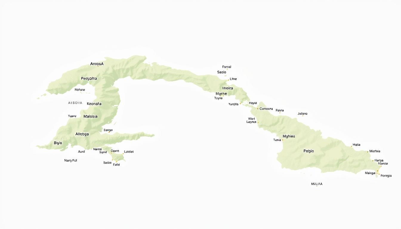
A detailed map shows the provinces’ layout, including their capitals and key spots. This guide will cover the 15 provinces and the special area. It aims to give a deep look at the administrative parts and their importance.
Whether you’re into city life or love the countryside, a map of Cuba is vital. It’s a must-have for anyone eager to discover this captivating island.
Geography and Administrative Divisions of Cuba
Cuba sits at the crossroads of the Caribbean Sea, the Gulf of Mexico, and the Atlantic Ocean. Its geography is both complex and fascinating. The island boasts diverse landscapes, from mountains to coastal plains.
Cuba’s Location in the Caribbean
Cuba is the largest island in the Caribbean, nestled in the northern part of the Caribbean Sea. Its strategic spot makes it a key player in regional politics and trade. The island faces the Atlantic Ocean to the north, the Gulf of Mexico to the west, and the Caribbean Sea to the south. Cuba’s geography features rugged mountains, fertile valleys, and long coastlines.
A geographical expert notes, “Cuba’s unique position in the Caribbean shapes its climate, biodiversity, and culture.” This highlights the need to grasp Cuba’s geographical context.
Overview of Cuba’s Current Administrative Structure
Cuba is split into 15 provinces and one special municipality, Isla de la Juventud. The provinces include Pinar del Río, Artemisa, Mayabeque, La Habana, Matanzas, Villa Clara, Cienfuegos, Sancti Spíritus, Ciego de Ávila, Camagüey, Las Tunas, Holguín, Granma, Santiago de Cuba, and Guantánamo. This division aids in governance and regional growth.
| Province | Capital |
|---|---|
| Pinar del Río | Pinar del Río |
| Artemisa | Artemisa |
| Mayabeque | Santa Cruz del Norte |
The administrative setup of Cuba aims to boost regional autonomy while keeping the nation united. As Cuba’s geography and divisions evolve, it’s vital to understand these aspects to appreciate the country’s identity.
Historical Evolution of Cuba’s Provinces
Cuba’s provinces have changed a lot over time. This reflects the country’s complex history and shifting politics. Today’s setup comes from important reforms that have shaped the island’s political and geographical divisions.
Pre-Revolutionary Provincial Organization
Before the Cuban Revolution, the country was divided into provinces. This was mainly due to Spanish colonial rule. The provinces were set up mainly for administrative reasons, ignoring the unique geography and culture of each area. This early setup was the foundation for future changes.
The pre-revolutionary Cuba had six provinces: Pinar del Río, Havana, Matanzas, Las Villas, Camagüey, and Oriente. These provinces were split into municipalities, creating a clear administrative hierarchy.
The 1976 Administrative Reform
In 1976, Cuba’s government structure was overhauled after the revolution. The goal was to make the government more efficient and centralized. The number of provinces was increased to 14, and Isla de la Juventud became a special municipality. The reform also changed how provincial and municipal governments worked, making local governance stronger.
The 2011 Reorganization
In 2011, Cuba made another big change to its government. This reform aimed to improve governance and economic management. Two new provinces, Artemisa and Mayabeque, were created from the old Havana Province. This was to make administration more efficient and boost local economies.
The 2011 reform also focused on giving more power to local governments. This was to make governance more effective and meet local needs better.
Comprehensive Cuba Map Guide: Types and Resources
Cuba’s geography is complex and best understood through different maps. Each map has its own purpose. They are vital for travelers, researchers, and anyone interested in Cuba’s history and divisions.
Political and Administrative Maps
Political and administrative maps show Cuba’s provinces, municipalities, and cities. They are key to understanding Cuba’s structure. The country is divided into 15 provinces and one special municipality, Isla de la Juventud. They help identify province boundaries and capitals, making navigation easier.
Dr. Maria Rodriguez, a Cuban geographer, says political maps are essential. They are available in print and digital formats.
Topographical and Geographical Maps
Topographical maps reveal Cuba’s physical features like mountains and valleys. The Sierra Maestra mountain range is a key feature. Geographical maps also show natural resources, climate zones, and more.
These maps are vital for environmental studies, tourism, and adventure activities. They offer a detailed view of Cuba’s landscapes.
Interactive and Digital Cuba Maps
In today’s digital world, interactive and digital maps are popular. Interactive Cuba maps let users zoom in and out for detailed views. They are great for trip planning and understanding city layouts.
“Digital maps have changed how we explore Cuba,” Juan Perez, a travel blogger, says. “Interactive maps make it easy to find Cuba’s attractions.” Digital maps also update in real-time, providing current info.
Cuba satellite maps offer a bird’s-eye view. They show the island’s features and cities. These maps are online and can be accessed for free or with a subscription.
Western Cuba: Regional Overview
Cuba’s western region is known for its unique landscapes and historical importance. It’s not just beautiful but also key to Cuba’s economy and culture.
Geographical Features of Western Cuba
Western Cuba has varied landscapes, from the mountainous regions of Pinar del Río to the coastal plains. The Viñales Valley, a UNESCO World Heritage Site, stands out. It’s famous for its karst topography and traditional farming.
| Geographical Feature | Description | Significance |
|---|---|---|
| Viñales Valley | Karst topography with mogotes | UNESCO World Heritage Site, traditional agriculture |
| Pinar del Río Mountains | Mountainous terrain | Rich in biodiversity, tobacco production |
| Coastal Plains | Flat, low-lying areas along the coast | Agriculture, urban settlements |
Economic and Cultural Significance
The western region of Cuba is vital for the country’s economy. It’s a big player in agriculture, with tobacco and sugar cane being major contributors. Havana, the capital, is a cultural powerhouse.
This area’s diverse economy and rich culture are essential to Cuba’s identity and stability.
Provinces of Western Cuba
Western Cuba’s provinces are full of adventure. From rugged coastlines to vibrant cities, there’s a lot to see. This area is famous for its stunning landscapes and cultural spots.
Pinar del Río Province
Pinar del Río is a beauty spot. It has the Viñales Valley and the Guanahacabibes Peninsula. It’s perfect for outdoor lovers.
Major Cities and Attractions
The capital, Pinar del Río, is rich in culture. You can visit the Fábrica de Tabacos and try local food.
Geographical Highlights
The Viñales Valley is a UNESCO site. It’s known for its mogotes and farming. It’s great for hiking.
Artemisa Province
Artemisa is a new province, created in 2011. It’s famous for its farms and history.
Major Cities and Attractions
Artemisa City has the Artemisa Municipal Museum. It shows the local history and culture.
Geographical Highlights
Artemisa has fertile valleys and the Sierra del Rosario Biosphere Reserve. It’s great for nature tours.
Mayabeque Province
Mayabeque was also created in 2011. It’s known for its varied landscapes and farming.
Major Cities and Attractions
San José de las Lajas is the capital. It has modern and traditional buildings. You can visit markets and cultural events.
Geographical Highlights
The Mayabeque River is important here. It helps with farming and the ecosystem.
La Habana Province
La Habana Province is around Havana. It’s full of history and culture.
Major Cities and Attractions
Places like the historic town of Guanabacoa and the Arcos de Canasí are must-sees. They show the area’s history and beauty.
Geographical Highlights
The coast of La Habana has beautiful beaches. It’s a favorite spot for both locals and tourists.
As a local saying goes, “
Cuba is a country of contrasts, where the old and the new coexist in harmony.
” This is true in Western Cuba. You’ll see old sites and new buildings together.
Havana: Cuba’s Capital Province
Havana is the heart of Cuba, rich in history. It’s known for its past, architecture, and impact on politics and culture.
Historical Development of Havana
Havana started in 1519 by the Spanish. It’s one of the oldest cities in the Americas. Over time, it grew into a lively city, shaped by Spanish, African, and indigenous cultures.
The city’s buildings show its history, from old colonial styles to modern designs. Havana’s role in the Cuban Revolution is also key. The city’s historic center is a UNESCO World Heritage Site, showing its cultural and historical value.
Major Districts and Landmarks
Havana has many districts, each with its own charm and landmarks. Some main areas include:
- Old Havana (Habana Vieja): Known for its colonial architecture and historic significance.
- Centro Habana: A densely populated area with a mix of old and new buildings.
- Vedado: A modern district with a vibrant nightlife and cultural institutions.
Key landmarks in Havana are the Capitolio building, the Castillo del Morro, and the Plaza de la Catedral. The city’s landmarks are not just tourist attractions but also symbols of its rich history and cultural identity.
Havana’s Role in Cuban Politics and Culture
Havana is more than Cuba’s capital; it’s the heart of politics, culture, and economy. It’s full of cultural spots like museums, theaters, and music venues. Havana’s culture mixes old and new, showing its rich heritage.
In politics, Havana is where the Cuban government and Communist Party are based. The city’s history in the Cuban Revolution shapes Cuban society today.
Some key aspects of Havana’s role in Cuban politics and culture include:
- The city’s influence on Cuban arts and literature.
- The presence of government institutions and political organizations.
- The city’s cultural festivals and events, which attract visitors from around the world.
Central Cuba: Regional Overview
Central Cuba is a place of varied landscapes and deep cultural roots. It’s a key part of Cuba’s identity. The area mixes geography and culture in a unique way, shaping the country’s history and growth.
Geographical Features of Central Cuba
Central Cuba boasts a range of landscapes, including mountain ranges, valleys, and coastal areas. These features support different ecosystems, from dense forests to fertile fields. Key highlights include:
- Majestic mountain ranges with stunning views and diverse wildlife.
- Fertile valleys essential for farming, boosting the local economy.
- Coastal spots with beautiful beaches and vital fishing industries.
Economic and Cultural Significance
Central Cuba’s economic and cultural value is immense. It’s a center for agriculture, tourism, and manufacturing. The area is also rich in cultural heritage, with many historical sites, festivals, and traditions.
Some key points include:
- Agriculture that feeds both locals and exports.
- Tourist spots that attract visitors worldwide, helping the economy.
- Cultural events and historical sites that celebrate the region’s heritage.
Provinces of Central Cuba
Central Cuba is a place of diverse landscapes and rich culture. It has five provinces: Matanzas, Villa Clara, Cienfuegos, Sancti Spíritus, and Ciego de Ávila. This area has varied geography, from coastlines to mountains and valleys. It is filled with history and culture.
Matanzas Province
Matanzas Province is famous for its stunning natural beauty. It has the famous Varadero Beach, a top tourist spot in Cuba. The province also has the Cueva de Saturno, a beautiful cave with a rich history.
Major Cities and Attractions
The capital, Matanzas, is a cultural and economic hub. Visitors can see the Matanzas Cathedral and the Plaza de la Vigía. This square offers beautiful views.
Geographical Highlights
Matanzas is also known for the Zapata Peninsula. It’s a paradise for nature lovers and bird watchers. The area has diverse ecosystems with many plants and animals.
Villa Clara Province
Villa Clara Province is a cultural and economic center in Central Cuba. It’s known for its vibrant city life, historic sites, and natural beauty.
Major Cities and Attractions
The city of Santa Clara is a major attraction. It has a historic center and the Monumento a Ernesto Che Guevara. This landmark honors the revolutionary leader.
Geographical Highlights
Villa Clara also has the Escambray Mountains. These mountains offer hiking and exploring opportunities. They showcase the region’s natural beauty.
Cienfuegos Province
Cienfuegos Province is called the “Perla del Sur” (Pearl of the South). It’s known for its beautiful landscapes and architectural charm. The province combines urban and natural attractions.
Major Cities and Attractions
The city of Cienfuegos is famous for its bay, historic buildings, and cultural venues. The Palacio de Valle is a notable cultural venue.
Geographical Highlights
The province also has the Guapacha Grasslands. This area is a natural beauty with diverse wildlife.
Sancti Spíritus Province
Sancti Spíritus Province is one of Cuba’s oldest. It has a rich history dating back to the early colonial period. The province is known for its historic towns and natural landscapes.
Major Cities and Attractions
The city of Sancti Spíritus is a key attraction. It has a historic center and the Puente Yayabo, a historic bridge.
Geographical Highlights
The province is also notable for the Topes de Collantes mountain range. It offers scenic views and outdoor activities.
Ciego de Ávila Province
Ciego de Ávila Province is known for its flat terrain and coastal areas. It’s a great place for nature and relaxation.
Major Cities and Attractions
The city of Ciego de Ávila is a major urban center. It has attractions like the Moret Park, a beautiful green space.
Geographical Highlights
The province is also home to the Jardines del Rey (Gardens of the King). This archipelago is known for its beautiful beaches and clear waters.
| Province | Capital City | Major Attractions |
|---|---|---|
| Matanzas | Matanzas | Varadero Beach, Cueva de Saturno |
| Villa Clara | Santa Clara | Monumento a Ernesto Che Guevara, Escambray Mountains |
| Cienfuegos | Cienfuegos | Palacio de Valle, Guapacha Grasslands |
| Sancti Spíritus | Sancti Spíritus | Puente Yayabo, Topes de Collantes |
| Ciego de Ávila | Ciego de Ávila | Moret Park, Jardines del Rey |
Eastern Cuba: Regional Overview
Eastern Cuba is known for its unique landscapes and cultural richness. It has mountains, valleys, and coastlines, adding to Cuba’s geography.
Geographical Features of Eastern Cuba
The Sierra Maestra mountain range is a key feature of Eastern Cuba. It includes Cuba’s highest peak, Pico Turquino. The area also has rivers, forests, and coastal plains, making it rich in biodiversity.
Eastern Cuba’s varied landscapes support many ecosystems. From tropical forests to coastal wetlands, it’s home to a wide range of wildlife. This diversity is essential for the region’s ecological balance.
Economic and Cultural Significance
Eastern Cuba is not just diverse geographically but also economically and culturally. It’s rich in natural resources like nickel and cobalt, mined in places like Moa. Its history, including its role in the Cuban Revolution, shapes its culture.
| Province | Capital | Main Economic Activity |
|---|---|---|
| Camagüey | Camagüey | Agriculture, Livestock |
| Santiago de Cuba | Santiago de Cuba | Industry, Tourism |
| Guantánamo | Guantánamo | Agriculture, Mining |
The cultural importance of Eastern Cuba is seen in cities like Santiago de Cuba. It’s known for its lively culture and historical sites. The region’s economy is a mix of agriculture, mining, and tourism, vital to Cuba’s strategy.
Provinces of Eastern Cuba
Eastern Cuba has many provinces, each with its own culture, history, and geography. This area is rich in heritage, from colonial cities to natural landscapes. It’s a fascinating place to explore.
Camagüey Province
Camagüey Province is one of Cuba’s largest. It’s famous for its colorful colonial buildings and rich history. The capital, Camagüey city, is a UNESCO World Heritage Site.
Major Cities and Attractions
Camagüey city is the main attraction. It has a historic center with landmarks like the Camagüey Cathedral and Plaza del Carmen.
Geographical Highlights
The province has vast plains and the Sierra de Cubitas mountains. These offer scenic views and outdoor activities.
Las Tunas Province
Las Tunas Province is known as “The City of Sculptures.” It’s famous for its vibrant culture and beautiful landscapes.
Major Cities and Attractions
Las Tunas city is known for its sculptures and monuments. The province also has beautiful beaches and natural reserves.
Geographical Highlights
The province has coastal plains and mountains. The Sierra de Cubitas is a notable feature.
Holguín Province
Holguín Province is known for its stunning natural beauty. It includes the Escaleras de Jaruco mountains and the Guardalavaca beach.
Major Cities and Attractions
Holguín city is a cultural center. Guardalavaca is a popular tourist spot with beautiful beaches and snorkeling.
Geographical Highlights
The province has diverse landscapes. From mountains to coastal areas, it’s great for nature lovers.
Granma Province
Granma Province is historically significant. It was where Fidel Castro and the revolutionaries landed in 1956.
Major Cities and Attractions
The province has the Granma National Park, a UNESCO World Heritage Site. It also has the Museo de la Revolución in Bayamo.
Geographical Highlights
Granma has mountains, including the Sierra Maestra range, and coastal areas. It offers scenic views and historical sites.
Santiago de Cuba Province
Santiago de Cuba Province is known for its vibrant culture, history, and natural beauty.
Major Cities and Attractions
Santiago de Cuba city is a cultural hub. It has landmarks like the Castillo del Morro and the Cathedral of Santiago de Cuba.
Geographical Highlights
The province has diverse geography. It includes mountains and coastal areas, with the Sierra Maestra mountains being a notable feature.
Guantánamo Province
Guantánamo Province is in southeastern Cuba. It’s known for its unique cultural heritage and complex history.
Major Cities and Attractions
Guantánamo city is known for its American naval base. The province also has the Caimanera municipality and beautiful southern coast beaches.
Geographical Highlights
The province has mountainous terrain. The Sierra Maestra and the Guantánamo River are significant features.
| Province | Capital | Notable Features |
|---|---|---|
| Camagüey | Camagüey | Colonial architecture, Sierra de Cubitas |
| Las Tunas | Las Tunas | Sculptures, beautiful beaches |
| Holguín | Holguín | Escaleras de Jaruco, Guardalavaca beach |
| Granma | Bayamo | Granma National Park, Sierra Maestra |
| Santiago de Cuba | Santiago de Cuba | Castillo del Morro, Sierra Maestra |
| Guantánamo | Guantánamo | American naval base, Sierra Maestra |
An interactive Cuba map can greatly enhance travel in Eastern Cuba. It helps visitors navigate the diverse provinces and attractions efficiently.
Isla de la Juventud: Cuba’s Special Municipality
Isla de la Juventud, or the Isle of Youth, is a special place in Cuba. It’s located south of the mainland and is known for its unique features and history.
Geographical Features and Location
Isla de la Juventud is the second-largest island in Cuba, covering about 2,419 square kilometers. It’s in the Caribbean Sea, south of the mainland. The island has beaches, mangrove forests, and caves.
The capital and largest town is Nueva Gerona.
Historical Significance
The island has a rich history. It was once a prison colony in the early 20th century. The Presidio Modelo, a former prison, is now a museum.
It was also a place of exile for political prisoners in Cuba’s history.
Current Status and Administration
Today, Isla de la Juventud is a special municipality, not part of any province. It’s directly administered by the national government. The island is known for its citrus fruits and growing tourism.
The local government aims for sustainable development. It balances economic growth with protecting the environment.
The special status of Isla de la Juventud shows its importance in Cuba. Knowing its place on the Cuba regions map helps us understand its role in the country’s geography and economy.
Practical Guide to Using Cuba Maps for Travelers
Cuba is full of diverse landscapes and bustling cities. A good map is key to exploring the island.
Choosing the right map is essential for your Cuba trip. Whether you want to see Havana’s historic streets, Varadero’s beaches, or Sierra Maestra’s mountains, a map will guide you.
Finding Your Way Around Major Cities
In Cuba’s major cities like Havana and Santiago de Cuba, a detailed city map is a must. These maps show landmarks, public transport, and places to see, making travel easier.
A Havana map will show you the historic center’s highlights, like the Capitolio and Plaza Vieja. A Santiago de Cuba map will guide you through the city’s lively areas and cultural spots.
Understanding Transportation Routes
Cuba’s transport network includes buses, trains, and taxis. Without a map, navigating can be tough. A transport map helps plan your trips and use your time wisely.
The Viazul bus service is a top choice for getting around. A map of Viazul routes helps plan your journey and reach your destinations quickly.
| Transportation Mode | Major Routes | Frequency |
|---|---|---|
| Viazul Bus | Havana to Santiago, Havana to Varadero | Multiple daily departures |
| Cuban Train | Havana to Santiago, Havana to Camagüey | Daily departures |
Printable and Offline Cuba Maps
For those who like traditional maps or need them offline, printable and offline Cuba maps are great. Download or print them before your trip for constant access.
A printable Cuba map lets you mark places, plan your trip, and track your visits. Offline maps on your phone offer GPS without internet.
Using these maps, travelers can enjoy Cuba more. They can explore with confidence and ease.
Conclusion
Knowing Cuba’s geography and its parts is key to exploring the island. The detailed Cuba map shows the country’s 15 provinces and special area, Isla de la Juventud. Each has its own geography and culture.
A good Cuba map guide is a must for travelers. It offers insights into the country’s history, culture, and setup. By looking at the map, visitors can see the island’s varied areas. From Pinar del Río and Artemisa in the west to Santiago de Cuba and Guantánamo in the east.
The geography of Cuba is interesting, with long coastlines, mountains, and valleys. A detailed map helps travelers plan their trip. They can follow the country’s roads and find its secret spots.
In short, knowing Cuba’s geography and its parts makes traveling better. It lets visitors dive deep into the island’s culture and history.