The region of Georgia is known for its complex geography and political tensions. It sits at the intersection of Europe and Asia. It borders several countries, including Russia.
Georgia’s territorial integrity faces threats from two breakaway areas. Abkhazia and South Ossetia have Russian backing. Knowing the Georgia Map helps understand the region’s politics.
This article will give you a detailed look at Georgia’s geography. It will also explore the status of its separatist areas. This will help clarify the region’s complexities.
Georgia at a Glance: Geographical Overview
Georgia sits at the crossroads of Europe and Asia. This unique spot has greatly shaped its history and culture.
Location and Strategic Position in the Caucasus
Georgia is in the Caucasus region, known for its complex geography and diverse cultures. Its spot between Europe and Asia makes it key for trade and cultural exchange. The Black Sea access also boosts maritime trade and commerce.
Borders and Neighboring Countries
Georgia shares borders with Russia to the north, Turkey to the southwest, Armenia to the south, and Azerbaijan to the southeast. Its terrain varies from mountains to lowlands, affecting climate and economy. The influence of its neighbors is clear in its politics and culture.
Major Geographical Features
Georgia’s landscape is varied, with the Greater Caucasus Mountains to the north and the Lesser Caucasus Mountains to the south. It also has valleys, forests, and a Black Sea coastline. This diversity supports a wide range of ecosystems and contributes to Georgia’s biodiversity.
| Geographical Feature | Description |
|---|---|
| Greater Caucasus Mountains | Mountain range to the north, forming a natural border with Russia |
| Lesser Caucasus Mountains | Mountain range to the south, influencing climate and local ecosystems |
| Black Sea Coastline | Georgia’s coastline along the Black Sea, facilitating trade and tourism |
Understanding Georgia’s Political Landscape
To understand Georgia’s politics, we need to look at its regions, how it’s governed, and its role on the world stage. Georgia is split into several areas, each with its own issues and strengths.
Administrative Divisions and Regions
Georgia has nine regions, including the capital Tbilisi, which is special. These areas are broken down into smaller parts for better local control. They help carry out national plans and handle local issues.
“The administrative divisions of Georgia are designed to balance regional autonomy with centralized governance, ensuring effective management of the country’s diverse territories.”
Governance Structure
Georgia runs on a parliamentary system, with a prime minister at the top. This setup has clear roles for the government, making sure no one branch gets too powerful. The prime minister makes sure policies are followed.
International Recognition and Diplomatic Relations
Georgia has friends around the world and is part of big groups like the United Nations. Its location in the Caucasus makes it key for both local and global powers. Georgia works hard to grow its influence and join the world community.
“Georgia’s membership in international organizations showcases its dedication to working together and promoting peace.”
Historical Context: Georgia’s Path to Independence
Georgia’s journey to independence is linked to the USSR’s fall and the rise of separatist movements. In 1991, Georgia broke free from the Soviet Union, changing its political landscape.
During the Soviet era, some areas in Georgia got special status. This set the stage for future disputes. South Ossetia and Abkhazia became key areas for separatist movements.
Soviet Era and Autonomous Regions
The Soviet Union divided Georgia into autonomous regions. South Ossetia and Abkhazia were among them. Each had its own culture and politics.
Dissolution of the USSR and Georgian Independence
When the USSR fell, Georgia saw a chance to be free. Its declaration of sovereignty in 1991 was a turning point. It showed the Georgian people’s wish for self-rule and freedom from the Soviets.
Early Conflicts and Separatist Movements
Soon, conflicts started in South Ossetia and Abkhazia. These were driven by history, culture, and economics. They created ongoing issues between these areas and the central government.
Knowing these early events helps us understand Georgia’s current politics and its relations with breakaway territories.
Comprehensive Georgia (Country) Map Guide
Exploring Georgia’s complex landscape needs a deep understanding of its political and territorial divisions. A detailed map guide is key to grasping the country’s geography and political landscape.
Understanding Political Boundaries
Georgia’s political boundaries are vital for its map. They define the country’s administrative divisions and regions. These boundaries help us understand governance and resource distribution.
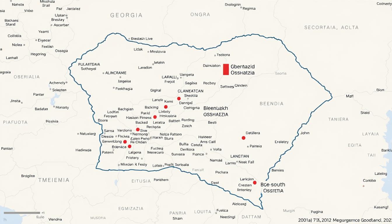
The map shows the borders between different regions. This includes the disputed areas of Abkhazia and South Ossetia.
Administrative divisions in Georgia are split into regions, municipalities, and cities. Knowing these divisions is essential for navigating the country’s politics.
De Jure vs. De Facto Territorial Control
The difference between de jure and de facto territorial control is important. De jure is the legal status, while de facto is the actual control. In Georgia, this is key to understanding Abkhazia and South Ossetia.
These areas are legally part of Georgia but are controlled by Russia in reality. This distinction is vital for map interpretation.
Map Legends and Symbols for Disputed Territories
Map legends and symbols are critical for showing disputed territories. For Georgia, they highlight areas under de facto control and administrative lines. Understanding these symbols is essential for accurate map interpretation.
Using a Georgia Tourist Map or a Georgia Road Map helps understand the impact of these divisions on travel and tourism.
Abkhazia: The Northwestern Separatist Region
Abkhazia, with its Black Sea coastline, is a key area of conflict between Georgia and Russia. Its history and importance make it vital to understanding the Georgia Region Map.
Geographical Features and Black Sea Access
Abkhazia has a varied landscape, with mountains and coastal plains by the Black Sea. Its Black Sea access offers economic benefits like tourism and trade. Sukhumi, the capital, is a cultural and economic hub.
Historical Context of Abkhazian Separatism
Abkhazia’s history is complex, starting as an autonomous republic in Georgia during the Soviet era. After the Soviet Union fell, Abkhazia sought independence, causing conflict with Georgia. Knowing this history helps understand today’s relations between Abkhazia, Georgia, and Russia.
The fight for independence led to the 1992-1993 war, causing displacement and loss of life. The Abkhazia Wikipedia page details these events.
Russian Military and Political Support
Russia’s backing has been key to Abkhazia’s fight for independence. This support includes military presence and economic aid, shaping the region’s politics and security.
Russian Military Bases in Abkhazia
Russia has a strong military presence in Abkhazia, with several bases. These bases are vital for Russia’s interests in the Caucasus and affect the region’s security.
Economic Ties with Russia
Abkhazia and Russia have strong economic ties, with Russia giving significant financial help. This aid supports infrastructure, energy, and other sectors, strengthening Russia’s role in Abkhazia.
The economic bond between Abkhazia and Russia includes:
- Direct financial aid to support Abkhazia’s budget
- Investment in infrastructure projects, such as roads and public buildings
- Energy sector cooperation, including electricity supply and infrastructure development
This support shows Russia’s dedication to its presence in the region. It also highlights the complex geopolitical dynamics in the Georgia Region Map.
South Ossetia: The Northern Breakaway Territory
South Ossetia has caught the world’s eye because of its complex past and strategic spot. It’s in northern Georgia and claims to be independent, but the world doesn’t officially recognize it.
Geographical Characteristics and Strategic Location
South Ossetia is known for its mountains, which have shaped its history and current politics. Its location in the Caucasus is key for trade and military routes.
Evolution of South Ossetian Separatism
The push for South Ossetian independence started long ago, during the Soviet times and after it fell apart. This journey has seen both conflict and diplomatic talks.
“The history of South Ossetia is complex, with roots tracing back to the early 20th century when the region first sought autonomy.”
Russian Influence and Support
Russia’s role in South Ossetia is big, touching on military, economic, and political areas. Russia’s backing has greatly influenced the region’s current state.
- Military presence and border fortifications
- Economic and political integration with Russia
Military Presence and Border Fortifications
Russia has a big military in South Ossetia, with strong border defenses. These have big effects on the area’s security and peace.
Economic and Political Integration with Russia
South Ossetia has grown closer to Russia in economy and politics. This has changed how it’s governed and its economic ties.
This closeness has made the region more dependent on Russia, shaping its politics.
To get South Ossetia’s story, we must look at its geography, history, and Russia’s role. Its future is unclear, with big impacts on local peace and global relations.
The 2008 Russo-Georgian War: Territorial Consequences
The 2008 Russo-Georgian War was a turning point in the region’s history. It had big effects on Georgia’s land and its politics. The war also changed the situation in Abkhazia and South Ossetia.
Causes and Escalation of the Conflict
The war was caused by many factors like history, politics, and ethnic issues. On August 7, 2008, fighting between Georgian and South Ossetian forces got worse. Russia’s support for the separatist regions was key in making things worse.
Military Operations and Russian Intervention
Russia helped the separatist regions with military force. Russian troops moved far into Georgia, beating Georgian forces quickly. The fighting stopped with a ceasefire, but a lot of damage and people had to leave their homes.
Post-War Border Changes and Russian Recognition
After the war, Russia said Abkhazia and South Ossetia were independent. This move was criticized by many countries, as they saw these areas as part of Georgia. Russia’s military stayed in these areas, changing the borders.
| Region | Pre-War Status | Post-War Status |
|---|---|---|
| Abkhazia | De facto independence | Recognized by Russia |
| South Ossetia | De facto independence | Recognized by Russia |
The 2008 Russo-Georgian War had lasting effects on the area. It changed Georgia’s land and its relationship with Russia. Knowing about this war helps us understand the current situation in the region.
Georgia’s Physical and Topographical Map Features
Georgia’s geography is incredibly varied. It ranges from the rugged Caucasus mountains to the soft Black Sea coast. The country’s maps show its beauty, with mountains, rivers, and a stunning coastline.
The Greater and Lesser Caucasus Mountain Ranges
The Greater Caucasus Mountain Range marks Georgia’s northern edge, separating it from Russia. It boasts peaks like Mount Kazbek and Mount Shkhara. The Lesser Caucasus Mountain Range is to the south, with lower hills. These ranges add to Georgia’s varied landscapes and climates.
Major River Systems: Mtkvari, Rioni, and Others
Georgia’s rivers are key to its geography and economy. The Mtkvari River runs through Tbilisi and into Azerbaijan. The Rioni River flows into the Black Sea. These rivers help with farming, power, and wildlife, making them essential to Georgia.
Black Sea Coastline and Lowlands
The Black Sea coastline is vital for Georgia’s economy and tourism. Places like Batumi are major attractions. The coastal areas are rich for farming, contrasting with the mountains. This coastline is a highlight of Georgia’s Georgia Physical Map and a big draw for visitors.
Climate Zones and Ecological Diversity
Georgia’s varied landscape leads to different climate zones. From the Black Sea’s subtropical areas to the mountains’ alpine climates, there’s a lot of variety. This variety supports a wide range of ecosystems, making Georgia very diverse and rich in nature.
Georgia Region Map: Cultural and Demographic Landscapes
Georgia’s culture is shaped by its history, geography, and ethnic groups. This mix has created a diverse cultural scene. It’s a topic worth exploring.
Historical Provinces and Cultural Regions
Georgia has many historical provinces, each with its own culture. Places like Samegrelo, Svaneti, and Kakheti stand out. They have their own traditions, buildings, and ways of life.
Ethnic Composition Before and After Conflicts
The ethnic makeup of Georgia has changed, mainly due to conflicts in Abkhazia and South Ossetia. Before these conflicts, these areas were more diverse. But the conflicts changed this:
- Abkhazia now mostly has Abkhazians.
- South Ossetia has more Ossetians.
- Many ethnic Georgians had to leave these areas.
These changes have deeply affected Georgia’s demographics.
Language Distribution and Cultural Heritage Sites
Georgia has a rich linguistic scene, with Georgian being the main language. Other languages like Abkhaz and Ossetian are also spoken. The country is full of cultural sites, like ancient churches and towns like Mtskheta and Gori.
These sites are key to Georgia’s culture and draw tourists. This helps the local economy.
Knowing about Georgia’s culture and demographics helps us understand its history and current challenges. The Georgia Tourist Map is a great tool for exploring these topics. It shows important cultural sites and areas to visit.
Georgia Road Map and Transportation Infrastructure
The road map of Georgia shows a wide network of highways and transit routes. These help with travel within the country and abroad. This network is key for Georgia’s economy and how it connects with others.
Major Highways and Transit Routes
Georgia’s roads connect important cities and areas. The E60 highway runs from east to west, and the E70 from north to south. These roads are important for moving people and goods, linking Georgia to Europe and Asia.
Key Transit Routes:
- The Transcaucasian Highway connects Georgia with Russia through the Caucasus Mountains.
- The route to Turkey helps with trade and travel between the two countries.
Border Crossings and Checkpoints
Georgia’s road map also shows several border crossings and checkpoints. These are key for international travel and trade. The main crossings are with Turkey, Armenia, Azerbaijan, and Russia. They are vital for moving goods and people.
Transportation Challenges in Divided Territories
The areas of Abkhazia and South Ossetia are big challenges for Georgia’s roads. The conflict in these areas has closed some routes and set up checkpoints. This makes travel and trade harder.
Challenges include:
- Restricted access to certain areas due to conflict.
- Increased travel times due to checkpoints and alternative routes.
- The need for enhanced security measures along key transportation routes.
Despite these challenges, Georgia keeps working on its roads. It aims to improve connections and boost the economy.
Georgia Tourist Map: Safe Travel Zones and Restricted Areas
Georgia is a country in the Caucasus region, known for its rich culture and natural beauty. It draws tourists from all over. The country has mountains and coastlines along the Black Sea, providing many experiences for visitors.
Popular Tourist Destinations and Heritage Sites
Georgia boasts many historical and cultural sites. Places like the ancient city of Mtskheta, Gelati Monastery, and Svaneti region are must-sees. These spots offer medieval towers and breathtaking mountains.
Tourists also love the cities of Tbilisi and Batumi. They mix old traditions with modern attractions.
- Ancient city of Mtskheta
- Gelati Monastery
- Svaneti region
- Tbilisi
- Batumi
Administrative Boundary Line (ABL) Restrictions
Georgia is a favorite among tourists, but some areas are off-limits due to conflict. The ABLs around South Ossetia and Abkhazia are sensitive. Travelers should be careful near these borders.
Key restrictions include:
- Limited access to areas near the ABL
- Restrictions on movement within South Ossetia and Abkhazia
- Checkpoints and surveillance
Travel Advisories and Safety Considerations
Before visiting Georgia, check the latest travel advisories. Be aware of the situation in separatist regions. Registering with authorities and staying updated on local conditions is wise.
Knowing safe zones and restricted areas helps plan a trip to Georgia. This way, tourists can enjoy their visit without worries.
Economic Geography of Georgia and Its Separated Territories
The economy of Georgia is shaped by its natural resources, main industries, and the effects of its divided territories. The country’s varied landscape, from the Caucasus Mountains to the Black Sea, greatly affects its economic activities.
Natural Resources and Key Industries
Georgia has a wealth of natural resources, including rich mineral deposits like manganese, copper, and gold. The main industries are:
- Agriculture, focusing on wine, hazelnuts, and citrus fruits
- Mining and metallurgy
- Tourism, boosted by its culture and natural beauty
These sectors are vital to Georgia’s economy. They provide jobs and help the country’s GDP grow.
Economic Impact of Territorial Division
The division of Abkhazia and South Ossetia has deeply affected Georgia’s economy. The loss of these areas has led to:
- Less economic output due to lost fertile land and mineral resources
- Higher transportation costs and more complex routes
- Trade and economic activity restrictions along the Administrative Boundary Lines (ABL)
These issues have put a strain on Georgia’s economy and hindered its growth.
Trade Routes and Energy Corridors
Despite these challenges, Georgia’s strategic location is key for trade and energy. The country plays a major role in several important projects, including:
- The Baku-Tbilisi-Ceyhan (BTC) pipeline, moving oil from the Caspian Sea to the Mediterranean
- The South Caucasus Pipeline (SCP), carrying natural gas from Azerbaijan to Turkey
- The Transport Corridor Europe-Caucasus-Asia (TRACECA), aiming to boost regional trade and cooperation
These efforts highlight Georgia’s importance as a key energy and trade route. They improve its economic outlook.
Interactive and Digital Maps of Georgia
Digital technology has changed how we explore Georgia’s geography. Now, it’s easy to find detailed maps online and on mobile apps.
Online Resources for Detailed Georgia Maps
Many websites offer interactive maps of Georgia. They have detailed geographical information like topography and administrative areas. Google Maps and other databases are great for both researchers and travelers.
A geographical expert said, “Digital maps have greatly improved our understanding of complex data.” These tools are key for studying Georgia’s territorial details.
GIS Data and Satellite Imagery of Disputed Areas
GIS data and satellite images are key for mapping Georgia’s disputed areas. They give accurate and current info on borders and infrastructure. Governments and organizations use them to track changes in places like Abkhazia and South Ossetia.
Mobile Applications for Navigation in Georgia
Mobile apps are a must for anyone in Georgia. Apps like Google Maps offer real-time traffic updates and help plan routes. They’re very helpful in areas with tough roads or limited access.
A user said, “
Mobile maps have been a game-changer for navigating the complex roads around Tbilisi
.” This shows how useful digital maps are for daily travel.
Conclusion: Georgia’s Territorial Challenges and Future Prospects
Georgia is dealing with big territorial issues. It has de facto separatist regions, Abkhazia and South Ossetia, backed by Russia. The 2008 Russo-Georgian War made things worse, with Russia occupying parts of Georgia.
Looking at the Georgia Physical Map shows the country’s complex geography and politics. It’s located in the Caucasus, next to Russia, Turkey, Armenia, and Azerbaijan. This makes it key in regional politics.
Despite its problems, Georgia is a democracy with a high Human Development Index. It’s also an emerging market economy. Its future depends on solving territorial disputes and improving diplomacy and economy.
It’s important to understand Georgia’s territorial issues to see its future. The Georgia Physical Map is a key tool. It helps us see the country’s geography and political lines.