Looking at the detailed map of Georgia shows more than just its geography. It also shows its key spot among other US states.
The southeastern United States is full of different landscapes and cultures. Georgia is right in the middle of it all.
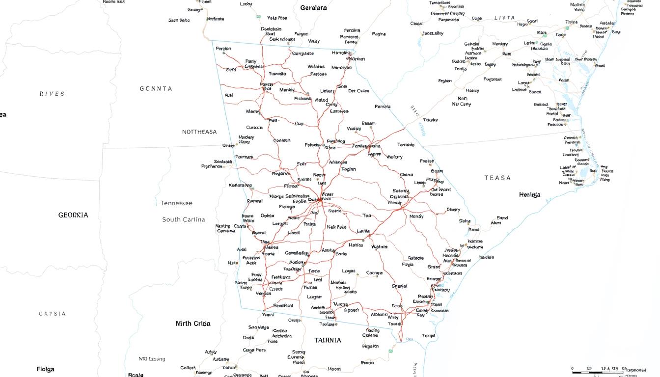
When we examine the Georgia Map (USA) closely, we see its borders with Tennessee, North Carolina, and Florida. This shows how connected and economically linked the region is.
This article will give you a full view of Georgia’s geography and its ties to nearby states. It will help you understand why this area is so important.
Georgia’s Geographic Position in the United States
Georgia is right in the middle of the southeastern US. It’s a key player in the country’s geography and economy. As the 24th largest state by area, it covers about 59,425 square miles. This makes it a big deal in the US.
Location and Size Comparison
Georgia shares borders with Tennessee and North Carolina to the north. It also borders South Carolina to the east, Florida to the south, and Alabama to the west. Its size is similar to countries like Guatemala or Iceland. This puts Georgia in a special spot in terms of influence.
| State | Area (Square Miles) | Population (2020) |
|---|---|---|
| Georgia | 59,425 | 10.7 million |
| Tennessee | 41,220 | 6.9 million |
| South Carolina | 32,875 | 5.1 million |
Topographical Overview
Georgia’s landscape is quite varied. It goes from the Blue Ridge Mountains in the north to the coastal plains in the south. The state is covered in forests, wetlands, and barrier islands.
The Chattahoochee River and Flint River run through Georgia. They help make the state’s farms productive and add to its natural beauty.
The Complete Georgia Map (USA): Features and Details
A detailed map of Georgia offers deep insights into the state’s diverse landscapes and infrastructure. It’s key to grasp the state’s layout, from its mountains to its coastal plains.
Key Elements of Georgia State Maps
Georgia state maps focus on several important aspects for navigation and geography understanding. These include:
- Scale: The scale shows the map’s distance ratio to real distances, aiding in accurate measurements.
- Legend: The legend clarifies the symbols and colors, making it easier to spot roads, rivers, and cities.
- Road Network: A detailed road map is vital for getting around, featuring highways, state routes, and local roads.
- Geographical Features: Maps highlight major geographical spots like mountains, lakes, and forests.
An interactive map of Georgia boosts the user experience. It allows for zooming, panning, and real-time traffic updates.
How to Read Georgia Maps Effectively
To read a Georgia map well, you need to grasp its parts. Here are some tips:
- Understand the Scale: Knowing the scale helps estimate distances and travel times.
- Use the Legend: Get to know the legend to decipher symbols and colors.
- Identify Key Features: Spot major geographical features, cities, and road networks.
- Check for Updates: Make sure the map is current, vital for trips or navigating new areas.
A Georgia road map is great for planning road trips. It shows how different parts of the state connect.
Georgia’s Border States: An Overview
Knowing about Georgia’s border states helps us understand its geography and culture. Georgia is surrounded by five states. Each state adds to its diverse landscape and identity.
Length and Nature of State Borders
Georgia borders Tennessee to the north, North Carolina and South Carolina to the east, Florida to the south, and Alabama to the west. Its borders stretch for about 1,244 miles. The borders vary, with some following rivers and mountains.
The Chattahoochee River marks the border with Alabama. The Savannah River does the same with South Carolina. Below is a table showing Georgia’s border lengths and types with its neighbors.
| State | Border Length (miles) | Nature of Border |
|---|---|---|
| Tennessee | 260 | Mountainous terrain |
| North Carolina | 96 | Mountainous terrain |
| South Carolina | 298 | Riverine and flat terrain |
| Florida | 200 | Marshy and coastal terrain |
| Alabama | 390 | Riverine and hilly terrain |
Historical Development of Georgia’s Boundaries
Georgia’s borders have changed a lot over time. It was first a colony in 1732. Its southern border was the Altamaha River, and its western border was the Chattahoochee River.
Later, treaties and agreements with Native American tribes and other colonies shaped its borders. After the American Revolution, the state’s borders were officially set. Adjustments were made through treaties and compacts, like the Compact of 1802 with the federal government.
Tennessee: Georgia’s Northern Neighbor
Tennessee is Georgia’s northern neighbor, with a border that shapes their relationship. Their shared history, geography, and economic ties influence their bond.
The Border Region
The Georgia-Tennessee border is known for its varied landscapes. From the Appalachian Mountains to valleys and rivers, it’s a beautiful area. It’s also key for trade and cultural exchange.
The border spans about 260 miles, with many crossing points. These points are important for commerce, tourism, and daily travel.
Key Connection Points and Crossings
Several key points and crossings along the border help move goods, services, and people. Notable ones include:
- The I-75 corridor, a major route for trade and travel.
- US-41 and US-76, which provide alternative routes for regional traffic.
- State routes that connect smaller towns and communities.
These crossings are vital for the regional economy. They support industries like manufacturing, logistics, and tourism. A satellite map of Georgia shows the region’s geography and infrastructure, highlighting these points’ importance.
| Crossing Point | Route | Significance |
|---|---|---|
| I-75 | Major interstate highway | Primary route for trade and travel |
| US-41/US-76 | US highways | Alternative routes for regional traffic |
| State Routes | Various state highways | Connects smaller towns and communities |
A regional transportation expert notes, “The connection between Georgia and Tennessee is key for the regional economy. It helps move goods and people.” This highlights the need to keep and improve the border’s infrastructure.
“The border between Georgia and Tennessee is more than just a geographical divide; it’s a region of cultural and economic exchange.”
North Carolina: The Northeastern Border
The northeastern border of Georgia meets North Carolina, a place of varied landscapes and deep history. This area is more than just a line between states. It’s a place of cultural, economic, and environmental importance.
The Blue Ridge Mountain Connection
The Blue Ridge Mountains mark the Georgia-North Carolina border. They create a stunning landscape and are key to the ecosystem. This mountain range is a big draw for tourists and supports many plants and animals.
The mountains have greatly influenced the area’s history and culture. Many communities depend on the mountains for resources.
Transportation Links Between Georgia and North Carolina
Georgia and North Carolina are connected by important roads. Highways like I-85 and US-23 link the two states, boosting trade and tourism. These roads are essential for the local economy. They also offer beautiful views that draw visitors from everywhere.
Knowing about the geography and roads of this border is key to understanding Georgia and North Carolina’s relationship. A detailed map of Georgia and its neighbors helps us see the region’s layout and key spots.
South Carolina: The Eastern Neighbor
Georgia shares its eastern border with South Carolina. The Savannah River flows along this border. It’s key to the area’s history, culture, and economy.
The Savannah River Border
The Savannah River is a major part of the Georgia-South Carolina border. It stretches about 360 miles. For centuries, it has been important for trade, travel, and fun.
The Savannah River has shaped the region’s past. It was a boundary and a path for settlers. Now, it supports tourism and fishing.
Major Border Cities and Crossings
Several cities along the border are key for their economy and culture. Augusta and North Augusta stand out for their history and modern ties.
| City | State | Significance |
|---|---|---|
| Augusta | Georgia | Historic city with significant cultural heritage |
| North Augusta | South Carolina | Major crossing point and economic hub |
| Savannah | Georgia | Significant port city and tourist destination |
| Beaufort | South Carolina | Historic district and tourist attraction |
The border cities and crossings help move goods and people. They also foster cultural exchange. This makes the area lively and connected.
Florida: Georgia’s Southern Boundary
Georgia’s border with Florida is special because of its natural beauty and economic value. This area is more than just a line on a map. It’s where two states meet, each with its own culture and environment.
An interactive map of Georgia helps us see this border’s importance. These maps show the border’s size, the local landscape, and important spots along the Georgia-Florida line.
The Georgia-Florida Coastal Region
The coastal area where Georgia and Florida meet is full of different environments. You’ll find marshes, beaches, and forests. This place is not just beautiful; it’s also key for fishing and tourism.
The land and sea here work together, making a unique place full of life. An interactive map can show us the details of this area. It helps us see how humans affect the environment.
Key Interstate Connections
Georgia and Florida are connected by more than just a border. They’re linked by important highways. Roads like I-75 help move goods and people easily.
| Highway | Route | Significance |
|---|---|---|
| I-75 | Connects major cities like Valdosta in Georgia to cities in Florida | Facilitates trade and travel between the two states |
| I-10 | Links Jacksonville, Florida, with southern Georgia | Important for regional transportation and commerce |
These highways show how vital the Georgia-Florida border is. It’s not just a line; it’s a key connection between the states. It helps with trade and cultural exchange.
Alabama: The Western State Line
The border between Georgia and Alabama is more than a line on a map. It connects two states with shared histories and economic ties. The Chattahoochee River defines this border, shaping the region’s landscape and local economies.
The Chattahoochee River Border
The Chattahoochee River is a key part of the Georgia-Alabama border. It’s a vital source of water, power, and transportation. The river has helped cities, industries, and farms grow along its banks.
Dams on the Chattahoochee provide hydroelectric power and create reservoirs. These support recreation and water supply. The river is also a natural boundary that has shaped the region’s culture and history.
It’s a site for fishing, navigation, and tourism. The river supports diverse wildlife and habitats, highlighting its ecological importance.
Economic and Cultural Connections
The Chattahoochee River connects Georgia and Alabama economically and culturally. It has helped trade and commerce between the states. Industries rely on it for transportation and power.
The region around the river has a diverse economy. It includes manufacturing, agriculture, and tourism, all connected across state lines. Culturally, the area is rich in heritage, with historical sites and cultural events.
These attract visitors from both Georgia and Alabama. The shared history and cultural practices create a sense of community. Efforts to preserve the river’s beauty and history promote cooperation between the states.
Major Geographic Features of Georgia
Georgia’s geography is varied, from mountains to coast. Its diverse landscape is filled with natural wonders. These features make Georgia unique and beautiful.
Rivers and Lakes
Georgia has many rivers and lakes that are vital to its ecosystem. The Chattahoochee River, for example, is a border with Alabama and a key source of water. It’s also great for recreation.
Lake Lanier and Lake Allatoona are other important water bodies. They offer boating, fishing, and more.
Major Rivers: Chattahoochee River, Flint River, Ocmulgee River
Notable Lakes: Lake Lanier, Lake Allatoona, Lake Sinclair
Mountain Ranges
Georgia’s north is home to several mountain ranges. The Blue Ridge Mountains are a standout, with their stunning views and outdoor fun. Brasstown Bald, the highest point in Georgia, is here.
“The Blue Ridge Mountains in Georgia are a haven for nature lovers and adventure seekers alike.”
Coastal Areas and Islands
The coastal area of Georgia is known for its marshes, beaches, and islands. The Golden Isles, like St. Simons and Jekyll Islands, are favorites among tourists. The coast also hosts the Port of Savannah, a major shipping center.
Key Coastal Features: Golden Isles, St. Simons Island, Jekyll Island, Tybee Island
Georgia’s varied geography makes it a unique and captivating place. It draws visitors and supports many ecosystems.
Georgia’s Major Cities and Metropolitan Areas
Georgia’s cities are key to its urban life. Each city has its own vibe and plays a big role in the state’s economy. The state’s metropolitan areas show us the economic, cultural, and demographic sides of Georgia.
Atlanta and the Urban Core
Atlanta, Georgia’s capital, is at the heart of the state’s urban life. It’s a big economic center with many industries like tech, logistics, and finance. The city also has a lively culture with lots of museums, theaters, and music spots.
Atlanta’s area has many special neighborhoods. Places like Inman Park with its old homes and Virginia-Highland with its cool bars and restaurants show the city’s mix of old and new.
Regional Cities and Their Significance
Outside of Atlanta, Georgia has other cities that are important for the state’s economy and culture. Augusta, Columbus, and Savannah are known for their history and economic impact. These cities are centers for manufacturing, healthcare, and tourism.
| City | Population | Economic Significance |
|---|---|---|
| Atlanta | 498,715 | Technology, Logistics, Finance |
| Augusta | 202,081 | Manufacturing, Healthcare |
| Columbus | 206,922 | Manufacturing, Military |
| Savannah | 72,060 | Tourism, Logistics |
Georgia’s Road Map and Transportation Network
Georgia’s transportation network has a mix of highways, state routes, and secondary roads. These help move goods and people across the state and beyond.
The heart of Georgia’s road map is its interstate highways. They connect major cities and give access to other states. The main highways in Georgia are:
- I-75: Runs north-south, linking cities like Macon and Valdosta.
- I-85: Connects Atlanta to the northeast and beyond.
- I-20: Goes from east to west, through Atlanta, and to other states.
- I-95: Runs along the coast, through Georgia’s coastal areas.
Interstate Highways Through Georgia
These highways are key for daily travel and the state’s economy. For example, I-75 is important for trucking, connecting the south to the north.
State Routes and Secondary Roads
Georgia also has many state routes and secondary roads. These roads connect rural areas to cities and offer alternative routes when traffic is heavy.
Some important state routes are:
- State Route 400: Links Atlanta to the north.
- State Route 17: Runs along the coast, giving scenic views.
- State Route 96: Connects rural areas to major highways.
Secondary roads are vital for local travel and access to rural areas. They often are the only way to connect rural communities to the wider transportation network.
Georgia Counties Map: Administrative Divisions
The Georgia counties map is key to understanding the state’s setup. It shows 159 counties, which are vital for governance, geography, and local economies.
The 159 Counties of Georgia
Georgia’s 159 counties differ a lot in size, people, and economy. Fulton County, for example, is very populous, with many people living in and around Atlanta. Smaller counties are often rural, with economies based on farming and local businesses.
These counties have been around for a long time, with some dating back to the 18th century. Knowing about them helps us understand Georgia’s administrative and geographical setup.
Notable County Features and Characteristics
Each Georgia county has its own special traits. For example, Chatham County, home to Savannah, is famous for its historic sites and coastal economy. Gwinnett County, on the other hand, is known for its fast-growing population and diverse economy.
Counties also differ in their natural beauty. Some have big water bodies, mountains, or coastlines. This variety adds to Georgia’s rich cultural heritage.
Satellite and Topographical Maps of Georgia
To understand Georgia’s geography, we need to look at its topographical and satellite maps. These maps show the state’s varied landscape. From the Blue Ridge Mountains to the coastal plains, it’s all there.
Understanding Georgia’s Terrain
Georgia’s terrain is full of different elevations and landforms. The topographical map shows the mountains in the north, the rolling hills in the middle, and the flat plains in the south. Satellite imagery adds visual details about land use, water, and plants.
Topographical maps are key for knowing Georgia’s natural features. For example, the Chattahoochee River, which borders Alabama, is easy to spot on these maps.
Using Satellite Imagery for Navigation and Planning
Satellite imagery helps us understand Georgia’s terrain and plan better. It’s great for finding the best travel routes, planning cities, and managing nature. Geographical maps of Georgia are vital for both locals and visitors.
| Feature | Description | Usefulness |
|---|---|---|
| Topographical Maps | Detailed elevation and landform information | Urban planning, hiking, and environmental studies |
| Satellite Imagery | Visual representation of land use and cover | Navigation, agricultural monitoring, and disaster response |
By mixing topographical maps with satellite imagery, we get a deeper understanding of Georgia’s geography. This method is useful for many things, from tourism to protecting the environment.
Conclusion: Navigating Georgia and Its Neighboring States
Knowing the geography of Georgia and its neighbors is key. A detailed map of Georgia shows the state’s layout, including cities, roads, and natural features.
The Georgia Map (USA) shows the state’s important location. It’s bordered by Tennessee, North Carolina, South Carolina, Florida, and Alabama. Each state brings its own culture, economy, and geography to the mix.
Looking at the Georgia map helps us see the state’s mountains, rivers, and coast. This info is vital for planning trips and understanding the region. It also helps in making smart choices about business and investments.
A detailed map of Georgia is a must-have for anyone exploring the state. With its rich history, varied geography, and lively cities, Georgia is a key and interesting part of the United States.