Calgary is a key city in Alberta, Canada. It’s a major economic and cultural center. By 2021, it had a population of 1,306,784, making it Canada’s third-largest city.
Understanding Calgary’s geographical context in North America is key. Knowing its location compared to other cities and landmarks is important. It helps businesses, travelers, and researchers.
The comprehensive map of Northern America shows where Calgary is. It gives a clear picture of its role in the area.
Geographic Overview of North America
North America is home to vast mountain ranges, expansive plains, and varied climates. This diversity helps us understand the importance of cities like Calgary. The continent’s landscape greatly affects its climate, economy, and culture.
Countries and Territories of North America
North America has 23 countries and many territories. This variety shows in the different landscapes and climates across the continent. The United States and Canada are among the largest countries by land area. Smaller nations in Central America and the Caribbean also exist.
Greenland and several island nations add to the continent’s geographical complexity.
| Region | Countries/Territories | Notable Features |
|---|---|---|
| Northern America | United States, Canada | Rocky Mountains, Great Plains |
| Central America | Belize, Costa Rica, Panama | Rainforests, Volcanic Mountains |
| Caribbean | Jamaica, Haiti, Dominican Republic | Island Chains, Beaches |
Major Geographical Features and Regions
The geography of North America is shaped by vast mountain ranges like the Rocky and Appalachian Mountains. The Great Plains, a key agricultural area, covers the central United States and Canada.
Key geographical features include:
- The Mississippi River, one of the longest rivers in North America
- The Grand Canyon, a notable natural wonder
- The Canadian Rockies, known for their scenic beauty
Canada’s Position on the North American Continent
Canada’s vast territory covers much of North America. It shares a long border with the United States. This makes Canada a key part of the continent.
To understand Canada’s role, we need to look at its provinces and territories. We also need to consider its border with the United States.
Canada’s Provincial and Territorial Boundaries
Canada is split into ten provinces and three territories. Each has its own unique features and powers. The provinces are Ontario, Quebec, British Columbia, Alberta, Saskatchewan, Manitoba, Nova Scotia, New Brunswick, Prince Edward Island, and Newfoundland and Labrador. The territories are Yukon, Northwest Territories, and Nunavut.
| Province/Territory | Capital | Population (approx.) |
|---|---|---|
| Ontario | Toronto | 14 million |
| Quebec | Quebec City | 8.5 million |
| British Columbia | Victoria | 5.2 million |
The Canada-United States Border Region
The Canada-United States border is the longest international border, at 8,891 kilometers. It’s important for trade, tourism, and cultural exchange. It connects the two countries economically and culturally.
Key aspects of the Canada-U.S. border region include:
- Trade: The border is a key route for trade between Canada and the U.S.
- Tourism: Millions cross the border each year for tourism and leisure.
- Cultural Exchange: The region promotes cultural exchange, with many communities sharing history and culture.
Alberta: The Provincial Context of Calgary
Alberta is in the heart of western Canada, with mountains and prairies. This mix of landscapes has made Alberta rich in natural resources and important for Canada’s economy.
Alberta’s Location Within Canada
Alberta is in western Canada, next to British Columbia, Saskatchewan, the Northwest Territories, and Montana. This strategic location connects Canada’s western provinces to North America.
Alberta is key to Canada’s economy because of its oil and natural gas. These resources are abundant here.
Key Cities and Geographic Features of Alberta
Calgary is a major city in Alberta, known for business and culture. Edmonton, the capital, is famous for its arts and education. The Rocky Mountains are in Alberta’s west, perfect for outdoor fun.
Alberta has prairies for farming and mountains for tourists. This diversity makes Alberta special.
Precise Location of Calgary on North American Maps
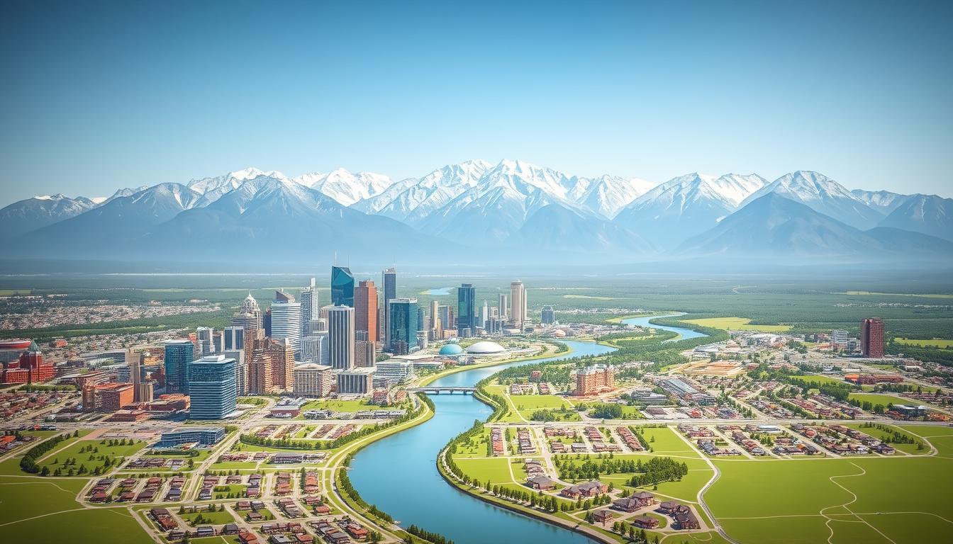
Calgary sits where the Bow and Elbow rivers meet. This spot is key on North American maps. It’s important for its location and for helping navigate the region and beyond.
Geographical Coordinates and Elevation
Calgary’s exact spot is 51°3′N latitude and 114°4′W longitude. It’s about 1,045 meters (3,428 feet) high. This puts Calgary in Alberta, Canada’s southwest.
Key Geographical Facts:
- Latitude: 51°3′N
- Longitude: 114°4′W
- Elevation: Approximately 1,045 meters
Calgary’s Position Relative to Major Landmarks
Calgary is close to many important places. It’s where the Bow and Elbow rivers come together. This spot has been vital for trade and settlement for a long time. The city is also near the Rocky Mountains, making it a big draw for tourists and outdoor lovers.
Distance from Key North American Cities
Knowing how far Calgary is from other cities is important for travel planning. Here are some distances:
- To Vancouver, BC, Canada: Approximately 970 km (603 miles)
- To Edmonton, AB, Canada: Approximately 300 km (186 miles)
- To Denver, CO, USA: Approximately 1,430 km (889 miles)
- To Seattle, WA, USA: Approximately 1,230 km (764 miles)
For the best map directions Calgary and route planning, use a reliable mapping service or a Calgary road map. They offer the latest and most accurate info.
The Complete Calgary Map Reference Guide
Calgary’s geography is complex, with a rich history in mapping. From old-school methods to today’s digital maps, the city’s maps are essential. They help everyone from locals to visitors and businesses.
Historical Development of Calgary’s Cartography
Calgary’s map history started in the early 1900s, as the city grew fast. Cartographers used methods like triangulation to make accurate maps. These maps showed roads, buildings, and more as the city expanded.
Technology and urban planning have shaped Calgary’s maps. Now, modern tools make maps more accurate and easy to use.
Modern Mapping Systems and Technologies
Today, Calgary uses advanced mapping tech like GIS and GPS. These tools help make detailed maps for tourism, navigation, and planning.
Digital maps offer real-time info and help with navigation. These systems have changed how we explore and understand Calgary.
| Mapping Technology | Description | Application |
|---|---|---|
| GIS | Geographic Information System | Urban planning, resource management |
| GPS | Global Positioning System | Navigation, tracking |
| Digital Mapping Platforms | Online platforms for map creation and dissemination | Tourism, navigation, urban planning |
Calgary Map: Types and Resources for Navigation
Exploring or navigating Calgary is easier with the right maps. The city has many maps for different needs. You can find official government maps and commercial ones too.
Official City Maps and Government Resources
The City of Calgary offers official maps and resources. These maps are reliable and updated regularly. They show city infrastructure like roads, public transport, and community facilities.
Residents and visitors can find these resources on the City’s website or at local offices.
The interactive map of Calgary is a key resource. It lets users explore the city in detail. You can find info on zoning, land use, and public services.
Commercial and Specialized Map Options
Calgary also has commercial and specialized maps. These maps are made for specific needs like tourism, outdoor activities, and business navigation. They often have extra features like real-time traffic updates and points of interest.
Specialized maps, like those for cycling routes or tourist spots, meet specific needs. They make navigating Calgary better.
Interactive Maps of Calgary for Digital Exploration
Interactive maps in Calgary are changing how we move around the city. They give us real-time info and easy navigation. The digital world has made exploring cities like Calgary much easier.
Web-Based Interactive Map Platforms
Web-based interactive map platforms make exploring Calgary simple. They offer detailed street maps, info on local spots, and traffic updates. You can use them on your computer or mobile device.
Mobile Applications for Calgary Navigation
Mobile apps are key for navigating Calgary. They have GPS and augmented reality features for a better experience. You can get real-time traffic info, find places, and discover new spots easily.
GPS-Based Navigation Tools
GPS tools in mobile apps are vital for Calgary navigation. They give turn-by-turn directions for easy travel. With GPS, you can avoid traffic and get to your destination fast.
Augmented Reality Map Features
Augmented reality (AR) map features are changing city navigation. AR shows digital info on top of the real world. It makes finding places and getting directions more fun and easy.
Printable Maps of Calgary: Downloads and Resources
Looking for a physical map of Calgary? You can find high-resolution downloads and specialized maps. These resources meet different needs. Whether you’re a tourist, commuter, or business professional, there’s a map for you.
High-Resolution Downloadable City Maps
Calgary’s downloadable maps offer detailed street info. They’re perfect for navigation. You can find them in various formats, working with many devices and printing software. High-resolution maps are great for those needing exact details, like business owners or tourists.
Specialized Printable Maps for Various Purposes
Specialized maps meet specific needs, improving navigation. For example, tourist maps show key attractions, while transit maps focus on public transport.
Tourist-Oriented Printable Maps
Tourist maps of Calgary help visitors find their way around. They highlight key landmarks, cultural sites, and entertainment spots. This makes planning easier for tourists.
Transit and Transportation Printable Maps
Commuters find transit and transportation maps very useful. They show public transit routes, bus stations, and major highways. This helps with smooth travel across the city.
| Map Type | Description | Use Case |
|---|---|---|
| High-Resolution City Map | Detailed street information | Navigation, Business Planning |
| Tourist-Oriented Map | Key attractions and landmarks | Tourism, Travel Planning |
| Transit Map | Public transportation routes | Daily Commuting |
Detailed Calgary City Map: Urban Structure and Layout
Calgary’s cityscape is a mix of modern business areas, historical sites, and natural spots. This mix gives the city its special character and usefulness.
Downtown Core and Business Districts
The downtown area of Calgary is lively. It has major business spots like the Calgary Tower and Stephen Avenue Walk. This place is filled with tall buildings, shops, and places to have fun. It’s the center of Calgary’s business life.
Major Landmarks and Points of Interest
Calgary has many landmarks and places to see, like the Glenbow Museum and Calgary Zoo. These spots attract visitors and add to the city’s culture and fun activities.
Parks, Rivers, and Natural Areas
Even though Calgary is built up, it has worked hard to keep its natural spots. Places like Prince’s Island Park and the Bow River pathway are there for people to enjoy. They offer places for fun and calm.
| Feature | Description | Location |
|---|---|---|
| Downtown Core | Central business district with high-rise buildings and shopping centers | Center of Calgary |
| Glenbow Museum | Major cultural institution showing Western Canadian history | Downtown Calgary |
| Prince’s Island Park | Large public park with recreational and cultural events | North of downtown, on the Bow River |
Calgary Neighborhood Maps: Community Exploration
Exploring Calgary’s neighborhoods gives us a peek into the city’s heart and soul. Calgary has many neighborhoods, each with its own vibe and story. Knowing these areas helps us understand the city’s community and culture.
Residential Districts and Suburban Communities
Calgary’s residential areas and suburbs have their own look and feel. Neighborhoods like Inglewood and Bridgeland are filled with history and life. On the other hand, Seward is a calm, family-friendly spot.
| Neighborhood | Characteristics | Notable Features |
|---|---|---|
| Inglewood | Historic, vibrant community | Riverwalk, antique shops |
| Bridgeland | Diverse, urban lifestyle | Community events, local eateries |
| Seward | Family-oriented, suburban | Parks, community centers |
Historic and Cultural Neighborhoods
Calgary boasts many historic and cultural neighborhoods. Places like Kensington and Forest Lawn show off the city’s rich history and diversity. These areas are perfect for those who love history and culture.
Calgary Road Map: Transportation Networks
Knowing Calgary’s road map is key to getting around the city. The city’s roads and highways make it easy to move around. They also connect to areas outside the city.
Major Highways and Arterial Roads
Calgary has many important highways and roads. These are vital for the city’s connection to other places. Some major highways include:
- Trans-Canada Highway: A major east-west route that connects Calgary to other major cities in Canada.
- Deerfoot Trail: A major north-south highway that is vital for daily commutes and long-distance travel.
- Memorial Drive and 16th Avenue (Highway 1A): Important arterial roads that facilitate movement within the city.
These roads are built to handle a lot of traffic. They keep the city connected and accessible.
Public Transit Routes and Stations
Calgary’s public transit is wide-ranging, with buses and the CTrain (light rail transit). The CTrain has many lines that cover a lot of the city. It’s a great choice for those commuting.
Key parts of Calgary’s public transit include:
- CTrain Lines: The Red Line and Blue Line provide service to various parts of the city, with frequent departures.
- Bus Network: An extensive network of buses complements the CTrain, covering areas not served by the light rail.
- Transit Stations: Major transit stations like the City Hall and Downtown West stations serve as hubs, facilitating easy transfers between different routes.
By understanding Calgary’s transportation network, people can move around the city better. This is true for both locals and visitors.
Calgary Tourist Map: Visitor Attractions and Destinations
Calgary is a city that mixes city life with nature’s beauty. It’s a top spot in North America. The city’s map shows many places to see, for all kinds of interests.
Cultural and Historical Sites
Calgary has many cultural and historical spots. The Glenbow Museum shows the city’s history and art. The Calgary Heritage Park has old buildings and people in costumes.
Don’t miss the Chinese Cultural Centre. It tells the story of Calgary’s diverse culture.
Entertainment and Recreation Venues
Calgary has lots of places for fun and games. The Scotiabank Saddledome is great for sports and concerts. The Calgary Tower gives you a view of the whole city.
Prince’s Island Park is perfect for outdoor fun. You can also shop at places like CF Chinook Centre and Market Mall.
Seasonal Events and Festival Locations
Calgary has many events and festivals all year. The Calgary Stampede is a famous rodeo in July. In winter, there’s the Calgary Ice Festival with ice skating and snow art.
The Calgary Folk Music Festival in July is a music lover’s dream. It features music from all over the world.
Map Directions to Calgary: Travel Planning Guide
Travelers going to Calgary need the right map directions. Calgary is a key spot in North America. Knowing how to get there is key for a smooth trip.
Driving Routes from Major North American Cities
Calgary is easy to reach by car from big cities in North America. For example, from Vancouver, Canada, take the Trans-Canada Highway east to Calgary. From the U.S., Seattle or Los Angeles travelers can use I-5 and then connect to Canadian roads. Google Maps or Waze offer real-time traffic info and the best paths.
Air Travel, Airports, and Ground Transportation
For air travel, Calgary International Airport (YYC) is a big hub with many flights. After landing, you can use taxis, ride-sharing, or public transit. Calgary’s airport is close to the city center, making it easy to get to your destination.
Topographic and Geographic Features of Calgary
Calgary’s geography is a mix of river systems and varied terrain. This mix greatly affects the city’s climate, ecosystem, and environment.
River Systems and Watersheds
The Bow and Elbow rivers run through Calgary, playing key roles in its ecosystem. Their watersheds add to the city’s beauty and support local wildlife. These rivers also shape urban planning and development.
Terrain, Elevation, and Climate Considerations
Calgary’s terrain changes a lot, with big differences in elevation between valleys and the prairie. Its location near the Rocky Mountains also influences its climate. This leads to cold winters and mild summers. Knowing these features helps manage environmental challenges and enjoy the city’s natural beauty.
Historical Evolution of Calgary Through Cartography
The history of Calgary’s maps shows how the city has grown. These maps have helped plan and develop the city.
Early Settlement Maps and City Planning
Early maps of Calgary helped the city grow. They showed where to build and how to plan. These maps tell us about Calgary’s start and how it grew, like with the Canadian Pacific Railway.
“The history of Calgary is written on its maps, from the early days of settlement to the present.”
Modern Urban Development and Expansion
Today, Calgary keeps changing, thanks to new mapping tools. Interactive maps help plan the city better. They show us where to go and what to see, like public transit and parks.
| Era | Cartographic Features | Impact on Development |
|---|---|---|
| Early Settlement | Basic topographic features, settlement boundaries | Guided initial infrastructure development |
| Modern Era | Detailed street networks, public transit, recreational areas | Enhanced urban planning and navigation |
Conclusion: Navigating Calgary with Confidence
With the right Calgary Map, exploring the city becomes easy and fun. Knowing Calgary’s layout, how to get around, and what to see is key for a smooth trip.
There are many maps to choose from, like official city maps, online platforms, and apps. These help you find your way through Calgary’s different areas, landmarks, and cultural spots.
Using a good Calgary Map lets you plan your journey, find new places, and enjoy your time in Calgary. Whether you’re driving, taking public transport, or walking, having the latest maps is a must.
As Calgary grows, its maps will keep helping you get around. Stay updated with the right maps and explore everything Calgary has to offer with confidence.