The West African region is a diverse area. It covers the southern part of the continent’s bulge. It stretches westward to the Atlantic Ocean.
This area is split by the African Transition Zone. It borders the southern edge of the Sahara Desert. Countries like Burkina Faso, Mali, and Niger are key to understanding this region.
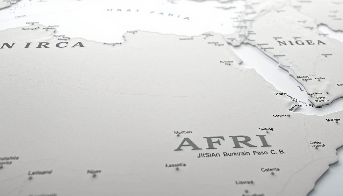
A detailed African countries map is vital. It helps us understand the region’s history, economy, and politics.
Understanding the West African Region
The West African region is a mix of different cultures and landscapes. It’s a key part of the African continent. The area has the Sahara Desert in the north and tropical forests in the south.
Geographical Definition of West Africa
West Africa is very diverse, with landscapes from deserts to forests. Its geography has shaped its history and culture.
Countries Comprising West Africa
The region includes countries like Burkina Faso, Mali, Niger, Senegal, and Nigeria. These countries share history, culture, and economy, making the region important.
- Burkina Faso
- Mali
- Niger
- Senegal
- Nigeria
Regional Significance in Africa
West Africa was home to ancient empires like Ghana, Mali, and Songhai. These empires were key to the region’s history. The area’s culture and history make it a key study area in Africa.
The West African region’s diverse geography and rich history highlight its importance in Africa. It’s a key area for ongoing exploration and study.
West Africa Map: A Detailed Overview
Exploring West Africa’s map shows its varied landscapes and importance. From the Sahara Desert in the north to the tropical forests in the south, these areas greatly influence the climate, economy, and culture.
Key Features of West African Geography
West Africa’s geography is marked by several key features. The Sahara Desert, covering much of the north, is a major landmark. The Niger River, vital for agriculture and livelihood, runs through the region.
Major Geographical Landmarks
West Africa boasts significant landmarks like the Fouta Djallon Highlands and the Cameroon Highlands. These areas are rich in biodiversity and play a key role in the ecosystem. The Fouta Djallon Highlands, known as the “Water Tower of West Africa,” feeds several major rivers.
Regional Divisions and Zones
The region is divided into several physiographic regions. The western Sudan, a semiarid terrain, spans the northern part of West Africa. Other zones include the Sahel, savannas, and tropical forests. Each zone has unique ecological features and supports various economic activities.
| Region | Characteristics | Economic Activities |
|---|---|---|
| Sahel Region | Semiarid terrain, prone to drought | Pastoralism, agriculture |
| Savannas | Grasslands with scattered trees | Agriculture, livestock |
| Tropical Forests | Dense forests, high biodiversity | Logging, sustainable forest products |
Grasping these geographical features and divisions is key to understanding West Africa’s complexity. It sheds light on the region’s climate, economy, and culture.
Burkina Faso: Geographical Profile
Burkina Faso is a landlocked country in West Africa. It has a unique geography shaped by its location and natural features. The country is bordered by Mali to the west, Niger to the north, Benin to the southeast, and Togo and Ghana to the south. Its geography is key to its economy and culture.
Location and Borders
Burkina Faso is in the heart of West Africa. It’s a big player in regional affairs. Being landlocked, it depends on neighbors for access to the world.
It shares borders with six countries. This leads to a rich cultural and economic exchange.
Major Cities and Capital Ouagadougou
Ouagadougou, the capital, is the biggest city and the country’s cultural and economic center. Other big cities like Bobo-Dioulasso and Koudougou also play important roles in development.
Urban Centers and Population Distribution
People live in various cities across Burkina Faso. Ouagadougou is the most crowded. Urban areas are hubs for business, industry, and culture, drawing people from rural areas.
Historical Development of Cities
Colonial and post-colonial times have shaped Burkina Faso’s cities. Ouagadougou, for example, has grown into a modern city while keeping its traditional spirit.
Topographical Features
Burkina Faso’s landscape varies, with savannas, forests, and mountains. The country’s diverse terrain supports different ecosystems, from the Sahel in the north to the fertile south.
“The geographical diversity of Burkina Faso is a key factor in its economic and environmental challenges.”
Understanding this diversity is key to solving these challenges.
In conclusion, Burkina Faso’s geography is complex. It involves location, urban areas, and topography. This complexity highlights the need for a detailed approach to manage resources and grow the economy.
Mali: Geographical Profile
Mali is a landlocked country in West Africa. It has a diverse geography and many historical landmarks. Understanding its geography helps us see its economy, culture, and challenges.
Location and Borders
Mali is surrounded by several countries. Algeria is to the north, Niger to the east, and Burkina Faso to the southeast. Côte d’Ivoire and Guinea are to the south, and Senegal and Mauritania to the west. This location makes Mali key in West African geography.
Major Cities and Capital Bamako
Bamako, the capital, is the largest city and a major economic center. Timbuktu is famous for its history and culture. Mopti is a key trade center.
Urban Centers and Population Distribution
Most people in Mali live in rural areas. But cities like Bamako are growing fast. The population moves based on agriculture, trade, and access to resources like the Niger River.
Historical Development of Cities
Timbuktu’s history goes back to ancient trade routes. Bamako started as a small village and grew into a big city. This shows Mali’s development over time.
Topographical Features
Mali’s landscape varies a lot. The Sahara Desert is in the north, savannas in the south, and mountains too. The Niger River is key for agriculture and water.
| Geographical Feature | Description | Significance |
|---|---|---|
| Niger River | Major river flowing through Mali | Supports agriculture and provides water |
| Sahara Desert | Vast desert covering northern Mali | Influences climate and population distribution |
| Timbuktu | Historic city known for cultural significance | Important for tourism and cultural heritage |
Niger: Geographical Profile
Niger is a landlocked country in West Africa. It has extreme landscapes, from deserts to lush river valleys. These varied landscapes greatly affect the country’s climate, economy, and where people live.
Location and Borders
Niger is in the heart of West Africa. It shares borders with Libya, Chad, Nigeria, Benin, Burkina Faso, Mali, and Algeria. Its location is key for trade and commerce in the region.
Major Cities and Capital Niamey
Niamey is Niger’s capital and a major city. It’s a center for politics, business, and culture. Zinder and Maradi are also important for trade and commerce.
Urban Centers and Population Distribution
People in Niger mostly live in cities, with many in Niamey. The city’s growth comes from people moving from rural areas. This movement is due to better services and jobs.
Historical Development of Cities
Niger’s cities, like Niamey, have a rich history. Niamey started as a small village and grew into a bustling capital. Its growth shows Niger’s economic and historical changes.
Topographical Features
Niger’s landscape is varied, with deserts, savannas, and mountains. The Niger River runs through the country. It’s essential for water, agriculture, and fishing.
The country’s geography is key to understanding its economic challenges. Deserts are tough, but fertile areas along the Niger River offer chances for farming.
Comparative Analysis of Burkina Faso, Mali, and Niger
Burkina Faso, Mali, and Niger share many geographical features and challenges. They are in the heart of West Africa. Their complex geography affects their economies, cultures, and regional dynamics.
Shared Geographical Features
These countries have the Sahara Desert and the Sahel region. The Sahel is a semi-arid zone between the desert and savannas. It has a challenging climate and variable rainfall, affecting agriculture and livelihoods.
The Niger River runs through Mali and Niger. It’s vital for water, agriculture, fishing, and drinking water.
Border Relationships and Crossings
The borders of Burkina Faso, Mali, and Niger are porous. Many unofficial crossing points exist. This makes it easy for people and goods to move but also raises security concerns.
Smuggling and terrorist movements are issues. Regional cooperation is key to solving these problems and ensuring security.
Regional Cooperation and Challenges
Cooperation among Burkina Faso, Mali, and Niger is vital. They face common challenges like security in the Sahel and environmental issues like desertification. They work together on initiatives like managing the Niger River basin.
Security Concerns in the Sahel
The Sahel region has big security concerns. Terrorism, banditry, and violence are major threats. The countries have set up joint military operations and share intelligence to fight these threats.
Environmental Collaboration
Environmental cooperation is also important. Burkina Faso, Mali, and Niger collaborate on desertification, water management, and biodiversity protection. They work through regional organizations to tackle these environmental challenges.
In conclusion, Burkina Faso, Mali, and Niger share many geographical features and challenges. Regional cooperation is essential for addressing security and environmental issues. It promotes sustainable development and improves the well-being of the people in the region.
Physical Map of West Africa
The physical map of West Africa shows a wide range of landscapes. From the Sahara Desert in the north to the tropical forests in the south, it’s all here. This diversity makes the region unique.
Terrain and Elevation Patterns
The terrain in West Africa is quite varied. You’ll find mountain ranges like the Atlas Mountains and the Guinea Highlands. But, vast plains and lowlands cover much of the area too.
Elevation patterns greatly affect the climate and ecosystems. The highest points are in the mountains, while the coastlines are the lowest.
Major Rivers and Water Bodies
West Africa has many important rivers and water bodies. These support agriculture, fishing, and transportation. The Niger River is a key example, flowing through several countries.
Niger River Basin
The Niger River Basin is vital for ecology and economy. It supports millions through farming and fishing. It also helps with trade in the region.
Lake Chad and Other Water Systems
Lake Chad is a major water body, though its size changes. Other rivers and wetlands add to the region’s biodiversity.
Desert Regions and Vegetation Zones
West Africa has vast deserts like the Sahara. It also has diverse vegetation zones, like the Sahel and the Guinea forest-savanna mosaic. These areas are key to understanding the region’s ecological challenges and opportunities.
“The Sahel region, a transitional zone between the Sahara Desert and the savannas, is very vulnerable to climate change and desertification.”
Knowing these geographical features is vital. It helps manage natural resources and tackle environmental challenges in West Africa.
West Africa Political Map
A detailed look at West Africa’s political map shows the complex ties between borders, claims, and regional interactions. The area has a variety of countries, each with its own politics and geography.
National Boundaries and Territorial Claims
The map of West Africa highlights the complex national borders and claims. These lines have been shaped by history, colonialism, and post-colonial times.
- The region’s borders are often straight, a result of colonialism.
- Border disputes and claims are common, showing the region’s complex past.
Administrative Divisions Within Countries
Administrative divisions in West Africa are key to governance and growth. These include regions, provinces, and municipalities, each with its own center.
Key administrative divisions include:
- Regions: Large areas with some autonomy.
- Provinces: Smaller units within regions or countries.
- Municipalities: Local areas for basic services.
Historical Border Changes and Disputes
West Africa’s history is filled with border changes and disputes. These were influenced by colonialism, post-colonial adjustments, and regional conflicts. Knowing this history helps us understand today’s politics.
The effects of these changes are seen in West Africa’s modern political map.
West Africa Map with Capitals: Political Centers
Understanding the role of capital cities is key to knowing West Africa. The map shows the region’s political scene. It points out cities that lead in governance, economy, and culture.
Capital Cities and Their Strategic Importance
Cities like Ouagadougou, Bamako, and Niamey are more than just political centers. They are also economic and cultural centers. They are vital for the growth and leadership of Burkina Faso, Mali, and Niger.
Secondary Political Centers
Secondary cities also play a big part in governance and growth. They act as administrative centers. This helps in regional cooperation and economic development.
Historical Evolution of Capital Cities
The history of these cities gives us a glimpse into West Africa’s past. Many cities have deep historical roots. They were key during pre-colonial and colonial times, shaping their roles today.
Climate and Ecological Zones of West Africa
West Africa’s climate and ecosystems vary greatly, affecting farming, jobs, and the environment. The area has different zones, from the dry Sahel to wetter tropical and subtropical areas. These zones shape West Africa’s geography.
Sahel Region Characteristics
The Sahel has a dry climate with unpredictable rains and is at risk of desertification. It covers parts of several West African countries. It’s key for farming and herding but its ecosystem is fragile and vulnerable to climate change.
Tropical and Subtropical Zones
The tropical and subtropical zones get more rain and have lush greenery. They support many farms and have diverse ecosystems like rainforests and savannas.
Climate Change Impact on Regional Geography
Climate change is deeply affecting West Africa’s geography. It’s changing ecosystems and lives. Desertification and shifts in rain patterns are major concerns.
Desertification Patterns
Desertification, caused by climate change and human actions, is a big worry in the Sahel. It causes land to degrade, biodiversity loss, and lower farm yields.
Changing Rainfall Patterns
Rainfall changes are making farming and water planning hard in West Africa. This can cause droughts and floods, hurting food and jobs.
| Ecological Zone | Characteristics | Impact of Climate Change |
|---|---|---|
| Sahel | Semiarid, variable rainfall | Desertification, reduced agriculture |
| Tropical/Subtropical | High rainfall, diverse ecosystems | Changing rainfall patterns, increased flooding |
Historical Context of West African Borders
To understand West African borders, we must look at the region’s history. This complex past has molded today’s borders and politics.
Pre-Colonial Boundaries and Kingdoms
Before colonial times, West Africa had mighty kingdoms like Ghana and Mali. These empires had their own territories and influences. Their legacy affects the region’s culture and identity today.
Colonial Influence on Modern Borders
European powers arrived in the 19th and 20th centuries, changing West Africa’s borders. Britain and France drew new lines, often ignoring ethnic and cultural differences. These borders were made for colonial gain, not for the region’s history or culture.
Post-Independence Border Developments
After gaining independence, West African countries kept most colonial borders. Some changes and disputes have happened, but most borders are stable. Regional groups and agreements help keep borders secure and foster cooperation.
The history of West African borders is complex. It involves pre-colonial, colonial, and post-independence factors. Knowing this history helps us understand West Africa’s politics and economy today.
Economic Geography of West Africa
The economic geography of West Africa is complex. It includes natural resources, agricultural zones, and trade routes. Countries like Burkina Faso, Mali, and Niger have a lot of natural wealth. This wealth is key to their economies.
Natural Resources Distribution
West Africa is rich in minerals, oil, and gas. The resources are spread out across the region. Some countries have more than others.
Mining Regions
Mining is big in West Africa. Ghana and Mali have a lot of gold. Diamonds, iron ore, and bauxite are found too.
Energy Resources
The region has lots of energy resources. Nigeria is a big oil producer. Ghana and Côte d’Ivoire also have oil.
Agricultural Zones and Food Production
Agriculture is vital in West Africa. The region has different zones for farming. From the Sahel to the coast, there’s fertile land.
Crops like cotton, cocoa, and peanuts are important. Maize, rice, and yams are for eating at home.
Trade Routes and Economic Corridors
Trade routes and corridors are key for growth. They help landlocked countries reach ports. This makes it easier to export and import.
The Abidjan-Lagos corridor is a big example. It connects several countries to Abidjan’s port.
Experts say better infrastructure is needed. This includes roads and railways. It’s important for the region’s growth and integration.
Printable West Africa Map Resources
Printable West Africa maps are great for teaching geography and studying regions. They are useful for schools, researchers, and businesses.
Educational Maps for Classroom Use
Educational maps are easy to understand and perfect for classrooms. They show West Africa’s countries, capitals, and big cities.
- Simplified maps for younger students
- Detailed maps for advanced learners
Detailed Regional Maps for Research
Detailed regional maps offer deep insights for researchers. They include topography, rivers, and other important details for studies.
Key features of detailed regional maps include:
- Topographical information
- Major rivers and water bodies
- Regional divisions and zones
Customizable Map Templates
Customizable map templates let users create their own West Africa maps. They are good for school projects, research, or business plans.
West Africa Map Quiz: Testing Your Knowledge
Try our West Africa map quiz to see how much you know. It’s great for students, teachers, and anyone who loves geography.
Identifying Countries and Capitals
The quiz focuses on finding countries and their capitals. For example, can you spot Burkina Faso and its capital Ouagadougou on the map? It’s also important to know where Mali and Bamako are, or Niger and Niamey.
Recognizing Geographical Features
The quiz also tests your knowledge of the region’s geography. You’ll need to recognize big rivers like the Niger River, mountains, and the Sahara Desert. Knowing these features helps you understand the area better.
Interactive Learning Tools and Resources
Our West Africa map quiz is an interactive way to learn. It’s perfect for school and makes studying fun. You can find many online quizzes and educational sites to help you learn more.
Contemporary Challenges in Mapping West Africa
West Africa’s geography is changing due to political and environmental shifts. This makes mapping harder. Countries like Burkina Faso, Mali, and Niger face unique challenges. These affect the accuracy and relevance of their maps.
Political Instability and Changing Borders
Political instability in West Africa often changes national borders. This means maps need frequent updates. It’s hard to keep maps accurate and current because of this.
Environmental Changes Affecting Geography
Environmental changes, like desertification and climate change, impact West Africa’s geography. They change the terrain, water bodies, and vegetation. This requires constant monitoring and updates in mapping.
Technological Advances in Cartography
New technologies, like satellite imaging and GIS, help in mapping. They allow cartographers to gather detailed geographical data. This improves the precision of West Africa’s maps.
Conclusion: The Importance of Understanding West African Geography
Knowing West African geography is key to tackling the region’s problems and chances. Its varied climate, natural resources, and politics greatly affect its economy, environment, and society.
The West African area, with countries like Burkina Faso, Mali, and Niger, has a rich history and culture. Studying its geography helps us understand the region’s dynamics and how climate change affects it.
An accurate map of African countries is vital for dealing with the region’s complexities. It shows where we can work together and where challenges lie. This helps in achieving sustainable growth and stability in West Africa.