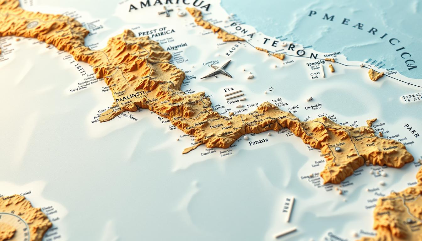
Central America is a bridge between North and South America. It’s filled with different cultures, landscapes, and countries. At its center is Panama, known for its strategic role and natural wonders.
Panama sits on the Isthmus of Panama, connecting the Atlantic and Pacific Oceans. The Panama Canal runs through it, making it a key spot for global trade.
Panama’s location brings together Caribbean and Pacific coast vibes. It’s also home to rich biodiversity and a lively cultural scene.
Geographical Overview of Central America
Central America connects North and South America, with varied landscapes. It’s known as the Isthmus of Central America. This area is key in global geography.
The Isthmus Connecting North and South America
The Isthmus of Central America links North and South America. It’s a narrow land strip. This feature is important because it divides the Pacific Ocean from the Caribbean and Atlantic Oceans.
“The strategic importance of Central America cannot be overstated, as it provides a natural bridge between two vast continents,” notes a geographical expert.
Countries Comprising Central America
Seven countries make up Central America: Belize, Costa Rica, El Salvador, Guatemala, Honduras, Nicaragua, and Panama. Each country has its own geography, like volcanic highlands and coastal plains.
Political Boundaries and Capital Cities
Central America’s countries are defined by their borders. Each has a capital city, like Panama City in Panama. It’s known for its modern skyline and history.
Population Distribution Across the Region
Population in Central America varies. Some areas are very crowded, while others are not. Cities like San José in Costa Rica and Guatemala City in Guatemala are densely populated.
Knowing Central America’s geography helps us understand its culture, economy, and environment. The region’s diverse landscapes add to its rich life.
Panama’s Strategic Position in Central America
Panama is a key spot that connects the Atlantic and Pacific Oceans. Its unique spot makes it a big deal for world trade and business.
The Narrowest Point Between Atlantic and Pacific Oceans
Panama has the Isthmus of Panama, the thinnest part between the oceans. This narrow strip of land helped build the Panama Canal, a huge engineering success.
The Panama Canal changed shipping by saving time, fuel, and money. It lets ships go through the continent, skipping South America.
Panama as a Land Bridge Between Continents
Panama connects North and South America as a land bridge. This spot has been key in the country’s history and growth.
Historical Significance of Panama’s Location
Panama’s spot has been key for trade and sharing cultures. The Isthmus of Panama helped move goods, ideas, and cultures between continents.
- Helped trade between Europe and Asia
- Enabled cultural exchange between North and South America
- Was key in the Spanish conquest of South America
Modern Geopolitical Importance
Today, Panama’s spot is also very important. The Panama Canal is a major waterway for trade. Its strategic location makes it a big player in global business.
Panama’s importance is seen in its role in regional groups and its ties with other countries. Its strategic position draws foreign investment and trade.
Borders and Neighboring Countries of Panama
Knowing about Panama’s borders helps us understand its role in the region. It sits in Central America, linking North and South America.
Panama has borders with two countries: Colombia to the southeast and Costa Rica to the northwest. These borders shape Panama’s culture and economy.
Colombia to the Southeast: The Darién Gap
The border with Colombia features the Darién Gap, a dense jungle. It’s known for its wildlife and tough terrain, making it a hotspot for illegal activities.
The Darién Gap stretches about 60 miles and is very hard to reach. Building roads here is tough because of the rainforest and environmental worries.
Costa Rica to the Northwest: The Sixaola River Border
The border with Costa Rica is defined by the Sixaola River. This area is key for trade and cultural exchange.
The Sixaola River crossing is vital for both business and tourism. It helps move goods and people between Costa Rica and Panama.
Maritime Borders and Territorial Waters
Panama also has big maritime borders in the Caribbean Sea and the Pacific Ocean. These are key for its economy, like shipping and fishing.
Panama’s waters are full of marine life and are important for global shipping. The Panama Canal is a major waterway.
| Border | Characteristics | Significance |
|---|---|---|
| Colombia (Darién Gap) | Dense jungle, challenging terrain | Biodiversity, illegal activities |
| Costa Rica (Sixaola River) | Natural river boundary | Trade, cultural exchange |
| Maritime Borders | Caribbean Sea and Pacific Ocean | Shipping, fishing industries |
Topographical Features of Panama
Panama has a unique geography with mountains, rivers, and coastal plains. Its diverse landscape shapes its climate, ecosystems, and human activities.
Mountain Ranges and Highlands
Panama’s mountains are a standout feature. The country’s ranges are part of the Central American mountain chain, stretching from Mexico to Panama.
Volcán Barú and the Cordillera Central
The Cordillera Central mountain range has Volcán Barú, Panama’s highest peak at 3,475 meters. This volcanic peak is a landmark for hikers and nature lovers. The range affects the local climate and supports various ecosystems.
The Serranía del Darién
The Serranía del Darién is a key mountain range in eastern Panama, near Colombia. It’s known for dense rainforests and diverse wildlife, vital for conservation.
Coastal Plains and Lowlands
Panama also has extensive coastal plains and lowlands. These areas are more populated and key for agriculture. Crops like bananas and sugarcane are common here.
Major Rivers and Watersheds
Panama’s rivers are vital for its ecosystem and economy. The Chagres River is key for the Panama Canal, and the Chiriquí River supports irrigation and hydroelectric power. Watersheds are essential for biodiversity and water supply.
Panama’s varied topography supports its rich natural heritage and various economic activities. From mountains to coastal plains and rivers, it’s a diverse country.
Panama Map: Detailed Geographical Breakdown
To understand Panama’s geography, we need to look at its provinces, comarcas, and main regions. The country’s varied landscape is shaped by its administrative areas and natural features.
Provinces and Comarcas
Panama is split into administrative areas like provinces and comarcas. Provinces are the main divisions, while comarcas are for indigenous groups with some freedom.
The Ten Provinces of Panama
Panama has ten provinces, each with its own special features. These provinces help make up the country’s geography. Here are the provinces:
- Bocas del Toro
- Chiriquí
- Coclé
- Colón
- Darién
- Los Santos
- Panamá
- Panamá Oeste
- Veraguas
- Ngäbe-Buglé
The Five Indigenous Comarcas
Panama also has five indigenous comarcas. These are:
- Emberá-Wounaan
- Guna Yala
- Ngäbe-Buglé
- Naso Tjër Di
- Wargandí
Major Geographical Regions
Panama’s geography can be divided into several main regions. Each region has its own special features.
Eastern Panama (Darién Region)
The Darién Region is famous for its dense forests and tough terrain. It’s a unique part of Panama’s geography.
Central Panama
Central Panama is home to the Panama Canal and its surroundings. These areas are key for the country’s economy and global trade.
Western Panama (Chiriquí Region)
The Chiriquí Region is known for its volcanic landscapes and fertile highlands. These areas help make Panama’s agriculture productive.
Together, these regions and areas make up Panama’s complex geography. It’s a country full of interesting places to explore.
The Panama Canal: A Geographical Marvel
The Panama Canal is a symbol of human creativity. It’s a key part of Panama’s geography and economy. It connects the Atlantic and Pacific Oceans, cutting travel time and costs for trade.
How the Canal Divides and Connects the Country
The Panama Canal runs across the Isthmus of Panama. It divides the country but links two oceans. This has shaped Panama’s geography and where people live.
Impact on Panama’s Geography and Economy
The Panama Canal has deeply influenced Panama. It changed the landscape and boosted the economy. It makes a lot of money from tolls and services.
The Canal Zone on Maps
Once, the Panama Canal Zone was a U.S.-controlled area. It was 5 miles wide on each side of the canal. Maps showed it as a special area, showing its importance. Even though Panama took control in 1999, the Canal Zone’s mark remains.
Canal Expansion and Modern Mapping
In 2016, the Panama Canal grew to let bigger ships pass. This change is seen in new maps and guides. They help ships navigate the canal’s new size.
| Year | Major Development | Impact |
|---|---|---|
| 1914 | Initial Opening of the Canal | Revolutionized global trade by connecting the Atlantic and Pacific Oceans. |
| 1999 | Transfer of Control to Panama | Marked a significant shift in Panama’s sovereignty and economic control. |
| 2016 | Canal Expansion | Allowed for larger Neopanamax ships, increasing the canal’s capacity and efficiency. |
The Panama Canal remains a critical trade route. It keeps getting better with new tech and upgrades. This ensures it stays important today.
Major Cities and Urban Centers in Panama
Panama’s major cities, like Panama City and David, are hubs of commerce, culture, and innovation. These cities are economically thriving and rich in cultural heritage.
Panama City: The Capital and Largest Urban Area
Panama City is the heart of Panama’s economy and culture. It has the Panama City Map, showing its historic and modern areas.
Districts and Neighborhoods
The city has several districts, each with its own vibe. Casco Viejo is historic, while Punta Paitilla is modern and financial.
Historical and Modern Sections
Panama City mixes history with modern architecture. San Felipe de Nery shows its colonial past. Marbella has modern skyscrapers.
Colón, David, and Other Significant Cities
Colón and David are also key cities in Panama. They are important for the economy and connecting regions.
Port Cities and Their Importance
Colón is near the Panama Canal and is a major port. Its location makes it a key economic center.
Interior Urban Centers
David, in Chiriquí Province, is a major city in western Panama. It’s known for farming and local culture.
| City | Province | Significance |
|---|---|---|
| Panama City | Panamá | Capital and largest urban area, economic hub |
| Colón | Colón | Major port city, trade facilitation |
| David | Chiriquí | Agricultural production, cultural significance |
Natural Landmarks and Protected Areas
Panama is full of natural wonders, from lush rainforests to beautiful coastlines. Its unique mix of mountains, plains, and islands supports many ecosystems. This diversity makes Panama a treasure trove of biodiversity.
National Parks and Reserves on the Panama Map
Panama works hard to protect its nature by creating national parks and reserves. These places not only keep biodiversity alive but also offer chances for eco-tourism and research.
Darién National Park
Darién National Park in the Darién Province is incredibly diverse. It has rainforests, beaches, and wetlands. It’s a UNESCO World Heritage Site and a key home for endangered species.
Coiba National Park
Coiba National Park is off Panama’s coast and famous for its marine life. The park includes Coiba Island and its waters. It’s a home for many marine animals, like sharks and sea turtles.
Significant Geographical Features
Panama’s geography is marked by several key features. These features add to its natural beauty and ecological value.
Pearl Islands and San Blas Archipelago
The Pearl Islands and San Blas Archipelago are known for their beautiful beaches and clear waters. These island chains attract tourists and are also home to indigenous communities.
Gulf of Panama and Gulf of Chiriquí
The Gulf of Panama and Gulf of Chiriquí are two important bodies of water in Panama. They are vital for the country’s marine life and economy, supporting fishing and tourism.
| Protected Area | Location | Features |
|---|---|---|
| Darién National Park | Darién Province | Rainforests, beaches, wetlands |
| Coiba National Park | Off the coast of Panama | Marine biodiversity, island ecosystems |
| Pearl Islands | Gulf of Panama | Beaches, crystal-clear waters |
Panama’s natural landmarks and protected areas show the country’s dedication to preserving its nature. These areas support biodiversity and help the economy through eco-tourism.
Climate Zones Across Panama
Panama has many different climates because of its unique geography. Its location near the equator and its mountains play big roles in its climate.
Tropical Climate Variations
Panama’s climate is mostly tropical. But, different areas have their own tropical climate variations. The temperature stays pretty much the same all year. But, the amount of rain changes a lot.
Seasonal Weather Patterns
Seasonal weather patterns in Panama are clear. There are dry and rainy seasons. Knowing these patterns helps us understand Panama’s climate better.
Dry and Rainy Seasons
The dry season, or “verano,” is from December to April. The rainy season, or “invierno,” is from May to November. These seasons affect Panama’s nature and daily life a lot.
Microclimates in Different Regions
Panama’s varied geography leads to many microclimates. For example, the highlands are cooler than the coastal areas. Coastal areas are hotter and more humid.
Transportation Networks on the Panama Map
Understanding Panama’s transportation is key to its role in global trade. The country’s strategic location is backed by a wide network of roads, railways, and waterways. These help move goods and people.
Major Highways and Roads
Panama’s road network is vital for its transportation. The Pan-American Highway runs from Alaska to Argentina, through Panama. It’s a major route for regional trade.
The Pan-American Highway
The Pan-American Highway connects Panama to its neighbors and beyond. It helps move goods and people across borders, boosting the economy.
Regional Road Systems
Panama also has regional roads connecting major cities and towns. These roads are key for local transport and commerce.
Railways and Waterways
Panama’s rail and water transport are just as important. The Panama Canal Railway links the Atlantic and Pacific Oceans. It’s a vital route for international shipping.
Panama Canal Railway
The Panama Canal Railway is a major artery. It offers a fast way to transport goods across the isthmus.
Maritime Routes and Ports
Panama’s maritime infrastructure is critical to its economy. The Panama Canal is one of the busiest waterways in the world.
Interactive Panama Maps and Digital Resources
Interactive maps have changed how we explore Panama’s landscapes and culture. Digital technology makes it easier and more fun to discover this Central American country.
Online Mapping Tools for Exploring Panama
Online mapping tools give a full view of Panama. They show its geography, major cities, and interesting spots. These tools are great for travelers, researchers, and anyone wanting to know more about Panama.
GIS Resources and Applications
Geographic Information System (GIS) resources offer detailed data. They help with planning cities and protecting the environment. GIS lets users see and analyze Panama’s data in new ways.
Virtual Tours and 3D Mapping
Virtual tours and 3D mapping let you explore Panama online. They’re perfect for planning trips or studying the geography up close.
GPS and Navigation Resources for Panama
GPS and other navigation tools are key for traveling in Panama. They give directions and info in real-time, making travel easier.
Mobile Apps and Services
Many mobile apps provide maps and directions for Panama. They let users find their way using their smartphones.
Offline Map Options for Travelers
Offline maps are a big help for travelers. They work without internet, which is great for places with no Wi-Fi.
Using these interactive Panama maps and digital tools, we can learn more about the country. We can plan better and explore its culture and nature.
Printable and Educational Panama Maps
Printable Panama maps are great for learning and personal use. They show Panama’s geography in detail. This makes them perfect for students, teachers, and travelers.
Resources for Classroom and Personal Use
Printable maps are great for teaching geography, history, and culture. They come in many formats. You can find downloadable maps for different purposes and specialized educational materials.
Downloadable Maps for Various Purposes
These maps meet different needs. You can study Panama’s provinces, understand its topography, or plan a trip.
Specialized Educational Materials
Teachers can find maps that fit their curriculum. This makes learning more engaging.
Customizable Map Options
Users can pick from various map types. You can choose political, physical, or thematic maps based on your needs.
Political vs. Physical Maps
Political maps show administrative divisions. Physical maps focus on geographical features.
Thematic Maps of Panama
Thematic maps show specific data. This includes climate zones, population density, or economic activities.
| Map Type | Description | Use Case |
|---|---|---|
| Political | Shows administrative divisions | Understanding governance |
| Physical | Highlights geographical features | Studying topography |
| Thematic | Illustrates specific data | Analyzing climate or population |
Satellite Views and Remote Sensing of Panama
Through satellite imagery, Panama’s diverse landscapes shine. We see its dense rainforests and wide waterways clearly. This gives us a full view of the country’s geography.
Aerial Perspectives of Panama’s Geography
Satellite images give us a special look at Panama’s geography. Tools like Google Earth show us the country’s varied landscapes in great detail.
Google Earth and Similar Platforms
Google Earth is a key tool for seeing Panama’s geography. It shows high-resolution images of the country. We can see the dense forests of Darien National Park and the big city of Panama City.
High-Resolution Imagery Sources
Other sources like satellite imagery services also offer detailed views of Panama. They provide current images of the terrain. This helps with tasks like environmental monitoring and planning cities.
Environmental Monitoring Through Satellite Imagery
Satellite images are key for watching over Panama’s environment. They help track deforestation and monitor forest health. They also show how cities are growing.
Forest Cover and Deforestation Tracking
Images from satellites help track forests and deforestation. This info is critical for saving Panama’s wildlife. It helps find areas that need protection and guides conservation efforts.
Urban Development Visualization
Images from satellites show how cities like Panama City are growing. This info is vital for city planning. It helps ensure cities grow in a way that’s good for everyone.
Using satellite views and remote sensing, we learn more about Panama’s geography and environmental issues. This knowledge is key for managing resources and planning for the future.
Cultural and Economic Significance of Panama’s Location
Panama’s location has been key to its culture and economy for a long time. It sits between North and South America and the Atlantic and Pacific Oceans. This makes it a center for trade and cultural sharing.
Trade Routes and Commercial Importance
The Panama Canal is a major engineering achievement of the 20th century. It has made Panama a vital trade route. Ships save time, fuel, and resources by going through the canal instead of around it.
The Panama Canal Authority says the canal brings in a lot of money. This helps keep the country’s economy stable and growing. Here’s a look at the canal’s economic impact:
| Year | Toll Revenue (in millions USD) | Total Economic Contribution (in millions USD) |
|---|---|---|
| 2020 | 2,500 | 8,000 |
| 2021 | 2,700 | 8,500 |
| 2022 | 3,000 | 9,000 |
Cultural Crossroads: Influences from North and South
Panama is a cultural mix of North and South America. Its culture is a blend of indigenous, Spanish, African, and American influences.
Indigenous Cultural Territories
Panama has several indigenous territories, like the Ngäbe-Buglé Comarca. It’s one of the biggest in Central America. These areas help keep Panama’s indigenous culture alive.
“The Ngäbe-Buglé Comarca is a testament to Panama’s commitment to preserving its indigenous cultures. It is a vibrant community that continues to thrive despite external influences.”
Modern Cultural Geography
Today, Panama’s culture is a mix of old and new. Cities like Panama City are modern, while rural areas keep traditional ways alive.
Conclusion: Understanding Panama’s Place in Central America
Panama’s special spot in Central America is key to its wealth and culture. It acts as a bridge between North and South America. This helps in trade and sharing of cultures.
The Panama Canal makes the country a major center for world trade. Its role in global trade shows how important Panama is to the world economy.
Panama is more than just a location; it’s a big player in global and regional affairs. Its mix of rainforests and cities adds to its cultural and economic value.
To sum up, Panama’s role is vast and affects its economy, culture, and global status. As a major player in Central America, Panama uses its unique spot to boost growth and connection.