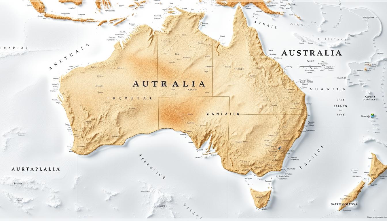
The Pacific Region is huge and full of different islands and countries. A detailed map of this area is key to knowing its geography and importance.
A detailed map of Australia helps us understand the country’s long coastline. It also shows important places in the Pacific Region. This area is important for global trade, culture, and protecting the environment.
Knowing the geography of the Pacific Region is vital. It helps us see its role in today’s world.
Geographic Overview of Australia and the Pacific
The geography of Australia and the Pacific is vast and diverse. It includes big oceans and landmasses. This area is big and has many different features.
Australia’s Continental Position
Australia is both a country and a continent. It sits in the Southern Hemisphere. It’s far from other continents, surrounded by oceans.
Size and Scale Comparisons
Australia is the sixth-largest country and smallest continent. It covers about 7,692,024 square kilometers. It’s almost as big as the United States.
Geographical Coordinates
Australia’s location is from 9° to 44° south and 112° to 154° east. This affects its climate and geography.
Pacific Region Context
The Pacific Region includes Australia and many island nations. It’s key for global shipping and economy.
Major Ocean Boundaries
The Pacific Ocean borders Australia to the east. Its boundaries are vital for climate and economy.
Strategic Importance
The Australia and Pacific Region is very important. It has key shipping lanes, maritime boundaries, and natural resources. An interactive Australia map helps understand these.
Understanding Australia’s geography is key to its global role. An Australia physical map helps grasp this.
Historical Development of Australia Maps
Australia’s map-making history is full of interesting changes. It started with indigenous mapping and moved to modern digital maps. Both indigenous peoples and European explorers played big roles in mapping Australia.
Early Indigenous Mapping Concepts
Indigenous Australians knew their land very well. They passed this knowledge down through stories and art. Their maps were not like European ones but were deeply rooted in their culture and land connection.
European Exploration Cartography
European explorers changed how Australia was mapped. They made maps that showed coastlines, rivers, and more. These maps were a big step forward.
Cook’s Voyages and Early Charts
Captain James Cook’s voyage in the late 18th century was a key moment. His maps of Australia’s coast were very accurate. They showed the eastern coast of Australia for the first time.
Colonial Mapping Efforts
As Europeans settled more, they needed better maps. These maps helped with farming, city planning, and building roads. They were very important for the growing colonies.
Modern Cartographic Evolution
The 20th century brought big changes in mapping with aerial photos and satellites. These tools made maps more accurate and detailed. Now, we have printable Australia maps and online maps for many uses, like learning and finding your way.
Types of Australia Map Resources Available
Australia’s map resources cover everything from political boundaries to physical landscapes. They meet various needs, like administrative tasks, geographical exploration, or thematic analysis.
Political and Administrative Maps
Political and administrative maps are key for understanding Australia’s governance. They outline federal and state boundaries, along with electoral divisions.
Federal and State Boundaries
Maps of federal and state boundaries are vital for governance and administration. They show how Australia is split into states and territories, each with its own government.
Electoral Divisions
Electoral division maps are essential for elections. They define the areas each elected official represents, ensuring a clear democratic process.
Physical and Topographic Maps
Physical and topographic maps reveal Australia’s varied landscapes. They include elevation and relief features, as well as water bodies.
Elevation and Relief Features
Topographic maps are great for understanding Australia’s relief and elevation. They highlight mountain ranges, valleys, and other key landforms.
Hydrological Elements
Hydrological maps focus on water bodies like rivers, lakes, and coastlines. They are vital for managing Australia’s water resources effectively.
Specialized Thematic Maps
Australia is also mapped through specialized thematic maps. These include geological and vegetation and land use maps, each giving unique insights into the continent.
Geological Maps
Geological maps are essential for understanding Australia’s geology. They detail rock formations, mineral deposits, and other geological features.
Vegetation and Land Use Maps
Vegetation and land use maps show how Australia’s areas are used. They highlight different vegetation types and land use for agriculture, conservation, and more.
In conclusion, Australia’s map resources are diverse and meet many interests and needs. Whether for political, physical, or thematic purposes, these maps offer valuable insights into the continent.
Major Geographical Regions of Australia
Australia has many geographical regions, like coastal areas, the outback, and mountain ranges. These areas have different landscapes and ecosystems. They make up Australia’s rich natural heritage.
The Coastal Regions
The coastal regions of Australia are very populated and economically important. They are split into several parts:
- Eastern Seaboard: Famous for its beaches, bays, and cities like Sydney and Brisbane.
- Southern Coastline: Known for rugged cliffs, bays, and ports like Melbourne.
- Western and Northern Shores: Has sandy beaches, mangrove forests, and tropical coastlines.
The Outback and Interior
The outback and interior of Australia are vast and not very populated. They are known for their unique landscapes and harsh climate.
- Desert Landscapes: Includes the famous Outback, red desert sands, and rocky outcrops.
- Channel Country: A region of braided rivers and floodplains, important for pastoral industry.
Mountain Ranges and Highlands
Australia’s mountain ranges and highlands have diverse ecosystems. They are key for the country’s biodiversity.
- The Great Dividing Range: The biggest mountain range, along the eastern coast, affecting climate and settlement.
- Central Uplands: Older, eroded mountain ranges in the central parts of the country.
Knowing these regions helps us understand Australia’s complex geography. It shows how it affects human settlement, economy, and environmental conservation.
Australia Map: State and Territory Divisions
Understanding Australia’s state and territory divisions is key to knowing the country’s geography and regional differences. The continent is split into six states and two territories. Each has its own unique features and roles.
Eastern States
The eastern states are important for Australia’s population, economy, and culture. They include:
New South Wales
New South Wales is famous for its iconic cities like Sydney. It’s a center for culture, finance, and commerce.
Victoria
Victoria is known for its cultural events, schools, and Melbourne city.
Queensland
Queensland boasts beautiful beaches, tropical weather, and attractions like the Great Barrier Reef.
Central and Western Regions
These areas are vast and varied. They have deserts, mining spots, and important farmland.
South Australia
South Australia is famous for its wine, cultural festivals, and mining.
Western Australia
Western Australia is the biggest state. It’s known for mining, coastlines, and Perth city.
Northern Territory
The Northern Territory is known for its deserts, Aboriginal culture, and natural wonders like Uluru.
Island and Capital Territories
Australia also has island and capital territories. They are important for politics, culture, and geography.
Tasmania
Tasmania is an island state with pristine wilderness, historic sites, and unique wildlife.
Australian Capital Territory
The Australian Capital Territory is home to Canberra, the nation’s capital. It’s the heart of Australia’s government and politics.
| State/Territory | Capital | Notable Features |
|---|---|---|
| New South Wales | Sydney | Iconic cities, cultural hubs |
| Victoria | Melbourne | Cultural events, education |
| Queensland | Brisbane | Beaches, Great Barrier Reef |
| South Australia | Adelaide | Wine regions, mining |
| Western Australia | Perth | Mining, coastlines |
| Northern Territory | Darwin | Deserts, Aboriginal culture |
| Tasmania | Hobart | Wilderness, wildlife |
| Australian Capital Territory | Canberra | National capital, government |
Major Urban Centers and Population Distribution
Australia’s people mostly live in cities. These cities are key to the country’s economy and culture. The population is mainly found in a few big cities.
Eastern Seaboard Cities
The eastern seaboard of Australia has some big cities. These cities are full of life and culture.
Sydney Metropolitan Area
Sydney is Australia’s biggest city. It’s a major financial center and a hub for culture and tourism.
Melbourne and Surroundings
Melbourne is the capital of Victoria. It’s famous for its culture, education, and quality of life. It’s often called one of the world’s best cities to live in.
Brisbane and Southeast Queensland
Brisbane is the capital of Queensland. It’s growing fast and focuses on education, research, and tourism. The area around Brisbane is beautiful.
Other Capital Cities
Australia’s other capital cities are also important. They play big roles in the country’s economy and society.
Perth and Adelaide
Perth is the capital of Western Australia. It’s a big mining center. Adelaide, the capital of South Australia, is famous for its culture and wine.
Hobart and Darwin
Hobart is the capital of Tasmania. It’s known for its old buildings and nature. Darwin, the capital of the Northern Territory, connects to indigenous cultures and nature.
Regional Population Centers
Regional areas are also key. They help the economy and society.
Coastal Regional Hubs
Coastal towns and cities are big for tourism and local jobs.
Inland Population Centers
Inland cities and towns focus on farming and mining. They’re essential for Australia’s economy.
Knowing about Australia’s cities and towns is important for planning. An interactive Australia map helps understand these areas better.
Natural Landmarks and World Heritage Sites
Australia’s natural landmarks and World Heritage Sites show off the country’s amazing ecological diversity. These places are not just beautiful but also hold cultural and scientific value.
Coastal Natural Wonders
Australia’s coast is full of natural wonders that draw tourists and scientists. The Great Barrier Reef and the Twelve Apostles on the Great Ocean Road are two standout sites.
Great Barrier Reef
The Great Barrier Reef is the largest coral reef system in the world. It stretches over 2,300 kilometers and is home to thousands of reefs and islands. This habitat supports a wide variety of marine life.
Twelve Apostles and Great Ocean Road
The Twelve Apostles are limestone stacks off Victoria’s coast, near the Great Ocean Road. The sea has shaped these formations into a stunning sight.
Interior Landmarks
Australia’s interior boasts iconic natural landmarks like Uluru-Kata Tjuta National Park and Kakadu National Park.
Uluru-Kata Tjuta National Park
Uluru-Kata Tjuta National Park is famous for its massive rock formations, like Uluru (Ayers Rock). It’s sacred to the Anangu people. The park’s red sands, spinifex grass, and rocky outcrops are unique.
Kakadu National Park
Kakadu National Park is a UNESCO World Heritage Site. It’s known for its diverse wildlife and ecosystems, including wetlands and forests. It’s also rich in Aboriginal culture.
Unique Ecosystems
Australia has unique ecosystems recognized for their biodiversity. The Daintree Rainforest and the Blue Mountains are two examples.
Daintree Rainforest
The Daintree Rainforest is the oldest rainforest on land, dating back 180 million years. It’s part of the Wet Tropics of Queensland World Heritage Area. It’s known for its lush vegetation and diverse wildlife.
Blue Mountains
The Blue Mountains region has rugged terrain, deep valleys, and unique rock formations. The area is covered in eucalyptus forests, giving the mountains their blue color.
These natural landmarks and World Heritage Sites are key to Australia’s identity. They are highlighted on the Australia physical map and Australian topographic map, showing the country’s diverse natural heritage.
Interactive Australia Map Technologies
Interactive Australia maps have become more advanced. They now offer a range of features that enhance the user experience. These technologies change how we view and interact with maps, making them more dynamic and user-friendly.
Digital Mapping Platforms
Digital mapping platforms lead the way in interactive Australia map tech. They help create, host, and share these interactive maps.
Government Cartographic Resources
Government agencies provide essential cartographic resources for the public. They offer geospatial data and mapping services for various uses.
Commercial Mapping Services
Commercial services offer advanced features and tailored solutions for businesses and developers. They provide APIs and tools to add interactive maps to websites and apps.
User Experience Features
Interactive Australia maps focus on user experience. They aim to make navigation and finding information easy and quick.
Zoom and Layer Controls
Zoom and layer controls let users adjust their map view. Users can zoom in and out and turn different data layers on and off.
Search and Navigation Tools
Search and navigation tools help users find places and plan routes fast. These tools are vital for everyday use and complex tasks.
Data Integration Capabilities
Interactive Australia maps can combine different data types. This makes them more useful and provides a better user experience.
Real-time Information Overlays
Real-time information overlays show current data like weather or traffic updates on the map.
Historical and Projected Data Visualization
Maps can show historical and future data. This helps users analyze trends and plan for the future. It’s great for research, urban planning, and environmental monitoring.
Printable Australia Maps for Various Purposes
Printable maps of Australia are great for learning and planning trips. They show the country’s different landscapes and areas.
Educational Applications
Teachers use these maps to teach about geography, history, and science. They help students see Australia’s vast deserts, mountains, and coasts.
Classroom Resources
Teachers use these maps to teach about Australia’s states, territories, and cities. They are part of a bigger learning package.
Self-study Materials
Students use these maps to learn about Australia on their own. They are great for exams and projects.
Travel Planning Tools
Printable maps are also good for planning trips. They help tourists find their way around Australia.
Road Trip Mapping
For road trips, these maps show highways, rest stops, and sights. They make the trip smoother and more fun.
Hiking and Outdoor Activity Maps
Outdoor lovers use these maps for hiking and other activities. They show terrain, trails, and dangers.
High-Quality Map Sources
To get good maps, check out government sites and cartographic publishers. They offer accurate and current maps.
Government Agencies
Geoscience Australia has many free or low-cost maps. They are reliable and detailed.
Specialized Cartographic Publishers
Specialized publishers make maps for tourism and outdoor activities. Their maps are both useful and nice to look at.
Transportation Networks Across Australia
Australia has a vast network of roads, rails, and air travel. These systems help people and goods move around the country. They are key for Australia’s growth and connection.
Road Systems
Australia’s roads stretch far, linking cities, towns, and rural areas. They are essential for moving people and goods.
National Highways
The National Highway network is a major part. It connects big cities and regional areas with long routes.
State and Rural Roads
State and rural roads also play a big role. They help connect local communities and support regional growth.
Rail Infrastructure
Australia’s rail networks serve both passengers and freight. They offer a good alternative to roads for long trips and heavy loads.
Passenger Services
Passenger rail services, like those by NSW TrainLink and Queensland Rail, offer fast and comfortable travel. They link major cities and regional areas.
Freight Networks
The rail freight network is vital for moving goods. It helps reduce road traffic and lowers transport costs.
Air Travel Connections
Australia’s air travel network is well-established. It has many airports for domestic and international flights.
Major Airports
Big airports like Sydney, Melbourne, and Brisbane are major hubs. They handle both domestic and international flights.
Regional Aviation Routes
Regional aviation routes link smaller towns and remote areas to big cities. They support local development and tourism.
| Transportation Mode | Key Features | Significance |
|---|---|---|
| Road Systems | National Highways, State and Rural Roads | Connects major cities and regional areas |
| Rail Infrastructure | Passenger Services, Freight Networks | Alternative to road transport for long-distance travel and goods |
| Air Travel Connections | Major Airports, Regional Aviation Routes | Facilitates fast travel across the continent and to international destinations |
Pacific Region Nations and Territories
The Pacific Region surrounds Australia and is filled with diverse countries and territories. Each has its own culture and economy. The region’s complexity comes from its many geopolitical entities, from independent nations to territories ruled by others.
Neighboring Major Countries
The Pacific Region has several major countries that are important globally. Two key players are New Zealand and Papua New Guinea.
New Zealand
New Zealand is known for its strong economy and high standard of living. It plays a big role in regional organizations and has strong ties with its neighbors.
Papua New Guinea
Papua New Guinea is rich in natural resources and biodiversity. It faces development challenges but is key for regional stability and growth.
Melanesian Islands
The Melanesian Islands, including Fiji and the Solomon Islands, are known for their cultural diversity and history.
Fiji
Fiji is important in Pacific regional politics and has a mixed economy with a big tourism sector.
Solomon Islands
The Solomon Islands are famous for their natural beauty and resources. They face challenges in governance and economic development.
Polynesian and Micronesian Nations
The Pacific also includes Samoa, Tonga, and smaller island states. They add to the region’s cultural richness and economic diversity.
Samoa and Tonga
Samoa and Tonga are Polynesian nations that keep their culture alive while facing modern economic challenges.
Smaller Island States
Smaller island states in the Pacific face unique challenges. They are vulnerable to climate change and have limited resources.
The Pacific Region’s nations and territories are key to understanding Australia’s place in the world. Their diversity and complexity highlight the need for careful regional engagement and cooperation.
Economic Geography on Australian Maps
Australia’s economy is complex, with rich mineral deposits, agricultural zones, and marine resources. Maps of Australia highlight the country’s economic activities and natural resources.
Natural Resource Regions
Australia has vast natural resources, including mining and mineral deposits. Maps show these resources, which are key to the economy.
Mining and Mineral Deposits
Australia leads in minerals like iron ore, coal, and gold. The Pilbara region in Western Australia is famous for iron ore. Queensland and New South Wales are big coal producers.
Energy Production Areas
The country has lots of energy resources, like coal, natural gas, and renewables. Maps point out areas like the Surat Basin in Queensland and the North West Shelf in Western Australia for their energy.
Agricultural Zones
Australia’s agriculture is vital to its economy. Maps show different agricultural zones across the country.
Crop Production Regions
The eastern regions of Australia are key for crops. Places like the Darling Downs in Queensland and the Riverina region in New South Wales are big for farming.
Livestock and Grazing Areas
Australia’s outback is used for grazing. Areas like the Channel Country in Queensland and the Kimberley in Western Australia are famous for cattle and sheep.
Marine Economic Boundaries
Australia’s marine resources are also important, with fishing zones and offshore resources.
Fishing Zones
The country’s fishing is supported by its vast seas. Big fishing zones are along the southern coast and around Tasmania.
Offshore Resources
Australia’s offshore areas have oil and gas, mainly in the North West Shelf and the Bass Strait. These resources help meet the country’s energy needs and boost the economy.
| Region | Economic Activity | Key Resources |
|---|---|---|
| Pilbara, WA | Mining | Iron Ore |
| Surat Basin, QLD | Energy Production | Coal Seam Gas |
| Darling Downs, QLD | Agriculture | Crops (e.g., Wheat, Sorghum) |
| North West Shelf, WA | Offshore Resources | Oil, Natural Gas |
Climate and Environmental Features
Exploring Australia’s climate and environment is easier with a detailed map. It shows the country’s wide range of landscapes, from tropical to arid deserts.
Climate Classification Zones
Australia’s climate zones change a lot. They go from tropical in the north to temperate and arid in other parts.
Tropical Regions
The tropical areas in Northern Australia have high temperatures and humidity all year.
Temperate and Arid Areas
The temperate zones have more moderate weather. The arid Outback, though, has little rain and extreme temperatures.
Rainfall and Weather Patterns
Australia’s weather and rainfall vary a lot. This is because of its huge size and geography.
Seasonal Variations
Seasons change a lot here. Tropical cyclones hit the north in summer, while the south gets cooler winters.
Extreme Weather Regions
Some areas face droughts, floods, and bushfires. This shows the need for strong environmental plans.
Protected Environmental Areas
Australia has many protected areas, shown on its physical map. These are key for conservation.
National Parks
National parks like Kakadu and Uluru-Kata Tjuta protect unique ecosystems and cultural sites.
Marine Reserves
Marine reserves, like the Great Barrier Reef Marine Park, protect Australia’s marine life.
| Region | Climate | Environmental Features |
|---|---|---|
| Tropical North | High temperature, high humidity | Rainforests, mangroves |
| Temperate South | Moderate climate | Eucalyptus forests, coastal wetlands |
| Arid Center | Low rainfall, extreme temperatures | Deserts, spinifex grasslands |
Indigenous Australian Territories and Heritage
Australia’s Indigenous heritage is a rich mix of traditional lands, cultural landscapes, and modern communities. Their cultural heritage is seen in their traditional territories and landscapes.
Traditional Country Boundaries
Traditional country boundaries are key to Indigenous Australians. They show their connection to land, language, and culture.
Major Language Groups
There are over 250 distinct Indigenous languages. Major groups include Yolngu, Wiradjuri, and Pitjantjatjara.
Native Title Determinations
Native title determinations acknowledge Indigenous Australians’ rights to their lands. Over 200 have been made from 1992 to now.
Significant Cultural Landscapes
Cultural landscapes are very important to Indigenous Australians. They include sacred sites, rock art, and ceremonial grounds.
Rock Art Regions
Notable rock art regions are the Kakadu National Park and the Kimberley. They show ancient stories and cultural practices.
Ceremonial Sites
Ceremonial sites, like Uluru (Ayers Rock), are vital to Indigenous culture. They are considered sacred.
Contemporary Indigenous Communities
Indigenous Australians live in both cities and remote areas. They keep their cultural heritage while living in today’s world.
Urban Indigenous Populations
Many Indigenous Australians live in cities like Sydney and Melbourne. They add to the cultural diversity of these cities.
Remote Communities
Remote communities, like those in the Northern Territory, keep traditional practices alive. They face unique challenges, though.
Practical Applications of Australia Maps
Australia maps are more than just pictures of the country. They are essential tools in many areas, like tourism, business, education, and research.
Tourism and Travel Planning
For tourists and travelers, Australia maps are a must-have. They help plan trips and explore the country’s vast areas.
Popular Tourist Routes
Maps show famous paths like the Great Ocean Road and the Pacific Highway. This makes it simpler for visitors to plan their journeys.
Seasonal Travel Considerations
They also share info on weather changes by season. This helps travelers get ready for their trips.
Business and Economic Analysis
In business, Australia maps are key for market studies and logistics. They help companies understand where to sell and how to transport goods.
Market Research Applications
Maps help analyze market trends and where people live. This is useful for businesses to know their customers better.
Logistics Planning
They aid in finding the best routes for moving goods and managing supply chains.
Educational and Research Uses
Australia maps are great for schools and research places. They teach geography and support scientific studies.
Academic Applications
In schools, maps show how places relate to each other and history.
Scientific Field Research
Scientists use detailed maps to study the environment, ecosystems, and natural events.
Both interactive and printable Australia maps are useful for many things. They help with travel, learning, and work. Their value shows how important maps are in our lives and jobs.
Conclusion: The Future of Australia and Pacific Region Mapping
The Australia Map has changed a lot. It now offers a detailed map for many uses, like school and travel. Interactive Australia map technologies have made it even better, giving us real-time data and insights.
Mapping tech is getting better, and we’ll see more detailed maps soon. The future of mapping in Australia and the Pacific looks bright. We can expect new ways to use data and make maps more user-friendly.
These new tools will help us understand the region’s geography better. They will also aid in tourism, business, and research. With these technologies, we can dive deeper into the Australia Map and its surroundings.