The line between Pakistan and India is a key part of the world’s geography and politics. The Indo-Pak Borders have a long and complex history. It started with the partition of India in 1947.
This border has been a source of tension and conflict. There have been several wars and skirmishes over the years. Knowing the history and geography of the Pakistan India Boundaries helps us understand the region’s politics and geography better.
Geographical Overview of South Asia
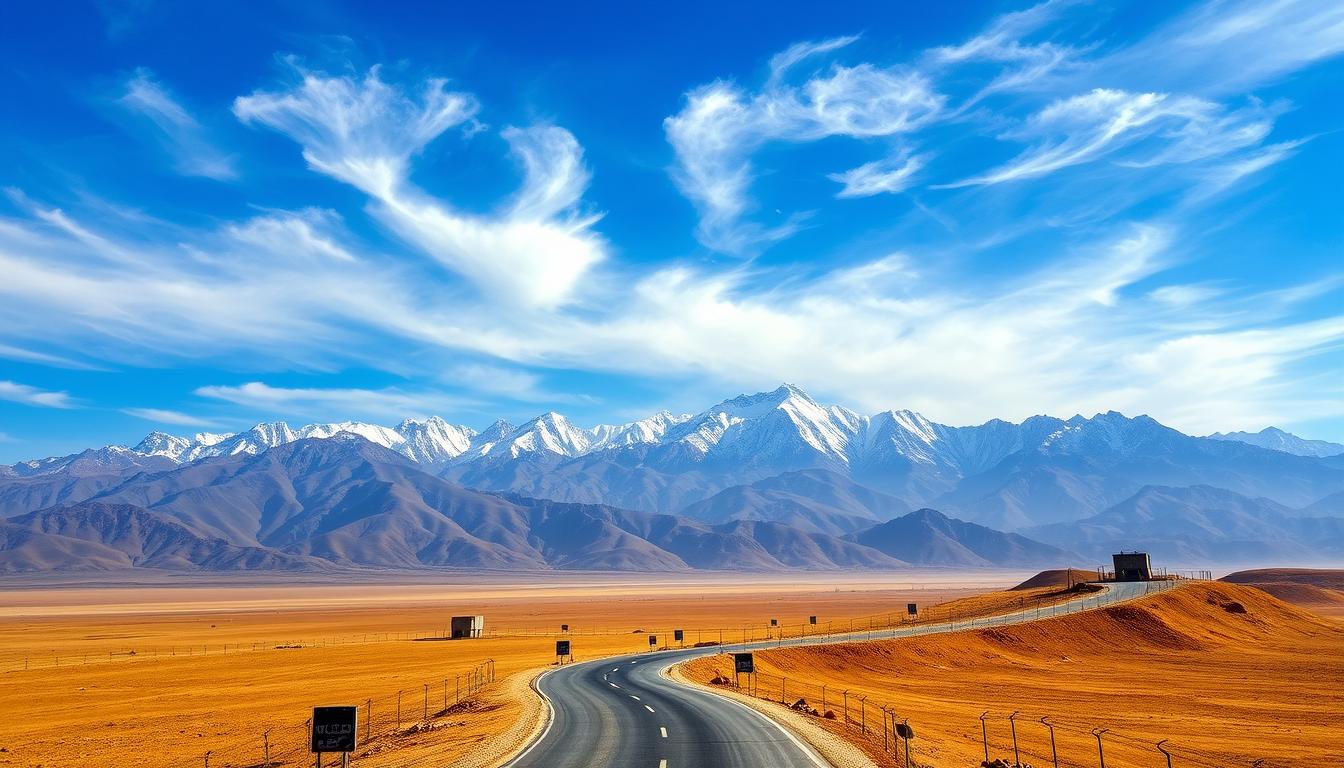
The geography of South Asia is rich and varied. It includes countries like Pakistan and India. The region’s terrains range from the towering Himalayas to the vast Thar Desert.
Major Geographical Features Defining the Region
The Himalayan mountain range is a key feature of South Asia. It affects the climate, culture, and economy. The Indus River is also vital, supporting ancient civilizations. The Thar Desert, with its unique ecosystem, poses challenges for living there.
Countries Sharing Borders with Pakistan and India
Pakistan and India are surrounded by several countries. These include China, Afghanistan, Nepal, Bhutan, Bangladesh, and Myanmar. Knowing about these neighbors helps understand the complex Indo-Pak borders. The borders between these countries have big political impacts.
| Country | Bordering Countries | Notable Geographical Features |
|---|---|---|
| Pakistan | India, China, Afghanistan, Iran | Indus River, Karakoram Range |
| India | Pakistan, China, Nepal, Bhutan, Bangladesh, Myanmar | Himalayan Range, Thar Desert, Ganges River |
Historical Context of Pakistan-India Boundaries
The history of Pakistan-India boundaries started with the 1947 partition. This event split British India into two nations: India and Pakistan. It was a key moment in history, causing a massive migration and creating a new border.
Pre-Partition Borders Under British Rule
Before the partition, the Indian subcontinent was one big area under British rule. It had many provinces and princely states. The provinces were directly ruled by the British, while the states were ruled by local leaders with British support.
- The British Indian provinces were categorized into major administrative units.
- Princely states operated under British protection but maintained internal autonomy.
- The British government’s decision to divide India was influenced by political and communal factors.
The 1947 Partition and Border Formation
The 1947 partition created the Radcliffe Line, the border between India and Pakistan. Sir Cyril Radcliffe drew this line. He had to do it quickly, without knowing the area’s people well.
The partition caused huge migrations and violence. Millions moved across the new borders. The Radcliffe Line was a big issue, like in Kashmir. The Kashmir dispute is a major problem between India and Pakistan today.
After the partition, the border situation between India and Pakistan became very complex. Knowing this history helps us understand today’s border issues between them.
The Radcliffe Line: Birth of the Indo-Pak Border
The Radcliffe Line was created in 1947 and is key to South Asia’s politics. It was drawn by Sir Cyril Radcliffe’s Boundary Commission. Their job was to set the border between India and Pakistan.
Sir Cyril Radcliffe’s Boundary Commission
Sir Cyril Radcliffe’s team had to draw the India-Pakistan border fast. They faced big challenges, like dealing with different lands and people’s rights. The task was complex and urgent.
The team used data on people and land to set the border. But, the rush and the importance of the task made it very contentious.
Controversies and Immediate Consequences
The Radcliffe Line sparked a lot of debate. Many felt it didn’t match their culture or land. The results were harsh, with big migrations and violence.
One of the biggest migrations in history happened. It caused a lot of suffering and loss of life.
| Aspect | Description | Impact |
|---|---|---|
| Geographical Division | The Radcliffe Line divided the Indian subcontinent into India and Pakistan. | Created two separate nations with distinct geopolitical identities. |
| Population Exchange | Mass migration occurred as people moved to their respective countries. | Resulted in significant human suffering and loss of life. |
| Economic Consequences | Division of resources and infrastructure. | Led to economic challenges for both newly formed countries. |
The Radcliffe Line is a big deal in South Asia’s politics. It affects India and Pakistan’s relations even today.
Pakistan India Boundaries: Current Official Demarcation
The border between Pakistan and India is made up of several parts. It’s a complex issue, with different types of borders and infrastructure.
International Border Segments
The India-Pakistan border has key segments: the International Border, the Line of Control, and the Working Boundary. The International Border is the official line between the two countries. Former Indian Prime Minister Atal Bihari Vajpayee said, “The border is not just a line, it’s a symbol of the country’s sovereignty.” The Line of Control and the Working Boundary, though, are disputed and have caused tension.
Border Infrastructure and Crossing Points
The border’s infrastructure is key for security. It includes fencing, floodlights, and surveillance systems. There are official crossing points like Wagah-Attari, a major trade route and tourist spot.
As
“The border is a reality that we have to live with, but it’s also a reminder of the divisions that we need to overcome,”
noted by a diplomat, showing the border’s complexities.
The Kashmir Dispute: Territorial Complexities
The Kashmir dispute is a long-standing issue between India and Pakistan. It’s filled with historical, cultural, and political complexities. These factors have kept tensions high.
Historical Claims and Princely State Status
The princely state of Jammu and Kashmir was a key issue in 1947. Maharaja Hari Singh wanted to stay independent but eventually joined India. Pakistan disagreed, leading to the region’s division.
Divided Control and Administrative Boundaries
Now, the Line of Control (LoC) divides Kashmir between India and Pakistan. It’s a sensitive area with lots of military presence. This division has created different rules and governments on each side.
UN Resolutions and International Perspectives
The United Nations has tried to solve the Kashmir issue with resolutions. They suggest a vote to decide the future. But, India and Pakistan’s disagreements have blocked these efforts.
Resolving the Kashmir dispute needs a peaceful and all-encompassing approach. It’s important to understand the historical, cultural, and political aspects of the region.
The Line of Control (LoC): A De Facto Border
The LoC started in 1948 and has become a tense border between India and Pakistan. It acts as a real border between parts of Kashmir controlled by India and Pakistan. This border is key in the Kashmir dispute.
Origin and Evolution of the LoC
The LoC began as a ceasefire line after the 1947 war. Over time, it has become more militarized and tense. The Simla Agreement in 1972 made it officially the Line of Control.
Many conflicts and peace talks have shaped the LoC. Yet, the area remains heavily militarized.
Military Presence and Ceasefire Violations
The LoC has a big military presence on both sides. There are often ceasefire violations, leading to deaths and more tension between India and Pakistan.
A table showing major ceasefire violations along the LoC is below:
| Year | Number of Ceasefire Violations | Casualties |
|---|---|---|
| 2018 | 1,149 | 271 |
| 2019 | 3,479 | 418 |
| 2020 | 5,133 | 261 |
Civilian Life Along the LoC
People living near the LoC face big challenges. They deal with security risks, displacement, and economic struggles. The constant firing and shelling have forced many families to leave.
The situation along the LoC is very tense, with ongoing tensions between India and Pakistan. There are efforts to make life better and reduce tensions. But finding peace is a hard journey.
The Siachen Glacier and Actual Ground Position Line
The Siachen Glacier is a disputed area between India and Pakistan. It’s known for its extreme climate and strategic value. The region’s high altitude and harsh weather make it one of the most challenging places on Earth.
World’s Highest Battlefield: Geography and Conditions
The Siachen Glacier is in the Karakoram range, with heights up to 22,000 feet. Temperatures can drop to -50°C, and avalanches are common. These conditions make military operations very tough.
- Extreme weather conditions
- High altitude terrain
- Frequent avalanches
Strategic Importance and Ongoing Disputes
The Siachen Glacier is key due to its location near the Karakoram Pass and Indira Col. Both India and Pakistan have a strong military presence. The Actual Ground Position Line (AGPL) acts as the de facto border.
The dispute over the Siachen Glacier is a major issue between India and Pakistan. There are ongoing tensions and ceasefire violations along the AGPL.
Sir Creek Maritime Boundary Dispute
The Sir Creek maritime boundary dispute is a big issue between India and Pakistan. It involves complex history and law. The fight is over who gets to control the Sir Creek area in the Arabian Sea.
Historical Claims and Legal Positions
Both sides have strong historical and legal arguments. India and Pakistan disagree on who should control the Sir Creek. This is because Sir Creek is a tidal estuary, making it hard to decide where the boundary is.
- India says the boundary should follow the creek’s deepest channel.
- Pakistan wants the boundary to be in the middle of the creek.
Economic Implications and Resource Rights
The dispute has big economic implications and resource rights at stake. The area is thought to have lots of oil and gas. Who gets to use these resources is a big deal for both countries.
The Wagah-Attari Border: Symbol of Division and Connection
The Wagah-Attari border stands as a symbol of both division and connection between India and Pakistan. It’s located between the Indian state of Punjab and the Pakistani province of Punjab. This border is more than just a line on a map; it holds deep cultural and political significance.
The Famous Border Ceremony and Tourism
The Wagah-Attari border is famous for its daily border ceremony. It draws thousands of visitors from all over the world. The ceremony is a mix of patriotism, national pride, and a bit of rivalry.
- The ceremony takes place every evening.
- It attracts a large crowd of spectators and tourists.
- The event is a display of military precision and national pride.
Trade and Transit Facilities
The Wagah-Attari border is also a key trade route between India and Pakistan. It allows for the exchange of goods and people, boosting economic ties. Efforts are ongoing to improve trade and transit facilities here.
Key aspects of trade and transit facilities include:
- Simplification of customs procedures.
- Improvement of border infrastructure.
- Enhancement of security measures.
In conclusion, the Wagah-Attari border is a complex boundary. It shows both the division and connection between India and Pakistan. Its importance goes beyond being a border, touching on culture, economy, and politics.
Pakistan’s Boundaries with Afghanistan and China
The borders of Pakistan with Afghanistan and China are very important. They define Pakistan’s territory and affect its foreign policy and regional relations.
The Durand Line: History and Controversies
The Durand Line is a 2,640-kilometer border between Pakistan and Afghanistan. It was set in 1893 by Sir Mortimer Durand. But, it has been a point of disagreement between Pakistan and Afghanistan ever after Pakistan became independent in 1947.
Afghanistan has always questioned the Durand Line’s legitimacy. They say it was imposed on them without their agreement. This issue is not just about borders. It also involves ethnic and cultural aspects, as it cuts through Pashtun tribal areas.
There have been ongoing efforts to solve this problem. But, there are often tensions and clashes along the border.
| Year | Event |
|---|---|
| 1893 | Durand Line established |
| 1947 | Pakistan gains independence; Afghanistan disputes the Durand Line |
Pakistan-China Border and the Karakoram Highway
The Pakistan-China border is a success story. It shows a strong partnership between the two countries. The Karakoram Highway, a challenging and beautiful road, connects Pakistan to China’s Xinjiang region.
“The Karakoram Highway is not just a road; it’s a symbol of the unbreakable bond between Pakistan and China, boosting trade, cultural exchange, and mutual understanding.”
The Karakoram Highway has greatly improved economic ties and people-to-people connections between Pakistan and China. It’s a key part of their strategic partnership.
India’s Boundaries with Neighboring Countries
India’s borders with its neighbors are filled with history, culture, and politics. These lines on the map show more than just where one country ends and another begins. They tell the story of India’s relationships with its neighbors through trade, culture, and politics.
India-China Border Disputes and the McMahon Line
The India-China border is a major issue in the region. The McMahon Line, set in 1914, marks the line between Arunachal Pradesh in India and Tibet in China. This line has been a source of conflict, leading to the 1962 Sino-Indian War.
India’s Borders with Nepal, Bhutan, Bangladesh, and Myanmar
India also shares borders with Nepal, Bhutan, Bangladesh, and Myanmar. Each border has its own story and challenges. The border with Nepal is open, with lots of trade and cultural exchange.
The border with Bhutan is special, thanks to a treaty that makes India responsible for Bhutan’s defense and foreign affairs. The India-Bangladesh border is very open, with efforts to make it safer. The border with Myanmar is complex, with many ethnic groups and rebel groups.
| Country | Border Characteristics | Key Issues |
|---|---|---|
| China | Disputed boundary, high-altitude terrain | Territorial claims, military standoffs |
| Nepal | Open border, significant trade | Cross-border migration, water resource management |
| Bhutan | Special treaty, secure border | Strategic cooperation, environmental concerns |
| Bangladesh | Porous border, fencing efforts | Smuggling, illegal migration |
| Myanmar | Diverse ethnic groups, insurgency | Border security, regional stability |
Key Border Treaties and Agreements
The India-Pakistan border has been shaped by several key treaties and agreements. These have played a big role in defining their boundaries.
The Simla Agreement of 1972
The Simla Agreement was signed in 1972. It was a big diplomatic effort between India and Pakistan. It established the Line of Control (LoC) in Kashmir, which has been a de facto border.
The agreement focused on solving conflicts peacefully. It also emphasized respecting each other’s territory.
The Indus Waters Treaty
The Indus Waters Treaty was brokered by the World Bank in 1960. It regulates the use of the Indus River and its tributaries between India and Pakistan. This treaty is seen as one of the most successful water-sharing agreements in the world.
It provides a framework for managing shared water resources.
Other Significant Border Negotiations
Other notable agreements include the Karachi Agreement and the Tashkent Declaration. These agreements have shaped the complex history of border negotiations between India and Pakistan.
They address issues like ceasefire violations and territorial disputes.
| Treaty/Agreement | Year | Key Provisions |
|---|---|---|
| Simla Agreement | 1972 | Established the Line of Control in Kashmir |
| Indus Waters Treaty | 1960 | Regulated the use of the Indus River and its tributaries |
| Karachi Agreement | 1949 | Established ceasefire lines and military arrangements |
Border Security Infrastructure and Management
The India-Pakistan border has a complex security system. It’s designed to stop unauthorized crossings and keep the region stable. This system is key to managing the border well and stopping illegal activities.
Fencing, Floodlights, and Surveillance Systems
The border is well-protected with fencing, floodlights, and advanced surveillance. Fencing acts as a main barrier. Floodlights light up the area at night, making it easier to see. Surveillance systems, like cameras and sensors, watch the border in real-time.
Border Security Forces and Operations
Border security forces, like the Border Security Force (BSF) in India and the Pakistan Rangers, are very important. They patrol the border, handle security breaches, and do joint operations when needed. Their presence stops intruders and keeps the border peaceful.
Good border security management is not just about physical barriers. It also needs the work of border security forces. These forces must keep learning and using new technology to face new challenges.
Cross-Border Challenges and Cooperation
The border between Pakistan and India is more than just a line on a map. It’s a place of both challenges and cooperation. The two countries have been dealing with disputes and agreements for a long time. These issues affect the lives of millions living near the border.
Refugee Movements and Migration Issues
Over the years, the India-Pakistan border has seen a lot of people moving due to conflicts and other reasons. Refugee movements are a big worry, with many families losing their homes because of violence. As Nayanika Mookherjee, a migration scholar, says, “The partition of India in 1947 caused a huge migration, with over 14 million people moving.”
“The partition of India in 1947 led to one of the largest mass migrations in history, with over 14 million people crossing the border.”
Trade Routes and Economic Relations
Even with tensions, Pakistan and India have trade routes. The Wagah-Attari border is a key spot for trade. Trade and economic ties are important for both countries, with agreements to improve cooperation. But, politics and security issues often slow down trade.
Environmental and Water Resource Management
The shared water resources of Pakistan and India are key to their environmental and economic ties. The Indus Waters Treaty helps manage the Indus River and its tributaries. Good management of these resources is vital for farming and industry in both countries.
In summary, the challenges and cooperation between Pakistan and India are complex. To tackle these issues, we need to understand the history, economy, and environment involved.
Cartographic Representation and International Recognition
The way the India-Pakistan border is shown on maps is key to their ongoing tensions.
How the border is mapped and recognized globally is very important. Both countries have their own views on the border, shown in their maps.
Official Maps and Territorial Claims
Maps are vital in showing a country’s claims to land. For example, India’s maps show the Line of Control (LoC) in Jammu and Kashmir as the real border. But Pakistan’s maps see the whole area as a disputed zone. This shows how complex mapping can be.
| Country | Territorial Claim | Cartographic Representation |
|---|---|---|
| India | Line of Control (LoC) as de facto border | Official maps depict LoC as the border |
| Pakistan | Entire Jammu and Kashmir as disputed territory | Official maps show the region as disputed |
Digital Mapping and Geopolitical Sensitivities
Digital maps have made things more complicated. They can change quickly and spread fast. But, they also bring up worries about accuracy and how they might affect relations between countries.
Conclusion: The Future of South Asian Boundaries
The future of South Asian boundaries is closely tied to the relationship between India and Pakistan. This has big effects on the region’s stability and security. Solving long-standing issues, like the Kashmir dispute, is key to better ties between the two nations.
For decades, South Asian boundaries have been a point of contention. Their shape greatly affects the region’s politics. Finding peace in these disputes could lead to more cooperation and economic growth, helping the people of the area.
The world has a big interest in South Asia’s stability because of its strategic and economic value. As India and Pakistan work through their complex relationship, everyone hopes for a peaceful and prosperous future for the region.