The capital city of Nigeria, Abuja, was built in the 1980s. It was planned by International Planning Associates (IPA). This group is made up of three American firms.
Abuja is the heart of Nigeria’s government and politics. It’s one of the few cities made for this purpose in Africa. Aso Rock, a 400-metre rock, is a key feature of the city’s landscape.
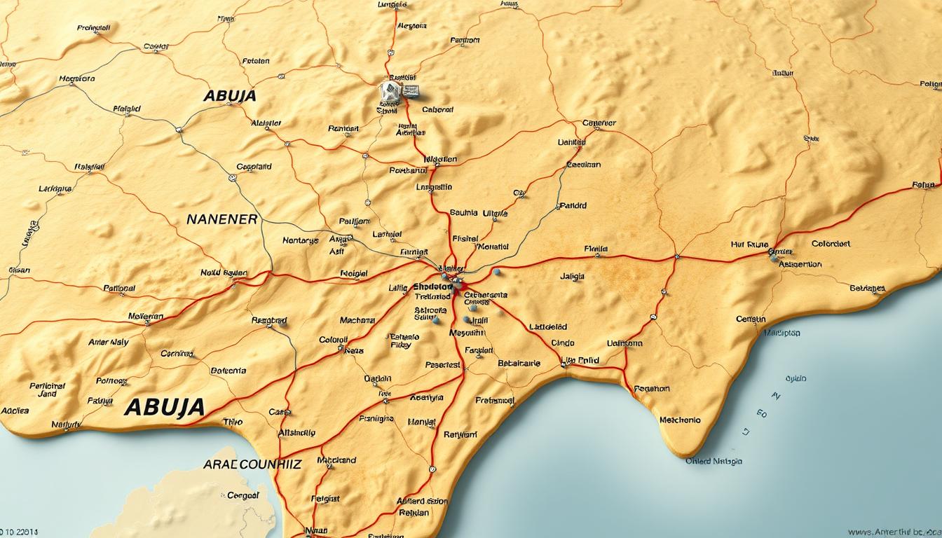
Knowing the layout of Abuja is key to getting around its six area councils. The city sits right in the middle of Nigeria. This makes it a major center.
A detailed map is vital for exploring Abuja. It helps you understand the city’s layout and its infrastructure.
The Evolution of Abuja as Nigeria’s Capital
In 1976, Nigeria’s government made a big change. They decided to move the capital to Abuja. This move was to make a more central and fair capital. It showed Nigeria’s unity and its varied landscapes.
Historical Development and Planning
The Military Government of Generals Murtala Mohammed and Olusegun Obasanjo started Abuja’s planning. International Planning Associates (IPA) designed the master plan. Japanese architect Kenzo Tange worked on the central areas.
This team mixed global skills with local ideas. They shaped Abuja’s future together.
| Year | Event | Key Players |
|---|---|---|
| 1976 | Decree No.6 promulgated to move the capital to Abuja | Federal Military Government |
| 1976-1980 | Planning and initial implementation | Generals Murtala Mohammed and Olusegun Obasanjo, IPA, Kenzo Tange |
Geographical Significance in Nigeria
Abuja sits at Nigeria’s heart, making it a symbol of unity. It’s easy to reach from anywhere in the country. The Abuja city map and Abuja satellite map show its importance.
The interactive Abuja map helps people understand and explore the city better.
Abuja’s location is key, not just because it’s in the middle. It also represents Nigeria’s diverse areas. The city was planned to be fair and inclusive, as seen in its design and buildings.
Administrative Structure of the Federal Capital Territory
Knowing how Abuja is run is key to understanding its growth. The Federal Capital Territory (FCT) is Nigeria’s government center. Its setup helps manage and coordinate different areas and councils well.
Federal Capital Territory Administration (FCTA)
The Federal Capital Territory Administration (FCTA) runs the FCT. It looks after Abuja’s development and governance. The FCTA works with six area councils to improve life for everyone.
Good governance in Abuja comes from the FCTA and area councils working together. Experts say, “effective administration is vital for a capital city’s growth.” This shows how important the FCTA is in Abuja’s development.
Overview of the Six Area Council System
The FCT has six area councils: Abuja Municipal Area Council (AMAC), Gwagwalada, Kuje, Bwari, Abaji, and Kwali. Each council manages its area. This system helps focus on each region’s needs.
For those visiting or living in Abuja, knowing the area councils is vital. It helps you navigate Abuja better. You can find “Abuja map directions” or use an “Abuja tourist map.” Even printing a map can help you explore the different councils.
“The division into area councils has facilitated targeted development and improved governance in Abuja.”
Comprehensive Abuja Map: Understanding the Capital’s Layout
A detailed map of Abuja gives us a peek into the city’s design and infrastructure. It’s a key tool for grasping the layout of Nigeria’s capital. It shows major roads, landmarks, and zones.
Key Features and Zones of the Abuja Map
The Abuja city map shows different zones, like the Central Business District. This area is full of commercial activities. It’s where you find government buildings, embassies, and big offices.
- The Central Area, from Aso Rock to the National Stadium, is a big landmark.
- Important roads like the Abuja-Kaduna highway and the Airport road connect the city.
- Residential zones are found in the six Area Councils, each with its own features.
Major Landmarks and Reference Points
An Abuja satellite map offers a detailed look at the city’s layout. It includes landmarks like the National Assembly, the Presidential Villa, and the National Mosque. These spots help guide you around.
Knowing Abuja’s layout through its map is key for easy navigation. It shows the city’s planning and growth. This makes it a great tool for both locals and visitors.
Abuja Municipal Area Council (AMAC)
The Abuja Municipal Area Council (AMAC) is at the heart of Nigeria’s capital. It oversees the Federal Capital City (FCC) and nearby areas. AMAC is the most populous and economically active council in Abuja.
Geographical Boundaries and Districts
AMAC covers a big part of Abuja. It includes important districts like Garki, Maitama, Wuse, and Asokoro. Its area includes the Central Business District and government zones, making it a center of economic and administrative activities.
Central Business District and Government Zone
The Central Business District is Abuja’s commercial center. It has many corporate offices, banks, and government buildings. The government zone is where the National Assembly and the Supreme Court are located.
Residential Areas and Suburbs
Maitama and Asokoro offer high-end living with modern amenities. Other suburbs under AMAC provide various housing options. This diversity adds to the council’s population.
Key Locations and Landmarks
AMAC is home to landmarks like the National Assembly, the Supreme Court, and the National Mosque. It also has cultural institutions and recreational facilities. These make AMAC appealing to both residents and visitors.
Population Demographics and Development
AMAC has a diverse population, showing Abuja’s cultural mix. The council works on improving infrastructure, healthcare, and education. This ensures sustainable growth and a good quality of life for its people.
As a recent report points out,
“AMAC’s strategic role in Abuja’s development highlights the need for effective urban planning and management.”
This shows how important AMAC is for Abuja’s future.
An interactive Abuja map is very useful for navigating and exploring. It offers detailed insights into AMAC and the rest of the city. Whether you need Abuja map directions or want to understand the city’s layout, these tools are essential.
Gwagwalada Area Council
Gwagwalada Area Council is in southwest Abuja, near the city center. It’s a key spot for living and learning. The area is lively with many neighborhoods and top schools, like the University of Abuja.
Geographical Overview and Boundaries
Gwagwalada sits in the heart of the Federal Capital Territory. It’s a big deal for living and studying. Its many districts make it a varied place.
Notable Features and Institutions
Gwagwalada has many important spots and schools. The University of Abuja stands out, boosting the area’s learning scene.
University of Abuja and Educational Facilities
The University of Abuja draws students from all over. It’s a big part of Gwagwalada’s learning vibe. Other schools in the area add to its educational appeal.
Commercial and Residential Zones
Gwagwalada has lots of shops and homes. These areas help the local economy and offer many services and places to live.
Economic and Social Characteristics
Gwagwalada’s economy and society are shaped by its schools and homes. The University of Abuja plays a big role, with many businesses serving students. A local expert says,
“Gwagwalada’s growth is closely tied to its educational institutions and the overall development of Abuja.”
AnAbuja satellite mapor aprint Abuja mapcan show Gwagwalada’s layout and growth. AnAbuja tourist mapcan also help visitors find the area’s highlights.
Kuje Area Council
Kuje Area Council is south of Abuja’s city center. It’s becoming a key semi-urban area. With more homes, it’s drawing families and workers. The council works on infrastructure and services, helping Abuja grow.
Geographical Layout and Districts
Kuje Area Council has a semi-urban feel. It has many districts growing fast. The area mixes planned and unplanned areas, aiming to improve services.
Important spots include Kuje town and nearby villages. They’re being linked to Abuja’s big area.
Key Features:
- Developing residential areas
- Improving infrastructure
- Integration with Abuja’s metropolitan area
Important Sites and Infrastructure
Kuje has key sites and projects. There are schools, hospitals, and roads to Abuja. The council aims to boost public services for its growing people.
- Road networks connecting to major highways
- Public transportation services
- Community facilities and amenities
Population Distribution and Cultural Heritage
Kuje’s people come from many cultures. The area is growing, thanks to its homes. It tries to keep its culture while growing.
Cultural events and community activities keep Kuje’s spirit alive.
Bwari Area Council
Bwari is one of Abuja’s six area councils. It’s known for its natural beauty and schools. Located northwest of Abuja, it has lush landscapes and traditional villages.
Geographical Scope and Boundaries
The Bwari Area Council has clear boundaries. It covers different landscapes and ecosystems. Its location in the Federal Capital Territory is key to Abuja’s administration.
Key Institutions and Landmarks
Bwari is home to important institutions and landmarks. These are key to its role in the Abuja Nigeria map.
Nigerian Law School and Educational Centers
The Nigerian Law School is in Bwari. It’s a top school. Other educational centers show Bwari’s focus on learning and growth.
Natural Features and Attractions
Bwari’s natural beauty is a big draw. Its landscapes and villages are shown on the Abuja satellite map. They highlight the area’s natural charm.
Demographic Profile and Urban Development
Bwari’s population is growing and diverse. Urban development is influenced by its closeness to Abuja. Efforts are made to grow while keeping natural and cultural heritage intact.
| Characteristics | Description |
|---|---|
| Geographical Location | Northwest of Abuja’s central area |
| Notable Institutions | Nigerian Law School, educational centers |
| Natural Features | Lush landscapes, traditional villages |
| Demographic Trend | Growing population |
Abaji Area Council
The Abaji Area Council is in Abuja’s southwestern part. It’s known for its rural feel and rich culture. It’s one of six areas in the Federal Capital Territory, each adding its own flavor to Abuja.
Geographical Features and Location
Abaji sits at Abuja’s southwestern tip, making it more rural than others. It has lots of farmland and traditional homes. A detailed map of Abuja shows where Abaji is and its borders.
Notable Places and Infrastructure
Abaji has many important places and infrastructure for farming and culture. The council has built roads and markets to better life for locals. An Abuja tourist map helps visitors find these spots.
- Major agricultural farms and cooperatives
- Traditional cultural festivals and events
- Local markets and trade centers
Population Characteristics and Economic Activities
Abaji’s people mostly live in rural areas, focusing on farming and tradition. Farming is the main job here, with big projects supported by the area council. To see where Abaji’s farms are, you can print Abuja map sections on agriculture.
| Economic Activity | Description | Percentage |
|---|---|---|
| Agriculture | Large-scale farming and livestock | 70% |
| Trade | Local markets and commerce | 20% |
| Services | Infrastructure and support services | 10% |
Kwali Area Council
The Kwali Area Council is in Abuja’s southwest. It’s famous for pottery and artisan work. This council is a big cultural spot, showing off Nigerian traditional crafts.
Geographical Context and Boundaries
Kwali Area Council has unique landscapes. Knowing its geography helps us see its cultural and economic value. The area’s terrain is good for farming, helping the local economy.
Its location near other councils in Abuja makes it key to the city’s setup.
Significant Locations and Natural Resources
Kwali has important places and natural resources. It’s known for pottery, with local artists making valuable ceramics. These items are loved worldwide.
The area also has resources for farming, mining, and more. This makes Kwali important for the local economy.
Demographic Insights and Development Initiatives
Kwali’s population is growing, with a focus on traditional ways. The council works on bettering infrastructure and supporting local artists. It also aims to improve healthcare and education.
These efforts help Kwali grow in a way that benefits everyone living there.
Transportation Network on the Abuja Map
Knowing Abuja’s transportation system is key to getting around the city. Abuja is divided into phases, each linked by expressways. Its roads also connect to the Federal highway network, reaching the countryside and nearby states.
Major Roads and Highways Connecting Area Councils
Abuja’s main roads and highways are essential for linking its six area councils. They help move people and goods, boosting the economy and social life.
| Road/Highway | Connecting | Significance |
|---|---|---|
| Airport Road | Nnamdi Azikiwe International Airport to City Center | Primary access for air travelers |
| Mubende-Kabba Highway | Abuja to neighboring states | Facilitates interstate commerce |
| Expressways | Various phases of Abuja | Separates phases, enhances navigation |
Public Transportation Systems and Routes
Abuja has buses and taxis for public transport, reaching key areas. The interactive Abuja map helps find these routes.
Using the Abuja Nigeria map and Abuja map directions makes city travel easier. The transport network is vital for Abuja’s daily life, for both locals and visitors.
Interactive Abuja Map: Digital Navigation Resources
Digital tools have changed how we explore Abuja. Interactive maps make it easy for everyone to get around the city. They give real-time info on landmarks, roads, and services in the Federal Capital Territory.
Online Platforms for Exploring Abuja
Many online platforms offer detailed Abuja maps. These sites show the city’s layout, including roads and landmarks. Google Maps is popular for its street views and traffic updates. OpenStreetMap uses data from users, keeping info current and correct.
Mobile Applications for Navigating the FCT
There are also mobile apps for navigating Abuja. Apps like Google Maps and Waze give directions and traffic updates. They’re great for daily trips and for visitors to find places to see.
Satellite View of Abuja: Aerial Perspectives
Abuja’s landscape is revealed through satellite imagery, showing how nature and buildings interact. This view is key to understanding the city’s geography and planning its future.
Accessing and Using Satellite Imagery
Satellite images of Abuja are available online. They offer detailed maps and aerial views. These tools are essential for both locals and city planners, giving insights into the city’s layout and infrastructure.
To use satellite imagery well, one needs to know the types of data available. High-resolution images, for example, show the city’s landscape in great detail.
Interpreting Geographical Features from Above
Understanding satellite imagery means knowing how to spot geographical features from above. In Abuja, this includes identifying natural landmarks, urban areas, and infrastructure like roads and buildings.
By studying these features, decision-makers can plan better for the city’s growth. This helps in sustainable development of the Federal Capital Territory.
Abuja Tourist Map: Visitor’s Guide to the Capital
Abuja, the capital of Nigeria, is more than just a government center. It’s filled with history, culture, and nature. An Abuja tourist map is key for exploring its many sights.
Essential Tourist Destinations Across Area Councils
Abuja has six area councils, each with its own attractions. In Abuja Municipal Area Council (AMAC), you can see the National Assembly, the National Mosque, and the National Christian Centre. Gwagwalada Area Council is famous for its markets and the Gwagwalada Stadium.
Kuje Area Council has historical sites like the Kuje Prison and cultural landmarks. Other councils like Bwari, Abaji, and Kwali offer natural beauty and cultural festivals. This makes Abuja a rich mix of experiences for tourists.
Practical Navigation Tips for Visitors
Exploring Abuja is easier with some tips. An interactive Abuja map helps plan your trip and find important spots. Knowing the city’s layout and landmarks makes your journey better.
For directions, Abuja map directions are available online and on mobile apps. This makes it simple to get around. Also, talking to local guides and using public transport adds to the experience. It lets you dive deep into Abuja’s beauty and culture.
Conclusion: Mastering Navigation Across Abuja’s Six Area Councils
Understanding Abuja’s six area councils is key. You need to know the city’s layout, its structure, and how to get around. A detailed map of Abuja helps everyone explore the Federal Capital Territory easily.
The Abuja Map shows the city’s layout, with important landmarks and roads. Knowing the FCT’s structure helps you understand its complexities.
This guide helps you navigate Abuja’s area councils with confidence. You’ll learn about the Abuja Municipal Area Council, Gwagwalada, Kuje, Bwari, Abaji, and Kwali. The Abuja Nigeria map is vital for discovering the city’s culture and economy.
Mastering Abuja’s area councils opens up the city’s beauty and complexity. Residents and visitors can fully appreciate what Abuja has to offer.