The Rocky Mountains are a famous mountain range in North America. They stretch from Canada to New Mexico. This range is a dream for travelers, scientists, and nature lovers.
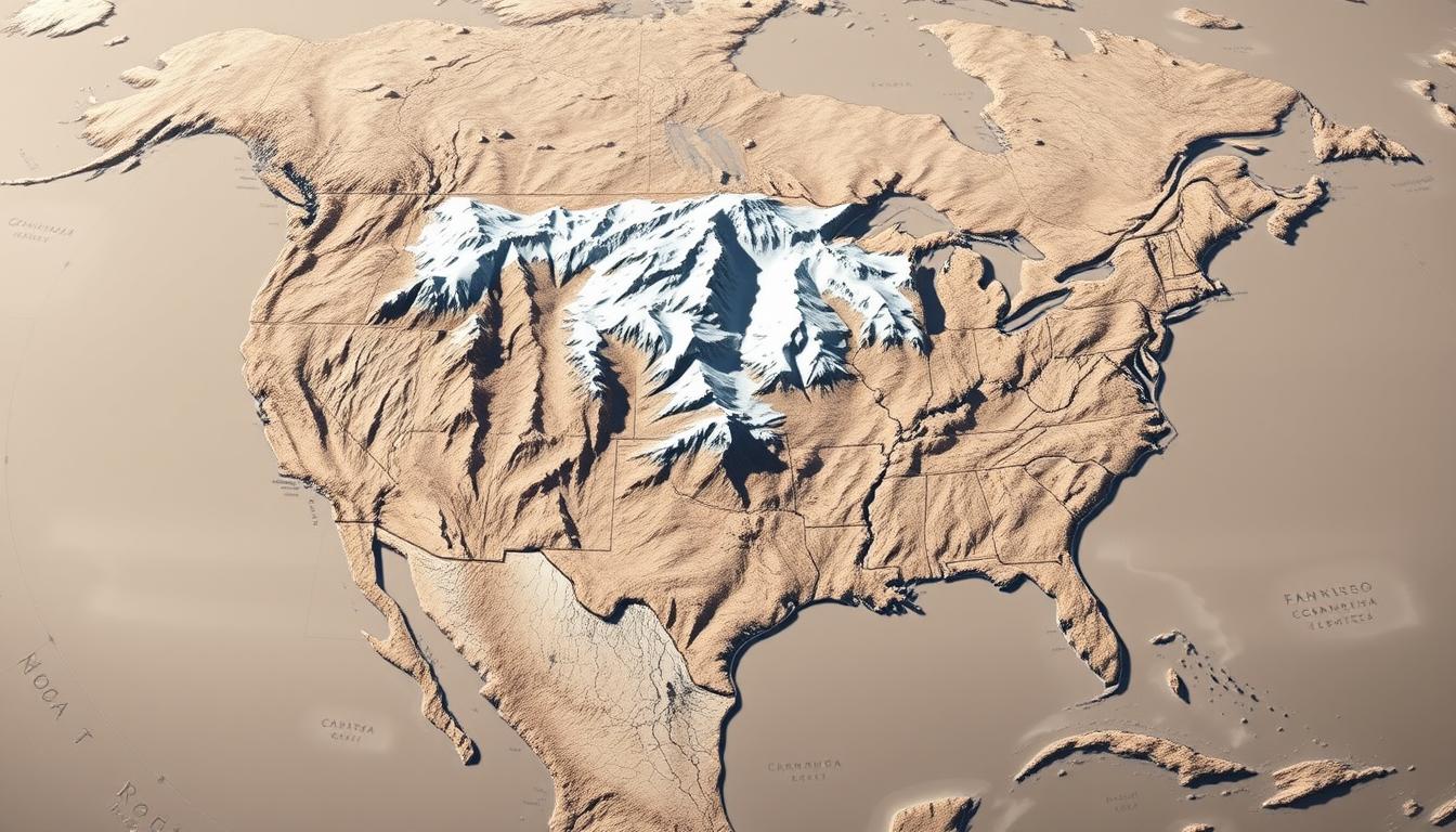
The Rocky Mountains location map shows how big this natural wonder is. It covers over 3,000 miles. The range has many sub-ranges, like the Bighorn and Wind River ranges in Wyoming, and the Sangre de Cristo mountains in Colorado.
A Rocky Mountains Map is key to understanding this area. It shows the peaks, valleys, and ecosystems. These features make the Rockies a special and interesting place.
The Rocky Mountains: A Geographical Overview
The Rocky Mountains are a stunning mountain range in western North America. They have a long geological history that spans millions of years. This history tells of huge tectonic forces that have molded the continent.
Formation and Geological History
The Rocky Mountains formed during the Laramide orogeny, a time of intense tectonic activity. This happened about 80 to 55 million years ago. The shallow subduction of the Farallon Plate under the North American Plate led to the mountains’ uplift.
Tectonic Activity and Mountain Building
The building of the Rockies was a complex process. It involved many phases of tectonic activity. This activity formed a wide belt of mountains across western North America.
Age and Rock Composition
The rocks in the Rockies vary greatly. They range from Precambrian metamorphic rocks to newer sedimentary and volcanic deposits. The ages of these rocks are also varied, with some being over a billion years old.
| Geological Era | Rock Type | Age |
|---|---|---|
| Precambrian | Metamorphic rocks | 1 billion+ years |
| Paleozoic | Sedimentary rocks | 541-252 million years |
| Mesozoic | Volcanic and sedimentary rocks | 252-66 million years |
Geologists call the Rocky Mountains a geological wonder. Their complex history has shaped the North American continent. The geological processes that formed the Rockies have created a unique and diverse landscape. This landscape continues to amaze scientists and visitors.
Rocky Mountains Map: Essential Features and Navigation
The Rocky Mountains are a complex and diverse area. They need different maps to show their many features. These maps help us navigate, understand the geography, and see the region’s ecological diversity.
It’s important to know the different types of maps. They meet various needs, like administrative, geographical, or thematic analysis.
Types of Rocky Mountain Maps
There are many types of maps for the Rocky Mountains. Each type has its own purpose. We have political maps, physical maps, and thematic maps.
Political vs. Physical Maps
Political maps show administrative areas like state and national borders. They also highlight human settlements. On the other hand, physical maps focus on the land itself, like mountains, rivers, and valleys. Physical maps are great for understanding the Rocky Mountains’ topography, which is key for hiking and climbing.
Specialized Thematic Maps
There are also specialized thematic maps. These maps focus on specific aspects of the Rocky Mountains. They show things like vegetation, climate, geology, and habitats. These maps are very useful for researchers, conservationists, and planners who need detailed information.
| Map Type | Purpose | Features Highlighted |
|---|---|---|
| Political | Administrative purposes | State and national borders, cities |
| Physical | Geographical understanding | Mountains, rivers, valleys |
| Thematic | Specific thematic analysis | Vegetation, climate, geology, etc. |
Knowing the different maps for the Rocky Mountains helps us navigate and appreciate this complex area. Whether for work, fun, or research, the right map offers essential insights and information.
The Rocky Mountains’ Position in North America
The Rocky Mountains are key to understanding North America’s geology and ecology. They stretch from northern British Columbia, Canada, to New Mexico in the southwestern United States. This makes them a vital part of North America’s geography.
Continental Context and Orientation
The Rocky Mountains mark the eastern edge of the North American Cordillera. This mountain system includes many ranges. Knowing where the Rockies fit in this larger system helps us see their impact on North America’s landscape.
Latitude and Longitude Coordinates
The Rocky Mountains cover a huge area. They stretch from about 49°N to 35°N latitude and from 116°W to 105°W longitude. This wide range supports diverse ecosystems and climates, making the region rich in biodiversity.
Relationship to Other North American Landforms
The Rocky Mountains are connected to other important landforms in North America. These include the Great Plains to the east and the Columbia Plateau to the west. Their unique position affects climate, ecosystems, and where people live. A geography expert says, “The Rocky Mountains are essential to North America’s identity. They influence everything from local ecosystems to global climate patterns.”
“The Rocky Mountains stand as a testament to the continent’s complex geological history, shaping the environment and human activities across North America.”
The Rockies’ connection with other landforms makes their environment complex and dynamic. This connection is key to understanding their ecological and cultural importance.
Major Geographical Divisions of the Rockies
The Rocky Mountains are split into the Northern, Central, and Southern Rockies. Each part has its own unique geology. This helps us understand the different landscapes and life forms in the range.
The Northern Rockies
The Northern Rockies cover parts of Canada and Montana and Idaho. This area is famous for its steep peaks and glacial landscapes.
Canadian Rockies Features
The Canadian Rockies are known for their breathtaking views and wildlife. Parks like Banff and Jasper are highlights here.
Montana and Idaho Sections
Montana and Idaho in the Northern Rockies are known for their tough terrain and mineral wealth. Glacier National Park in Montana is a key spot.
The Central Rockies
The Central Rockies include Wyoming and parts of Utah. This area has a different geological history and landscape than the Northern Rockies.
Wyoming Basin
The Wyoming Basin is a key part of the Central Rockies. It’s famous for its unique rocks and fossils.
Colorado Plateau Connection
The Central Rockies are linked to the Colorado Plateau. This area has high deserts and deep canyons. This link affects the local ecosystems and rocks.
The Southern Rockies
The Southern Rockies, in Colorado and New Mexico, have high peaks and varied ecosystems.
Colorado’s Front Range
Colorado’s Front Range is a busy area at the Rocky Mountains’ base. It includes cities like Denver and Boulder. It’s famous for its beauty and outdoor activities.
New Mexico Extensions
The Rockies also reach into New Mexico. This area is known for its unique geology and cultural importance.
| Division | Notable Features | States/Provinces |
|---|---|---|
| Northern Rockies | Rugged peaks, glacial features | Montana, Idaho, Alberta, British Columbia |
| Central Rockies | Wyoming Basin, Colorado Plateau connection | Wyoming, Utah |
| Southern Rockies | High peaks, diverse ecosystems | Colorado, New Mexico |
Notable Peaks and Landmarks on the Rocky Mountains Outline Map
A Rocky Mountains outline map shows the range’s most famous peaks and landmarks. It highlights North America’s mountainous beauty. The Rocky Mountains have some of the highest peaks and most stunning landscapes in North America.
Highest Elevations and Prominent Peaks
The Rocky Mountains have many high peaks, with over 50 in Colorado alone over 14,000 feet. Mount Elbert, in Colorado, is the highest at 14,433 feet.
14,000+ Foot Peaks
The Rocky Mountains are famous for their “Fourteeners,” peaks over 14,000 feet. Some top ones are:
- Mount Elbert (14,433 feet)
- Mount Massive (14,421 feet)
- Mount Harvard (14,420 feet)
Historically Significant Summits
Some peaks in the Rocky Mountains are historically important. They played key roles in exploration and settlement. For instance, Longs Peak in Colorado was important for early explorers.
Significant Passes and Valleys
The Rocky Mountains also have notable passes and valleys. These have helped with travel and settlement for centuries.
Major Mountain Passes
Mountain passes are key for crossing the Rocky Mountains. Some notable ones are:
| Pass Name | Location | Elevation |
|---|---|---|
| Red Mountain Pass | Colorado | 11,018 feet |
| Monarch Pass | Colorado | 11,312 feet |
| Berthoud Pass | Colorado | 11,307 feet |
Notable Valleys and Basins
The Rocky Mountains have many valleys and basins. These areas are home to diverse plants and animals. San Luis Valley in Colorado is famous for its farming and unique ecosystems.
The Continental Divide: A Key Feature of Rocky Mountains Geography
The Continental Divide is a key feature in the Rocky Mountains. It plays a big role in where water flows in North America. This divide is more than just a line on a map; it has big effects on water and nature.
Understanding the Continental Divide
The Continental Divide separates major rivers in North America. It runs through the Rocky Mountains, affecting climate, plants, and animals. It decides if water goes to the Atlantic or Pacific Oceans.
Hydrological Significance
The Continental Divide is very important for water. It blocks water flow, making rivers go to different oceans. This greatly affects local ecosystems and weather.
Ecological Implications
The Continental Divide shapes the environments on both sides. It leads to different climates, soils, and plants. Knowing this helps protect the Rocky Mountains’ nature.
Mapping the Divide Through the Rockies
Mapping the Continental Divide is hard because of its changes and tough terrain. Cartographers use special methods to show the divide and its key spots.
Notable Points Along the Divide
There are many important spots on the Continental Divide. These include high passes and peaks. They are key for their geography and impact on nature.
Variations and Complexities
The Continental Divide is not just a simple line. It has many changes and complexities. These include elevation changes, path shifts, and unclear areas.
| Feature | Description | Significance |
|---|---|---|
| Hydrological Significance | Directs water flow towards different oceans | Influences regional ecosystems and climate |
| Ecological Implications | Shapes environments and supports biodiversity | Crucial for conservation efforts |
| Notable Points | High passes and peaks along the divide | Significant geographical features and ecological impact |
Hydrological Features of the Rocky Mountains
The Rocky Mountains are the source of many important rivers and lakes. These support different ecosystems. They are key for keeping nature in balance and helping people too.
Major River Systems Originating in the Rockies
The Rocky Mountains are where many big rivers start. These rivers flow into different oceans. Knowing about these rivers helps us manage water better.
Eastern Watershed Rivers
Rivers like the Colorado and Platte go east. They end up in the Atlantic Ocean or the Gulf of Mexico. These rivers are important for water, farming, and power.
Western Watershed Rivers
Rivers such as the Columbia and Snake flow west. They reach the Pacific Ocean. They help with fishing, power, and jobs.
Lakes and Watersheds
The Rocky Mountains have lots of lakes and reservoirs. These are key to the area’s water system. Taking care of these water bodies is important for nature.
Natural Lakes and Reservoirs
Lakes like Granby and Granite are natural in the Rockies. Reservoirs, like Blue Mesa, are made by dams. They help store and control water.
Watershed Management
Good watershed management means keeping water clean and managing supply. It also helps wildlife. The USGS offers important data and research on this.
| River System | Direction | Destination |
|---|---|---|
| Colorado | East | Gulf of Mexico |
| Columbia | West | Pacific Ocean |
| Platte | East | Gulf of Mexico |
| Snake | West | Pacific Ocean |
Rocky Mountains Topographic Map: Understanding Elevation and Relief
Topographic maps and digital elevation models are key for seeing the Rocky Mountains’ varied landscape. They give important details about the terrain, like elevation, relief, and other geographical features.
Interpreting Contour Lines and Elevation Data
Contour lines on a topographic map show the terrain’s shape and elevation. Lines that are close together mean steep slopes. Lines that are far apart show gentler slopes. Knowing how to read these lines is key to understanding the map.
Reading Topographic Symbols
Topographic maps use symbols for different features like rivers, roads, and plants. It’s important to know these symbols to read the map right. For example, a blue line usually means a river, and a dashed line might be a trail.
Understanding Relief Representation
The relief on a topographic map gives a three-dimensional view of the terrain. By looking at the contour lines and symbols, you can see the elevation and relief. This is helpful for planning hikes or understanding the land’s layout.
Digital Elevation Models of the Rockies
Digital Elevation Models (DEMs) show the terrain digitally, making analysis and visualization easier. DEMs can create detailed topographic profiles and analyze terrain characteristics.
3D Visualization Techniques
DEMs can make 3D models of the terrain, giving a deeper understanding of the landscape. This is great for research and planning activities. 3D visualization helps spot hazards or interesting areas.
Applications for Research and Recreation
DEMs are used in many ways, from environmental studies to planning hiking trails. They offer valuable data for understanding the Rocky Mountains’ complex terrain. For instance, DEMs help study climate change’s effect on mountain ecosystems or plan new trails.
- Environmental research and monitoring
- Recreational planning and trail development
- Land use planning and management
Human Geography: Settlements and Infrastructure
Human settlements in the Rocky Mountains have a long history. They have developed unique features due to the region’s geography and infrastructure. Indigenous peoples and European settlers have shaped these communities.
Major Cities and Towns Along the Rocky Mountains
Major cities and towns in the Rocky Mountains are found in mountain valleys. These places have their own culture and economy. They grew around natural resources, tourism, and key transportation routes.
Urban Centers in Mountain Valleys
Mountain valleys are great for cities because of their access to water and fertile land. Aspen, Colorado, and Jackson Hole, Wyoming, are examples. They are now centers for tourism and outdoor activities.
Population Distribution Patterns
The Rocky Mountains’ population is spread out based on terrain, climate, and jobs. People mostly live in valleys and lower areas. These places are more livable.
Transportation Networks Through the Range
Transportation networks are key to the Rocky Mountains’ development. They help move people, goods, and services. Historic passes and modern roads and railways connect the area to North America.
Historic Mountain Passes and Routes
Old mountain passes, like the South Pass in Wyoming, were vital for exploration and settlement. They were used by Native Americans, fur traders, and pioneers. These routes shaped American history.
Modern Highways and Railways
Today, roads like I-70 in Colorado and railways like the Union Pacific Railroad make travel easy. These systems support the economy and tourism in the area.
| City/Town | State | Elevation (ft) |
|---|---|---|
| Aspen | Colorado | 7,890 |
| Jackson Hole | Wyoming | 6,237 |
| Boise | Idaho | 2,704 |
Ecological Zones on the Rocky Mountains Physical Map
The Rocky Mountains physical map shows a complex ecological landscape. It highlights various life zones shaped by climate and topography. This variety supports a wide range of ecosystems.
Vertical Life Zones
The Rocky Mountains have distinct vertical life zones. Each zone has its own plants and animals. These zones vary with elevation and climate.
Alpine and Subalpine Ecosystems
Higher up, alpine and subalpine ecosystems thrive. These areas face harsh weather, have little vegetation, and support adapted wildlife. The alpine zone has low-growing plants and a short growing season.
Montane and Foothill Environments
Lower down, montane and foothill environments differ. Montane forests are dense with many tree species. Foothill areas have grasslands and shrublands. These zones are key for biodiversity, supporting many plants and animals.
Climate Variations Across the Range
Climate greatly influences the Rocky Mountains’ ecological zones. Precipitation and temperature changes across the range create diverse habitats.
Precipitation Patterns
Precipitation in the Rocky Mountains changes with elevation and location. Higher areas get more snow, while lower areas get more rain. This affects the types of plants and animals that can live there.
Temperature Gradients
Temperature also changes with elevation in the Rocky Mountains. Temperatures drop as you go higher. This affects where plants and animals can live, with some species better suited to colder higher elevations.
Historical Mapping of the Rocky Mountains
The Rocky Mountains’ mapping story is one of slow discovery. It started with indigenous knowledge and ended with today’s cartography. This journey shows how exploration and mapping have grown, helping us understand this vast mountain range.
Early Exploration and Cartography
Indigenous peoples knew the Rocky Mountains well before Europeans arrived. They shared their knowledge with explorers, who then used new mapping methods in the area.
Indigenous Knowledge and Maps
For centuries, indigenous communities lived in and around the Rocky Mountains. They had a deep understanding of the land. Their knowledge was key in early exploration, even if it wasn’t documented like European maps.
European Exploration Maps
When Europeans came, they started making maps based on what they saw and learned from native peoples. These early maps were simple but started a more detailed mapping of the Rockies.
Evolution of Rocky Mountain Cartography
The 19th century was a big leap in Rocky Mountains mapping. Survey expeditions mapped the area in more detail. Today, we use aerial photos and satellite images to map the Rockies even better.
19th Century Survey Expeditions
The 19th century was a turning point for Rocky Mountains mapping. Survey teams created detailed maps. These maps were vital for science and for practical uses like mining and settling the area.
Modern Mapping Developments
Today’s Rocky Mountains mapping is thanks to new technology. Aerial photos and satellite images make maps very accurate and detailed. This helps us understand the area better and supports many uses.
Digital Resources for Rocky Mountains Relief Maps
Digital resources have changed how we view maps, making it easier to access detailed relief maps of the Rocky Mountains. These tools help everyone, from researchers to outdoor fans, to dive into the Rockies’ complex geography.
Online Interactive Mapping Tools
Online mapping tools are key for exploring the Rocky Mountains. They provide maps that can be adjusted to fit your needs.
GIS Applications for the Rockies
GIS apps help us understand the Rocky Mountains better. They’re vital for environmental studies, urban planning, and managing natural resources.
Mobile Apps for Navigation
Mobile apps make it simpler to navigate the Rocky Mountains. Apps like Gaia GPS and Topo Maps+ offer detailed topographic maps for offline use, helping you stay on track.
Accessing and Using Digital Map Data
Getting into digital map data means knowing where to find it. You can pick from public resources or specialized services, based on what you need.
Public Domain Resources
Public domain resources, like those from the USGS, are full of useful data. They include topographic maps and satellite images, all free for use.
Specialized Mapping Services
Specialized services offer more detailed data. They provide high-resolution aerial photography and other specialized data, great for professional use.
| Resource Type | Description | Example |
|---|---|---|
| GIS Applications | Advanced spatial data analysis | ArcGIS |
| Mobile Apps | Offline navigation | Gaia GPS |
| Public Domain Resources | Free data for public use | USGS Maps |
Conclusion: The Enduring Significance of Rocky Mountains Cartography
The Rocky Mountains are a wonder to behold, with their stunning beauty and diverse ecosystems. Knowing this area well is key for protecting it, for those who visit, and for using its resources. The Rocky Mountains Map is a critical tool for exploring and managing this vast landscape.
Cartography helps us grasp the Rocky Mountains’ geography, from the Continental Divide to its different ecosystems. As we look ahead, new mapping technologies will be vital in keeping the Rockies safe for the next generations.
The Rocky Mountains are more than just a natural treasure; they also hold cultural and economic significance. By using the latest Rocky Mountains Maps, we can better understand and protect this unique region.