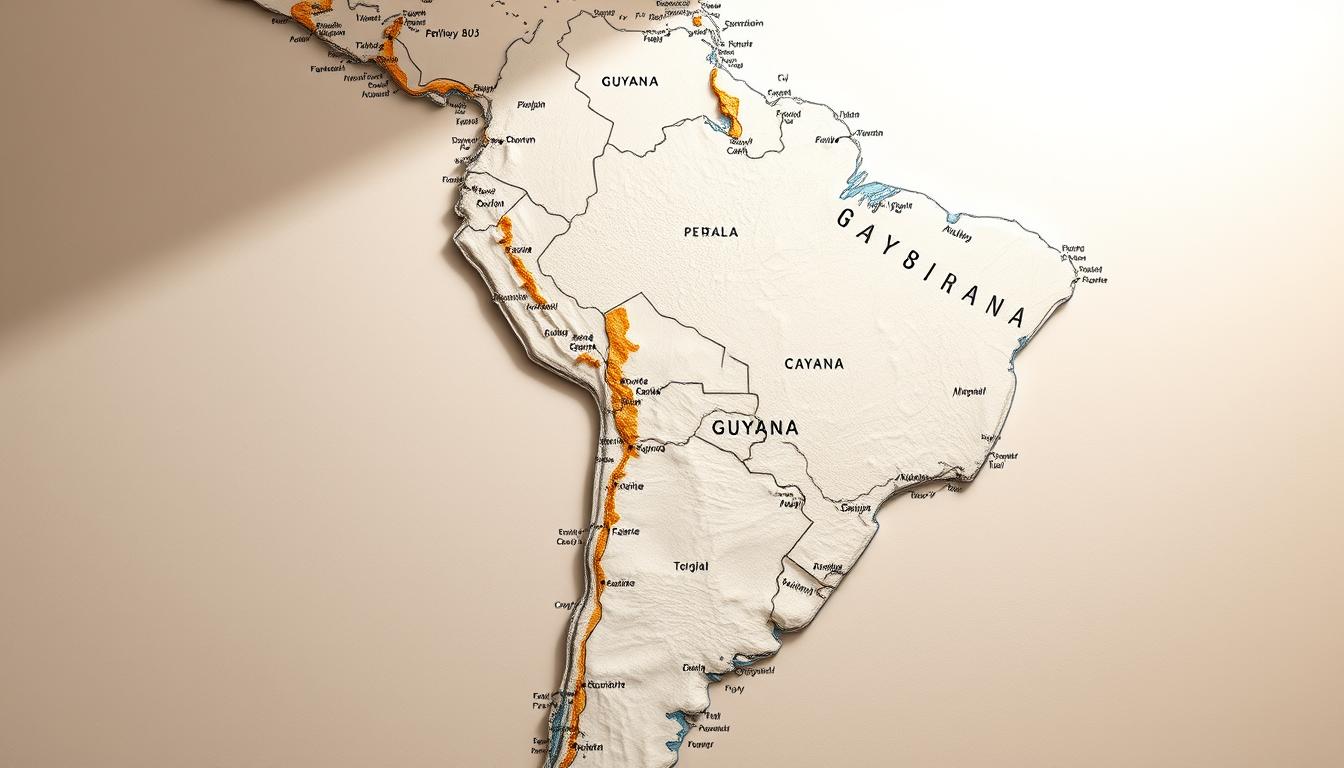
The country’s location is key to understanding its climate, economy, and culture. A visual map of Guyana’s Location in South America offers valuable insights.
The map, from Wikimedia Commons, shows Guyana’s spot in the continent. This info is vital for understanding the country’s context.
Looking at Guyana’s spot in South America helps us see its role in regional affairs. It also shows its ties to nearby countries.
Geographic Overview of South America
South America’s landscapes and climates are diverse, making it a great place to learn about Guyana’s geography. The continent is surrounded by the Pacific Ocean to the west, the Atlantic Ocean to the east, and the Caribbean Sea to the north.
Continental Boundaries and Countries
South America has 12 countries, each with its own unique geography. Guyana, on the northern coast, is one of them. The oceans around it shape the climate and ecosystems.
The countries in South America differ in size. From Brazil and Argentina to Guyana and Suriname, they all add to the continent’s rich culture and environment.
| Country | Capital | Population (approx.) |
|---|---|---|
| Guyana | Georgetown | 800,000 |
| Suriname | Paramaribo | 600,000 |
| Brazil | Brasília | 212 million |
South America’s Geographic Diversity
South America boasts vast rainforests, like the Amazon, the world’s largest. It also has the Andes mountain range, with Aconcagua in Argentina being the highest peak.
Guyana shows the diversity of South America with its rainforests and savannas. Its location, bordering the Atlantic and near the Caribbean, makes it unique.
“The diversity of South America’s geography is a testament to the continent’s complex geological history and its varied climates.”
The varied landscapes of South America support many ecosystems. From rainforests to deserts and mountains, this diversity is key to understanding Guyana’s environment.
Guyana Location: Precise Positioning in South America
Guyana is located between latitudes 1° and 9°N, and longitudes 56° and 62°W. This spot in South America affects its climate, ecosystems, and culture.
Coordinates and Geographic Boundaries
Guyana’s borders are set by its latitude and longitude. The north is the Atlantic Ocean, and the south is Brazil. To the east is Suriname, and to the west, Venezuela.
Its history has shaped its borders. This history is key to understanding Guyana’s role in the world.
Guyana’s Position Relative to the Equator
Guyana is north of the equator, between 1° and 9°N. This affects its climate, with constant sunlight and high temperatures. It’s very humid, like in tropical areas.
Being near the equator also helps its ecosystems. Rainforests and diverse wildlife thrive here. This makes Guyana a top spot for Guyana Travel and eco-tourism.
Significance of Guyana’s Geographic Position
Guyana’s location is key for its economy and culture. It’s close to the Caribbean and other South American countries. This makes trade and cultural exchange easier.
“Guyana’s strategic location makes it an important player in regional affairs, with its natural resources and cultural heritage opening up economic opportunities.”
Guyana’s mix of Caribbean and South American cultures is due to its location. It’s a unique place for cultural exploration and tourism.
Guyana Map: Understanding the Country’s Shape and Size
A closer look at Guyana’s map reveals its size, shape, and landmarks. It covers 214,969 km², making it the third-smallest mainland country in South America. Knowing its map helps us understand its geographic importance.
Territorial Dimensions and Comparative Size
Guyana’s shape is relatively compact. It’s about 440 km long and 370 km wide. It’s slightly smaller than Idaho in the United States. This size comparison helps us see its scale and the variety of geographic features it can have.
Notable Geographic Features on the Map
The map of Guyana shows many key features. It has dense rainforests, rugged Highland Regions, and Tepuis, unique table-topped mountains. Major rivers, like the Essequibo River, are also shown. They are vital for the country’s ecosystem and economy.
How to Read Guyana Maps Effectively
To read Guyana maps well, look at the scale. It shows how map distances relate to real-world distances. Also, understand the legend or key. It explains symbols and colors for different features like forests, rivers, and roads. This way, you can better understand Guyana’s geography and its effects on the environment, economy, and people.
Guyana’s Borders and Neighboring Countries
Guyana’s geography is diverse, touching three countries and a major ocean. It borders Venezuela to the west, Brazil to the south, Suriname to the east, and the Atlantic Ocean to the north. This unique position affects its regional relations, trade, and tourism, including Guyana Tourism.
Venezuela Border Dispute
The border between Guyana and Venezuela has been disputed for years. Venezuela claims a big part of Guyana’s territory, causing tension. This issue impacts Guyana’s international relations and tourism.
A recent statement noted, “The border controversy between Guyana and Venezuela remains a pressing issue that requires diplomatic resolution.”
Borders with Brazil and Suriname
Guyana shares its southern border with Brazil, a major economic power in South America. This border helps with trade and cultural exchange. To the east, it borders Suriname, sharing historical and cultural ties.
These borders are key for regional cooperation and Guyana’s economic and tourism growth.
Atlantic Ocean Coastline
Guyana’s northern border is the Atlantic Ocean, vital for its economy through trade and fishing. The coastline also offers tourism opportunities, like beach and coastal ecotourism. As Guyana Tourism expands, managing and developing its coastline is essential.
Physical Geography of Guyana
Guyana’s landscape is unique, with highlands, vast plains, and rivers. This geography supports many ecosystems. It also shapes the country’s climate, biodiversity, and where people live.
Highland Region and Tepuis
The highlands of Guyana are home to tepui formations, table-top mountains. These mountains are full of life and unique species. They were shaped by erosion over millions of years.
The highlands are beautiful and important to indigenous communities. They hold cultural and spiritual value.
The tepui formations attract tourists worldwide. They come to see the mountains and the unique plants and animals that live there.
Coastal Plain and River Systems
The coastal plain of Guyana is densely populated. It’s where most of the Guyana Population lives. This area is fertile and supports agriculture, making it the country’s economic center.
Georgetown, the capital, is located here. It’s the heart of commerce, culture, and government.
Guyana’s rivers are key to its geography. The Essequibo, Demerara, and Berbice rivers support fisheries, transportation, and power. They also help the country’s biodiversity and support many communities.
Kaieteur Falls and Notable Landmarks
Kaieteur Falls is a major landmark in Guyana. It’s one of the world’s most powerful waterfalls. Located on the Potaro River, it’s a symbol of national pride.
The falls are surrounded by untouched rainforest. This makes them a unique spot for ecotourism.
Climate and Ecosystems of Guyana
Guyana’s tropical climate supports many ecosystems, like rainforests and savannas. This variety is key for keeping nature in balance. It also helps a wide range of plants and animals thrive.
Tropical Climate Patterns
Guyana has a tropical climate with two rainy seasons. This makes its ecosystems lush. The climate is always warm and humid, with little change between seasons. This helps dense rainforests and other ecosystems grow well.
Rainforest Biodiversity
Guyana’s rainforests are among the most diverse places on Earth. They are home to many unique plants and animals. These rainforests are vital for global biodiversity and are a big part of Guyana’s nature.
Coastal and Savanna Ecosystems
Guyana also has coastal and savanna ecosystems. The coast is shaped by the Atlantic Ocean, with mangrove forests protecting it. The savannas are grasslands with few trees, home to various wildlife.
| Ecosystem Type | Characteristics | Biodiversity |
|---|---|---|
| Rainforest | Dense, humid, and tropical | High levels of endemism, diverse plant and animal species |
| Coastal | Influenced by the Atlantic Ocean, mangrove forests | Supports marine life, protects against erosion |
| Savanna | Grasslands with sparse tree cover | Habitat for various wildlife, less dense than rainforests |
The capital, Georgetown, is important for Guyana’s nature and economy. It’s the heart of economic activity but also faces environmental challenges.
Political and Administrative Geography
Understanding Guyana’s administrative geography is key to knowing how it’s managed. The country is split into several regions, each with its own traits and hurdles.
Guyana’s Regions and Administrative Divisions
Guyana has 10 administrative regions, broken down into 27 neighborhood councils. These regions are vital for public services and building projects.
| Region | Capital | Area (km²) |
|---|---|---|
| Barima-Waini | Mabaruma | 20,339 |
| Cuyuni-Mazaruni | Bartica | 47,213 |
| Demerara-Mahaica | Paradise | 2,232 |
Georgetown: The Capital City of Guyana
Georgetown, Guyana’s capital and largest city, is the heart of politics, economy, and culture. It sits on the Atlantic coast, famous for its colonial buildings, lively markets, and landmarks like the St. George’s Cathedral.
The city’s infrastructure and services are essential for Guyana’s growth. It’s home to government offices, businesses, and cultural events.
Historical Context of Guyana’s Borders
The history of Guyana’s borders is closely tied to its colonial past. The country’s borders were shaped during the colonial era. Various European powers fought over the region.
Colonial Influences on Border Formation
The borders of Guyana were shaped by the British, Dutch, and French. The Dutch were the first to settle, but the British took over later. The border with Venezuela was a big issue, with both sides claiming territory.
The discovery of gold and other resources made things even more complicated.
Post-Independence Border Developments
After gaining independence in 1966, Guyana had to deal with the borders set by the colonizers. The country faced challenges in keeping its territory whole, mainly with Venezuela. The 1966 Geneva Agreement helped start talks to solve these issues.
Current Border Disputes and Resolutions
Even today, border disputes affect Guyana‘s relations with its neighbors, like Venezuela. The fight over the Essequibo region is a big problem. Diplomatic efforts are underway to solve these issues through talks and international help.
Understanding Guyana’s border history shows how colonial times continue to influence the country’s identity.
Guyana Population and Demographics
Guyana’s history of colonization and immigration has shaped its demographics. The country is a mix of cultures and communities. This diversity shows in its population statistics, ethnic makeup, and where people live.
Population Statistics and Density
Guyana has about 790,000 people, with a low population density. More people live in coastal areas. The density is about 9 people per square kilometer, one of the lowest in the Caribbean and South America.
Ethnic Diversity and Cultural Geography
Guyana’s population is diverse, with Indians, Africans, and indigenous peoples. Indians make up the largest group, followed by Africans. Indigenous peoples, though a minority, are key to the country’s culture.
Urban vs. Rural Population Distribution
Most people in Guyana live in rural areas, mainly along the coast. But, the capital city Georgetown is home to a large urban population. Urban areas are centers for work, education, and culture. Rural areas focus on farming and traditional life.
Knowing about Guyana’s population and demographics helps us understand its culture and development. It makes Guyana a fascinating place for Guyana Travel enthusiasts.
Economic Geography and Natural Resources
Guyana’s economy is shaped by its natural resources. These include agriculture, mining, forestry, and oil reserves. The country’s diverse economy comes from its rich natural resources.
Agricultural Zones and Production
Guyana’s agriculture is key to its economy. Crops like sugarcane, rice, and tropical fruits are major contributors. The coastal plain is where most farming happens.
Agricultural activities create jobs and boost the GDP.
Mining and Forestry Industries
The mining sector is big for Guyana’s economy. Bauxite, gold, and diamonds are the main minerals mined. Forestry is also vital, with rainforests providing timber and other products.
These industries help Guyana grow economically and bring in a lot of revenue.
Recent Oil Discoveries and Economic Impact
Oil discoveries in Guyana have changed its economy. Oil extraction is expected to boost the country’s economy a lot. It will bring in new money and growth chances.
But, the government must manage this new resource well for sustainable growth.
The oil discovery has raised environmental concerns. Guyana must balance economic growth with protecting the environment.
Guyana Tourism: Exploring the Country’s Attractions
Guyana is a unique mix of nature and culture, attracting travelers from all over. Its tourism is growing fast. This is thanks to its many attractions and the government’s push for green tourism.
Major Tourist Destinations
Guyana has something for everyone. You can see natural wonders, cultural spots, and historical sites. It’s a place where every traveler can find something interesting.
Natural Wonders and Parks
Guyana has some of the most untouched nature in the world. The Kaieteur Falls is a huge waterfall by volume. The Iwokrama Forest and Kanashen Amerindian Protected Area are great for eco-adventures and seeing wildlife.
Cultural and Historical Sites
The capital, Georgetown, is full of colonial buildings, lively markets, and historic sites like the St. George’s Cathedral. Guyana’s culture is also celebrated in museums and festivals.
Ecotourism Opportunities
Guyana is perfect for ecotourism because of its focus on conservation. Visitors can explore rainforests, stay in eco-lodges, and join tours that help local communities.
Travel Infrastructure and Accessibility
Guyana’s tourism is getting better, with new transport and places to stay. The Cheddi Jagan International Airport welcomes international visitors. Local airlines also connect to remote spots.
Essential Guyana Facts for Travelers and Researchers
Guyana is a unique mix of cultures and stunning landscapes. It’s a must-see for both travelers and researchers. This section gives a quick look at the country’s key features, cultural spots, and tips for visitors.
Geographic Superlatives and Unique Features
Guyana boasts several geographic wonders. The Kaieteur Falls is one of the world’s largest waterfalls by volume. The country’s geography varies from coastal plains to the Tepui highlands. These table-top mountains are home to a rich variety of life.
Cultural and Historical Highlights
Guyana’s culture is a blend of indigenous, African, European, and Asian traditions. The capital, Georgetown, shows off the country’s colonial past. It has Victorian buildings and lively markets. Don’t miss the St. George’s Cathedral, one of the tallest wooden churches in the world.
Practical Information for Visitors
Knowing Guyana’s geography is key for travelers. The country’s map shows a wide range of landscapes, from coastlines to rainforests. You can get around by road or air, with Cheddi Jagan International Airport being the main entry point. Here’s a quick guide for your trip:
| Location | Information | Details |
|---|---|---|
| Capital | Georgetown | Main city with historical significance |
| Major Airport | Cheddi Jagan International Airport | Primary entry point for international travelers |
| Notable Landmark | Kaieteur Falls | One of the world’s largest waterfalls |
Conclusion: Understanding Guyana’s Place in South America
Guyana is a special country in South America. It mixes Caribbean and South American cultures. Its location on the northern coast, next to Venezuela, Brazil, and Suriname, makes it key in regional talks.
The country’s geography is diverse. It has the Pakaraima Mountains, vast rainforests, and a coastal plain. This variety supports a rich biodiversity and opens up ecotourism opportunities.
Guyana’s spot on the Atlantic coast boosts its economy. It has direct access to global shipping routes. Recent oil finds have also lifted its economic status, making it a rising star in the area.
Knowing where Guyana is and what its geography is like helps us understand its culture and economy. As a bridge between the Caribbean and South America, Guyana gives a unique view of the region’s history, culture, and nature.