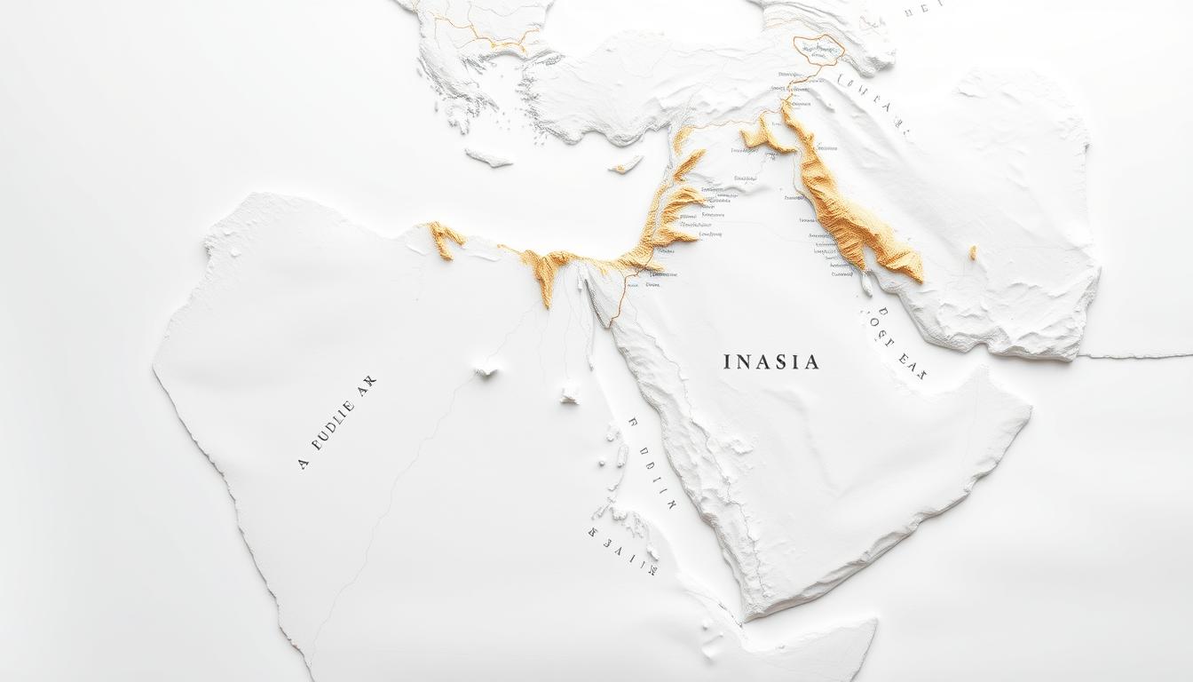
Knowing the geography, politics, and culture of the Middle East is key. A Downloadable Scientific Diagram of the area is detailed and accurate. It’s a valuable resource for everyone.
The Arab World Map is essential for learning and research. It helps us understand the region’s complex dynamics. This includes its history, culture, and politics.
Using a Downloadable Scientific Diagram gives you access to a wealth of information. It makes studying or researching easier and more reliable.
The Arab World: Geographic Definition and Scope
The Arab World covers many continents, known for its rich culture and complex politics. It has both official and cultural sides to its definition.
Official Definitions of the Arab World
The Arab League sets the official boundaries of the Arab World. Its member states aim to strengthen bonds and foster cooperation.
Arab League Member States
The Arab League has 22 member states. They are from North Africa and the Middle East. Countries include Algeria, Bahrain, Comoros, Djibouti, Egypt, Iraq, Jordan, Kuwait, Lebanon, Libya, Mauritania, Morocco, Oman, Palestine, Qatar, Saudi Arabia, Somalia, Sudan, Syria, Tunisia, United Arab Emirates, and Yemen.
Cultural vs. Political Definitions
The Arab World’s definition changes depending on whether you look at culture or politics. Culturally, it includes countries with Arabic-speaking people and Islamic traditions.
Geographic Extent and Boundaries
The Arab World stretches from the Atlantic Ocean to the Arabian Sea. It covers parts of Africa and Asia.
Continental Distribution
The region spans North Africa and parts of the Middle East. It covers a big part of Africa and Asia.
Total Land Area and Population
The Arab World has about 13.4 million square kilometers of land. It has over 400 million people living there.
Historical Development of the Arab World Map
The Arab World Map has evolved over time. It has been shaped by ancient cartography, colonial impacts, and modern science. To understand this, we must look at the key historical events that have influenced the map.
Pre-Modern Cartography of the Region
Medieval Arab cartographers greatly influenced the region’s maps. They were experts in geography and astronomy.
Medieval Arab Cartographers
Cartographers like Al-Idrisi made big contributions. His 12th-century world map was very accurate. It showed the Arabian Peninsula and nearby areas in great detail.
Ottoman Empire Mapping
The Ottoman Empire also played a big role. Ottoman cartographers made maps for administration and military use. These maps helped improve the region’s geography understanding.
Colonial Influence on Arab World Mapping
The colonial era changed Arab World mapping a lot. European powers, like Britain and France, set their own map standards and borders.
British and French Cartographic Legacy
The British and French legacy is seen in today’s Arab World maps. Their work led to new borders and changes to old ones. These changes often ignored local geography and ethnic realities.
Post-Colonial Border Establishment
After gaining independence, Arab nations kept these borders. These borders have caused issues in some areas. Knowing the historical maps and the context of these borders helps understand the region’s complex politics.
The Complete Arab World Map: Scientific Features and Details
A detailed map of the Arab World is more than just a picture of places. It’s a scientific tool that follows strict rules. These rules help make the map accurate and useful.
Cartographic Standards Used
The Arab World Map follows certain standards to be reliable and precise. These standards include things like coordinate systems, symbols, and legends.
Coordinate Systems and Datums
The map uses specific coordinate systems and datums to show geographical data correctly. The choice of system, like the World Geodetic System (WGS) 1984, is key for matching the map with global systems.
Symbology and Legend Elements
Symbols and legends on the map help share information clearly. Standard symbols and a clear legend make it easy for users to understand the map’s details, from political lines to natural features.
Scale and Projection Considerations
The scale and projection of the map are very important. The scale shows how detailed the map is, and the projection affects how the Earth looks on the map.
Distortion Factors in Arab World Mapping
Map projections can distort shapes, sizes, and distances. Knowing these distortions helps pick the best projection for the Arab World Map.
Optimal Projections for Regional Accuracy
Choosing the right projection for the Arab World Map is a balance. It needs to reduce distortion while keeping regional details accurate. Projections like the Albers Equal Area Conic are good for this because they keep shapes and areas right.
| Projection Type | Advantages | Disadvantages |
|---|---|---|
| Albers Equal Area Conic | Preserves area and shape well for mid-latitudes | Not ideal for global maps; some distortion near edges |
| Mercator | Useful for navigation; preserves angles | Distorts size and shape, specially near poles |
| Robinson | Balances shape and size distortion | Not conformal or equal-area; used for thematic maps |
Countries of the Arabian Peninsula
The Arabian Peninsula is home to a diverse range of countries. Each country has its own unique geography and cultural heritage.
Saudi Arabia
Saudi Arabia is the largest country in the Arabian Peninsula. It is known for its vast deserts and significant oil reserves. The Rub’ al Khali, one of the world’s largest sand deserts, dominates its geography.
United Arab Emirates
The United Arab Emirates (UAE) is a federation of seven emirates. It is known for its modern cities and economic prosperity. Dubai and Abu Dhabi are prominent cities in the UAE, famous for their architectural marvels and business hubs.
Qatar, Bahrain, and Kuwait
Qatar, Bahrain, and Kuwait are smaller Gulf countries with significant oil and gas reserves. Qatar is known for its media influence and hosting major international events. Bahrain has a diverse economy, while Kuwait’s economy is largely driven by its oil industry.
| Country | Capital | Main Economic Activity |
|---|---|---|
| Qatar | Doha | Gas and Oil |
| Bahrain | Manama | Diverse Economy |
| Kuwait | Kuwait City | Oil Industry |
Yemen and Oman
Yemen is known for its rich history and cultural heritage. It has a complex geography that includes mountainous regions. Oman is characterized by its rugged terrain and beautiful coastlines along the Arabian Sea.
Geographic Interconnections
The countries of the Arabian Peninsula are interconnected. They share a common history, culture, and geography. The region’s strategic location facilitates trade and cultural exchange between Asia, Europe, and Africa.
The Levant Region on the Arab World Map
The Levant region is a key part of the Arab World Map. It covers countries like Syria, Lebanon, Jordan, Palestine, and Iraq. This area has mountains, valleys, and deserts, making it interesting for map makers.
Syria and Lebanon
Syria and Lebanon have different landscapes. Syria has mountains, deserts, and the Euphrates River. Lebanon is known for its mountains and varied climate.
Key geographic features of Syria include:
- The Syrian Desert, a major arid region.
- The Euphrates River, vital for agriculture and settlements.
- The coastal mountains, which influence the climate.
Jordan and Palestine
Jordan and Palestine have different landscapes. Jordan has the Wadi Rum desert and the Jordan River. Palestine’s geography varies from the Jordan Valley to mountainous areas around Jerusalem.
The complex geography of this region has significant implications for the climate, economy, and political landscape.
Iraq and Its Geographic Position
Iraq is known for the Tigris and Euphrates rivers. The country has deserts, mountains, and fertile plains, like the Mesopotamian Plains.
Mesopotamian Plains
The Mesopotamian Plains are very important in Iraq. They are fertile and were home to ancient civilizations like the Sumerians and Babylonians.
Border Regions and Transitions
Iraq shares borders with Iran, Kuwait, Saudi Arabia, Jordan, Syria, and Turkey. These areas have different terrains, from deserts to mountains. They are key to understanding Iraq’s role in the region.
“The geography of the Levant region is not just a backdrop for human activity; it has actively shaped the course of history, influencing cultures, economies, and political structures.” –
North African Arab Nations
The North African Arab nations have a wide range of landscapes. They stretch from the Mediterranean coast to the Sahara Desert. Countries like Egypt, Morocco, Algeria, Tunisia, Libya, and Sudan each have their own geography and culture.
Egypt and Its Unique Geography
Egypt is famous for its history and unique geography. The Nile River runs through it, supporting Egyptian life for thousands of years.
The Nile Valley
The Nile Valley is very fertile, making it key for Egypt’s farming. It’s narrow, which means people live closely along the river.
Sinai Peninsula
The Sinai Peninsula connects Africa to Asia. It’s known for its tough terrain and historical sites.
The Maghreb: Morocco, Algeria, Tunisia
The Maghreb includes Morocco, Algeria, and Tunisia. These countries share history and culture. Their geography varies, with mountains, plains, and deserts.
Atlas Mountains Region
The Atlas Mountains run through Morocco and Algeria. They separate the Mediterranean from the Sahara. This area is beautiful and home to many different plants and animals.
Mediterranean Coastal Areas
The Maghreb’s coastal areas are fertile and busy. They support farming, industry, and trade.
Libya and Sudan
Libya and Sudan are geographically different but share some traits. Libya is mostly desert, while Sudan has desert and savanna. The Nile River is important in both countries.
| Country | Capital | Major Geographical Features |
|---|---|---|
| Egypt | Cairo | Nile Valley, Sinai Peninsula |
| Morocco | Rabat | Atlas Mountains, Mediterranean Coast |
| Algeria | Algiers | Atlas Mountains, Sahara Desert |
| Tunisia | Tunis | Mediterranean Coast, Sahara Desert |
| Libya | Tripoli | Sahara Desert, Mediterranean Coast |
| Sudan | Khartoum | Nile River, Sahara Desert, Savanna |
Physical Geography Features of the Arab World
The Arab World’s geography is full of diverse landscapes. You’ll find vast deserts, mountainous regions, and long coastlines. This variety makes the region’s geography complex.
Major Mountain Ranges
The Arab World has many important mountain ranges. The Atlas Mountains are in the Maghreb region, and the Hijaz Mountains are in Saudi Arabia. These mountains shape the climate and ecosystems around them.
Desert Landscapes
Deserts cover a lot of the Arab World. The Arabian Desert and the Sahara are the biggest. They are known for their hot temperatures and dry conditions.
The Arabian Desert
The Arabian Desert is huge, covering much of the Arabian Peninsula. It has endless sand dunes and very little greenery.
The Sahara in Arab Countries
The Sahara Desert also reaches into Arab countries in North Africa. It’s in Egypt, Libya, and Algeria. The Sahara is the biggest hot desert, with a very harsh climate and unique features.
River Systems and Watersheds
Rivers are key to the Arab World’s geography. The Nile, Tigris, and Euphrates rivers support farming and cities. These rivers also create watersheds that are vital for the ecosystem.
| River | Length (km) | Countries |
|---|---|---|
| Nile | 6,853 | Egypt, Sudan, South Sudan |
| Tigris | 1,850 | Iraq, Turkey, Syria |
| Euphrates | 2,800 | Iraq, Turkey, Syria |
Coastal Features and Maritime Boundaries
The Arab World has long coastlines along the Red Sea, Arabian Sea, and Mediterranean Sea. These coasts are important for trade and have many big ports for shipping.
The maritime boundaries of the Arab World are complex. Several countries have overlapping claims and agreements about their territorial waters.
Major Cities and Urban Centers on the Arab World Map
The Arab World is home to many cities, old and new. These cities have shaped history, culture, and the economy.
Historical Capital Cities
Historical capital cities in the Arab World are full of culture and amazing buildings. They were the birthplaces of art, science, and literature.
Ancient Centers of Civilization
Cities like Damascus and Baghdad were ancient centers of civilization. They are famous for their history and architecture. Damascus, for example, is one of the oldest cities in the world.
Religious and Cultural Hubs
Mecca and Medina are key cities in Islam, drawing millions of pilgrims. They are not just religious sites but also cultural centers, shaping the Islamic world.
Modern Metropolitan Areas
Modern cities in the Arab World are different. They are centers of business and growth.
Gulf Financial Centers
Dubai and Doha are major financial centers. They are known for their business-friendly environments and strategic locations. Many big companies and banks are based there.
North African Urban Corridors
Cities like Cairo and Algiers are key in North Africa. They are full of people and are important for trade and business.
Here’s a table that shows some major cities and what makes them special:
| City | Region | Significance |
|---|---|---|
| Dubai | Gulf | Financial Hub |
| Cairo | North Africa | Cultural and Economic Center |
| Damascus | Levant | Ancient Center of Civilization |
Natural Resources Depicted on the Arab World Map
The Arab region is rich in natural resources, which are key to the global economy. The Arab World Map shows these resources. They are essential for the region’s economic stability and growth.
Oil and Gas Fields
The Arab World is famous for its vast oil and gas reserves. These resources are mainly found in the Persian Gulf and North Africa.
Persian Gulf Resources
The Persian Gulf is a major oil-producing area. Countries like Saudi Arabia and the UAE have large reserves. Their oil fields are among the biggest in the world, helping supply global oil needs.
North African Energy Deposits
North Africa, mainly Libya and Algeria, also has significant oil and gas reserves. These resources are vital for the regional economy and the global energy market.
Water Resources and Agricultural Regions
Water resources are another key natural resource in the Arab World. The region’s agriculture depends heavily on water.
Major Aquifers and Groundwater
The Arab World has several major aquifers, important for groundwater. These aquifers help agriculture and provide drinking water.
Fertile Agricultural Zones
Places like the Nile Valley are very fertile and support intensive farming. These areas are key for food production in the Arab World.
Transportation Networks Across the Arab World
The Arab World connects Europe, Asia, and Africa, boosting international trade. It has highways, railways, and maritime routes. These are key for regional and global trade.
Major Highways and Road Systems
The Arab World has a vast network of highways. These roads link major cities and economic centers. They help move goods and people across the region.
- Key highways connect countries like Saudi Arabia, Egypt, and Morocco.
- Modern roads support trade and tourism growth.
Railway Networks
Railway networks in the Arab World are growing. Countries are investing in new lines and improving old ones.
- Projects like the Saudi Landbridge aim to improve connectivity.
- Railways help transport goods and passengers over long distances.
Maritime Routes and Ports
The Arab World has some of the world’s busiest ports. The Suez Canal in Egypt and ports in Jeddah and Jebel Ali are examples.
- Strategic maritime routes link the region to global markets.
- Major ports handle a lot of container and bulk cargo.
Strategic Waterways and Chokepoints
The Arab World controls key waterways like the Bab al-Mandab and the Strait of Hormuz. These are vital for global oil supplies.
Commercial Shipping Hubs
Cities like Dubai and Jeddah are major commercial shipping hubs. They offer advanced facilities and logistics services.
Downloading and Using the Scientific Arab World Map
The downloadable scientific map is key for understanding the Arab world. It offers a detailed and precise view of the region. It’s great for education, research, and professional use.
File Formats and Resolution Options
The Arab World Map comes in various file formats. Knowing the differences helps you pick the right one for your needs.
Vector vs. Raster Versions
The map has vector and raster versions. The vector version is best for scaling without losing quality. It’s perfect for GIS software or large prints. The raster version works well for web use or digital presentations where high-resolution images are needed.
GIS-Compatible Formats
The map is also in GIS-compatible formats. These formats are great for advanced spatial analysis and data integration. They make the map useful for research and professional work.
Licensing and Attribution Requirements
Using the map requires following licensing and attribution rules. You must give credit to the map’s source in your work. The licensing terms are included with the download. It’s important to read them carefully.
| Use Case | Licensing Requirement | Attribution Requirement |
|---|---|---|
| Academic Research | Required | Yes, with citation |
| Commercial Use | Required, with additional fees | Yes, with specific attribution text |
| Educational Purposes | Required, with possible exemptions | Yes, with citation |
Printing Recommendations
For printing the map, follow some guidelines for the best results. The map’s resolution and color management are key for quality prints.
Large Format Printing Guidelines
For large prints, use the vector version to keep details clear. Also, make sure your printer is calibrated for color accuracy.
Color Management for Accuracy
To get the best colors, follow the color management guidelines. Use color profiles that match your printing device or software.
Educational Applications of the Arab World Map
The Arab World Map is key for learning. It’s full of details that help students at all levels. It’s great for many subjects.
K-12 Educational Uses
At K-12, the map teaches about the Arab region’s geography, culture, and history. It boosts students’ spatial skills and shows the region’s global importance. Teachers can make lessons fun and interactive with the map.
Higher Education and Research Applications
In college, the map is essential for research and studies. It offers deep insights into the Arab World’s politics, economy, and environment. Students can explore regional trends and resource distribution with it.
Public Education and Awareness
The map also helps teach the public about the Arab World. It’s used in museums and lectures to share its complexities and global role. This way, more people learn about the region.
| Educational Level | Application | Benefits |
|---|---|---|
| K-12 | Geography and cultural studies | Enhanced spatial awareness and cultural understanding |
| Higher Education | Research and academic studies | In-depth analysis of regional dynamics |
| Public Education | Museums and cultural exhibitions | Broadened public awareness and understanding |
The Arab World Map is a flexible tool for education. It helps people of all ages understand and appreciate the Arab region.
Comparing Arab World Maps: Historical and Contemporary Perspectives
Maps of the Arab World have changed a lot. They show how geography, politics, and technology have evolved. This change shows how cartography has improved and how our views of the region have shifted.
Evolution of Arab World Cartography
The history of mapping the Arab World is filled with important moments. It has moved from old ways of mapping to using satellites and digital tools.
Traditional Mapping Techniques
Old maps were made by hand and with the help of stars. These methods were slow but gave us a deep understanding of the Arab World’s geography.
Satellite and Digital Mapping Era
New technology has changed mapping. Today, maps are more precise, detailed, and easy to get. This is thanks to GIS and remote sensing.
Different Mapping Approaches and Their Implications
How we map the Arab World matters a lot. Different methods are used for different reasons. They range from showing political and physical features to focusing on specific themes.
Political vs. Physical Maps
Political maps show borders and how places are divided. Physical maps highlight natural features like mountains and rivers. Each type gives us a unique view of the region’s geography and politics.
Thematic Mapping of the Region
Thematic maps focus on certain data, like population or climate. They are great for research, planning, and learning. They help us understand the Arab World’s many sides.
| Mapping Approach | Key Features | Applications |
|---|---|---|
| Political Maps | Boundaries, Administrative Divisions | Political Analysis, Governance |
| Physical Maps | Natural Features (Mountains, Rivers, Deserts) | Environmental Studies, Tourism |
| Thematic Maps | Specific Themes or Data (Population Density, Climate) | Research, Planning, Education |
Geopolitical Considerations in Arab World Mapping
Mapping the Arab World is not just about drawing maps. It’s about understanding the region’s complex politics. Disputed territories and border disputes make it hard to create maps everyone agrees on.
Disputed Territories and Boundaries
The Arab World has many disputed territories and border disputes. These issues affect the region’s politics a lot. For example, some countries’ borders are unclear, causing tensions and fights.
These problems often come from history, ethnicity, or resources.
International Recognition Issues
Getting countries to agree on some territories is tough. Some places are claimed by more than one country, or their status is in doubt. This makes inconsistencies in mapping and can lead to diplomatic problems.
Conclusion: The Significance of Accurate Arab World Mapping
Accurate mapping of the Arab World is key to grasping its complexities. The Arab World Map shows the region’s geography, politics, and culture. It gives a clear view of the area.
Mapping accurately is very important. It helps in making decisions in education, research, and politics. A good map helps people and groups understand the region better.
In summary, the Arab World Map is a must for anyone wanting to know the region. It’s more than just a map. It offers deep insights into history, culture, and geography. So, making sure the map is accurate is vital for a better understanding of this complex area.