The Philippines is an archipelago with over 7,000 islands. It is divided into 18 regions for easier government management. This helps in coordinating services and planning across the country.
The regions are split into three main groups: Luzon, Visayas, and Mindanao. Knowing these divisions is key to understanding the Philippine islands‘ diverse landscapes and cultures.
The country’s geography greatly influences its administrative setup. This setup impacts how government services are delivered and the development of each region.
The Philippine Archipelago: Geography and Formation
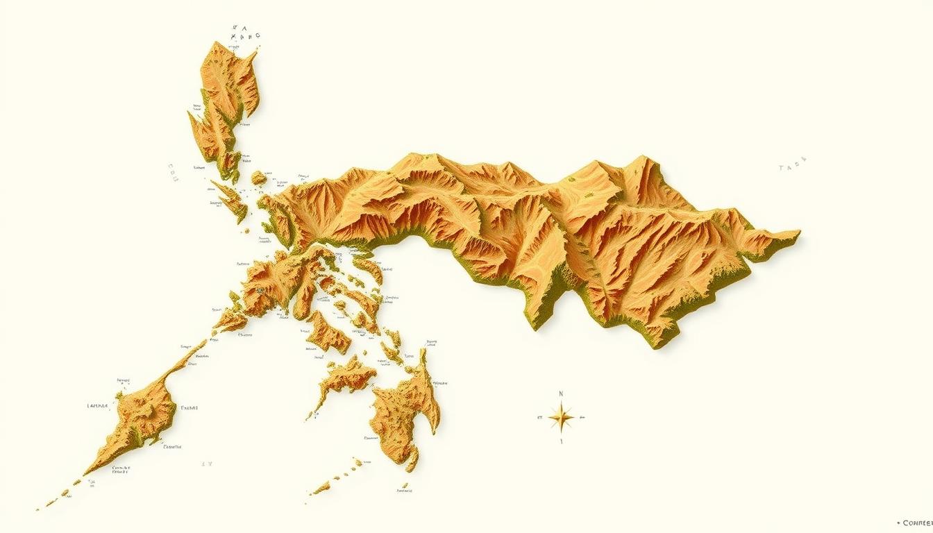
The Philippines is an archipelago with over 7,000 islands in Southeast Asia. This setup has greatly shaped the country’s history, culture, and nature.
Geographical Position in Southeast Asia
The Philippine archipelago lies between 116° and 127° East longitude and 4° and 21° North latitude. It is surrounded by the Philippine Sea to the east, the South China Sea to the west, and the Celebes Sea to the south. This location has been key to the country’s history and cultural mix.
Geographical data shows that “The Philippines is located in Southeast Asia, between 116° and 127° East longitude and 4° and 21° North latitude.” This spot has led to the islands’ rich biodiversity and varied landscapes.
Geological History and Island Formation
The islands of the Philippines were formed by volcanoes. The Philippine Trench separates the Eurasian and Philippine Sea plates. This geological activity has created the country’s diverse landscapes, from mountains to coastal plains.
| Geological Feature | Description |
|---|---|
| Volcanic Origin | The islands are mainly volcanic, leading to a mountainous terrain. |
| Philippine Trench | A deep-sea trench that marks the boundary between the Eurasian and Philippine Sea plates. |
| Diverse Landscapes | The geological activity has resulted in varied landscapes, including mountain ranges and coastal plains. |
The Philippines’ unique geological history has made its geography complex and diverse. It’s a fascinating topic for study and exploration.
The Philippines Map: A Guide
Exploring the Philippines requires a good map guide. The country has over 7,000 islands, split into Luzon, Visayas, and Mindanao. Knowing the map helps you navigate each region’s unique spots and features.
Reading and Interpreting Philippine Maps
Understanding Philippine maps is key. Political maps show the country’s divisions like regions, provinces, and cities. These maps help grasp the governance and key areas.
Topographic maps display the varied landscapes, like mountains and coastlines. These are essential for those who love the outdoors or need to study the geography.
Types of Philippines Maps Available
There are many types of maps for different needs. Some common ones are:
- Political maps
- Topographic maps
- Road maps
- Thematic maps
A printable Philippines map is great for travelers and researchers. Digital maps, like Philippines political maps, offer interactive features and updates. They’re perfect for exploring the country’s complex geography.
| Map Type | Description | Usefulness |
|---|---|---|
| Political Map | Highlights administrative divisions | Understanding governance structure |
| Topographic Map | Illustrates physical geography | Outdoor activities and research |
| Road Map | Shows transportation networks | Navigating the country |
“Maps are a fundamental tool for understanding the complex geography of the Philippines. By using different types of maps, one can gain a deeper appreciation for the country’s diverse landscapes and administrative divisions.”
Major Island Groups of the Philippines
The Philippines is made up of three main island groups: Luzon, Visayas, and Mindanao. Each group is different in geography, culture, and economy.
Luzon: The Northern Powerhouse
Luzon is the biggest island in the Philippines. It has the National Capital Region, including Metro Manila. Luzon is key to the country’s growth, thanks to its politics and economy.
It’s also full of natural resources. These include a lot of farming and minerals.
Visayas: The Central Islands
The Visayas group is famous for its beautiful beaches and lively culture. It draws tourists with its history, landscapes, and friendly people. Visayas also helps the economy a lot, mainly through farming and tourism.
Mindanao: The Southern Frontier
Mindanao is the southernmost island group. It’s full of natural resources like minerals and crops. The area has mountains and valleys, and many ethnic groups live here.
In summary, the Philippines is made up of Luzon, Visayas, and Mindanao. Each group is special and helps shape the country. Knowing about these groups helps us understand the Philippines better.
Administrative Structure: Understanding the 17 Regions
Starting in 1972, the Philippines was split into regions for better governance. The first regions were set up on September 24, 1972, by Presidential Decree No. 1. This change was a big step in how the country was managed.
Evolution of Regional Divisions
The Philippines’ regions have changed a lot over time. At first, they helped coordinate government services and planning. Now, the number and where the regions are have changed to fit the country’s needs.
This change shows how the Philippines’ geography and people have evolved. The regions help with economic growth, better public services, and more local control. Changing the regions’ boundaries helps with better governance and using resources wisely.
Function and Governance of Regions
The regions in the Philippines are very important. They help put national policies into action locally and deliver public services. There are special structures for regional governance to plan and carry out regional plans.
Good regional governance is vital for the Philippines’ growth. It helps coordinate services and boosts regional economies. The regions also handle disaster responses and tackle regional problems.
Luzon Regions Part 1: NCR, CAR, and Northern Luzon
Luzon, the biggest island in the Philippines, is full of diversity. From Metro Manila’s busy streets to the Cordillera mountains, each region has its own charm. These areas are key to the country’s economy, culture, and governance.
National Capital Region (Metro Manila)
Metro Manila, or the National Capital Region (NCR), is the heart of the Philippines. It includes the capital, Manila, and cities like Quezon and Makati. This area is a major hub for business, learning, and fun, driving the country’s growth.
Cordillera Administrative Region (CAR)
The Cordillera Administrative Region (CAR) is famous for its mountains and rich culture. It’s home to many indigenous tribes and is important for farming and mining. Its unique culture and stunning views attract tourists.
Ilocos Region (Region I)
The Ilocos Region, or Region I, is in Luzon’s northwest. It’s known for its history, beaches, and lively culture. The region grows a lot of food, like rice, tobacco, and veggies.
Cagayan Valley (Region II)
Cagayan Valley, or Region II, is in Luzon’s northeast. It’s the second-largest region by land and rich in natural resources. It’s also a big producer of food.
Central Luzon (Region III)
Central Luzon, or Region III, is a major food producer. It’s called the “rice granary” because it grows most of the country’s rice. It has the most productive farmland in the country.
| Region | Key Characteristics | Major Cities |
|---|---|---|
| National Capital Region (NCR) | Political and economic hub | Manila, Quezon City, Makati |
| Cordillera Administrative Region (CAR) | Mountainous terrain, rich cultural heritage | Baguio City |
| Ilocos Region (Region I) | Historical landmarks, beautiful beaches | Laoag City, Vigan City |
| Cagayan Valley (Region II) | Rich natural resources, agricultural production | Tuguegarao City |
| Central Luzon (Region III) | Agricultural production, “rice granary” | San Fernando City |
Luzon Regions Part 2: Southern Luzon
Southern Luzon is a diverse area that greatly helps the country grow. It’s rich in culture, economy, and natural wonders.
CALABARZON (Region IV-A)
CALABARZON stands for Cavite, Laguna, Batangas, Rizal, and Quezon. It’s a top economic region in the Philippines. It’s a big player in industry and farming, adding a lot to the country’s wealth.
The region is famous for its industrial zones, farming, and tourist spots. Its close location to Metro Manila draws businesses and investors.
MIMAROPA (Region IV-B)
MIMAROPA includes Occidental Mindoro, Oriental Mindoro, Marinduque, Romblon, and Palawan. It’s known for its stunning beaches, islands, and sea life. Tourists flock here for its culture and nature.
The economy thrives on farming, mining, and tourism.
Bicol Region (Region V)
The Bicol Region is known for its unique dishes, like those with coconut milk and chili peppers. It boasts natural wonders like Mayon Volcano and Cagraray Island. Farming, like growing rice and coconuts, drives the economy.
Tourism also boosts the region, thanks to its landscapes and culture.
The regions in Southern Luzon are linked by their economy, culture, and geography. Learning about them helps us understand the Philippines’ growth and diversity.
Visayas Regions: Western, Central, and Eastern
Visayas, made up of Western, Central, and Eastern regions, is a key area in the Philippines. It’s famous for its rich history and beautiful landscapes. The region plays a big role in the country’s economy and culture.
Western Visayas
Western Visayas, or Region VI, is known for its stunning beaches and lively festivals. It’s home to Boracay Island, famous for its white sand and nightlife. Tourism is a big deal here, with places like Miag-ao and Antique province.
“Boracay’s beaches are among the most beautiful in the world, making Western Visayas a top destination for travelers.”
Central Visayas
Central Visayas, or Region VII, is a major economic center in the Philippines. Cebu is its heart, with a booming BPO industry and tourism. It’s famous for its history, like Fort San Pedro, and lively city life.
The region also boasts natural wonders like the Chocolate Hills in Bohol and Siquijor’s scenic islands.
Eastern Visayas
Eastern Visayas, or Region VIII, is full of natural beauty and history. It has the San Juanico Bridge, connecting Samar and Leyte. It’s a paradise for those who love nature and adventure.
The region celebrates its culture through festivals and crafts. This shows the strength and rich history of its people.
Mindanao Regions Part 1: Western and Northern
Mindanao is the second-largest island in the Philippines. It has many regions that help the country’s economy and culture grow. From the Zamboanga Peninsula to Northern Mindanao, each region is unique.
Zamboanga Peninsula (Region IX)
The Zamboanga Peninsula is at Mindanao’s west. It’s known for its strategic location and cultural diversity. Here, many cultures mix, thanks to different ethnic groups.
This region is also key for the economy, thanks to agriculture and trade. Its culture and history make it a place worth exploring.
| Province | Capital | Major Industries |
|---|---|---|
| Zamboanga del Norte | Dipolog | Agriculture, Fishing |
| Zamboanga del Sur | Pagadian | Agriculture, Mining |
| Zamboanga Sibugay | Ipil | Agriculture, Forestry |
Northern Mindanao (Region X)
Northern Mindanao, or Region X, is known for its agricultural production and natural resources. It grows crops like corn, rice, and pineapple.
The economy here is mainly based on agriculture. But, the service sector also plays a big role. The region is rich in minerals and forests, adding to the country’s wealth.
In summary, the Zamboanga Peninsula and Northern Mindanao are key to Mindanao’s growth. They each bring something special to the island and the country. Learning about these regions helps us understand the Philippines’ rich culture and geography.
Mindanao Regions Part 2: Eastern and Southern
Mindanao’s Eastern and Southern parts are key for their farming, mining, and tourism. They are vital to the Philippines’ economy. These areas also showcase a rich cultural mix.
Davao Region
The Davao Region, or Region XI, is famous for farming and tourism. It grows a lot of bananas, coconuts, and cacao. The region is also known for Mount Apo, the Philippines’ highest peak, and Davao del Sur’s beautiful beaches.
SOCCSKSARGEN
SOCCSKSARGEN, or Region XII, is rich in farming and minerals. It includes South Cotabato, Cotabato, Sultan Kudarat, Sarangani, and General Santos. These places are known for their fertile soil and minerals. The region grows a lot of rice and corn and has big mining activities.
Caraga
Caraga, or Region XIII, is known for mining and natural beauty. It has lots of minerals like gold, copper, and nickel. The region is also home to the Agusan Marsh and Surigao del Norte’s stunning beaches and islands.
| Region | Key Features | Economic Significance |
|---|---|---|
| Davao Region (XI) | Agricultural production, tourism, Mount Apo | Major producer of bananas, coconuts, cacao |
| SOCCSKSARGEN (XII) | Agricultural and mineral resources | Rice, corn production, mining activities |
| Caraga (XIII) | Mining activities, natural attractions, Agusan Marsh | Rich in gold, copper, nickel deposits |
The Eastern and Southern parts of Mindanao are economically and culturally rich. They offer a mix of traditions and natural beauty. Knowing about these areas helps us understand the Philippines’ complexity and richness.
Bangsamoro Autonomous Region in Muslim Mindanao (BARMM)
The Bangsamoro Autonomous Region in Muslim Mindanao, or BARMM, is a big change for the Philippines’ southern islands. It started in 2019, replacing the Autonomous Region in Muslim Mindanao (ARMM). This marks a new chapter in regional autonomy.
Historical Context and Formation
The creation of BARMM comes from the Bangsamoro people’s long fight for self-rule. The region’s history is filled with peace talks between the Philippine government and Moro groups. BARMM’s goal is to give the Bangsamoro people a better, more effective government.
- BARMM was formally established in 2019.
- It replaced the Autonomous Region in Muslim Mindanao (ARMM).
- The region’s governance is designed to be more inclusive and representative of the Bangsamoro people’s aspirations.
Unique Governance and Cultural Landscape
BARMM has a special governance system that shows the culture and beliefs of its people. The leaders aim to keep the Bangsamoro’s rich culture alive while also improving the economy and society.
Key Features of BARMM’s Governance:
- A more autonomous decision-making process.
- Emphasis on Islamic principles and values.
- Efforts to promote economic development and social justice.
The Bangsamoro Autonomous Region in Muslim Mindanao is a big step forward for the Philippines. It brings new chances for peace, growth, and keeping cultural traditions alive.
Natural Landmarks on the Philippines Map
The Philippines is famous for its wide range of natural landmarks. Its geography is shaped by volcanoes, leading to mountains, rivers, lakes, and coastlines.
Significant Mountain Ranges and Volcanoes
The Philippines boasts many notable mountains and volcanoes. Mayon Volcano is famous for its perfect shape. Mount Pinatubo is known for its huge eruption in 1991.
The Sierra Madre mountain range stretches across Luzon. It’s the longest in the Philippines.
Major Rivers and Lakes
The Philippines has important rivers and lakes. They are vital for farming and giving us fresh water. The Cagayan River is the longest.
Laguna de Bay is the biggest lake. It’s a great place for fishing and supports many species.
Notable Coastal Features and Marine Areas
The Philippines has stunning coastlines and marine areas. Its waters are part of the Coral Triangle, full of marine life. The Puerto Princesa Subterranean River is a UNESCO World Heritage Site.
Urban Centers and Key Cities Across Regions
The Philippines has a lively urban scene. From Metro Manila’s busy streets to Cebu and Davao’s growth, the country’s cities are full of life. They are not just economic hubs but also centers of culture and social life.
Major Metropolitan Areas
The Philippines boasts several major cities that drive its economy. Metro Manila, the National Capital Region, is a global business, politics, and culture hub. Cebu and Davao are also key economic centers in their regions. These cities are known for their large populations, good infrastructure, and job opportunities.
Recent data shows Metro Manila as the country’s main city. Cebu and Davao are also major cities. These cities are vital for the country’s growth, innovation, and cultural exchange.
Emerging Urban Centers and Provincial Capitals
There are also many new urban centers and provincial capitals in the Philippines. Cities like Iloilo, Baguio, and Zamboanga are growing fast. They serve as economic and cultural centers for their provinces, providing important services and chances for locals.
As the Philippines becomes more urban, these new cities will play bigger roles. They will offer new chances for businesses, residents, and visitors.
Traveler’s Guide to Navigating Philippine Regions
Knowing the different regions of the Philippines is essential for a great trip. The country’s varied geography, climate, and culture need careful planning. This ensures a smooth and fun journey.
The Philippines has a transportation network that makes traveling between regions easy. It includes many roads, airports, and seaports.
Transportation Networks Between Regions
The Philippines has a well-developed transportation network. Travelers have many options to choose from. Some key ways to travel include:
- Air travel: With many domestic airports, flying is a convenient way to cover long distances.
- Land travel: The country has a wide network of roads and highways connecting cities and towns.
- Sea travel: The Philippines has many seaports. This makes sea travel a good choice for island-hopping and exploring regions.
Regional Climate Patterns and Best Times to Visit
The Philippines has a varied climate, with different weather patterns in each region. It’s important to know these patterns when planning trips.
Some areas have a tropical rainforest climate, while others are more temperate. The best time to visit depends on the region:
- Palawan and Boracay are best visited during the dry season (November to May).
- For Batanes, summer (June to August) should be avoided due to typhoons.
Cultural and Linguistic Diversity Across Regions
The Philippines is famous for its cultural and linguistic diversity. Each region has its own customs, traditions, and languages.
Travelers can experience this diversity by:
- Attending cultural festivals and events.
- Talking to local communities and learning about their customs.
- Tasting the regional cuisine, which varies greatly across regions.
Conclusion: The Philippines’ Regional Tapestry
The Philippines is a country full of rich regional diversity. This diversity is seen in its geography, culture, and how it is governed. The 18 regions each have their own special qualities, making the country’s tapestry vibrant.
To truly explore the Philippines, it’s important to understand and value this diversity. A detailed Philippines regions map helps navigate the country’s varied landscapes. From Luzon’s mountains to Visayas and Mindanao’s islands, each region is unique.
The Philippines geography shapes the country’s regional identities. Whether it’s the busy streets of Metro Manila or the peaceful countryside, each region offers a unique experience. Recognizing this regional diversity is key to grasping the Philippines’ complex identity.